logo

1888. Plan de Rome dresse en 1888 par l'abbe Nicole Membre de la Societe de Geographie.

  • Plan de Rome dresse en 1888 par l'abbe Nicole  Membre de la Societe de Geographie.

Plan de Rome dresse en 1888 par l'abbe Nicole Membre de la Societe de Geographie. information:

Year of creation: 
Resolution size (pixels): 
 19304x15116 px
Disk Size: 
 87.7135MiB
Number of pages: 
 1
Place: 
 Paris
Author: 

Print information. Print size (Width x height in inches):
Printing at 72 dpi 
  268.11 х 209.94
Printing at 150 dpi 
 128.69 х 100.77
Printing at 300 dpi 
 64.35 х 50.39

An example of detailing the file of this map of in a printable high-resolution:

Click to open in high resolution (open in new tab).
Attention! this is just the central piece (central area 960x960 px) of the map file!
This is an example, so that you can see and study the level of detail of a given map. The entire Map will be fully available after payment!

Plan de Rome dresse en 1888 par l'abbe Nicole  Membre de la Societe de Geographie.

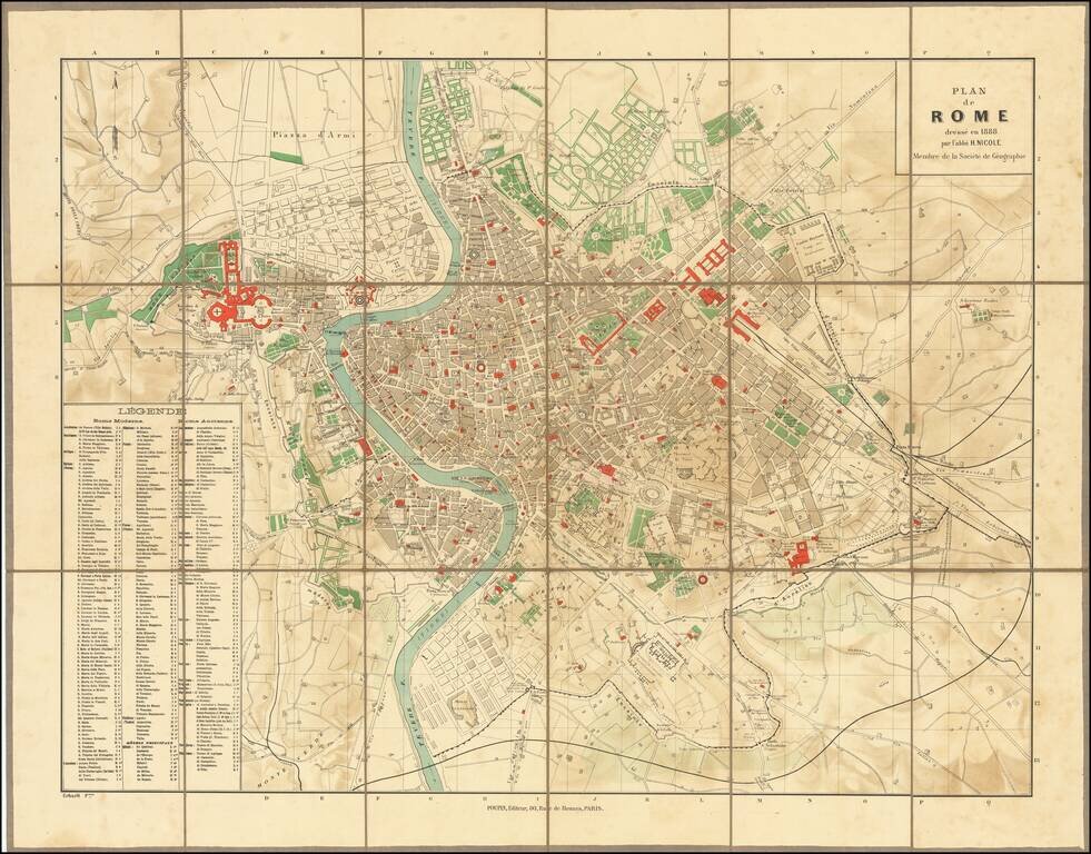
Highly detailed plan of Ancient and Modern Rome, published in Paris.

The map is credited to "l'abbe H. Nicole," a member of the French Geographical Society, but we are unable to locate the Abbey.

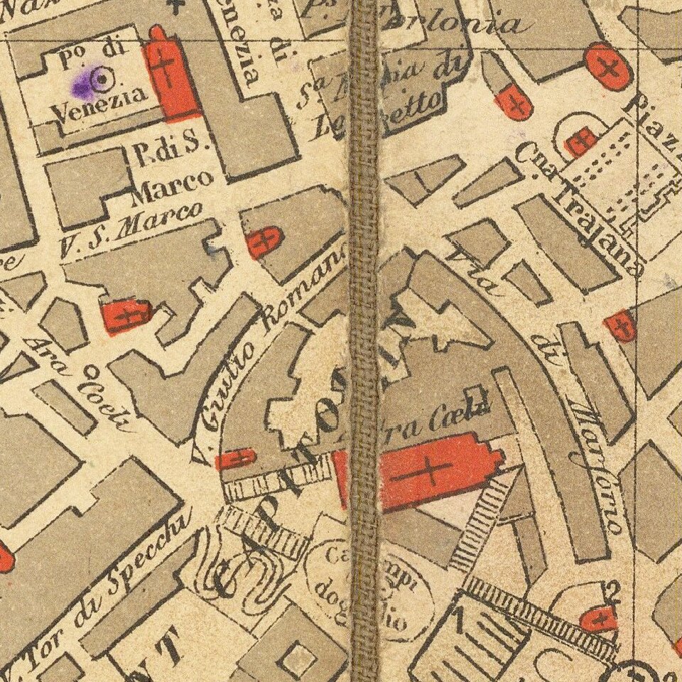
The key locates hundreds of important ancient and modern sites in Rome.


Special conditions for students!

If you are a student, write to us in telegram: @antiquemaps and indicate what material you need and for what work you need a map in high detail. We are ready to provide material on special terms. For students only!

Item information:

Year of creation:
Size:
19304x15116 px
Disk:
87.7135MiB
Number of pages:
1
Place:
Paris
Author:
Georges Erhard.
$14.99

Related item