logo

1663. Carte de L'Italie et des Isles adjacentes ou sont exactement decrits Tous set Estats et Principautes . . . 1663

  • Carte de L'Italie et des Isles adjacentes ou sont exactement decrits Tous set Estats et Principautes . . . 1663

Carte de L'Italie et des Isles adjacentes ou sont exactement decrits Tous set Estats et Principautes . . . 1663 information:

Year of creation: 
Resolution size (pixels): 
 7216x5399 px
Disk Size: 
 7.38591MiB
Number of pages: 
 1
Place: 
 Paris
Author: 

Print information. Print size (Width x height in inches):
Printing at 72 dpi 
  100.22 х 74.99
Printing at 150 dpi 
 48.11 х 35.99
Printing at 300 dpi 
 24.05 х 18

An example of detailing the file of this map of in a printable high-resolution:

Click to open in high resolution (open in new tab).
Attention! this is just the central piece (central area 960x960 px) of the map file!
This is an example, so that you can see and study the level of detail of a given map. The entire Map will be fully available after payment!

Carte de L'Italie et des Isles adjacentes ou sont exactement decrits Tous set Estats et Principautes . . . 1663

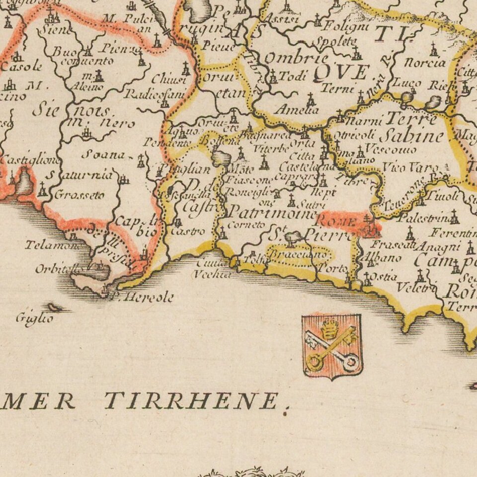
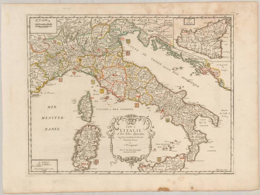
Scarce map of Italy, published in Paris by Pierre Du Val in 1663.

The map is embellished by approximately 20 coats of arms of the various regions of Italy.

Highly detailed, including towns, roads, rivers, castles, harbors, bays and a host of other details.

BORRI: Italia, Map 133

Special conditions for students!

If you are a student, write to us in telegram: @antiquemaps and indicate what material you need and for what work you need a map in high detail. We are ready to provide material on special terms. For students only!

Item information:

Year of creation:
Size:
7216x5399 px
Disk:
7.38591MiB
Number of pages:
1
Place:
Paris
Author:
Pierre Du Val.
$14.99

Related item