
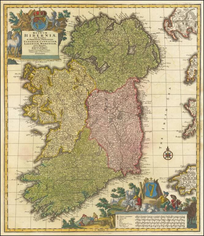
A finely colored example of Lotter's decorative map of Ireland, colored by regions and showing towns, roads, counties, rivers, lakes, castles, and more. Ireland is visible in its entirety, divided into its four provinces: Ulster in the north, Connacht...
![[Belfast and Carickfergus Lough] Plan der Gegend von Irrland, wo Ao. 1760 dens 18 Febr der See Avanturier u Capt. Thurot bey A gelandet und Carickfergus eingenomen auch bis Bellast vorge drungen, den 27 Febr: aber von den Engellandischen See Capitain Ell](/map/small/54174.jpg)
Fine old color example of Raspe's Plan of the area round Belfast and Carrickfergus Lough, from his Schauplatz des Gegenwaertigen Kriegs . . . This scarce map of Belfast Lough and view of Carrickfergus Castle illustrates the attack of the French...
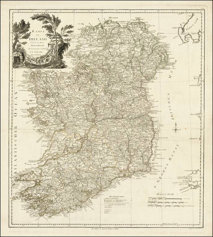
Fine large format map of Ireland, based upon the maps of Thomas Kitchin and John Rocque, published by Schraembl in Vienna in 1787.
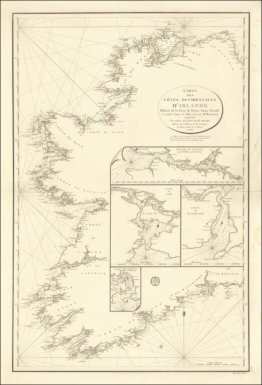
Scarce early 19th Century Sea Chart of Ireland, published by the French Depot De La Marine. Stuart Amos Arnold is credited as the source of the chart. Arnold published several commercial works on Navigation in the 18th Century, before losing an arm,...
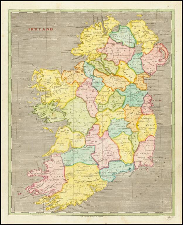
Early American-published engraved map of Ireland, part of the joint effort at atlas publishing between Arron Arrowsmith and Samuel Lewis.
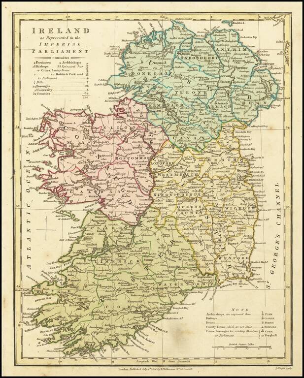
A fascinating map showing the electoral divisions of Ireland shortly after the island began sending MPs to Westminster. This map shows Ireland divided into its four provinces: Ulster, Leinster, Munster and Connaught and its 32 traditional counties. It...
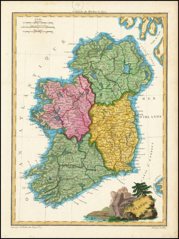
Engraved antique map of Ireland, engraved by J.B. Tardieu, and published by Conrad Malte-Brun in Paris, 1812. In the map, Ireland is divided into Connaught, Ulster, Linster, and Munster. The cartouche in the bottom-right features the columnar basalt...
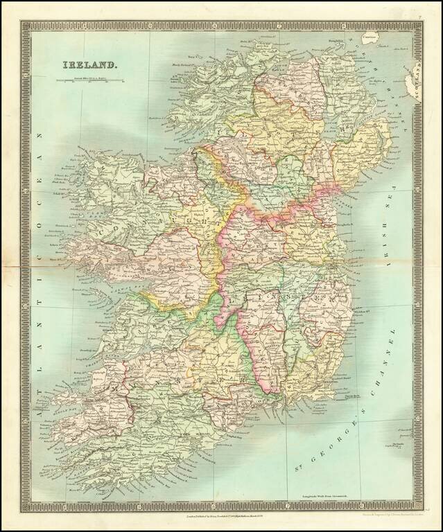
Striking early map of Ireland, published by Henry Teesdale. The map is colored by counties, and shows towns, roads, mountains, rivers and other details.
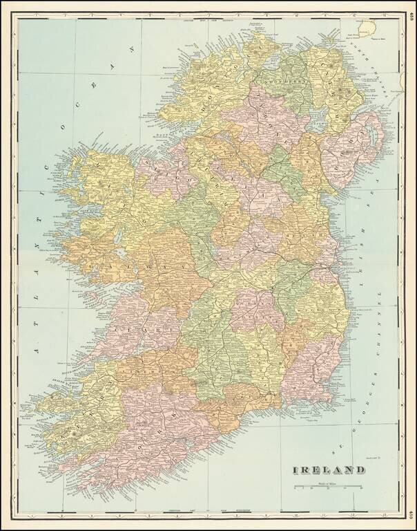
Detailed map of Ireland, colored by Counties, from Cram's Standard American Railway Atlas.
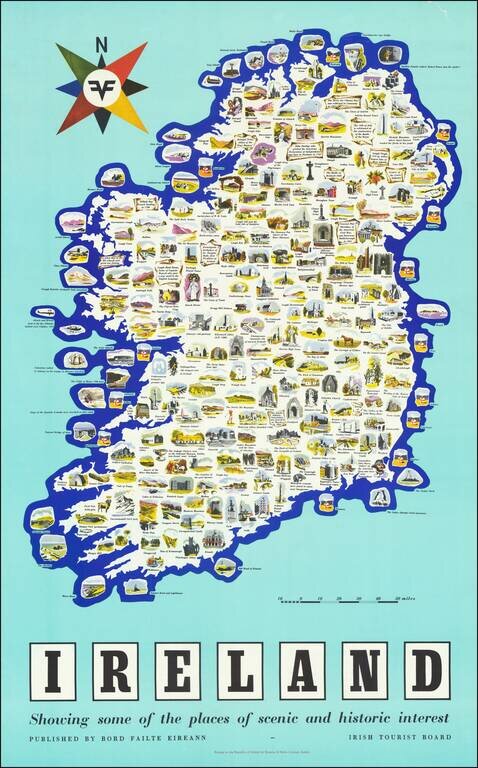
Vintage pictorial poster map of Ireland, issued by the Irish Tourist Board (Bord Failte Eireann) circa 1958. The map features dozens of captioned illustrations covering Ireland's many landmarks and points of interest. The map poster was printed by...