
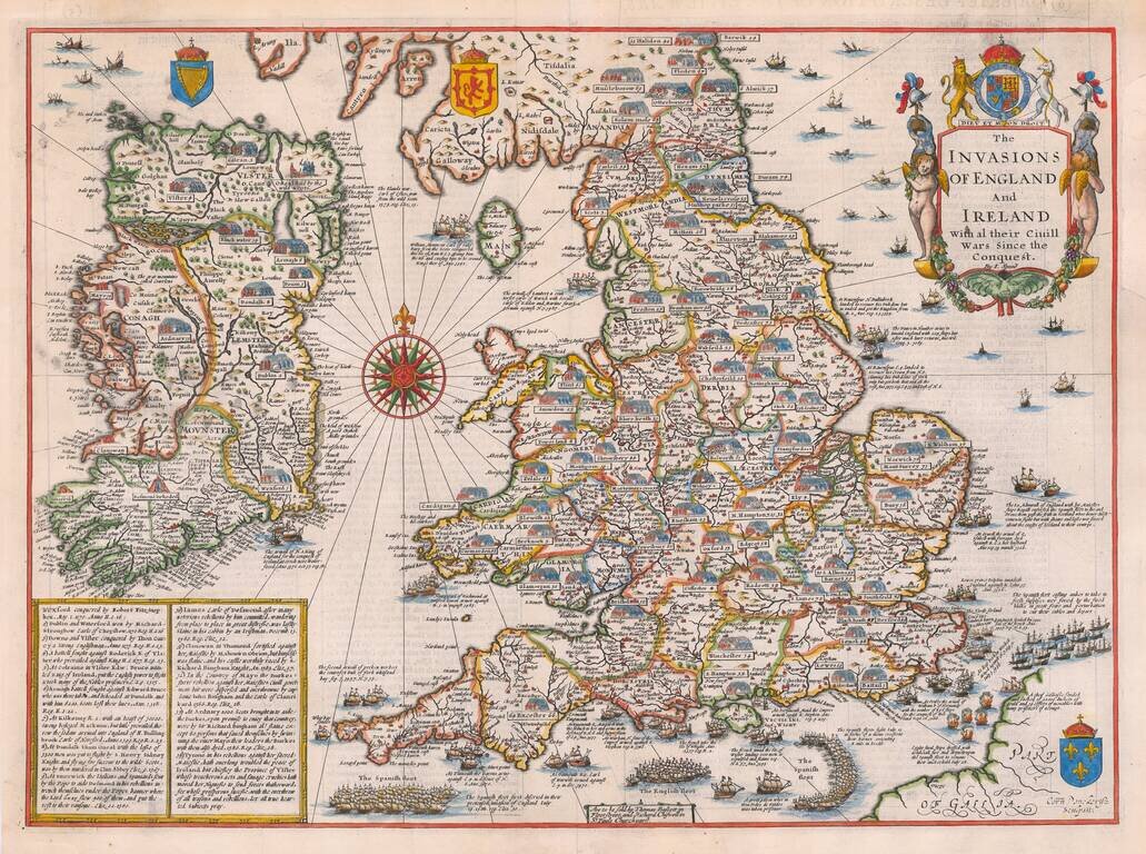
A striking example of Speed's map depicting the invasions of England and Ireland. A highly decorative detailed map, superbly engraved by Cornelius Danckerts, who copied a prototype map by Speed issued as a separate publication between 1601-03. The map...
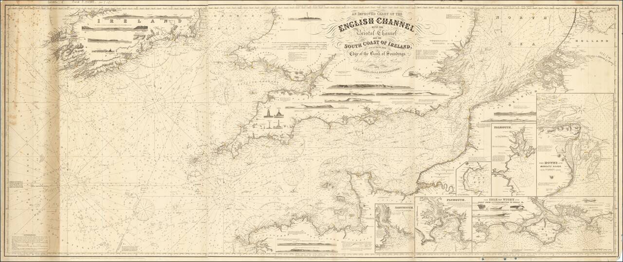
Rare working navigational sea chart, published in London by J.S. Hobbs. The map covers the English Channel, Bristol Channel and contiguous coasts of Southern Ireland, Southern England and a portion of the coast of France. Includes a number of profile...
![Johnson's Ireland [with] Johnson's Scotland](/map/small/71010.jpg)
Detailed maps of Scotland and Ireland, each hand colored by counties, with decorative borders. Shows towns, rivers, lakes, islands, roads, railroads, etc.
![Ireland in Provinces and Counties [with] County Map of Scotland](/map/small/69266.jpg)
A decorative map with Ireland and Scotland side by side, colored by counties. Includes a decorative border. Nice detail in both maps, including early roads, towns, railroads, rivers, lakes, islands, etc. Inset of the Shetland Islands. Mitchell makes...
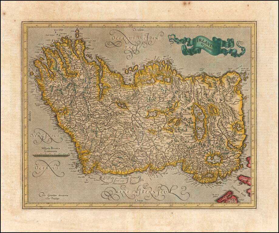
Old color example of Mercator's map of Ireland, which first appeared in the 1595 edition of Mercator's Atlas. A striking old color example.
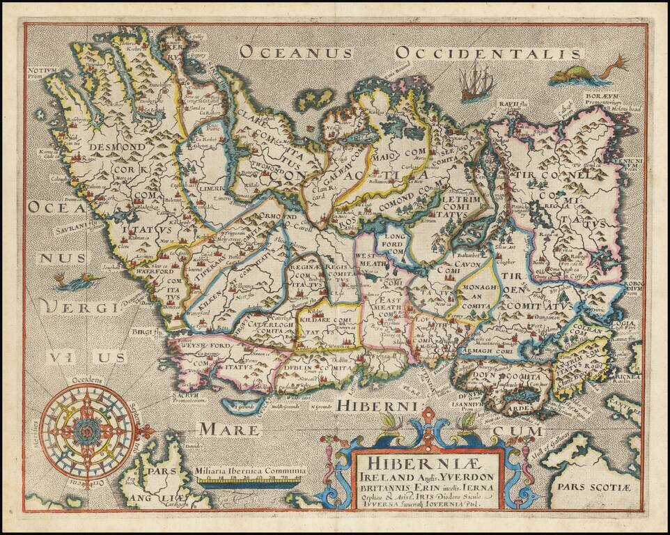
One of the earliest obtainable maps of Ireland, published in London. Oriented with West at the top.
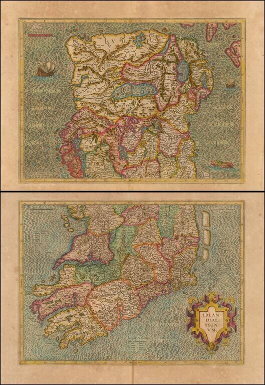
A beautifully detailed 2 sheet map of Ireland from an early edition of the Mercator-Hondius Atlas Sive Cosmographia. Fine dark image with a sea monster and sailing ship.
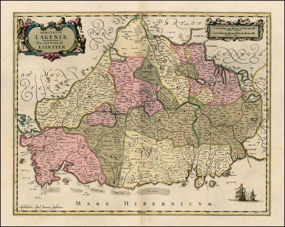
Striking old color example of Jansson's map of the County of Leinster. This example appeared in a composite atlas, issued in the late 17th Century and has no text on the verso.
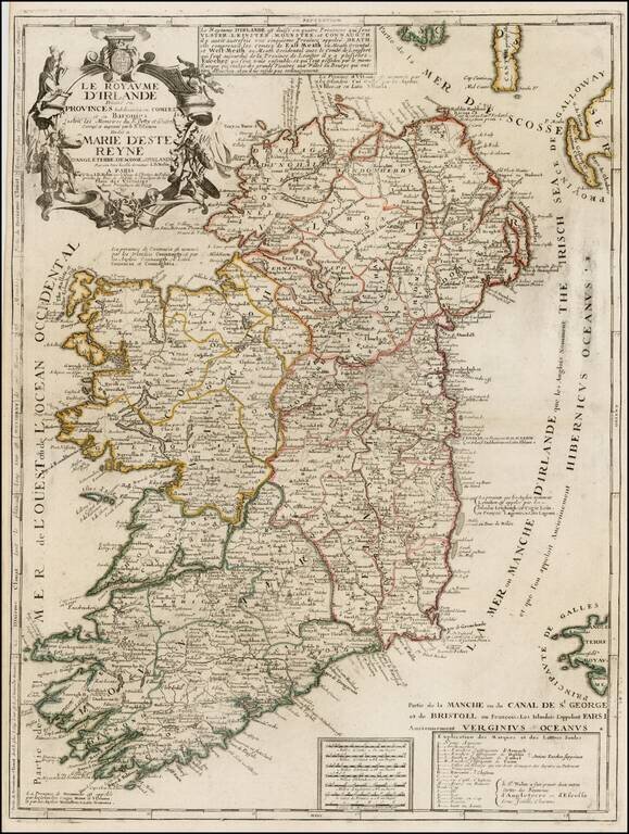
Scarce map of Ireland, published by Nolin. The map is colored by counties and includes an ornate cartouche, dedication to the Queen and a box of explanatory text not present in all editions. Nolin's maps are among the most accurate and well engraved...
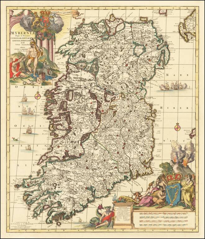
A spectacularly detailed map of Ireland, fabulously embellished with cartouches and scenes of the Spanish Armada surrounding the Island. Includes two of the largest and dramatic cartouches.
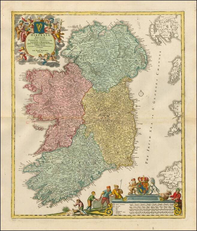
Fine early 18th Century map of Ireland, colored by regions and showing the towns, roads, counties, rivers, lakes, castles, etc. Includes two marvelous cartouches, coats of arms and allegorical details.
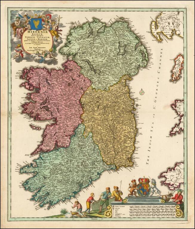
Finely colored early 18th Century map of Ireland, colored by regions and showing the towns, roads, counties, rivers, lakes, castles, etc. Includes two marvelous cartouches, coats of arms and allegorical details.
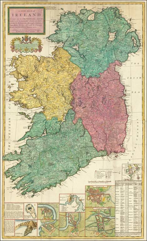
Decorative large map of Ireland, published by Herman Moll. Includes a number of insets including plans of Galloway, Waterford, Limerick, Dublin, and Corke. The map also includes an interesting depiction of the Giants Causeway, with the note "These...
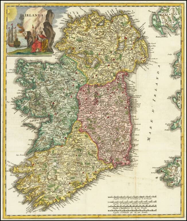
A nice example of Albrizzi's scarce map of Ireland, with decorative cartouche. The map is remarkably detailed, showing towns, roads, rivers, mountains, lakes, etc.
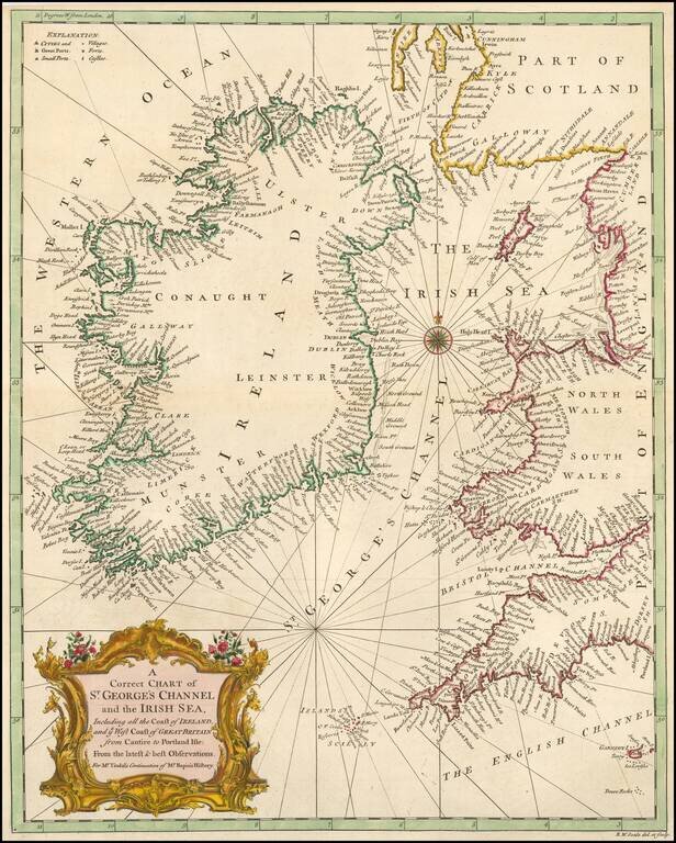
A handsome mid-18th century map of Ireland and the St. George Channel or Irish Sea.
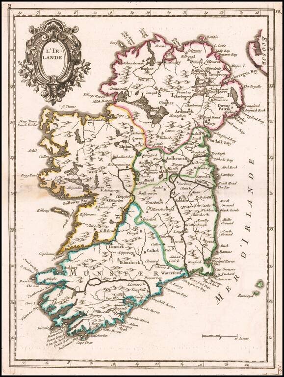
Beautiful small map of Ireland showing mountain ranges, cities, towns and sea ports. The map appeared in Le Rouge's Nouvelle Atlas Portatif.