
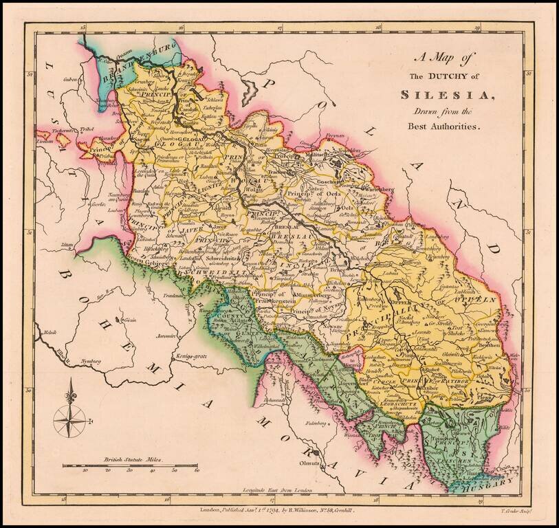
Scarce 18th Century English language map of Silesia, showing the region on either side of the Oder River. Includes Principalities of Glogau, Wolau, Lignitz, Oels, Breslau, Javer, Schweidnitz, Brieg, Oppeln, Neysze Trahenberg Sagan, Carolath,...
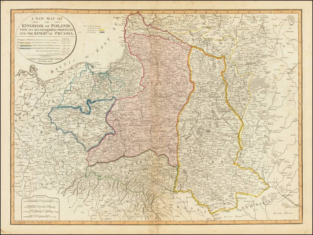
Striking full color example of this fine map of Poland, showing the provinces stripped from the control of Poland at the end of the 18th Century. The table notes the population of Poland before dismemberment (14,260,000), the populations of the...
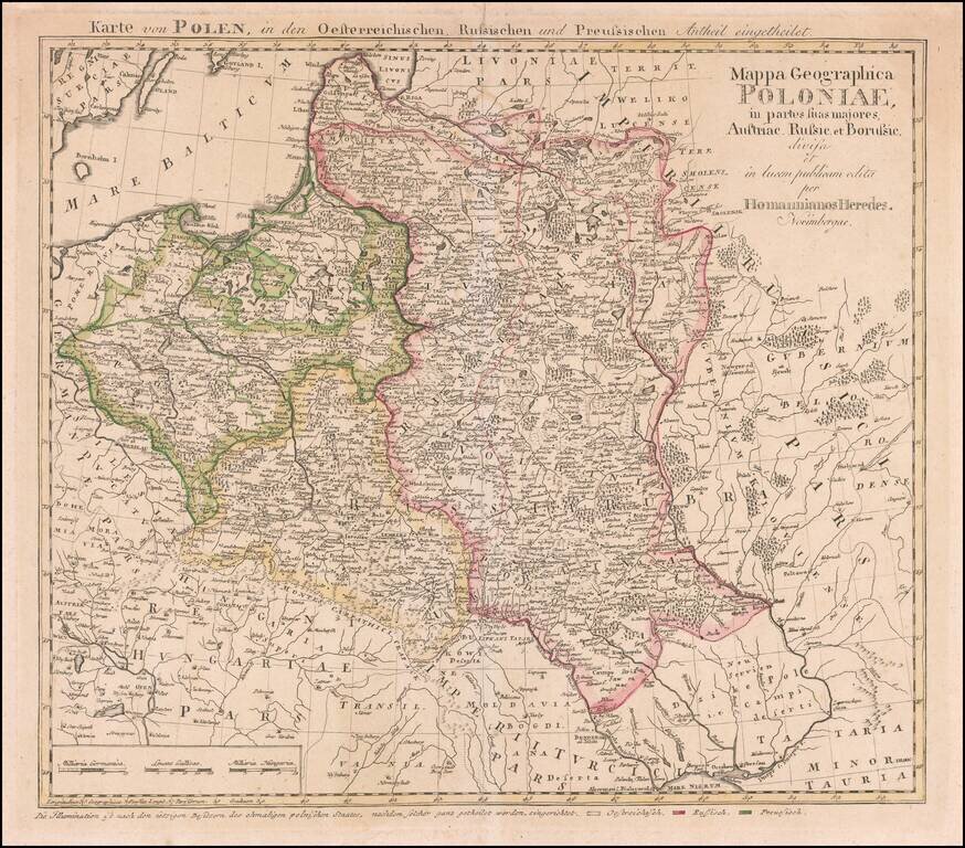
Rare map of Poland, published by the Homann Heirs is Nuremberg. This is the rare final state Tobias Mayer map of Poland. Additional title in upper margin: "Karte von Polen, in den Oesterreichischen, Russischen und Preussischen Antheil Eingetheilet"....
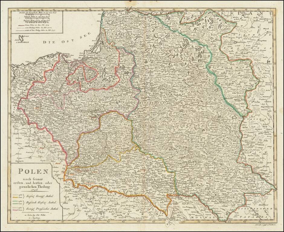
Detailed map of Poland, published in Augsburg by Johann Walch. The map shows Poland after the 3 dismemberments. The color coding shows the areas taken by the various European powers.
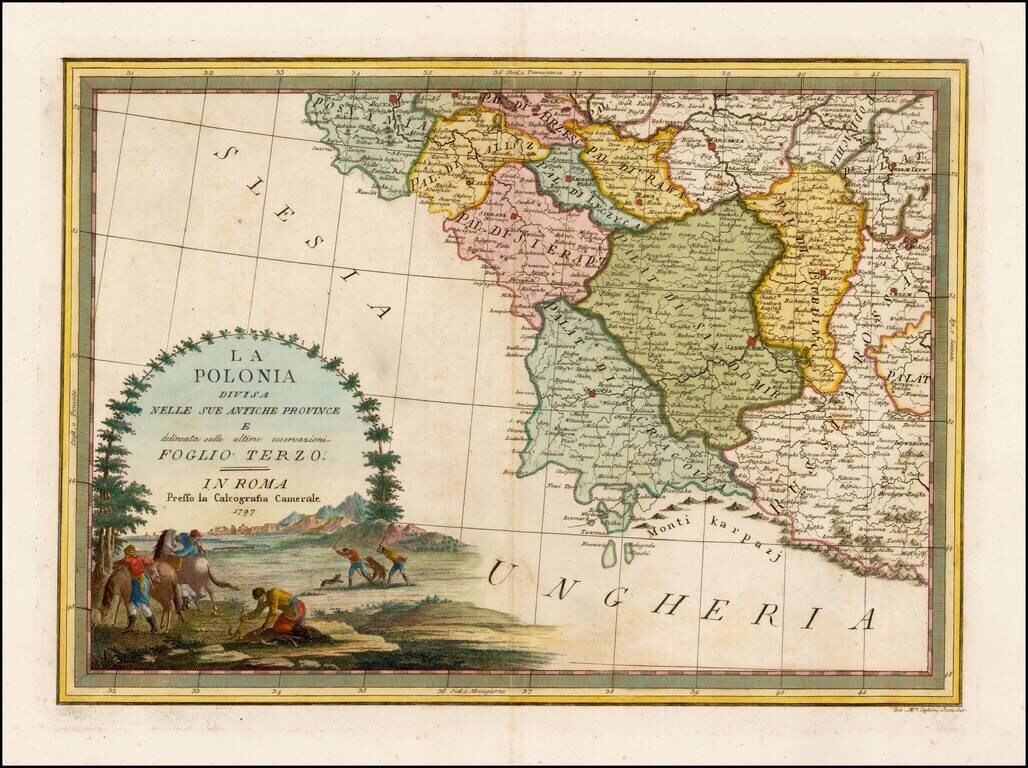
Rare and highly decorative regional map of Poland, showing the area which includes Warsawia, Posnan, Sieradz, Brzesc, Lublin, Chelm, Cracovia, etc. Ornate cartouche. Flawless example.
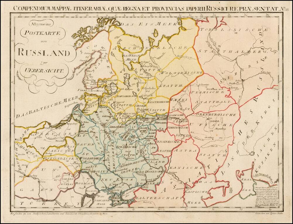
Rare postal map of the Russian Empire, which appeared in Von Reilly and Kuhn's Atlas Universae rei veredariae bilinguis ... Allgemeiner Postatlas von der ganzen Welt . . . , published in Vienna in 1799. Von Reilly & Kuhn's atlas is the first...
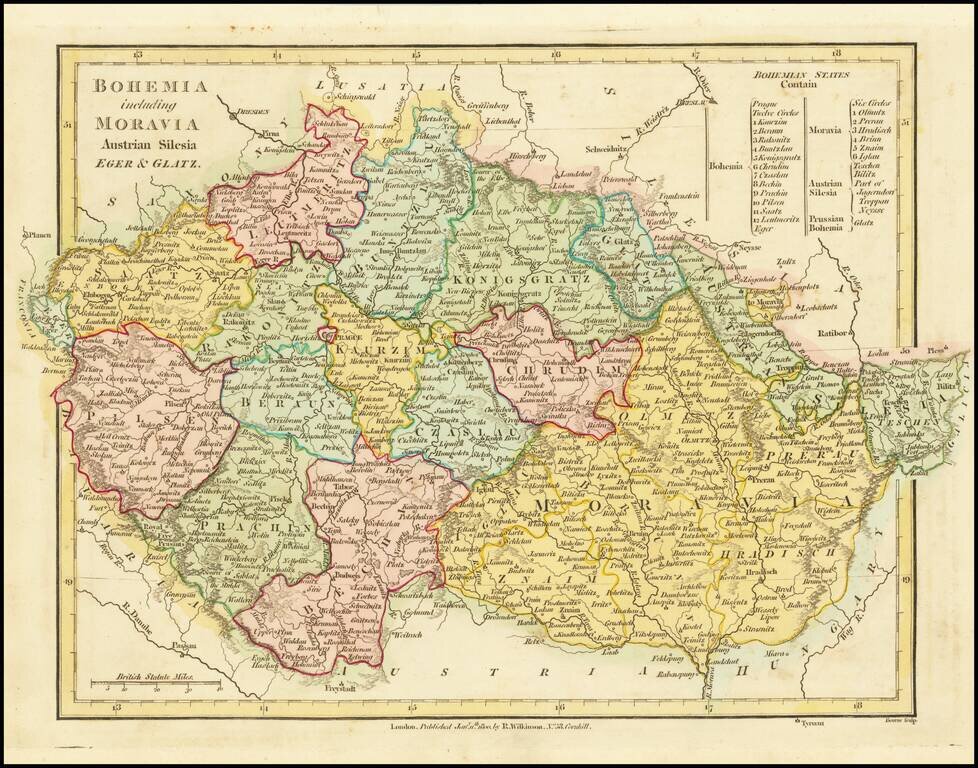
A fabulous regional map of Bohemia, Moravia, Silesia, Eger and Glatz, showing many long lost provincial borders, including Pilsen, Saatz, Leutmeritz, Buntzlau, Konigsgratz, Glatz, Olmutz, Chrudim, Cazslau, Kaurzim, Beraun, Rakonitz, Prachin, Bechin,...
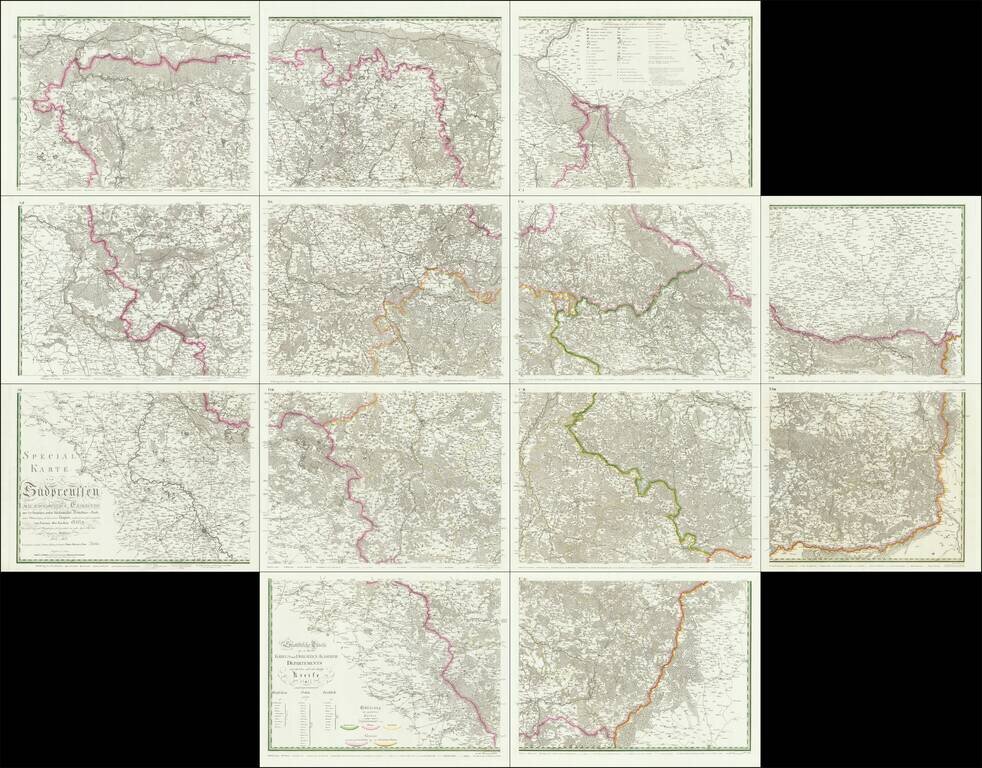
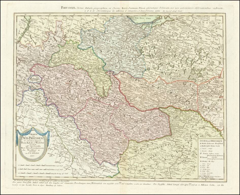
An Important Early Postal Route Map of South Prussia. -- The First Scientific Survey of South Prussia Special map of South Prussia prepared under royal decree by renowned architect and civil engineer, David Gilly after the final Partition of Poland....
Rare map of western Poland, published by Gussefeld. At the bottom left the title cartouche, with explanations and representation of the new political affiliation of the districts and areas that had fallen to Prussia after the division in 1793.
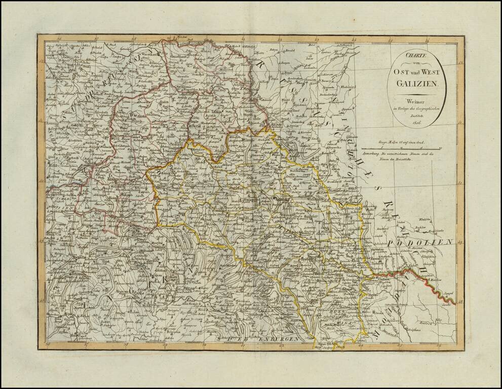
Scarce map of Eastern and Western Galizia in Poland, published in Weimar in 1806.
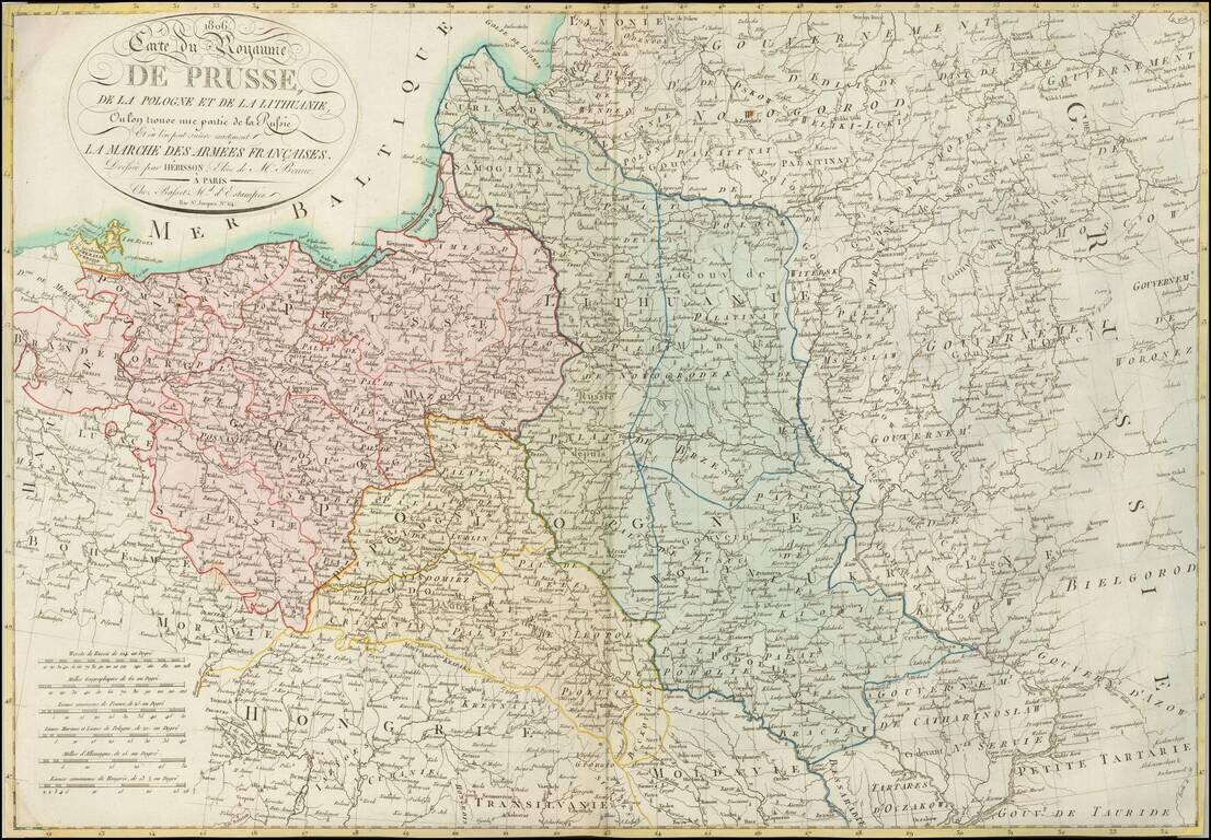
A Rare Map of Poland at the Time of the Creation of the Duchy of Warsaw. Detailed map of Poland and environs, showing the regions which were the subject of the marches of Napoleon's French Army and its allies, which resulted in the creation of the...
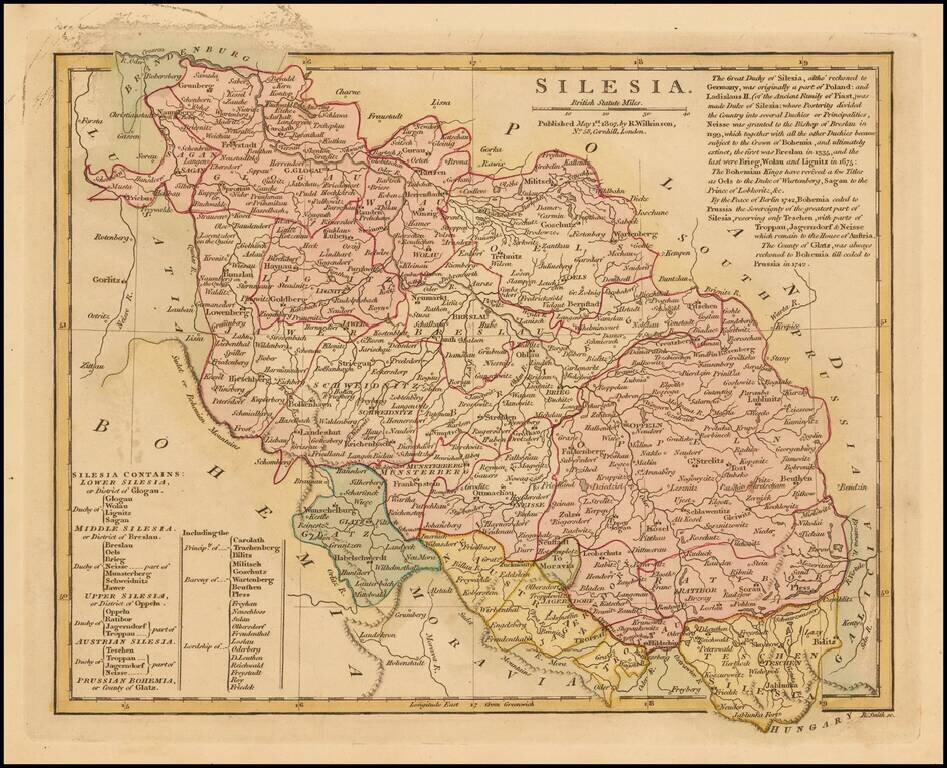
Detailed map of Silesia, colored by principalities. Extensive historical note. Striking original wash colors. Rovert Wilkinson was active in London as a cartographic publisher from 1785 to 1825. He produced a number of nice works, including a Genreal...
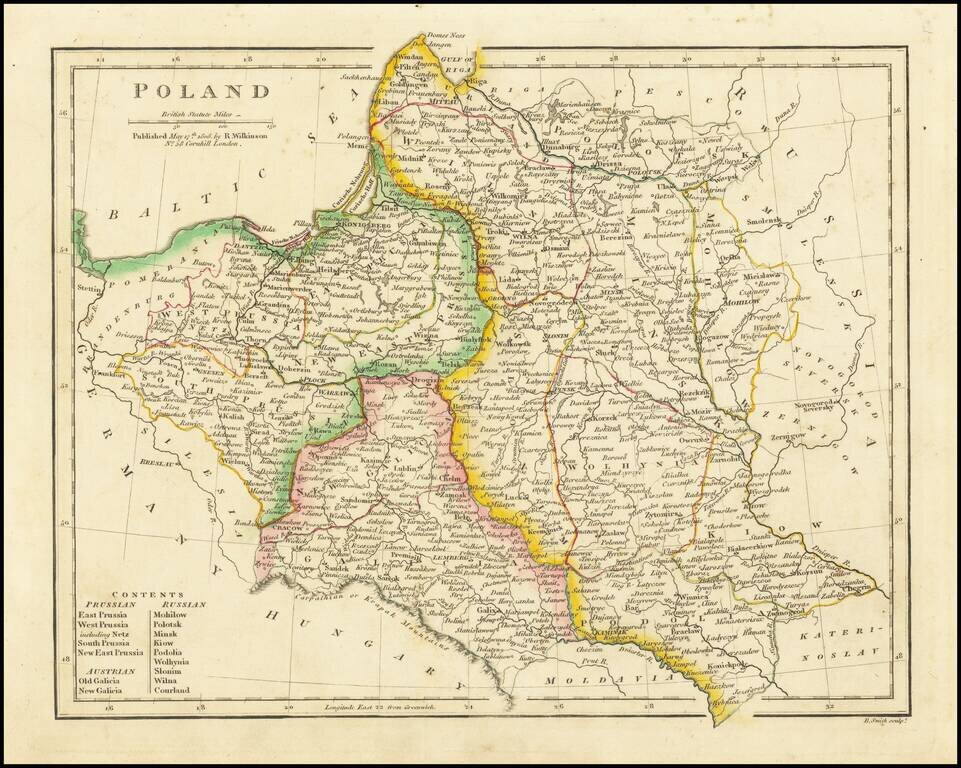
Detailed map of Poland, extending from Prussia in the west to Smolensk in the east. Highly detailed. Divided into the regions controlled by Prussia, Russia and Austria.
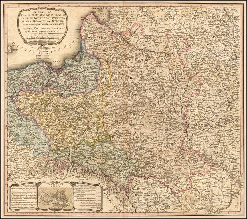
Scarce map of Poland, showing both the dismemberment and newest boundaries, following the Congress of Vienna. This map was originally published with a different title by William Faden in 1799. The map is based on the Rizzi-Zannoni 24-sheet map of 1772...
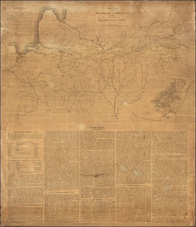
Wall Map Version of Napoleon's Grand Army Marches on Russia Rare separately published broadside and map illustrating the Russian Campaign of 1812, published by John Cary. At the top left corner, Cary reproduces a letter which he received from The...
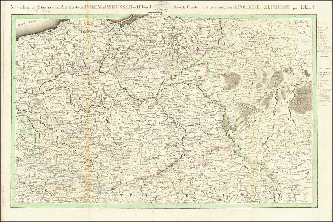
Postal & Military Map of Poland Extremely rare separately issued map of Poland and Prussia, published by Friedrich Campe in Nuremberg. The map was compiled by Johann Ernst Knittel of Nuremberg, who also created a postal map of Germany in 1810, a...