logo

1808. Poland . . . 1808

  • Poland . . . 1808

Map size in jpg-format: 10.9232MiB

Download "Poland . . . 1808", in high resolution.

Poland . . . 1808 information:

Year of creation: 
Resolution size (pixels): 
 7535x6022 px
Disk Size: 
 10.9232MiB
Number of pages: 
 1
Place: 
 London
Author: 

Print information. Print size (Width x height in inches):
Printing at 72 dpi 
  104.65 х 83.64
Printing at 150 dpi 
 50.23 х 40.15
Printing at 300 dpi 
 25.12 х 20.07

An example of detailing the file of this map of in a printable high-resolution:

Click to open in high resolution (open in new tab).
Attention! this is just the central piece (central area 960x960 px) of the map file!
This is an example, so that you can see and study the level of detail of a given map. The entire Map will be fully available after payment!

Poland . . . 1808

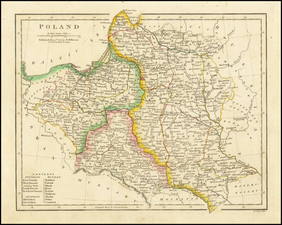
Detailed map of Poland, extending from Prussia in the west to Smolensk in the east. Highly detailed. Divided into the regions controlled by Prussia, Russia and Austria.


Special conditions for students!

If you are a student, write to us in telegram: @antiquemaps and indicate what material you need and for what work you need a map in high detail. We are ready to provide material on special terms. For students only!

Item information:

Year of creation:
Size:
7535x6022 px
Disk:
10.9232MiB
Number of pages:
1
Place:
London
Author:
Robert Wilkinson.
$14.99

Related item