Map size in jpg-format: 20.9832MiB
Click to open in high resolution (open in new tab).
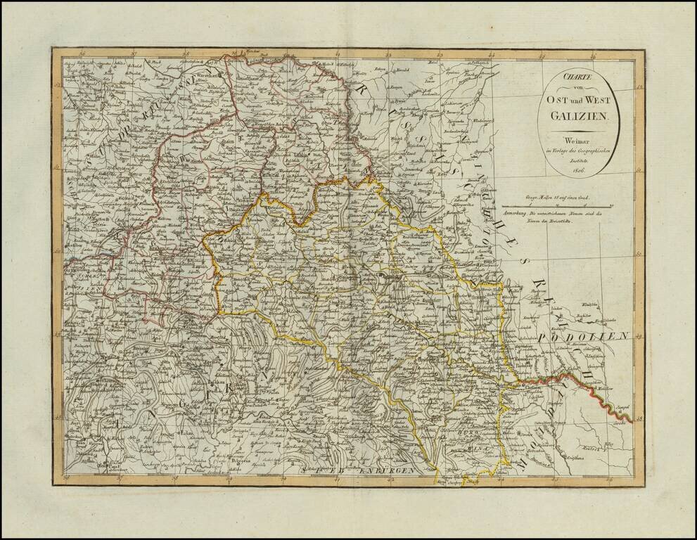
Scarce map of Eastern and Western Galizia in Poland, published in Weimar in 1806.
If you are a student, write to us in telegram: @antiquemaps and indicate what material you need and for what work you need a map in high detail. We are ready to provide material on special terms. For students only!


![[Hand Drawn Prussian Military Encampment at Opole, Poland] Special Grund-Riss Des Kaeyserl Feldl Lagers bey Oppeln in Ober Schlesien](/map/small/59726.jpg)