
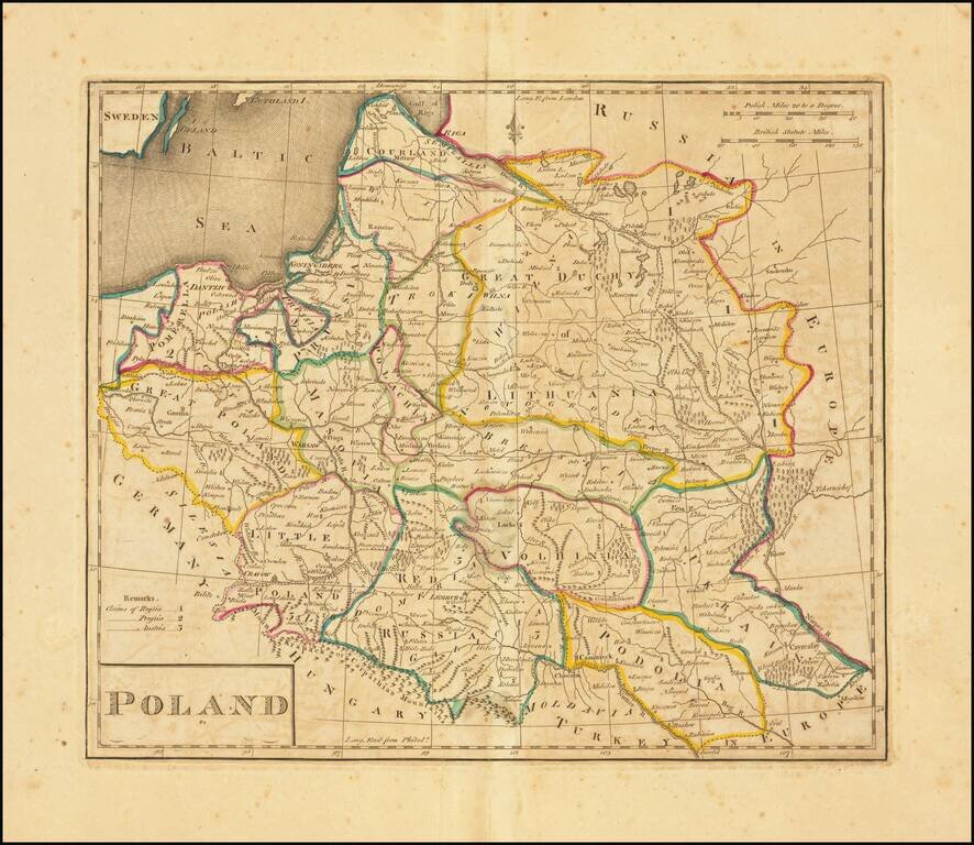
Second edition of the first map of Poland published in the United States. Published by Matthew Carey in 1814. Title revised and shortened from the first edition, although the content is unchanged.
Highly detailed map of Poland, Lithuania, Latvia and Estonia, along with neighboring regions, published in Vienna by Tranquillo Mollo. The map includes significant detail, including postal roads, post stations, etc.
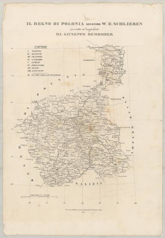
Very rare separately published map of Poland, drawn from W.E. Schlieben's map. The size is for the full sheet. The map shows the towns, roads, rivers, lakes and other details in Poland.
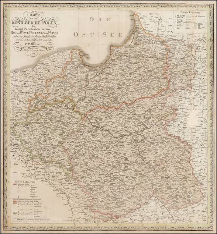
Scarce map of Poland and East and West Prussia, published by Weiland. The map includes the Free State of Cracow.
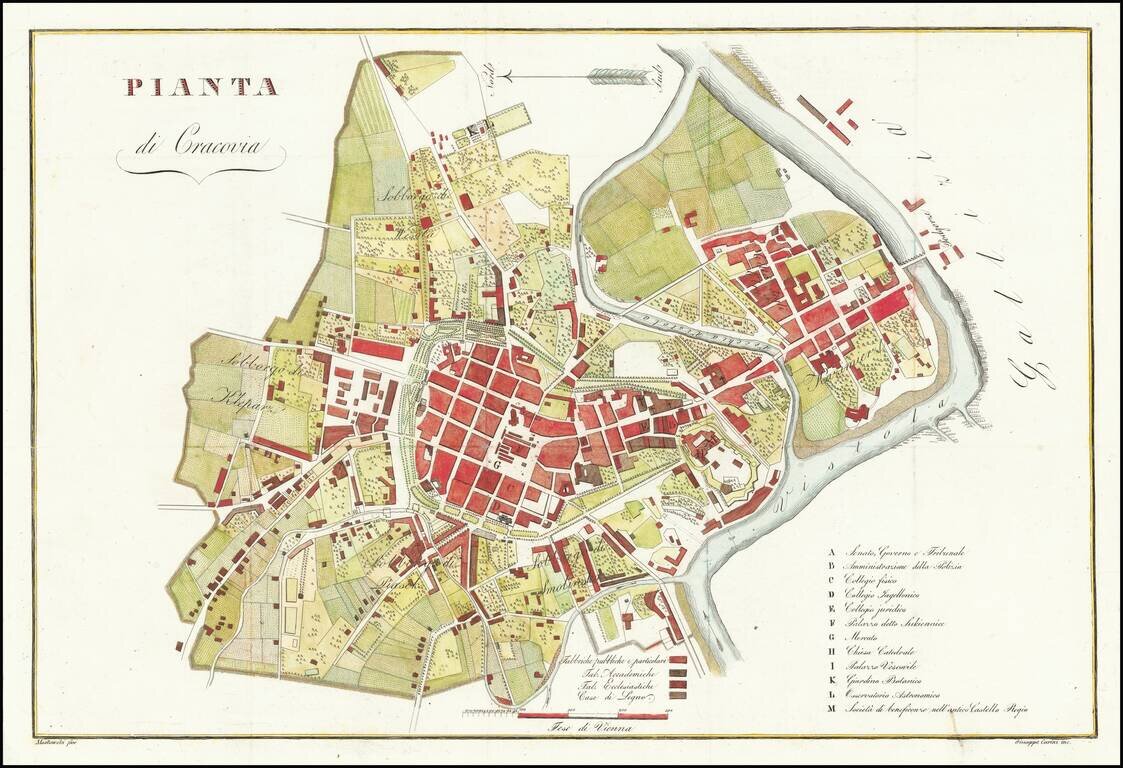
Rare plan of Krakow, published in Florence by Giuseppe Carini. The second name on the map shows the name Mostowski. This is the second time in more than 20 years we have offered the map for sale.
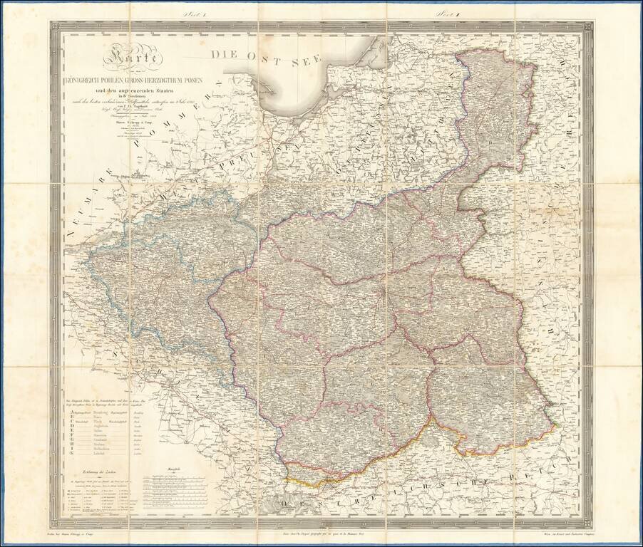
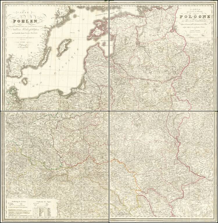
Large folding map of Poland and environs, published in Berlin. The map is subdivided into region, A to K. Includes towns, rivers, forests, postal roads and a host of other details.
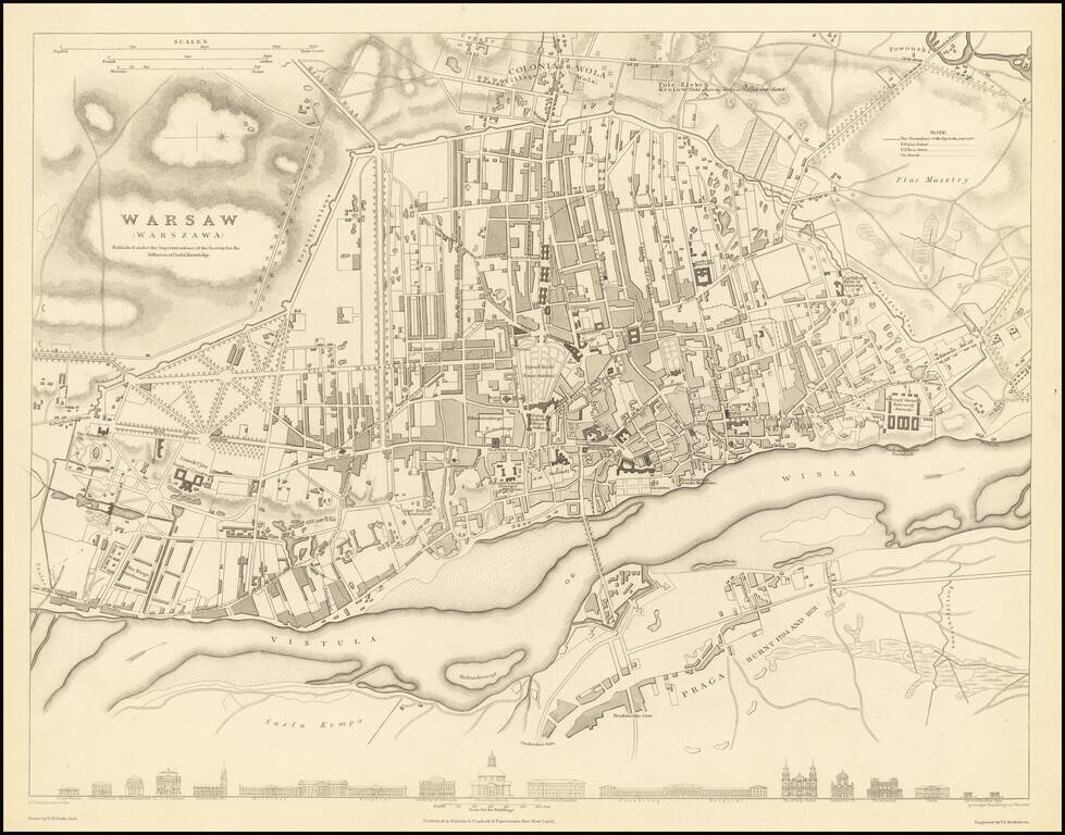
A highly detailed town plan of Warsaw which includes profile views of 16 major buildings across the bottom of the map. This forms part of the first edition of the best published commercial atlases of the 19th century. This map was published during the...
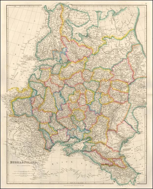
Detailed map of Russia, Belarus, Ukraine, Poland and the Baltic region, published by John Arrowsmith, London's leading mapmaker of the period. The map appeared in Arrowsmith's London Atlas.
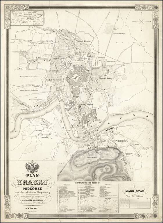
Fine large plan of Krakow, published in 1847 by Alexander Kocziczka, surmounted by the coat of arms of the Holy Roman Emperor. Kocziczka's plan depicts Krakow from Czarna Wies and Nowa Weis to Podgorze and from the Upper Silesian - Krakow Railway to...
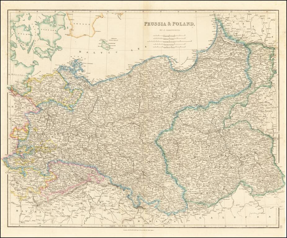
Striking map of the Kingdom of Poland, Prussia and the Baltic Region, published by John Arrowsmith. Highly detailed, showing towns, roads, rivers and other details, by John Arrowsmith, London's leading mapmaker of the period.
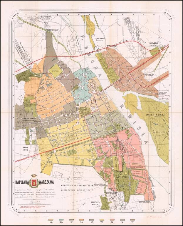
Warsaw-Published Antique Map of Warsaw, in both Polish and Russian. Color-lithographed antique folding map of Warsaw, issued in Warsaw in 1878 by the polish lithographer Felix Julian Kasprzykiewicz. The city is colored by ward (twelve in total), with...
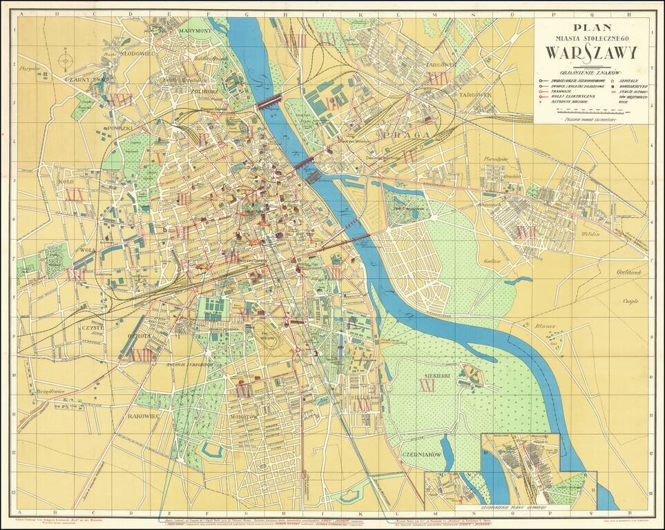
Wonderful Interwar Map of Warsaw. Detailed color-lithographed map of Warsaw issued by the famous Polish publisher and train station kiosk operator, RUCH. The map has an inset at the bottom showing a railway station. The map marks the main parts of...
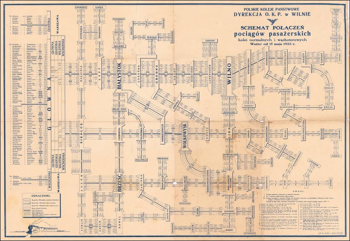
Detailed schematic map of the passenger train routes on normal and narrow gauge rail lines, centered on Vilnius and Bialystok. The title translates as: Polish State Railways Directorate P.K.P. Vilnius village - Diagram Connection of passenger trains...
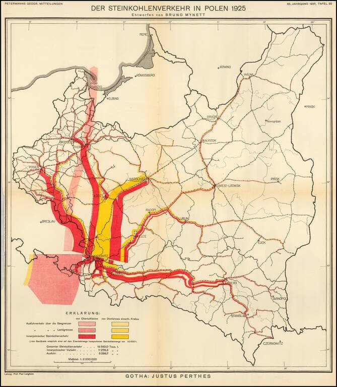
Thematic map of Poland, showing the Coal Industry in 1925, based upon the work of Bruno Mynett, Der Steinkohlenverkehr innerhalb Polens. The map was published by Augustus Petermann in 1937, based upon Bruno Mynett's book
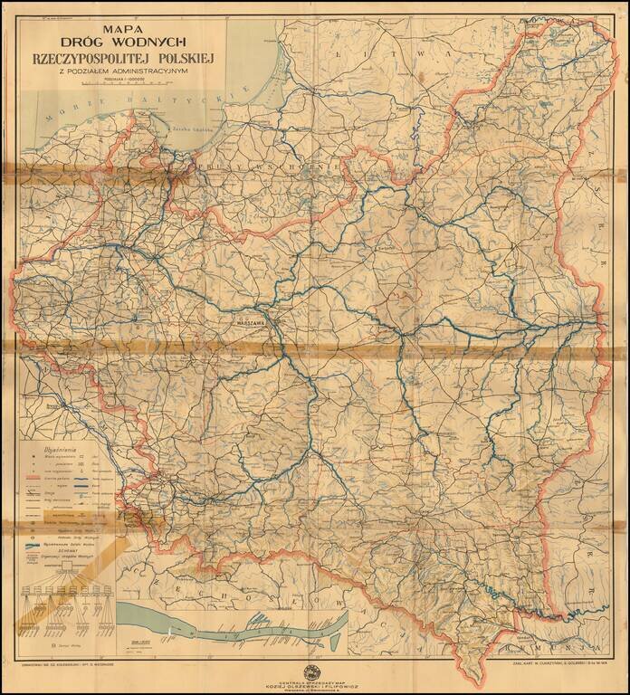
Detailed map of the waterways of Poland, focusing on both water routes and railroads (single, double and narrow gage) throughout country. The inset map shows the Vistula River route with marinas, sailing clubs and bridges.
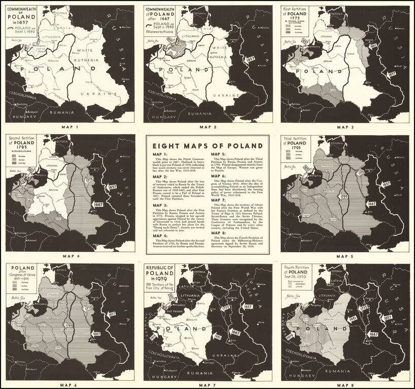
Polish Propaganda During World War II Interesting set of maps of Poland, illustrating the changing boundaries of Poland from 1657 through 1939, with a short explanation explaining each of the maps. On the verso, a set of 7 images of major Polish...