
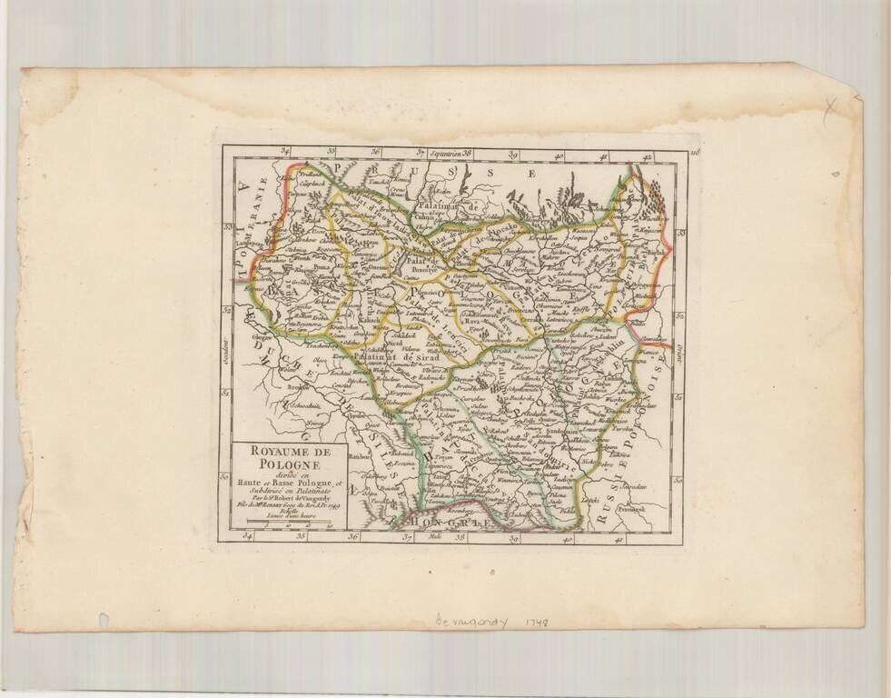
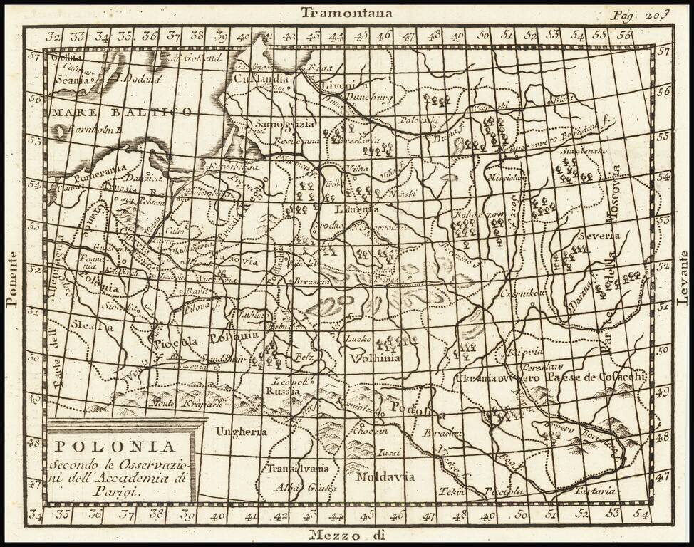
Striking example of De Vaugondy's map of the Kindgom of Poland, from his Atlas Portatif, Universel et Militaire. . . , first published in Paris in 1748.
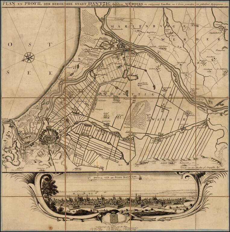
Rare plan and view of Dantzig (Gdansk) and neighboring regions, published in Amsterdam by Hendrik de Leth. Provides a final image of the town, including a coat of arms and key locating 9 places on the view. The view is quite rare, this being the...
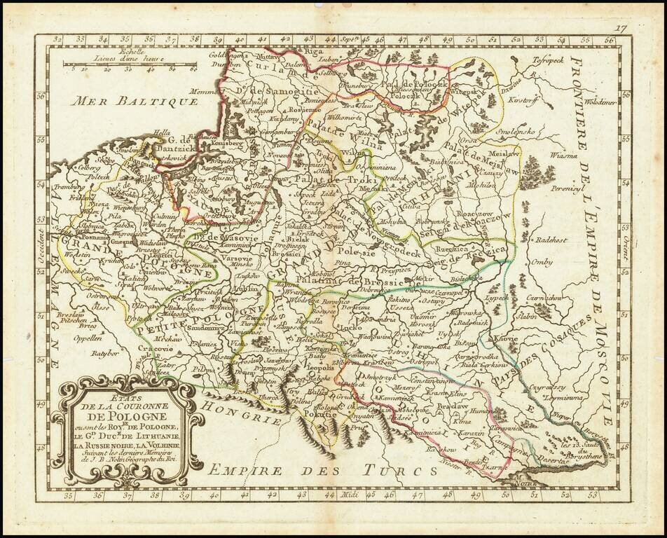
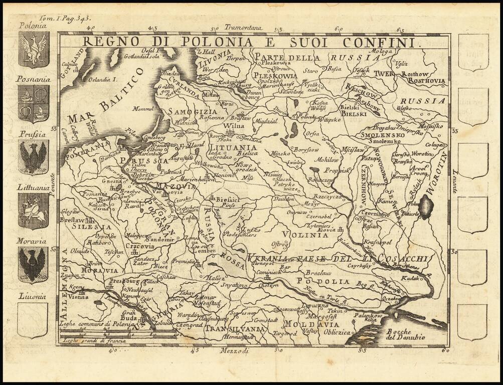
An attractive antique map of Poland showing the cities, rivers, lakes, and forests of the region during the commonwealth with the Grand Duchy of Lithuania. The various regions are demarcated and named, including Black Russia, Podolia, Volhynia, Greater...
![[Wroclaw] Carte du Diocese de Breslau, avec ses IV. Archidiaconats, subdivses en ses Cercles Archiprebyteriales desineee sous la Directiondu bien reverend Sieur Felbiger . . . MDCCLI](/map/small/59627.jpg)
From The First Official Survey of Silesia Detailed regional map of the Diocese of Breslau (Wroclaw), published in Nuremberg. The map was originally published separately in about 1736 and was later issued in the Homann Heirs Atlas Silesiae Id Est...
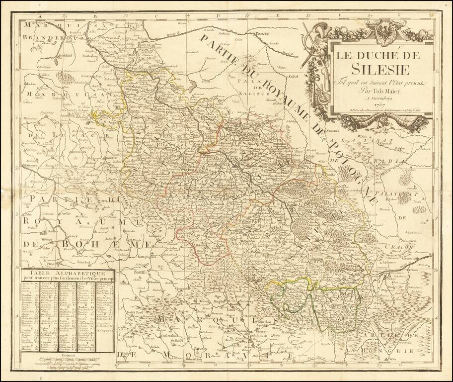
Rare and decorative map of Silesia region, based upon the map of Tobias Mayer. Published by Jean-Francois Daumont, who was active in Paris between approximately 1750 and 1760, where he engraved prints, playing cards, and a hand full of maps.
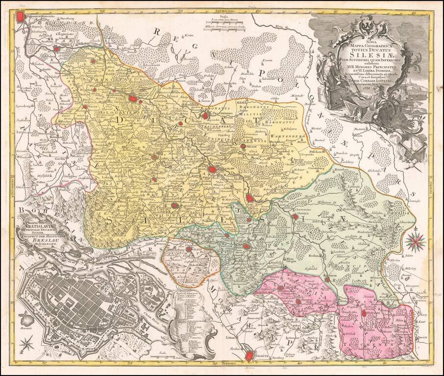
Detailed map of the region of Silesia, centered on Breslau (Wroclaw). Includes a large view of the town of Breslau (Wroclaw) in the lower left corner.
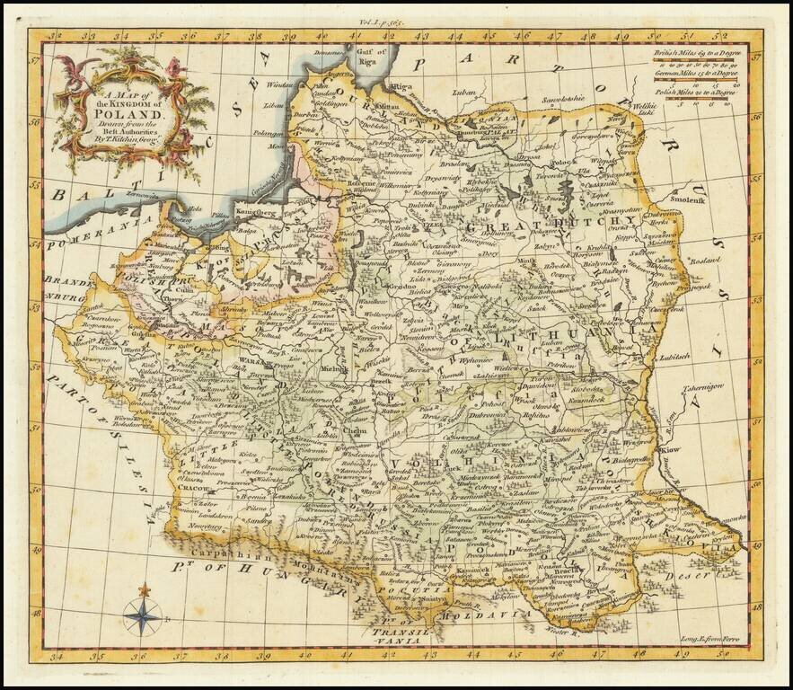
A map of Poland and the Baltic States, extending from Pomerania into Russia as far as Moscovia. Forests, rivers, mountains, settlements, and more are all shown. The four principal winds of the Mediterranean are shown at the edges of the map as a...
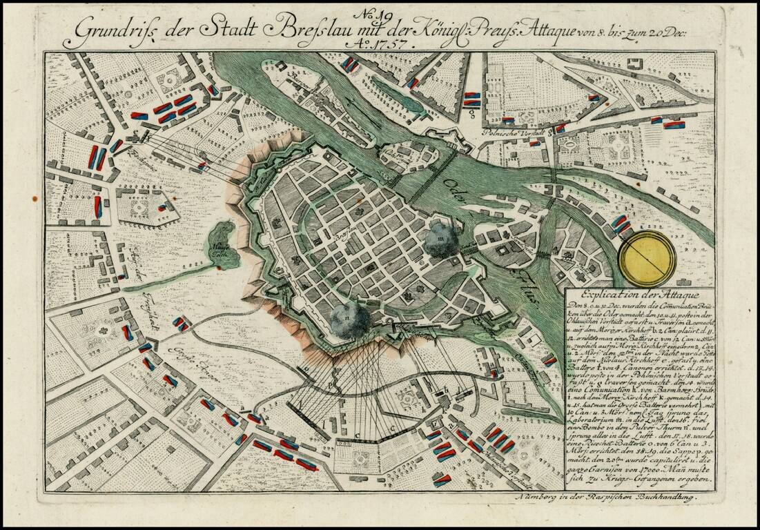
Detailed view of the Battle fought at Breslau during the 7 years war. The city fell to Austria in November 1757, before being retaken by PRussian forces the following month.
Rare map of Poland, with 5 coats of arms and 7 more blank escutcheons.
Scarce English map of the Kingdom of Poland (and Lithuania) on the eve of its initial dismemberment. The map appeared in Busching's A new system of geography: in which is given, a general account of the situation and limits... of the several kingdoms...
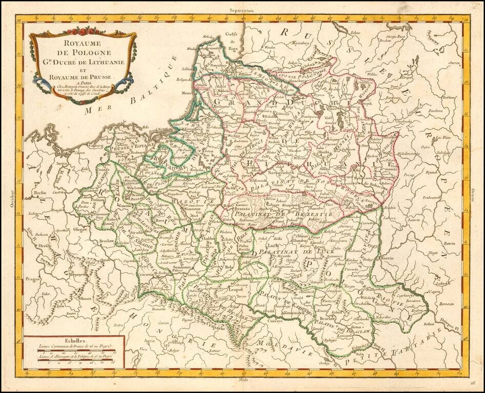
Scarce map of the Kingdom of Poland and Duchy of Lithuania, published by Pierre Bourgoin in Paris. The map is subdivided into Palatinates and includes topographical details, towns, rivers, lakes, etc. According to Niewodniczanski, this map first...
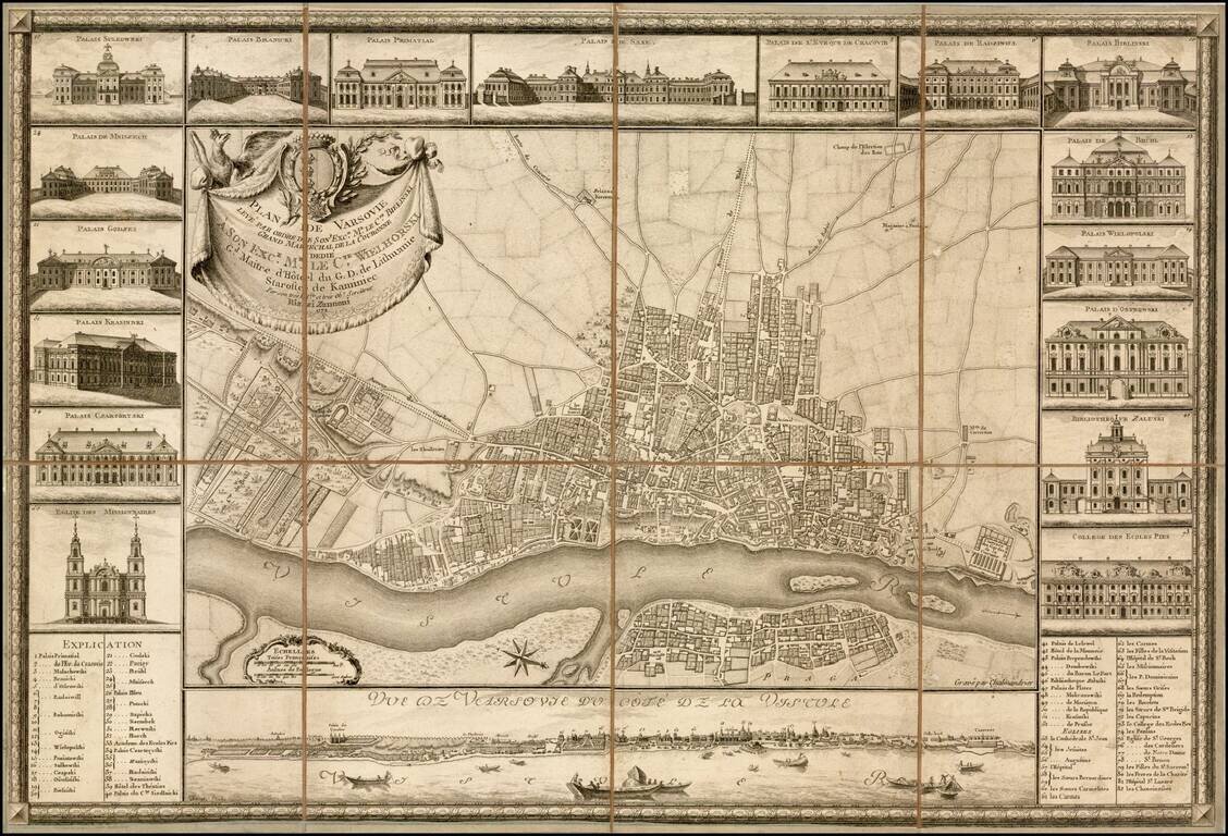
Fine example of the earliest obtainable city plan of Warsaw, engraved by Chalmandrier for Giovanni Antonio Rizzi Zannoni in 1772. Rizzi Zannoni's plan is based upon the 4-sheet plan of Warsaw by Pierre Ricaud de Tirregaille, entitled Plan de la ville...
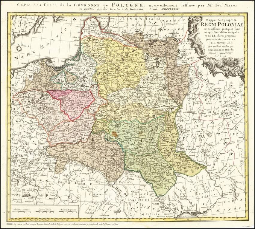
Detailed map of Poland, by Tobias Mayer, dated 1773 in the title cartouche. Poland extends from Glogau and Breslau in the west, to Braclaviensis in the south along the Dniestr River, east to the Dniepr River and Mscislaw and north to include parts of...
![Tabula Regni Borussiae Borussiam Orientalem exhibens MDCCLXXV [and] Borussiae Occidentalis Tabula . . . 1780](/map/small/58775.jpg)
Scarce map of Poland, Lithuania, Kalingrad, Pomerania, etc. The maps were created by Gussefeld, one of his earliest maps, and published by Homann Heirs.
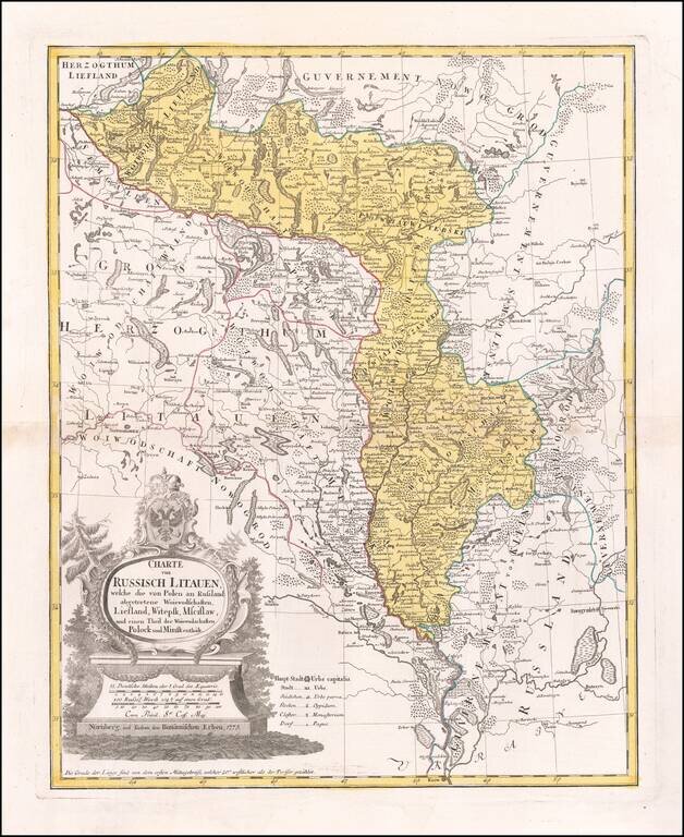
Antique Map of Russian Lithuania After The First Partition Interesting regional map of Russian Lithuania, showing remarkable detail along the upper Dniepr and Dwina River regions, from Liefland to Mscislaw and Woiwodschaft. This 1775 map depicts...
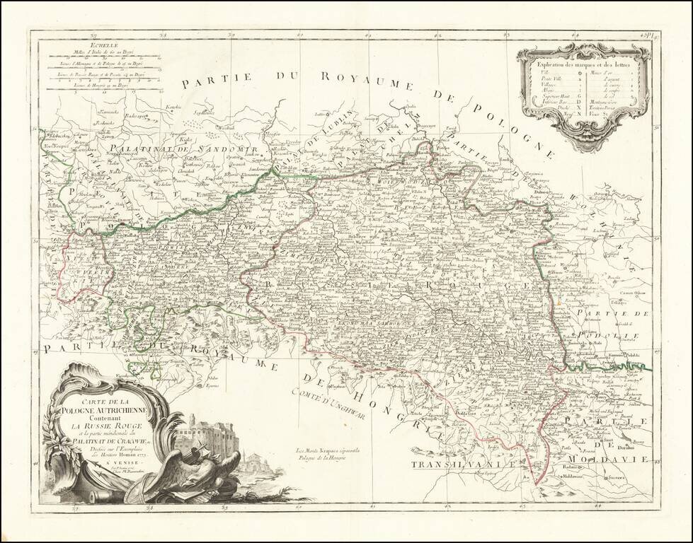
Fine and highly detailed map of Southern Poland and parts of Slovakia, Ukraine, Hungary, Romania and Moldova, which was then being called Austrian Poland and Red Russia. Santini gives credit to Homann Heirs in the cartouche.