
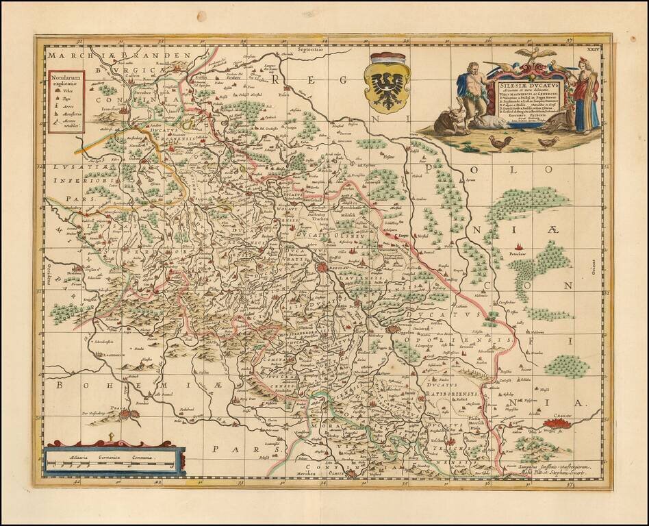
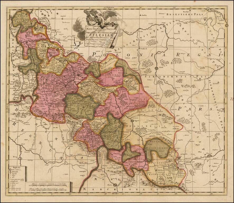
Scarce Moses Pitt map map of Silesia, centered on Breslau. Shows Cracow in the southeast, Prague in the southwest, and Posen in the North. Follows the course of the Oder from Ratisbone to beyond Frankfurt am Oder. Two cartouches and coat of arms....
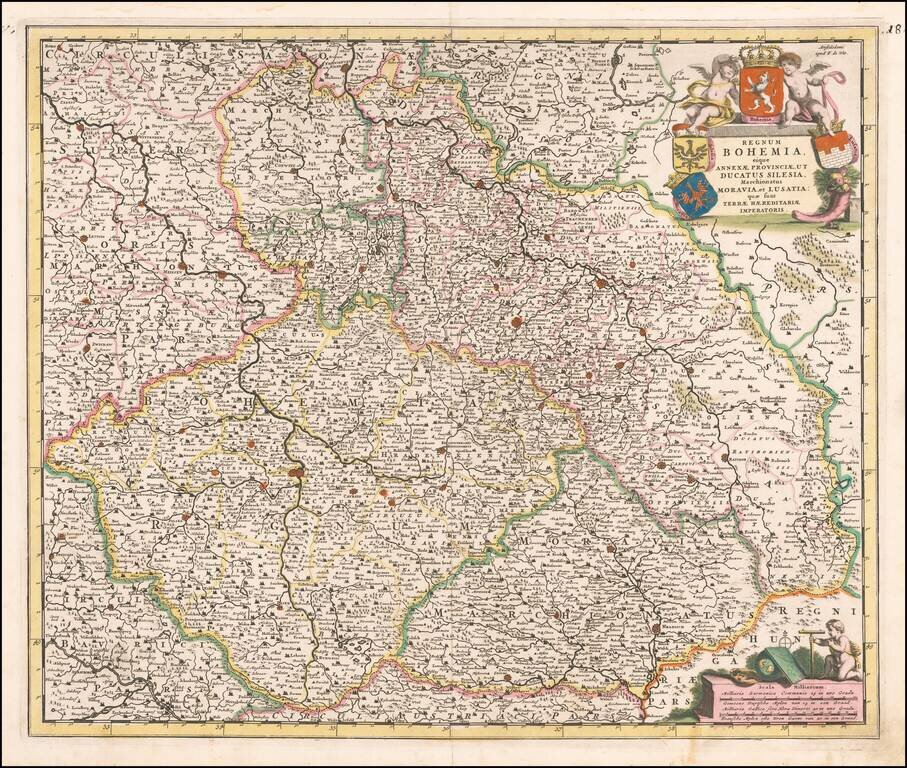
Fine old color example of Frederick De Wit's map of Bohemia, Silesia, Moravia and Lusatia. Includes several coats of arms and a decorative cartouche.
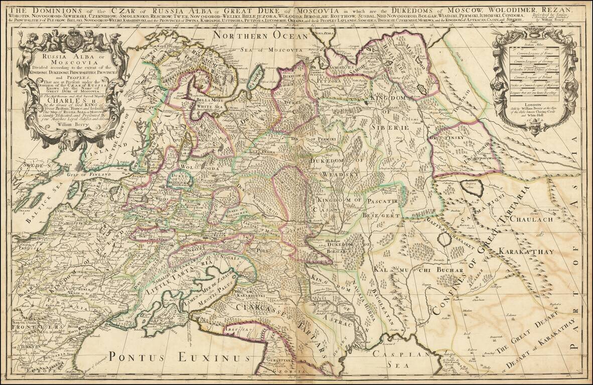
First state. Impressive two-sheet engraved antique map of Russia, published by the 17th century London mapmaker William Berry in 1682. The map covers all of Russia to the Ural Mountains and also depicts a large Kingdom of Poland dominating most of...
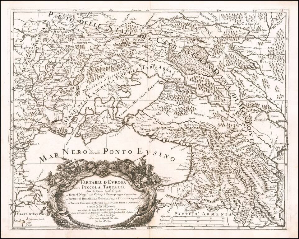
Rare map of the Ukraine, Georgia, Moscovy, Southeastern Poland / Lithuania and the Black Sea, by Cantelli da Vignola and published in Rome by Rossi. The map provides one of the most detailed and up to date treatments the area centered on the newly...
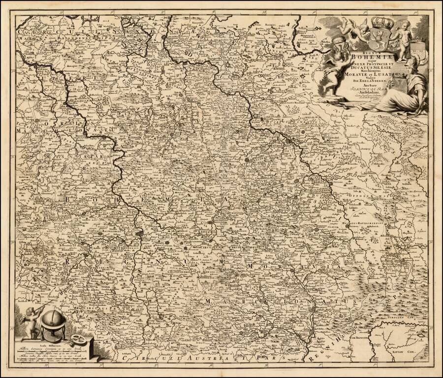
Rare Johannes De Ram map of Bohemia, Silesia, Moravia and Lusatia. Highly detailed map from one of the rarest Dutch map makers of the late 17th Century.
![Moscovia Parte Orientale . . . [with] Parte Occidentale . . .](/map/small/37824.jpg)
Nice example of Coronelli's two sheet map of Russia, extending from the Baltic and the Black Sea in the west to Gran Tartaria in the east. Coronelli's map of Russia is one of the most detailed and elaborate maps of the 17th Century, providing...
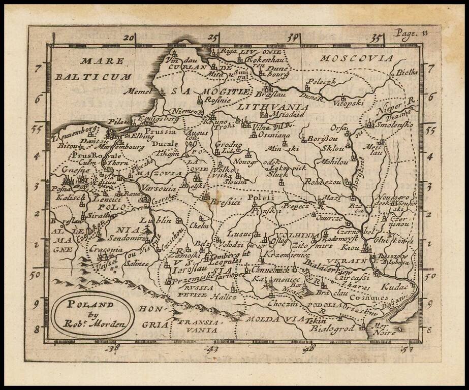
Rare early English map of Poland. Maximum Poland, extending from the Baltic to the Ukraine and beyond the Dniepr River.
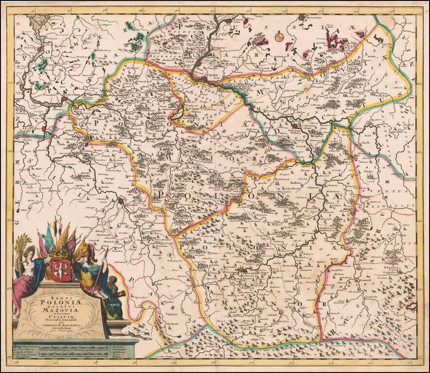
Fine old color example of this rare map of Poland Lithuania and Ukraine, etc., published in Amsterdam by Cornelis Danckerts and engraved by A. Schut. The map was later issued by Reiner & Josua Ottens during the first part of the 18th Century. The...
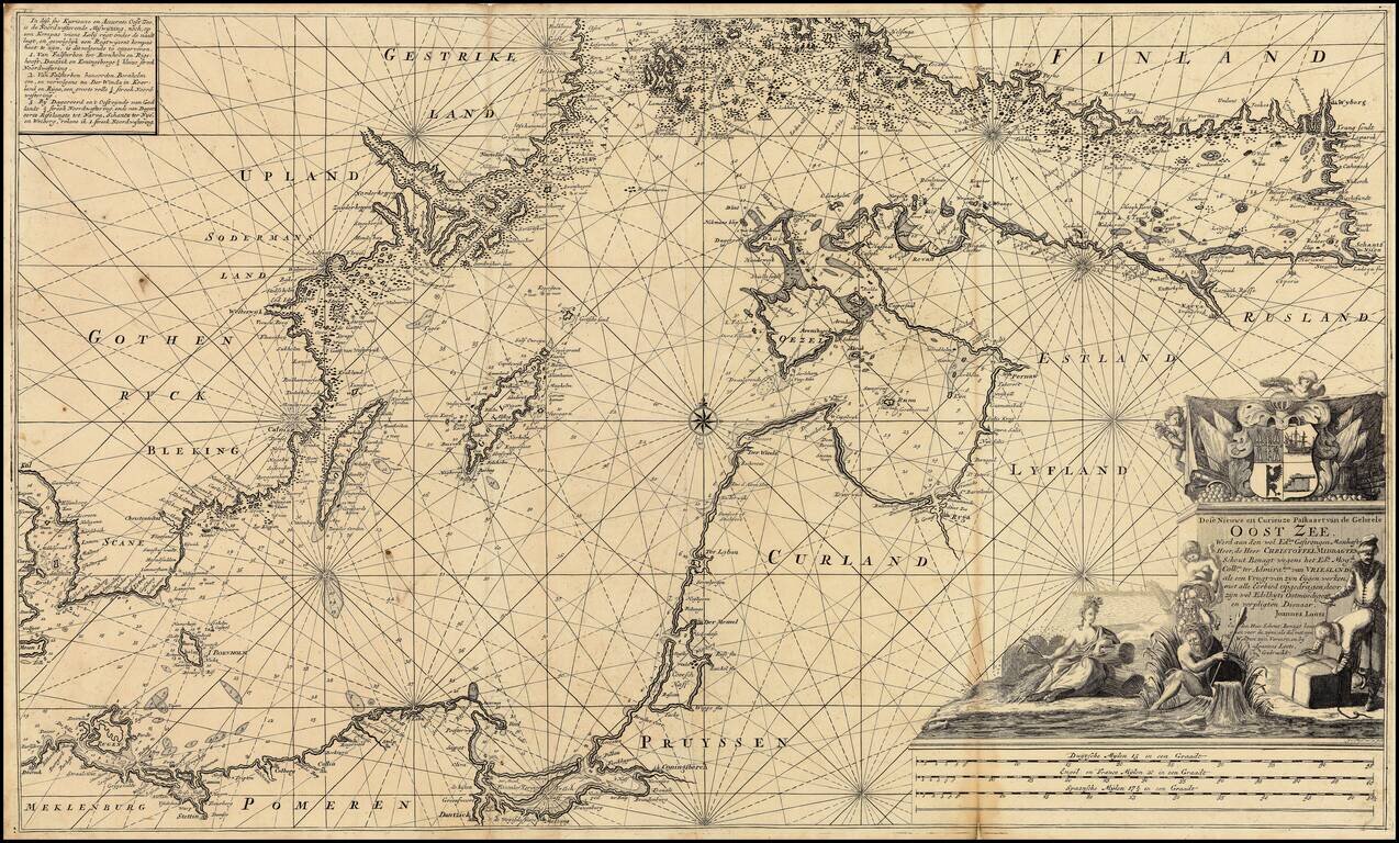
Extremely rare over-sized sea chart of the Baltic, published by Johannes Loots. Loots chart of the Baltic Sea extends from Copenhagen and Rostock in the west, to Wyborg, Narva and Ryga in the east, showing the region in exceptional detail, including...
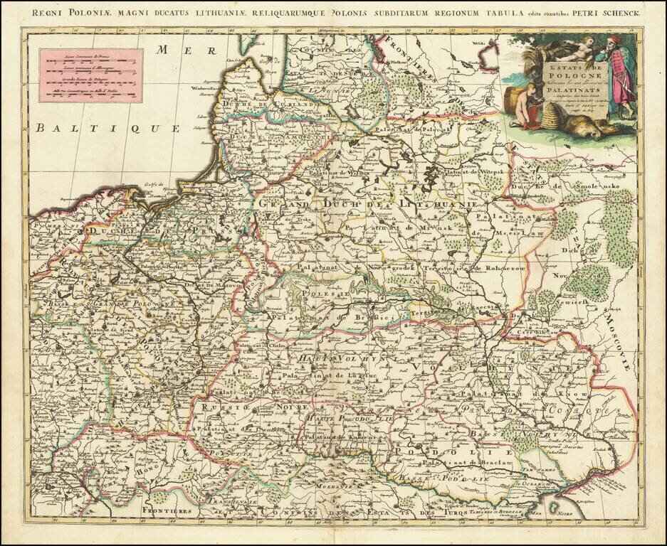
Scarce map of Silesia, in Poland, engraved in Amsterdam by Peter Schenk. The map shows Silesia at the end of the 17th century under Habsburg Rule.
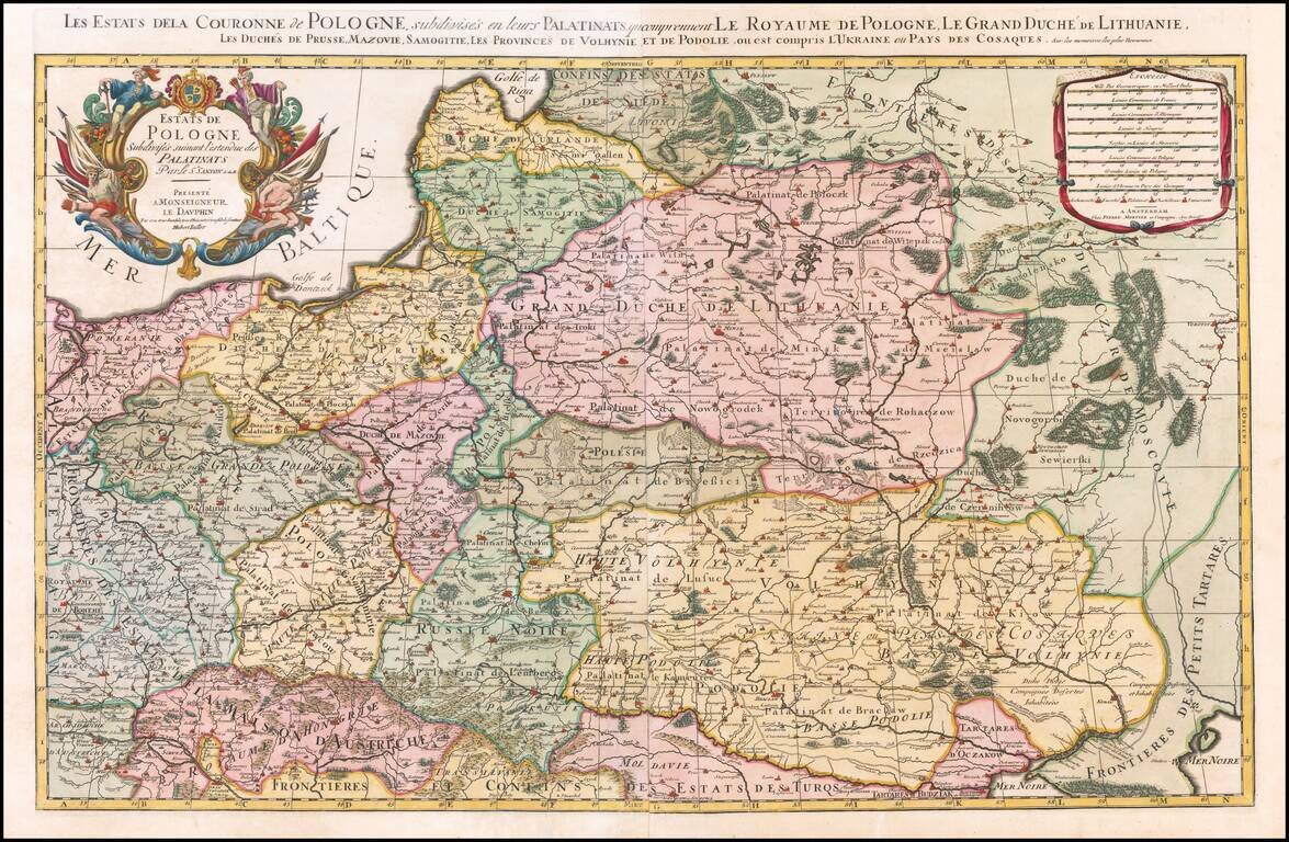
Nice example of the Pierre Mortier edition of this large format map of Poland, Lithuania, the Ukraine and part of Russia, first published by Hubert Jaillot in Paris, in 1679. One of the largest atlas maps of the late 17th Century to focus on Poland,...
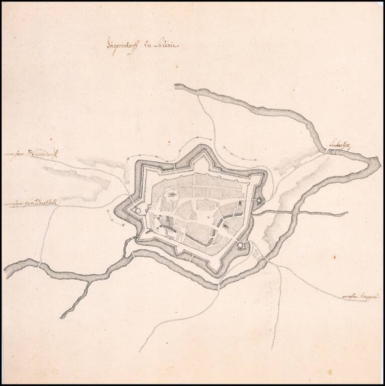
Fine Manuscript Plan of the Walled City of Krnov Striking, finely drawn map of Old City of Krnov, now in the Czech Republic, and previously a part of Austrian Silesia. It shows the walled portion of the city, which sits at the conjunction of two...
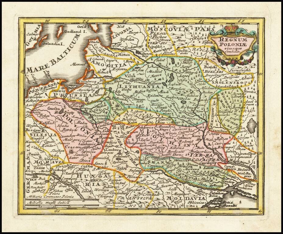
A scarce Pieter Schenk map of Poland, which is attributed to an earlier map published by Sanson. The map extends to the Black Sea and Vienna in the south and to Estonia in the north. The work is a prime example of Schenk's strong engraving style,...
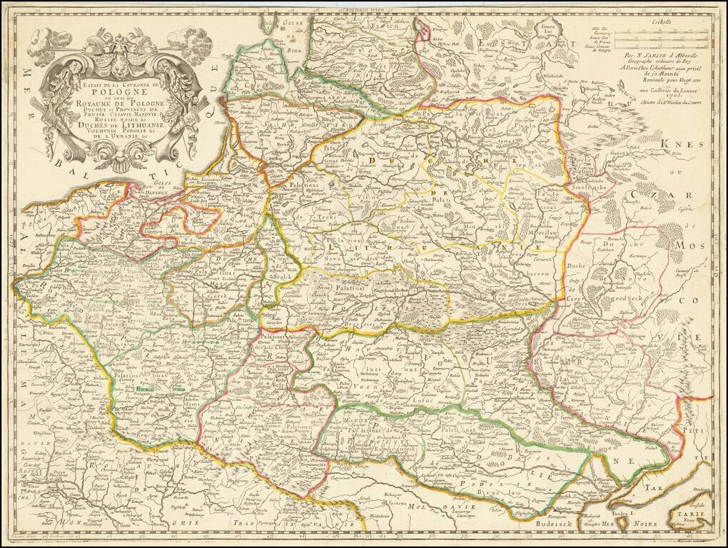
Rare late edition of Sanson's second map of the Polish Empire, Lithuania, Ukraine, etc. Sanson created this scarce map of modern day Poland, Lithuania, Belarus and Ukraine, etc. in 1655 and revised several times over the next 50 years. The date 1679...
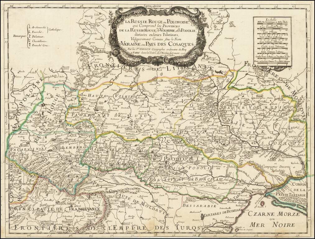
Very rare Sanson map of Ukraine and so-called Russie Rouge, stretching from Lublin in the west to Kherson Oblast in the east (here called "Confin de La Petite Tartarie"). "Russie Rouge" or Red Ruthenia or Red Rus' is a term dating back to the Middle...
Decorative map of Poland and Lithuania in their grandest configurations, published by Weigel. The map extends from the Baltic to the Black Sea, capturing the details and reach of these then powerful countries at the beginning of the 18th Century. The...