Map size in jpg-format: 400.975MiB
Click to open in high resolution (open in new tab).
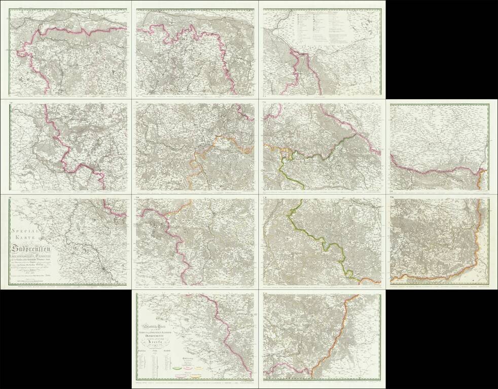
An Important Early Postal Route Map of South Prussia. -- The First Scientific Survey of South Prussia
Special map of South Prussia prepared under royal decree by renowned architect and civil engineer, David Gilly after the final Partition of Poland.
Published on 13 sheets, the map notes the postal routes and is colored by Departments.
Along the bottom, the key explains the different types of postal routes.
If you are a student, write to us in telegram: @antiquemaps and indicate what material you need and for what work you need a map in high detail. We are ready to provide material on special terms. For students only!


![[Hand Drawn Prussian Military Encampment at Opole, Poland] Special Grund-Riss Des Kaeyserl Feldl Lagers bey Oppeln in Ober Schlesien](/map/small/59726.jpg)