
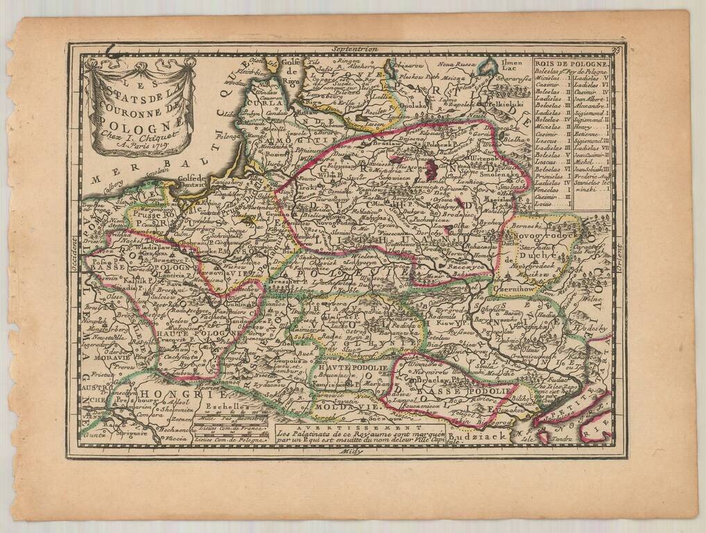
Fine example of Chiquet's map of Poland, from his Le Nouveau et Curieux… Includes a finely engraved cartouche.
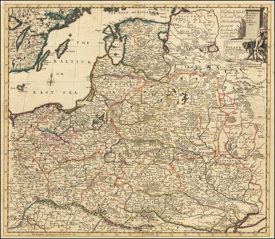
Detailed map of the Polish Empire, published by John Senex. This is the second edition of the map, which was first published by Morden & Browne in 1710. The remnants of the earlier printing , which have been burnished out of the cartouche, are...
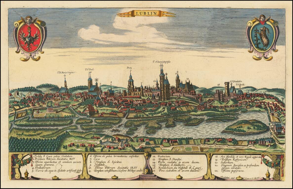
Rare engraved view of the city of Lubin in southwest Poland, published in Amsterdam, about 1721, by Covens & Mortier. The view was originally engraved for Braun & Hogenberg's Civitates Orbis Terrarum in 1617. The plate was eventually acquired...
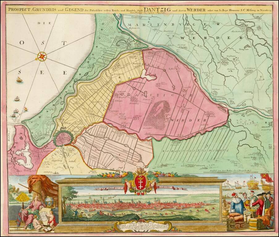
Striking example of Homann's map of Dantzig (Gdansk) and neighboring regions and striking birdseye view, major port to the Baltic Ocean, which for centuries was an important trading center for the Polish, Prussian, German and Baltic regions whose...
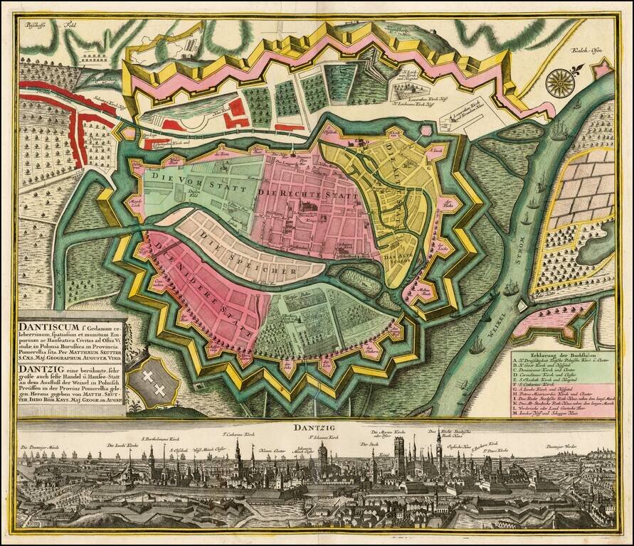
Fine example of Seutter's plan and birdseye view of Dantzig. The plan shows the fortifications of the town, streets, buildings and other points of interest. At the bottom is a fantastic view of the city.
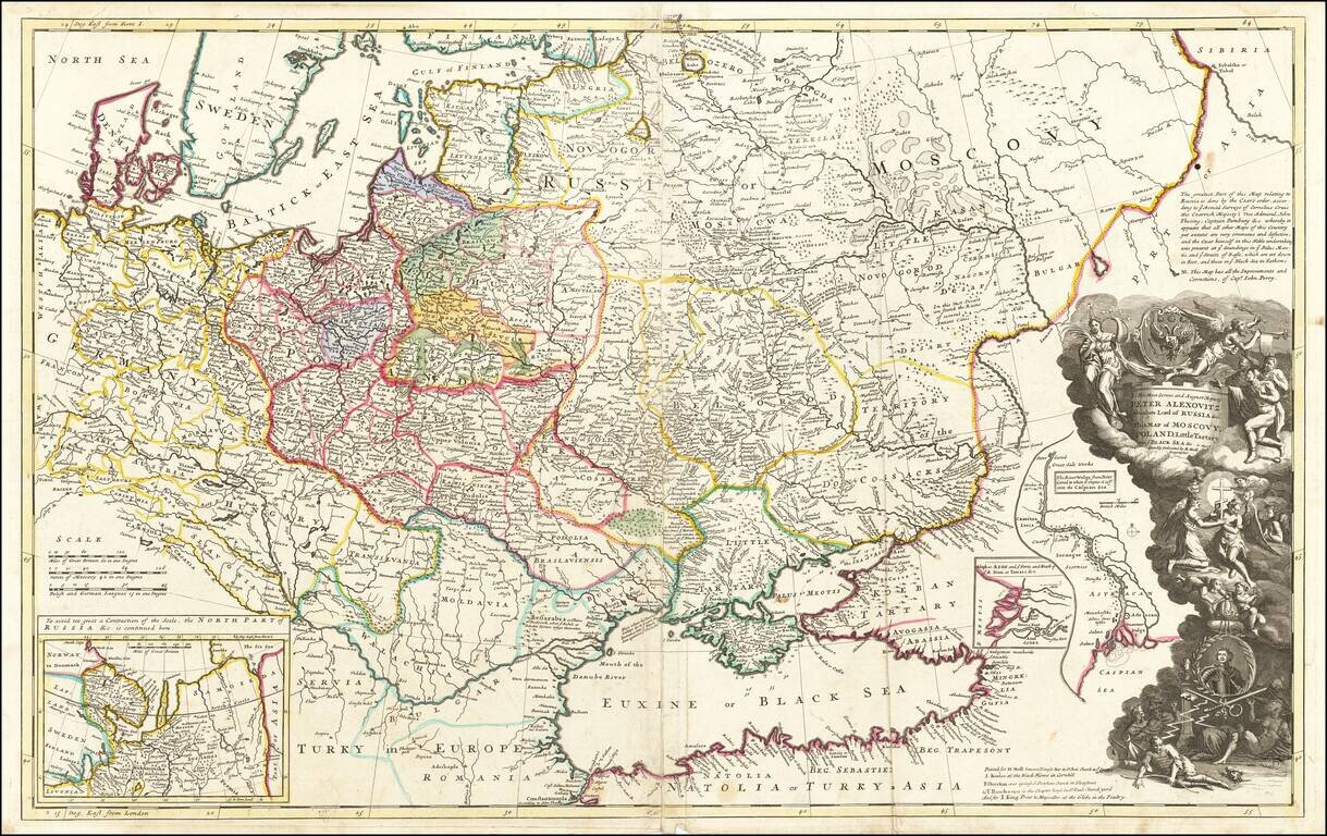
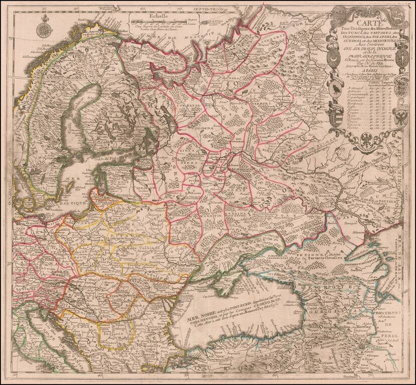
Striking large format map of Russia, Ukraine, Poland, Finland and the Baltic Countries and extending south to the Black Sea and the Balkans, with an ornate dedication cartouche to Peter the Great, including a portrait of the Czar near the bottom of the...
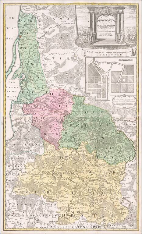
Fine large map of the Baltic and Poland, published by the Homann Heirs. The map illustrates what was then 'Lithuania Minor', the most easterly province of the Kingdom of Prussia, given the name because of the large number of Lithuanian speakers. The...
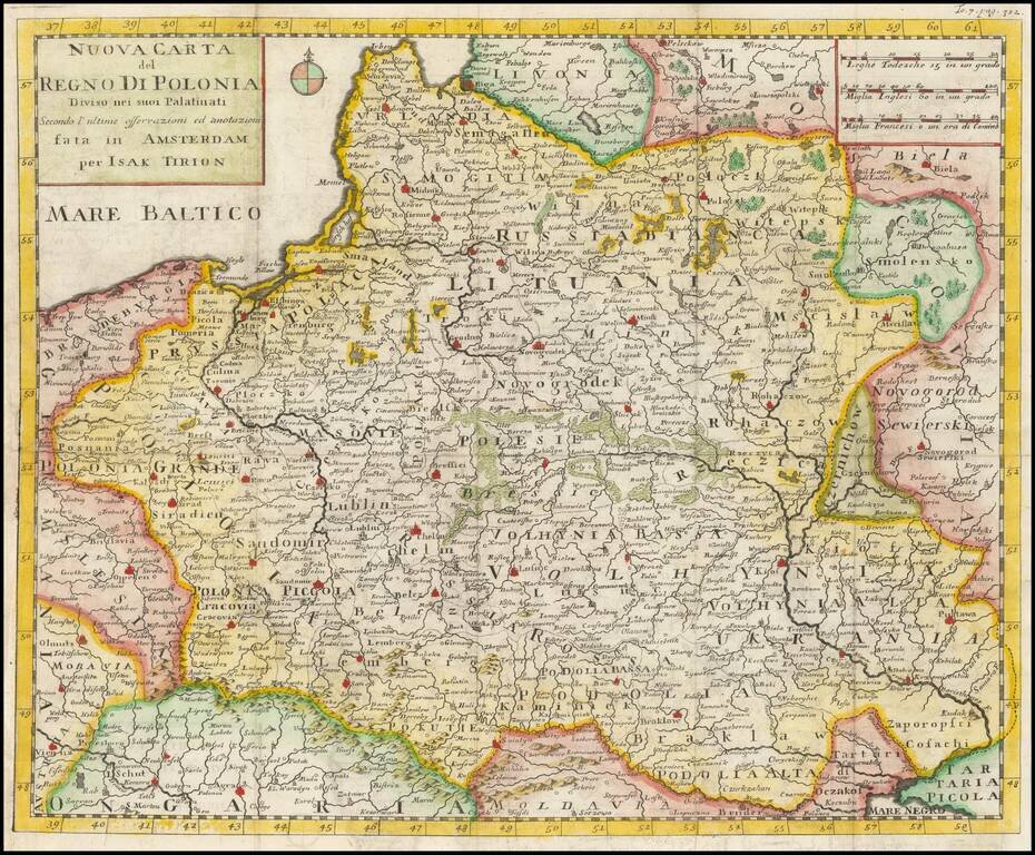
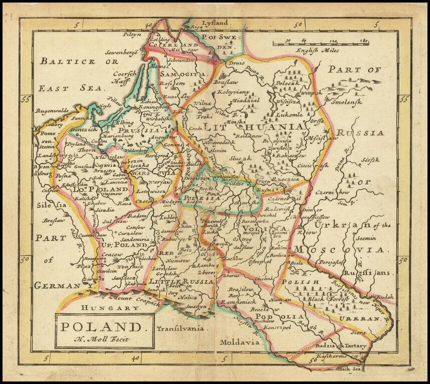
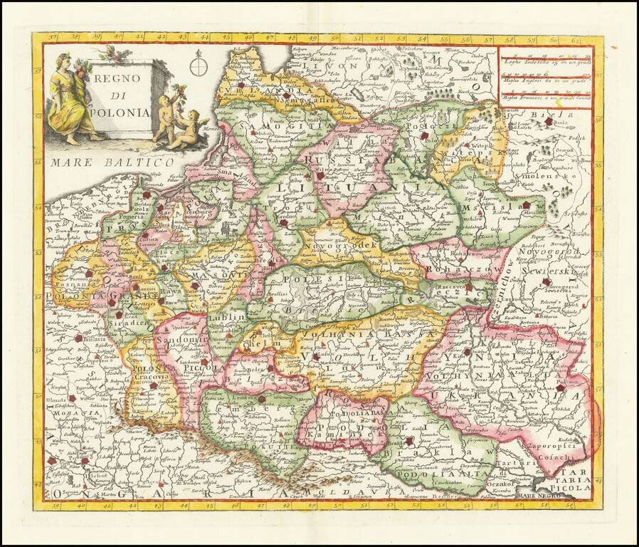
Detailed map of the Kingdom of Poland, extending to Ukrainia and the Black Sea. The present example is the first edition of the map, pre-dating the use of the map in the Italian edition of Salmon's Geography. The two states can be differentiated by...
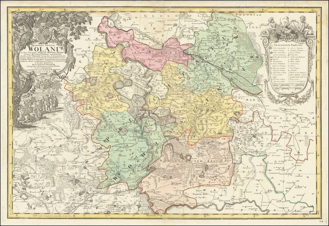
Fine large map of part of Wohlau, Parchwitz, Lüben and Herrnstad, the northwestern part of Breslau, originally drawn by Johann Wolfgang Wieland (?-1736) and Mattheus von Schubarth (1723-1758). The map is dissected by the Oder River, The Atlas...
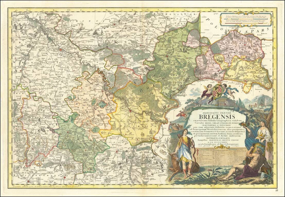
Fine large map of part of the Northern part of Silesia, originally drawn by Johann Wolfgang Wieland (?-1736) and Mattheus von Schubarth (1723-1758). The map is dissected by the Oder River, The Atlas Silesiae, was a large scale atlas of Silesia,...
Scarce map of the region centered on the Black Sea and Russia, published by Nicolas De Fer in Paris. The map extends from Scandinavia and the Baltic in the west to the mouth of the Volga in the Caspian Sea. Elaborate cartouche includes 9 coats of...
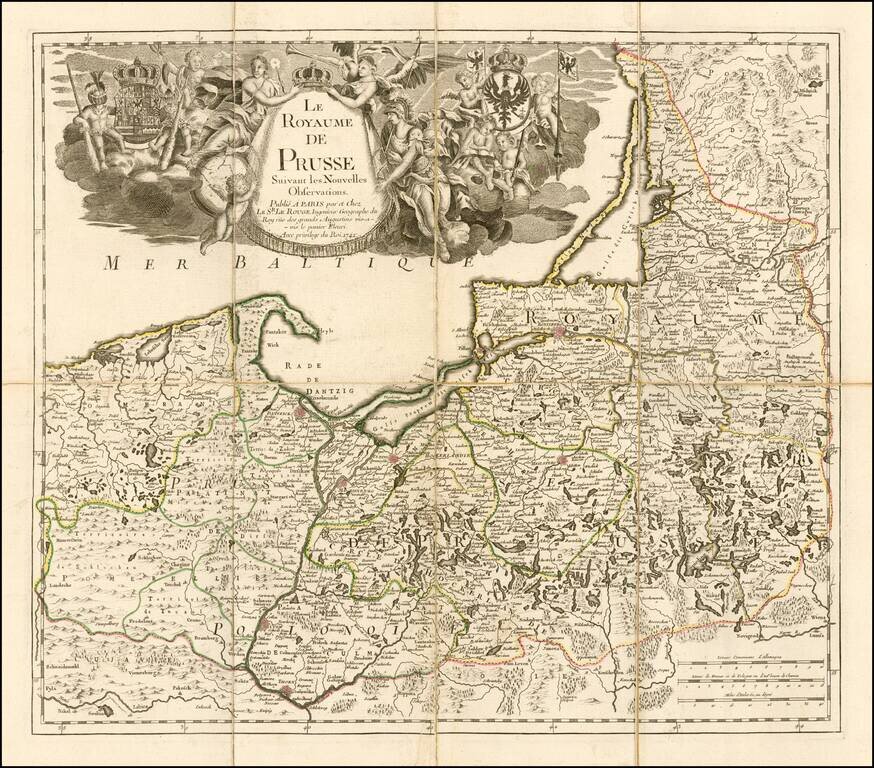
Fine separately issued example of Le Rouge's map of the Kingdom of Prussia, incorporating Poland and the Baltic countries. The map was published two years into the reign of Frederick II (1712-1786) as 'king in Prussia." Includes a fine elegant...
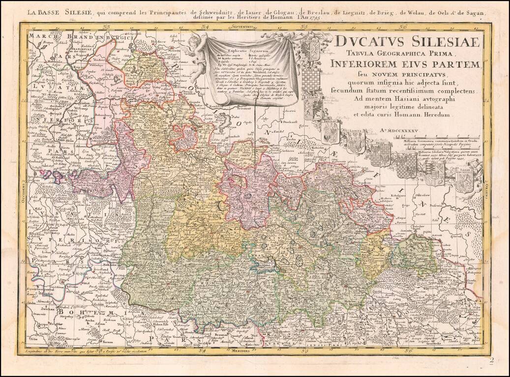
From The First Official Survey of Silesia Detailed map of Lower Silesia, with title cartouche including coat-of-arms of Schweidniz, Iaver, Glogau, Breslau, Lignitz, Brieg, Wolau, Oels and Sagan, with early pencil notes next to each coat of arms. The...
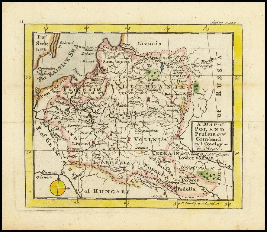
Antique engraved map of the area covering modern-day Poland, the Baltics, and Belarus, by John L. Cowley from “A New and easy introduction to the study of geography”. The map includes Lithuania as the dominating polity in the region. Along with...