
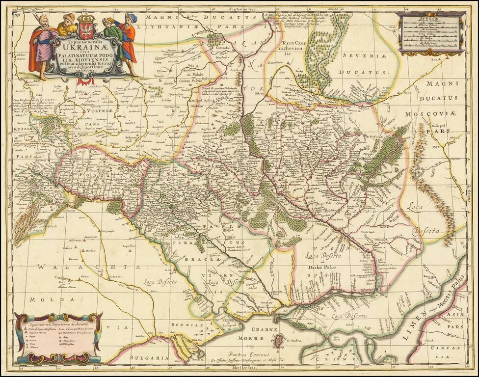
Finely colored example of Moses Pitt's map of Ukraine, divided into provinces, which appeared in a composite atlas by Abraham Wolfgang. Pitt's map, first issued by Jan Jansson in about 1657, is one of the earliest maps to include the name Ukraine in...
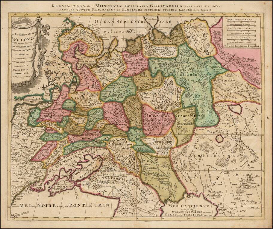
Nice example of the Valk & Schenk's map of the European part of Russia. Includes a Russian Imperial coat of arms and 2 cartouches.
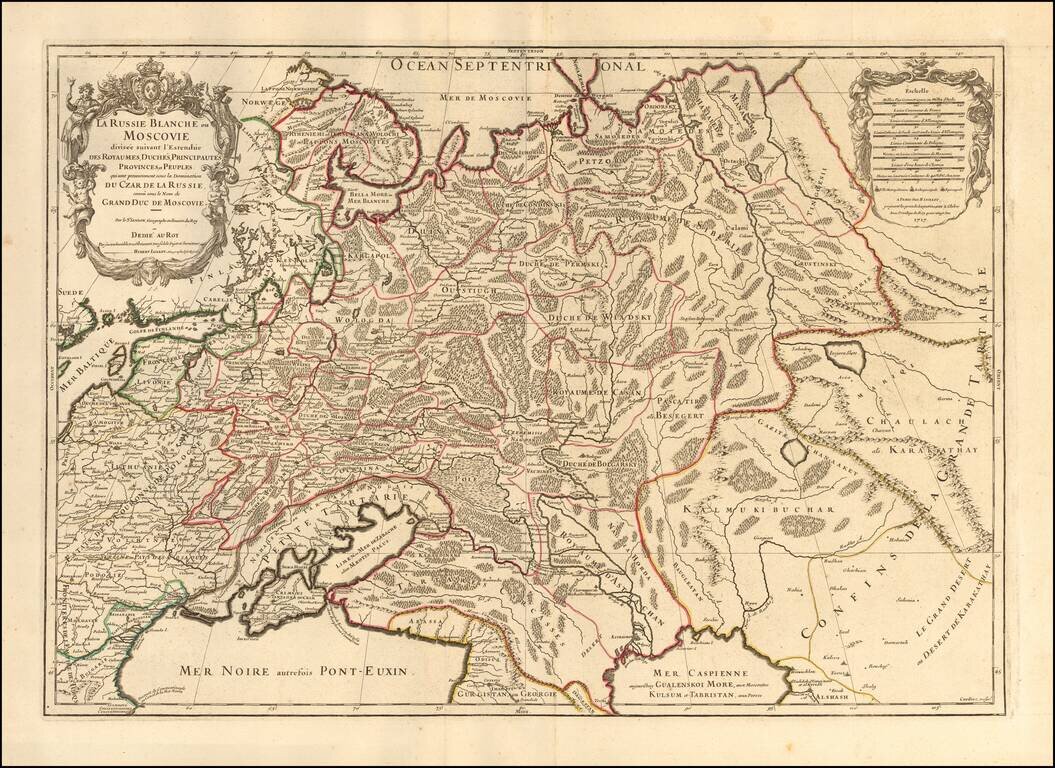
Striking large format map of Russia, extending from the Baltic and Black Seas to Grande Tartarie and the Grande Desert or Desert De Karkkathay, published by Hubert Jaillot. This map of Russia provides a highly detailed picture of European Russia and...
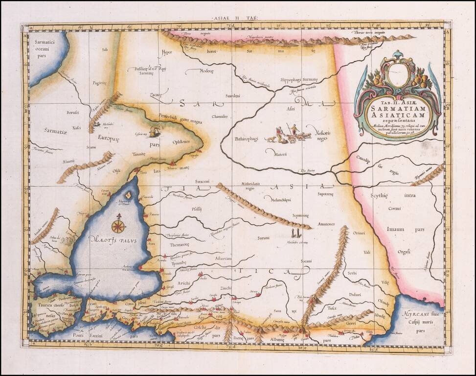
Colored example of Mercator's map of Armenia, Georgia, eastern Turkey, and parts of Ukraine and Southern Russia, from Mercator's Geographia, first published in 1578 and republished in Amsterdam beginning in 1695. Includes decorative cartouche and sea...
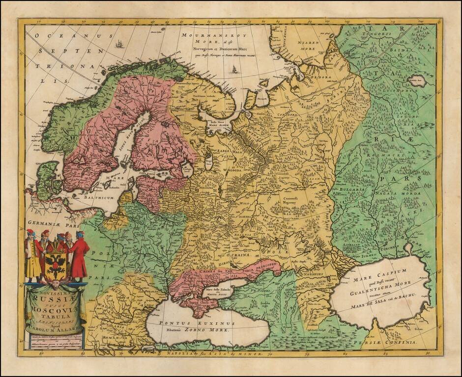
Nice example of Carol Allard's map of Russia and much of Northern Europe. Embellished with a decorative cartouche and coat of arms, plus sailing ships and sea monsters. Based on the cartography of Isaac Massa. The map is an updated version of Hugo...
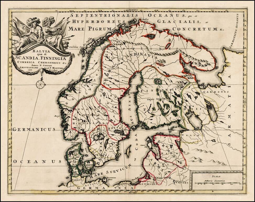
Scarce map of Scandinavia, the Baltic Region and contiguous parts of Finland and Russia. The map appeared in Mortier's Atlas Antiquus, based upon the work of Nicolas Sanson.
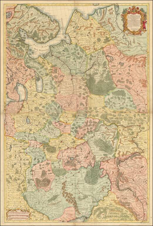
Decorative example of Vander Aa's map of the northern part of European Russia. Nice example, with the picture frame border, which appeared in Vander Aa's Nouvelle Theatre Du Monde, published in 1713.
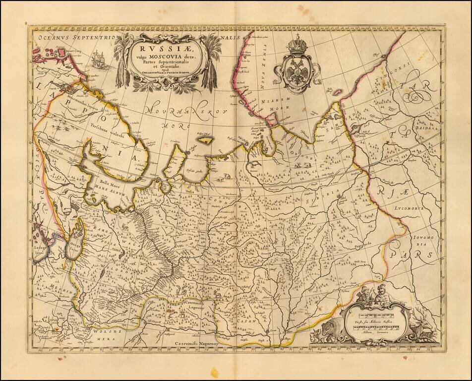
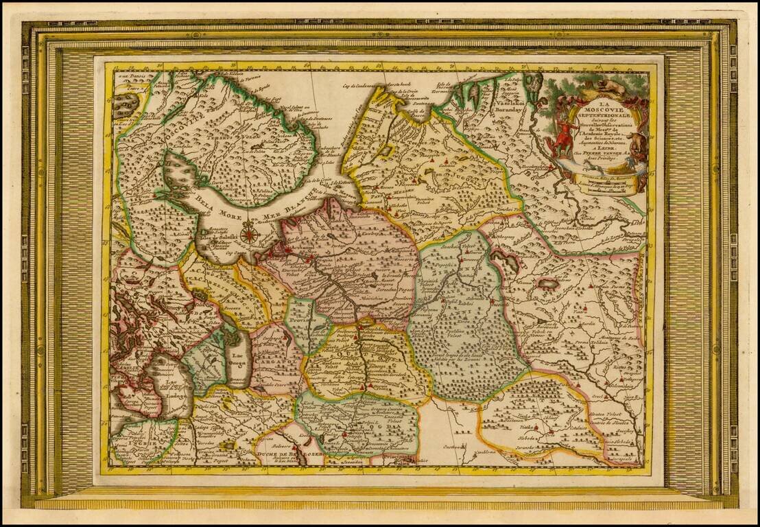
Scarce map of White Russia or Moscovy, published in Amsterdam by Schenk. The map shows the extent of the Czar's Russian Empire in Europe. The political divisions are delineated and the forested areas are graphically shown. Cherubs hang from the...
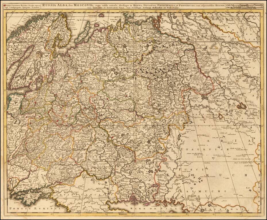
Scarce map of Russia and Ukraine, hand colored by political subdivisions, by Gerard and Leonard Valk. The map extends far to the east, showing some portion of the Tartar and Mongol regions.
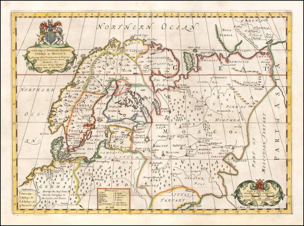
Decorative map of Scandinavia and Russia at the beginning of the 18th Century. This map was part of an atlas dedicated to the Duke of Glocester, who was then attending school in Oxford. English coat of arms and decorative cartouche.
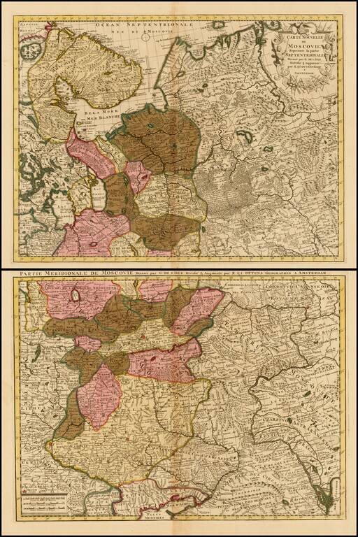
Important early map of Russia and the Ukraine, drawn by Guillaume De L'Isle, the leading French mapmaker at the beginning of the 18th Century.
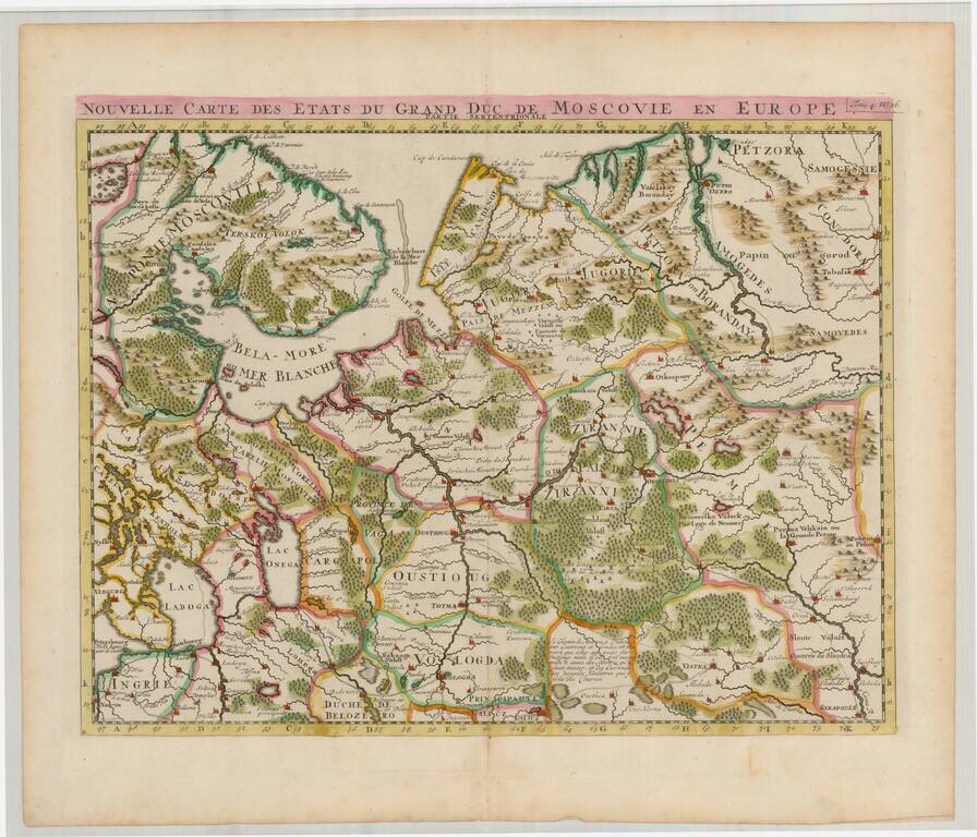
Striking regional map of the northern parts of European Russia. The map appeared in Chatelain's monumental Atlas Historique.
Attractive and detailed map of Russia and part of Ukraine, including decorative cartouche.
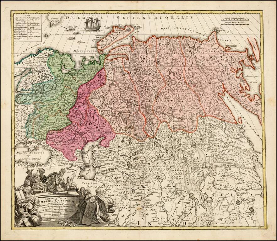
Striking large format map of Imperial Russia, at the beginning of the period when Russia was aggressively exploring the Pacific Ocean and Arctic Seas. Highly detailed map of the Russian Empire and northern China covering the region from Finland and...
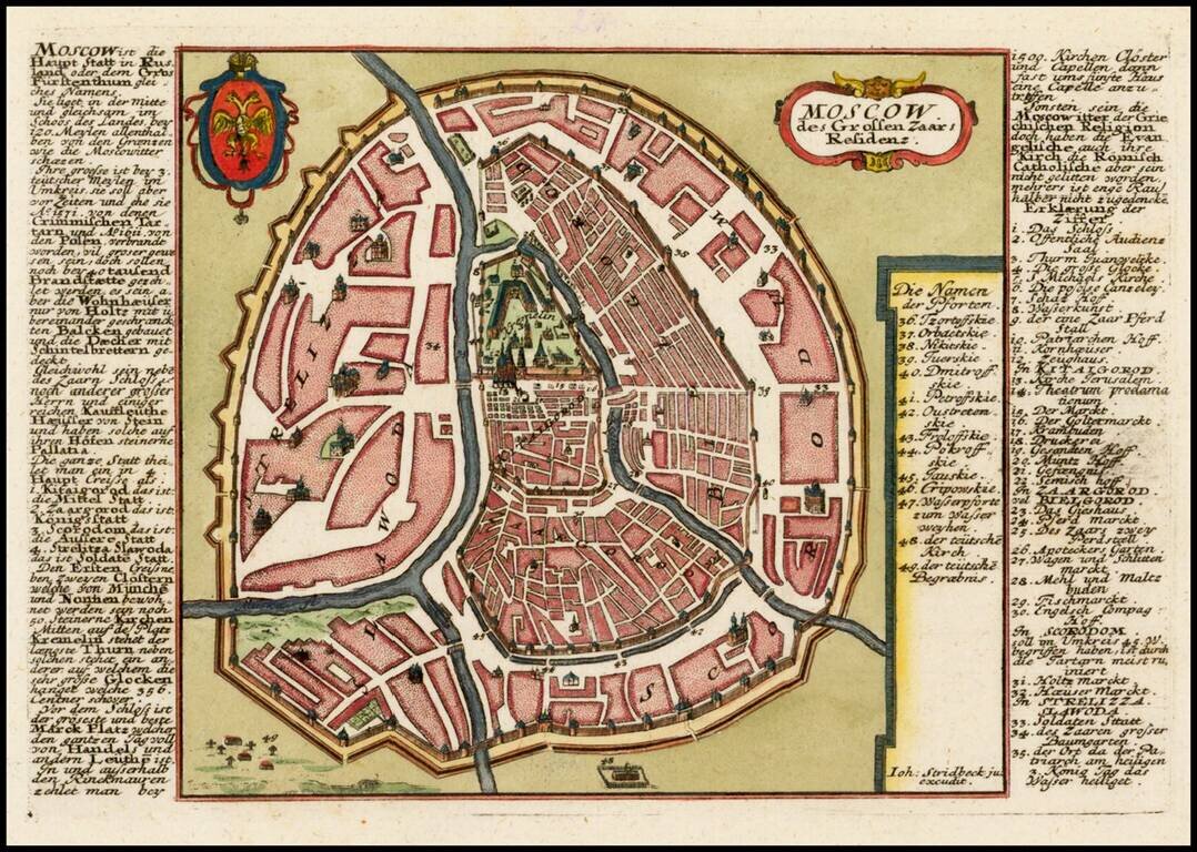
Finely detailed plan of Moscow, with extensive keys on either side of the map, identifying important places. Includes title cartouche and coat of arms.
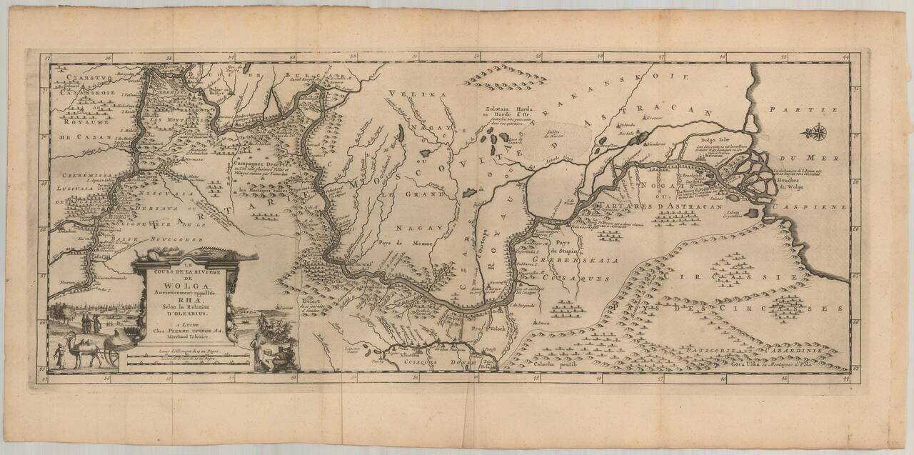
Nice example of Olearius' map of the Volga River, which first appeared in of Olearius' Relation du voyage d'Oléarius Adam en Moscovie, Tartarie, et Perse avec celui de I.A. De Mandelslo aux Indes Orientales - traduit de l'Allemand et augmenté par A....