Map size in jpg-format: 53.1579MiB
Click to open in high resolution (open in new tab).
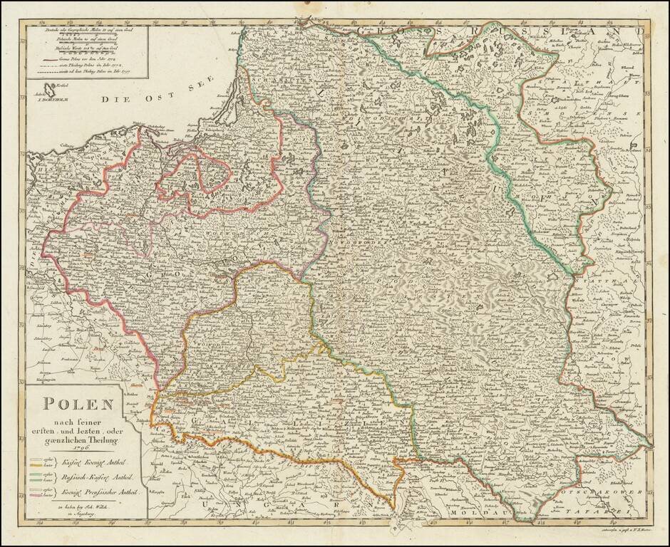
Detailed map of Poland, published in Augsburg by Johann Walch.
The map shows Poland after the 3 dismemberments. The color coding shows the areas taken by the various European powers.
Johann, or Johannes, Walch (1757-1816) was a painter and engraver. He was well-known for painting miniature portraits, having trained in Geneva, Venice, and Rome. Walch published several atlases and sheet maps. As with his atlases, many of Walch’s maps were reprinted after his death.
If you are a student, write to us in telegram: @antiquemaps and indicate what material you need and for what work you need a map in high detail. We are ready to provide material on special terms. For students only!


![[Hand Drawn Prussian Military Encampment at Opole, Poland] Special Grund-Riss Des Kaeyserl Feldl Lagers bey Oppeln in Ober Schlesien](/map/small/59726.jpg)