Map size in jpg-format: 55.1867MiB
Click to open in high resolution (open in new tab).
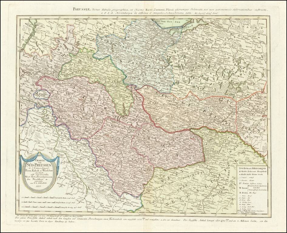
Rare map of western Poland, published by Gussefeld.
At the bottom left the title cartouche, with explanations and representation of the new political affiliation of the districts and areas that had fallen to Prussia after the division in 1793.
If you are a student, write to us in telegram: @antiquemaps and indicate what material you need and for what work you need a map in high detail. We are ready to provide material on special terms. For students only!


![[Hand Drawn Prussian Military Encampment at Opole, Poland] Special Grund-Riss Des Kaeyserl Feldl Lagers bey Oppeln in Ober Schlesien](/map/small/59726.jpg)