Map size in jpg-format: 44.2514MiB
Click to open in high resolution (open in new tab).
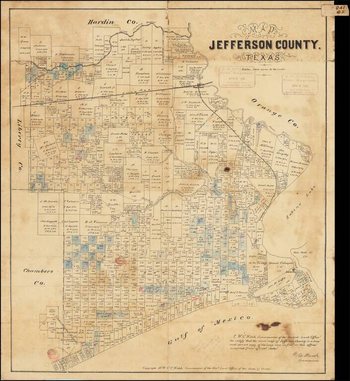
Antique Texas General Land Office map of Jefferson County, Texas. The map was prepared in 1879 by W.C. Walsh, Commissioner of the Genl. Land Office.
This example of the map has manuscript annotations related to land sales and the oil industry. Three red pencil circles have been drawn on the map, one at the Big Hill salt dome oilfield, one at the High Island oilfield, and the other at the Spindletop oilfield.
This example was owned by Galveston-based surveyor R.W. Luttrell. Luttrell was active through the initial Texas oil boom.
If you are a student, write to us in telegram: @antiquemaps and indicate what material you need and for what work you need a map in high detail. We are ready to provide material on special terms. For students only!


