Map size in jpg-format: 59.7173MiB
Click to open in high resolution (open in new tab).
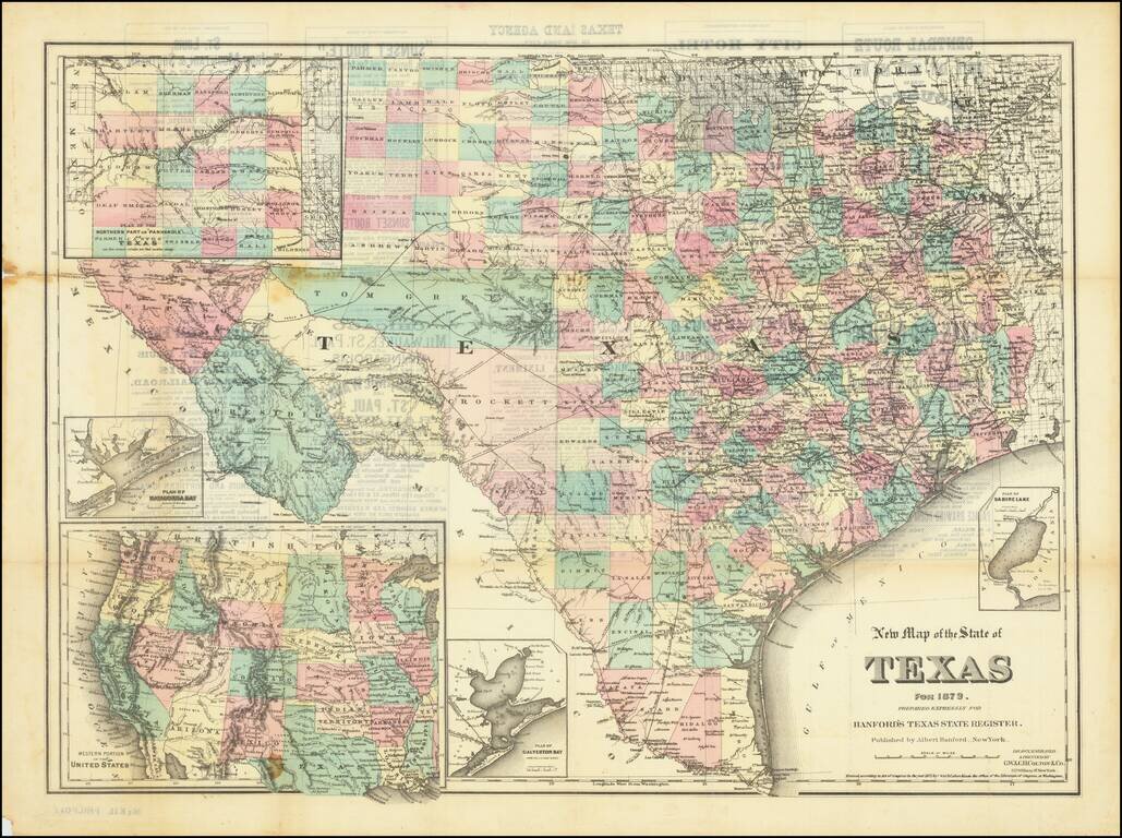
Scarce separately-issued version of Albert Hanford's map of Texas, originally published for his Texas State Register of 1879. The map was prepared by G.W. & C.B. Colton.
The map includes a number of good insets: Plan of Sabine Lake; Plan of Galveston Bay From the U.S. Coast Survey; Western Portion of the United States; Plan of Matagorda Bay; and, Plan of the Northern Part or "Panhandle" of Texas on the same scale as the main map.
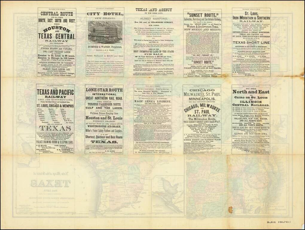
There are extensive advertisements on the back of the map, including for Hanford's "Texas Land Agency in New York City". The map bears a copyright date of 1875, but the advertisement on the verso only mentions a Register for the years 1877, '78, and '79.
This map came out in the last years of the Golden Age of Texas Mapmaking, which lasted from 1830 with the publication of Stephen F. Austin's map (or 1826 with the Galli map) to 1879 and the publication of the massive Pressler & Langermann map of Texas.
G. W. & C. B. Colton was a prominent family firm of mapmakers who were leaders in the American map trade in the nineteenth century. The business was founded by Joseph Hutchins Colton (1800-1893) who bought copyrights to existing maps and oversaw their production. By the 1850s, their output had expanded to include original maps, guidebooks, atlases, and railroad maps. Joseph was succeeded by his sons, George Woolworth (1827-1901) and Charles B. Colton (1831-1916). The firm was renamed G. W. & C. B. Colton as a result. George is thought responsible for their best-known work, the General Atlas, originally published under that title in 1857. In 1898, the brothers merged their business and the firm became Colton, Ohman, & Co., which operated until 1901, when August R. Ohman took on the business alone and dropped the Colton name.
If you are a student, write to us in telegram: @antiquemaps and indicate what material you need and for what work you need a map in high detail. We are ready to provide material on special terms. For students only!


