Map size in jpg-format: 14.7775MiB
Click to open in high resolution (open in new tab).
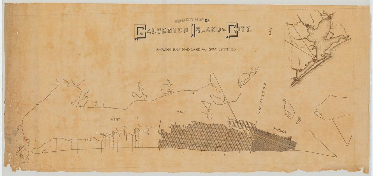
A Pre-Hurricane Manuscript Map of Galveston.
Detailed manuscript map of Galveston Island and the city of Galveston, Texas. The map was prepared before the Galveston Hurricane of 1900, when the city was booming and plans for its expansion across the entire island abounded.
In the upper right corner is an inset map of Galveston Island in context with Galveston Bay, Houston, and the rail connections between the two.
The main city center, which still exists today, is shown at the east end of the island. The area west of that is gridded along a different template and was the subject of much real estate speculation and planned development before the Hurricane.
This map came from a very large collection of Galveston- and southeast-Texas related printed and manuscript maps, assembled by multiple generations of Galveston based surveyors.
This map was probably drawn with the intention that it would be converted into a printed map that would then be used for real estate promotion.
The map might have been prepared for the sale of some of the "Galveston Island Lots" sections 1-3 (section 4 lying still farther west). That area was surveyed by R.C. Trimble and Wm. Lindsey.
If you are a student, write to us in telegram: @antiquemaps and indicate what material you need and for what work you need a map in high detail. We are ready to provide material on special terms. For students only!


