logo

1890. Topographical Map for Commerce of Dallas, Texas

  • Topographical Map for Commerce of Dallas, Texas

Topographical Map for Commerce of Dallas, Texas information:

Year of creation: 
Resolution size (pixels): 
 11949x15192 px
Disk Size: 
 49.5977MiB
Number of pages: 
 1
Place: 
 Baltimore
Author: 

Print information. Print size (Width x height in inches):
Printing at 72 dpi 
  165.96 х 211
Printing at 150 dpi 
 79.66 х 101.28
Printing at 300 dpi 
 39.83 х 50.64

An example of detailing the file of this map of in a printable high-resolution:

Click to open in high resolution (open in new tab).
Attention! this is just the central piece (central area 960x960 px) of the map file!
This is an example, so that you can see and study the level of detail of a given map. The entire Map will be fully available after payment!

Topographical Map for Commerce of Dallas, Texas

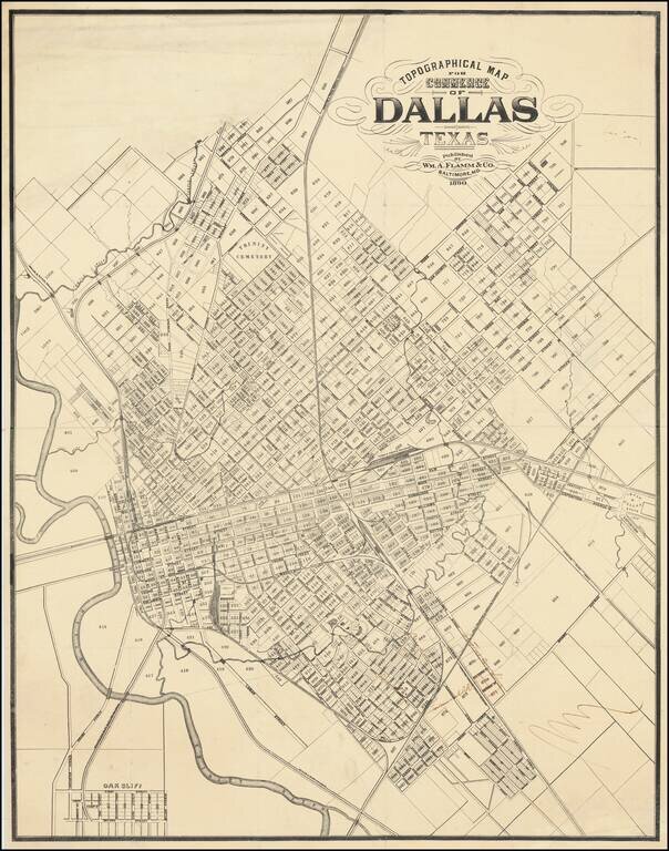
Important 19th-Century Map of Dallas. The Only Known Example.

The only known example of this 1890 map of Dallas, Texas, by William Flamm & Co. of Baltimore, Maryland.

Curiously, Flamm calls the map a "Topographical Map for Commerce" but there is not topography indicated.

The map shows Dallas roughly bounded at the north by Turtle Creek.

In the south of the map are manuscript notes about two "Electric Car Lines" and one mark that says "Terminal RR".

Rarity

This is the only known example of this map; OCLC and RBH record no examples of the map in any institutional collections or sales.


Special conditions for students!

If you are a student, write to us in telegram: @antiquemaps and indicate what material you need and for what work you need a map in high detail. We are ready to provide material on special terms. For students only!

Item information:

Year of creation:
Size:
11949x15192 px
Disk:
49.5977MiB
Number of pages:
1
Place:
Baltimore
Author:
William A. Flamm.
$14.99

Related item