

Map size in jpg-format: 14.542MiB
Click to open in high resolution (open in new tab).

The Thomas W. Streeter - Warren Heckrotte Copy -- Rare Early California Railroad Map and Pamphlet By One of America's Most Important Railroad Engineers
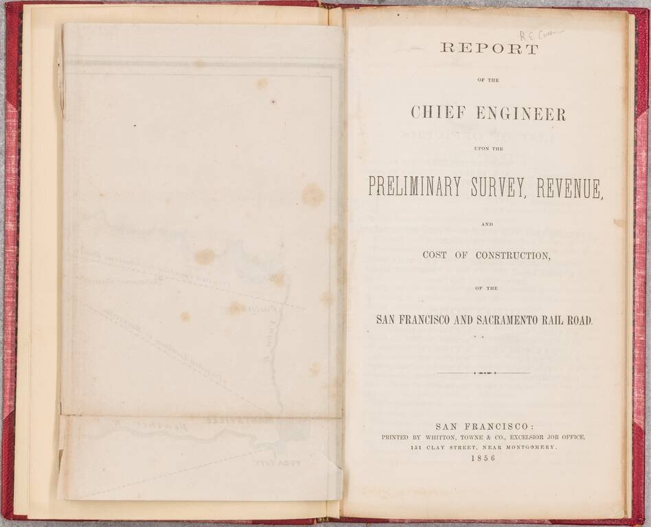
Rare early report on a California railroad, produced by Theodore Judah, the engineer who was the driving force behind the quest for an intercontinental railroad.
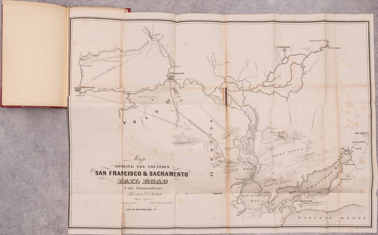
The present work is the second map produced by Theodore Judah, following his Map of the Sacramento Valley Railroad, published in September 1854. Recruited from the East Coast, Judah served as the Chief Engineer in construction of the Sacramento Valley Railroad, California's first operating railroad line, which commenced operations in February 22, 1856. The present map, dated February 1,1856, would be Judah's last work prior to the publication of his Practical Plan for Building The Pacific Railroad, published in January 1857, which would catapult him into prominence in the quest to build America's First Transcontinental Railroad.
The present copy of the Report is the Thomas W. Streeter copy, with Streeter's pencil notes on the front free endpaper stating that he "Got this from R.E. Cowan in 1924 or 1930." In describing this work, Streeter wrote:
. . . This report gives much data on existing methods, extent and costs of transportation and travel in California. Judah had previously been the Chief Engineer of the Sacramento Valley Railroad but had left that position shortly before its line reached Folsom, about January 1, 1856.
No progress was made in building the railroad lines from Benicia to Sacramento until 1865 when the California Pacific Railroad Company was organized. In 1867 this new company began construction and the road between Vallejo and Sacramento was finished in 1869. It is now part of the main line of the Central Pacific between Oakland and Sacramento. As usual the map is interesting.
The map, on a scale of 4 miles to the inch, was lithographed in San Francisco by Britton & Rey. The map shows all San Francisco Bay, San Jose, Marysville, Folsom, and Stockton. The railroad is to run from Benicia to Sacramento. The Sacramento Valley Rail Road from Sacramento to Folsom and the proposed route of the Pacific Atlantic R.R. from San Francisco to San Jose are shown.
In this rare pamphlet, Judah, the highly respect engineer, described in detail the advantages and costs of building a straight-line railroad of 58 miles from Benicia to Sacramento (actually to the town of Washington on the west side of the Sacramento River). In this way, passengers and the agricultural products of northern California could be efficiently linked to San Francisco, “the great commercial emporium of the Pacific.” At Benicia, ships would deliver freight and passengers to the flourishing port city.
Judah notes that the proposed railroad would be more economical and faster than the existing upriver steamship lines. Judah estimated the total cost of the project at $3,000,000.
While the project had merit, Judah's attention was shortly thereafter turned to the creation of a transcontinental railroad, an endeavor which he would continue for the rest of his life and would result in most important early groundwork for both the route of the Central Pacific Railroad and Congressional approvals which would lead to the commencement of work on the transcontinental railroad (see biographical information below).
As noted by Rogers & Spink in describing Judah's work surveying a route across the Sierra Nevada Mountains as part of his work on the Transcontinental Railroad:
In purely engineering retrospect, Judah’s achievements would seem nothing short of providential, especially in comparison to modern route surveying efforts. With a minimal survey crew utilizing crude instruments and only draft animals for transportation, Judah was able to lay out a remarkably accurate alignment across the most difficult natural obstacles undertaken up until that time (1861)."
Rarity and Provenance
The map and report are very rare on the market. In the past 50 years, we note only one other example at auction since the 1968 Streeter sale, the McClatchy copy, sold at Witherell's in 2020 for $9,983.00. Other than the McClatchy copy, we note only an example offered by Warren Howell in 1979.
Provenance: Thomas W. Streeter, purchased from Cowan circa 1924-30. Purchased at PBA Galleries Warren Heckrotte Sale, part II, 2015 (Warren Heckotte copy, purchased from Bill Reese, May 1999).
If you are a student, write to us in telegram: @antiquemaps and indicate what material you need and for what work you need a map in high detail. We are ready to provide material on special terms. For students only!


