logo

1855. Coast Route, California. Map No. 1. From San Francisco Bay to the Plains of Los Angeles . . .

  • Coast Route, California. Map No. 1. From San Francisco Bay to the Plains of Los Angeles . . .

Coast Route, California. Map No. 1. From San Francisco Bay to the Plains of Los Angeles . . . information:

Year of creation: 
Resolution size (pixels): 
 21730x17831 px
Disk Size: 
 85.5576MiB
Number of pages: 
 1
Place: 
 Washington

Print information. Print size (Width x height in inches):
Printing at 72 dpi 
  301.81 х 247.65
Printing at 150 dpi 
 144.87 х 118.87
Printing at 300 dpi 
 72.43 х 59.44

An example of detailing the file of this map of in a printable high-resolution:

Click to open in high resolution (open in new tab).
Attention! this is just the central piece (central area 960x960 px) of the map file!
This is an example, so that you can see and study the level of detail of a given map. The entire Map will be fully available after payment!

Coast Route, California. Map No. 1. From San Francisco Bay to the Plains of Los Angeles . . .

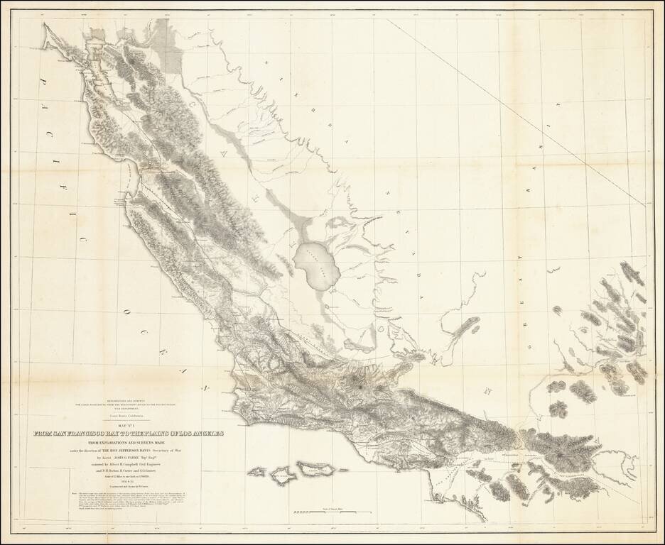
Fabulous regional map, extending from just north of San Francisco Bay to Orange County (not named) and the San Bernardino Valley. The map includes remarkable topographical detail throughout.


Special conditions for students!

If you are a student, write to us in telegram: @antiquemaps and indicate what material you need and for what work you need a map in high detail. We are ready to provide material on special terms. For students only!

Item information:

Year of creation:
Size:
21730x17831 px
Disk:
85.5576MiB
Number of pages:
1
Place:
Washington
Author:
U.S. Pacific RR Survey.
$21.99

Related item