logo

1975. Cincinnati

  • Cincinnati

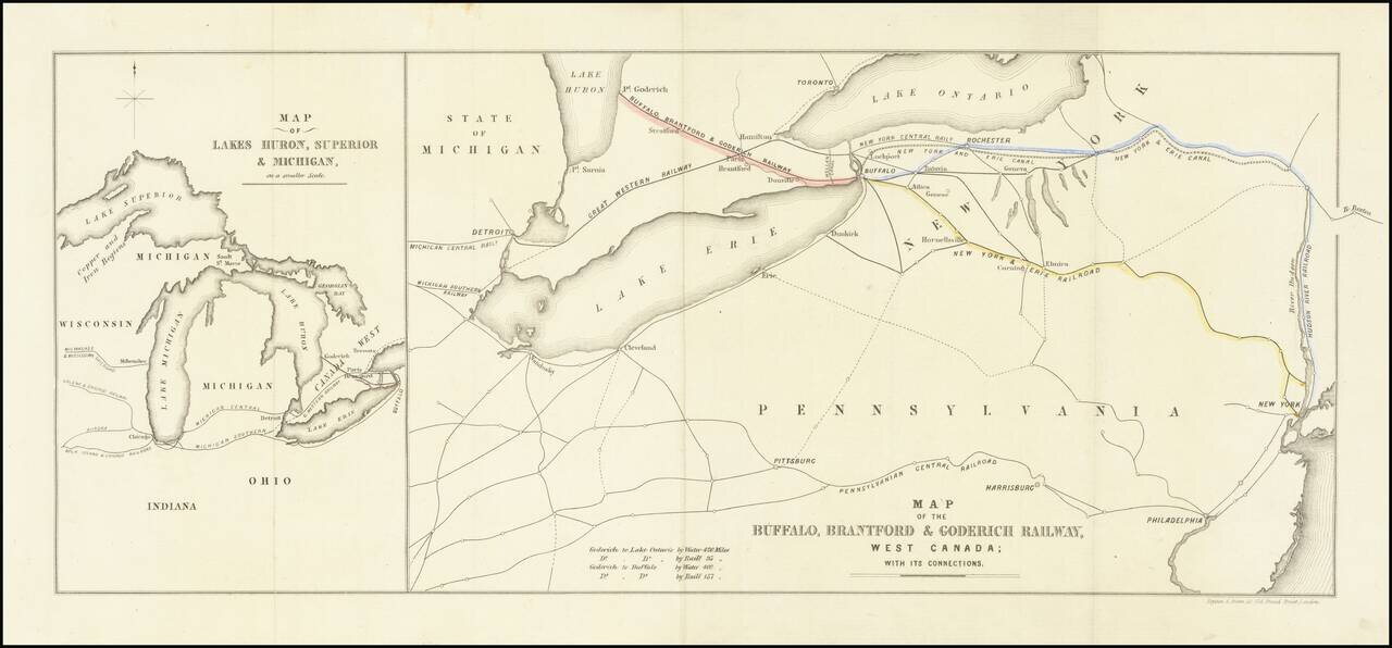
Map size in jpg-format: 175.718MiB

Download "Cincinnati", in high resolution.

Cincinnati information:

Year of creation: 
Resolution size (pixels): 
 24261x18106 px
Disk Size: 
 175.718MiB
Number of pages: 
 1
Place: 
 Scarborogh, Ontario, Canada
Author: 

Print information. Print size (Width x height in inches):
Printing at 72 dpi 
  336.96 х 251.47
Printing at 150 dpi 
 161.74 х 120.71
Printing at 300 dpi 
 80.87 х 60.35

An example of detailing the file of this map of in a printable high-resolution:

Click to open in high resolution (open in new tab).
Attention! this is just the central piece (central area 960x960 px) of the map file!
This is an example, so that you can see and study the level of detail of a given map. The entire Map will be fully available after payment!

Cincinnati

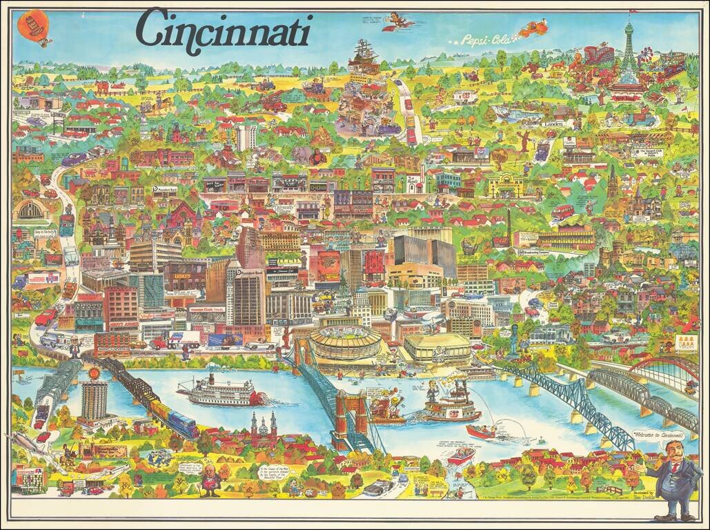
Lively pictorial map of Cincinnati, published by City Design Print and illustrated by Tom Dodds.

The map includes advertising for dozens of Cincinnati's local businesses, including a number of local landmarks, providing an entertaining an informative look at the city in the mid 1970s.

Kings Island Family Entertainment Center appears at the top right, including the Jack Nicklaus Golf Center.


Special conditions for students!

If you are a student, write to us in telegram: @antiquemaps and indicate what material you need and for what work you need a map in high detail. We are ready to provide material on special terms. For students only!

Item information:

Year of creation:
Size:
24261x18106 px
Disk:
175.718MiB
Number of pages:
1
Place:
Scarborogh, Ontario, Canada
Author:
Tom Dodds.
$21.99

Related item