Map size in jpg-format: 87.2059MiB
Click to open in high resolution (open in new tab).
First Edition!
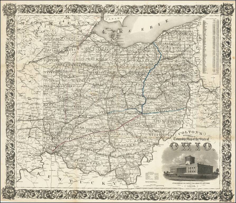
Detailed engraved folding map of Ohio, issued by J.H. Colton in 1852.
The map shows the "new" Ohio Statehouse building. Ohio had planned to build a new statehouse building for years, but the project took on urgency in 1852 when the old Ohio Statehouse burned down. The construction of the new statehouse lasted until 1861.
Colton's "Railroad & Township" maps tend to be some of the largest and most detailed maps of a particular state that he issued.
Rarity
To our knowledge, no authoritative census of editions exists, however, Rumsey has at least six editions. The earliest he has is 1853, which he describes as the second edition.
If you are a student, write to us in telegram: @antiquemaps and indicate what material you need and for what work you need a map in high detail. We are ready to provide material on special terms. For students only!