logo

1889. Akron 1889. Ohio, U. S. A.

  • Akron 1889.  Ohio, U. S. A.

Akron 1889. Ohio, U. S. A. information:

Year of creation: 
Resolution size (pixels): 
 19926x17676 px
Disk Size: 
 105.064MiB
Number of pages: 
 1
Place: 
 Akron, Ohio
Author: 

Print information. Print size (Width x height in inches):
Printing at 72 dpi 
  276.75 х 245.5
Printing at 150 dpi 
 132.84 х 117.84
Printing at 300 dpi 
 66.42 х 58.92

An example of detailing the file of this map of in a printable high-resolution:

Click to open in high resolution (open in new tab).
Attention! this is just the central piece (central area 960x960 px) of the map file!
This is an example, so that you can see and study the level of detail of a given map. The entire Map will be fully available after payment!

Akron 1889.  Ohio, U. S. A.

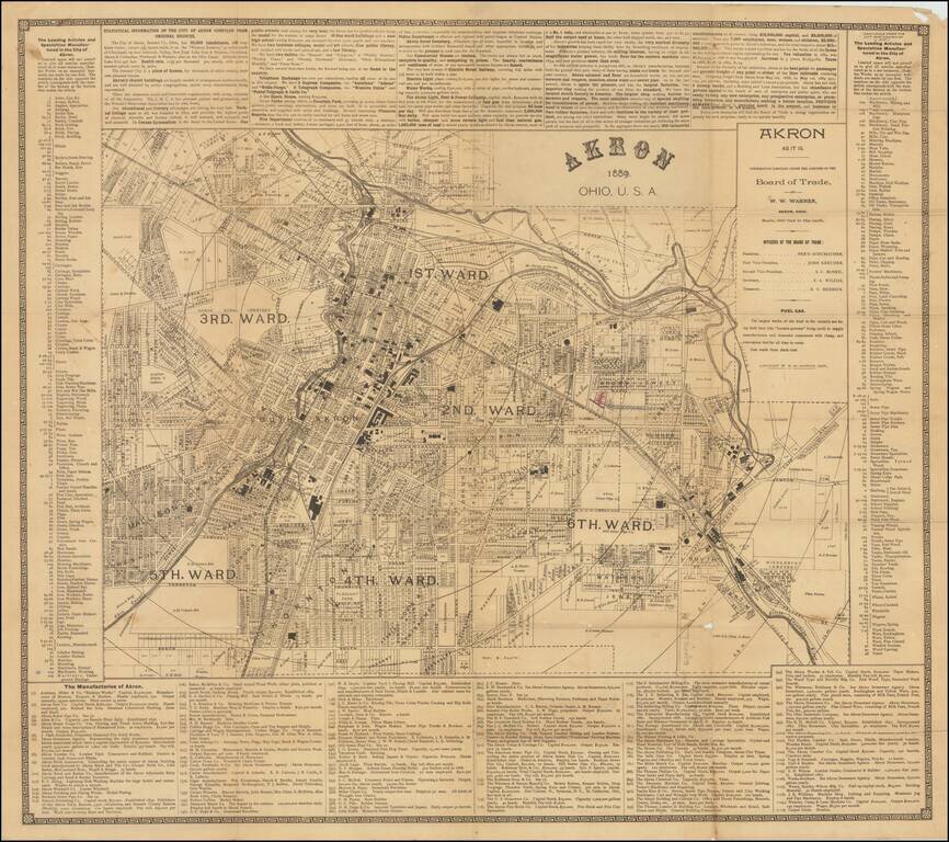
Great early map of Akron, Ohio by W.W. Warner, produced under the auspices of the Akron Board of Trade.

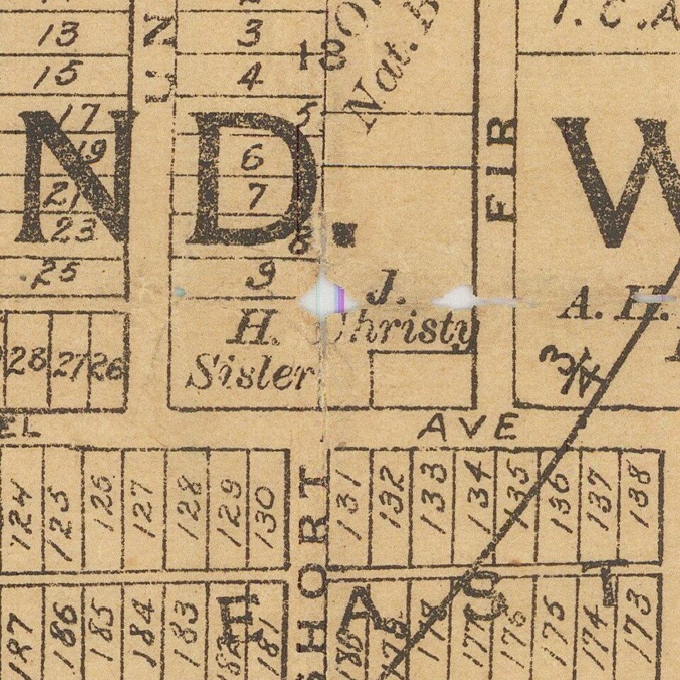
The map shows the city divided into wards, with fine plot-level detail throughout the covered area. Some neighborhoods and landowners are named.

The whole map image is surrounded by explanatory text and tables, which paint a picture of a booming town. The list of "Manufactories of Akron" shows 110 factories producing all manner of goods.

Rare. OCLC lists a single map of Akron from 1889, but that appears to differ from the present map.


Special conditions for students!

If you are a student, write to us in telegram: @antiquemaps and indicate what material you need and for what work you need a map in high detail. We are ready to provide material on special terms. For students only!

Item information:

Year of creation:
Size:
19926x17676 px
Disk:
105.064MiB
Number of pages:
1
Place:
Akron, Ohio
Author:
W. W. Warner.
$14.99

Related item