
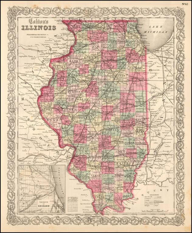
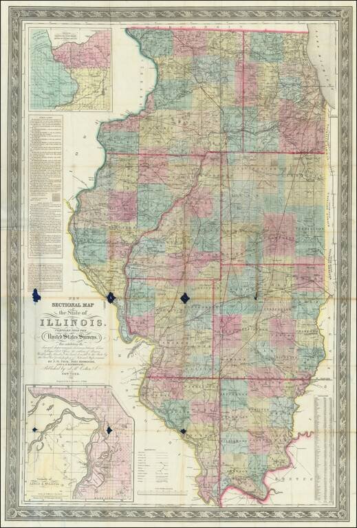
Detailed map of Illinois, colored by counties. The map shows roads, railroads, towns, villages, post offices, canals, rivers, lakes, stations and a host of other details. Inset of Chicago vicinity in lower left corner. Decorative border. A terrific...
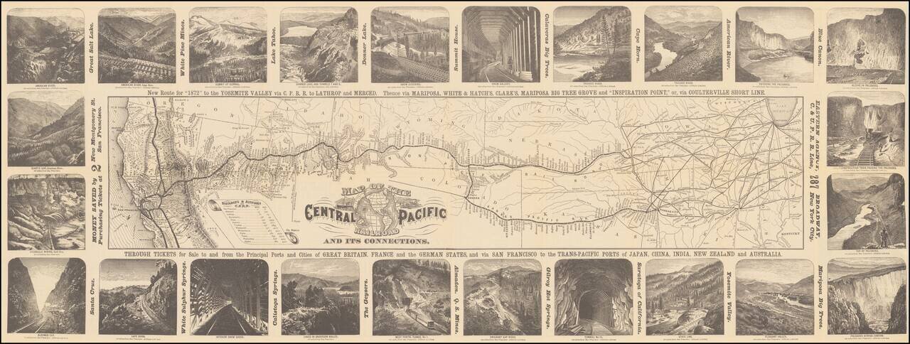
Decorative map of the route of the Central Pacific from the midwest to San Francisco, illustrated with 24 images of the west, primarily of California and Nevada. Decorative and highly detailed map, with vignettes of major points of interest in the...
![[Eastern Sheet -- Ohio] Post Road Map of the States of Ohio and Indiana with Adjacent Parts of Pennsylvania Michigan Illinois Kentucky and West Virginia Showing Post Offices With The Intermediate Distances and Mail Routes In Operation On the !st of Febru](/map/small/44153.jpg)
Eastern Sheet (Ohio and parts of Kentucky, etc.) of W.L. Nicholson's Postal Map, published in 1885. Beginning with David Burr in the 1830s, the tradition of the American regional postal map became a centralized service provided from Washington, D.C....
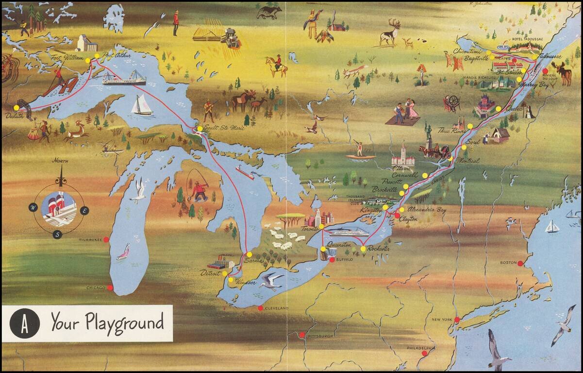
Interesting pictorial map, advertising for Canada Steamship Lines. The route shown goes from Duluth, Fort William and Port Arthur to Sault Ste Marie, Darnia, Detroit and Windsor, with a second route from Buffalo and Toronto to the mouth of the St....

Rare pictorial map of the Mormon Trail, published by American Pioneer Trail Association. The map includes lively historical vignettes focusing on the early history of the West, Mormon Battalion and Mormon Settlers. "Issued by American Pioneer Trails...
Nice example of this important early map of Illinois from Carey & Lea's Geographical, Statistical and Historical Atlas of North America. Carey & Lea's map of Illinois is one of the earliest obtainable maps of Illinois. This important and...
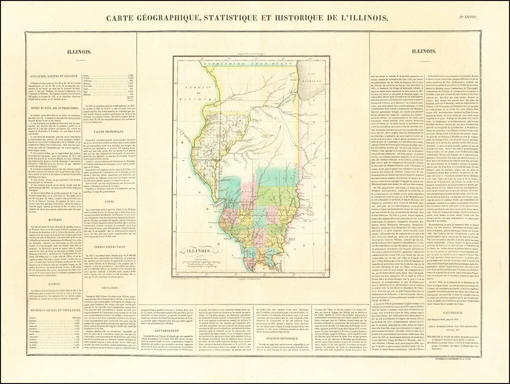
A gorgeous example of Buchon's early map of Illinois Territory, showing very early county configurations and other interesting details. Buchon's atlas was the first foreign atlas to include a separate map of Illinois and is one of the very earliest...
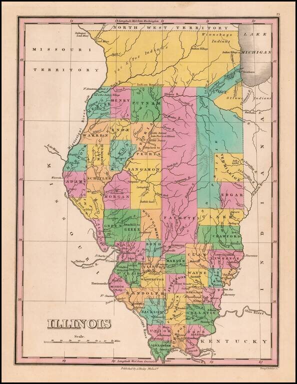
Great example of this early state of Finley's map of Illinois, hand colored by counties, with much of the northern lands still dominated by Indians. Includes a number of oversized counties and several unnamed counties. Cook County is not yet shown. A...
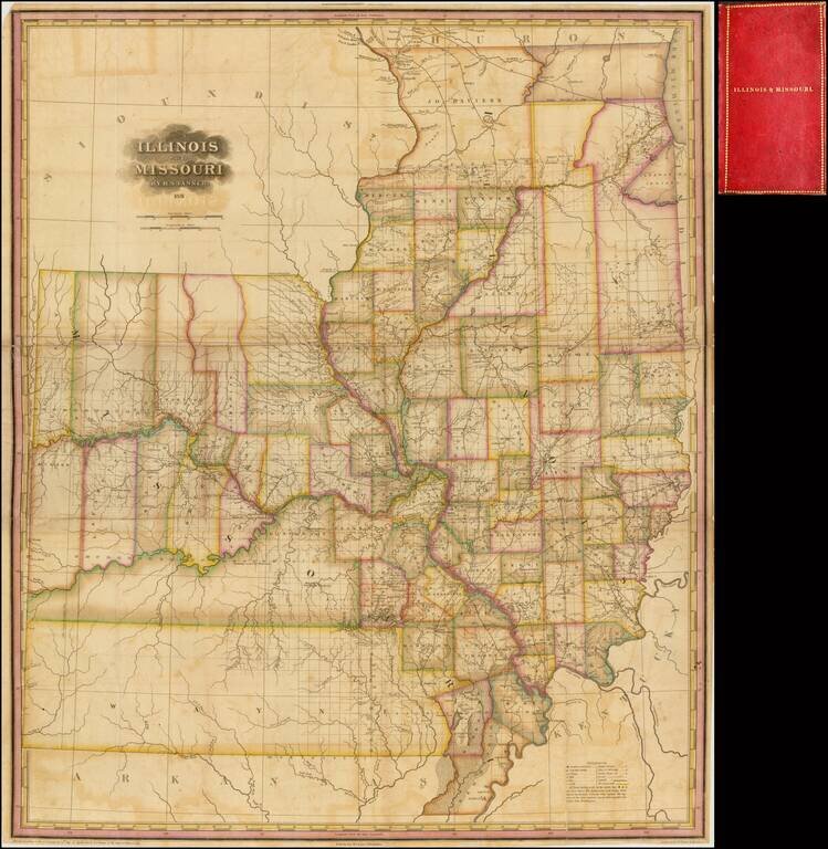
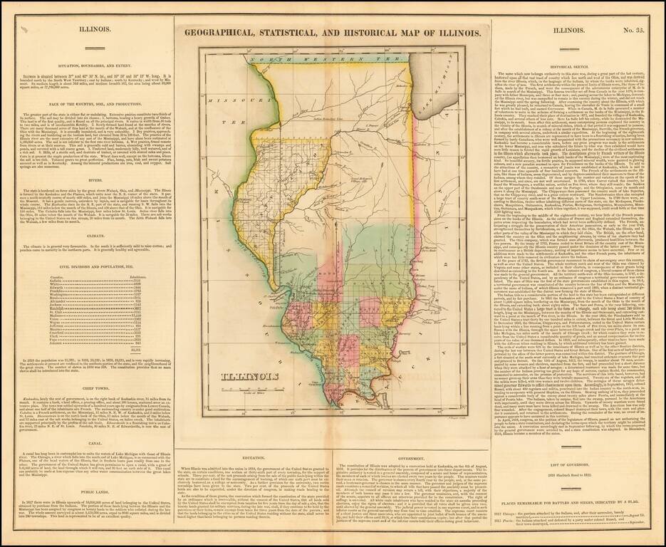
Significantly revised and updated version of HS Tanner's large format map of Missouri and Illinois Territories, first issued in 1821. The map includes remarkable detail where there had been relatively little detailed cartographic work to date. The...
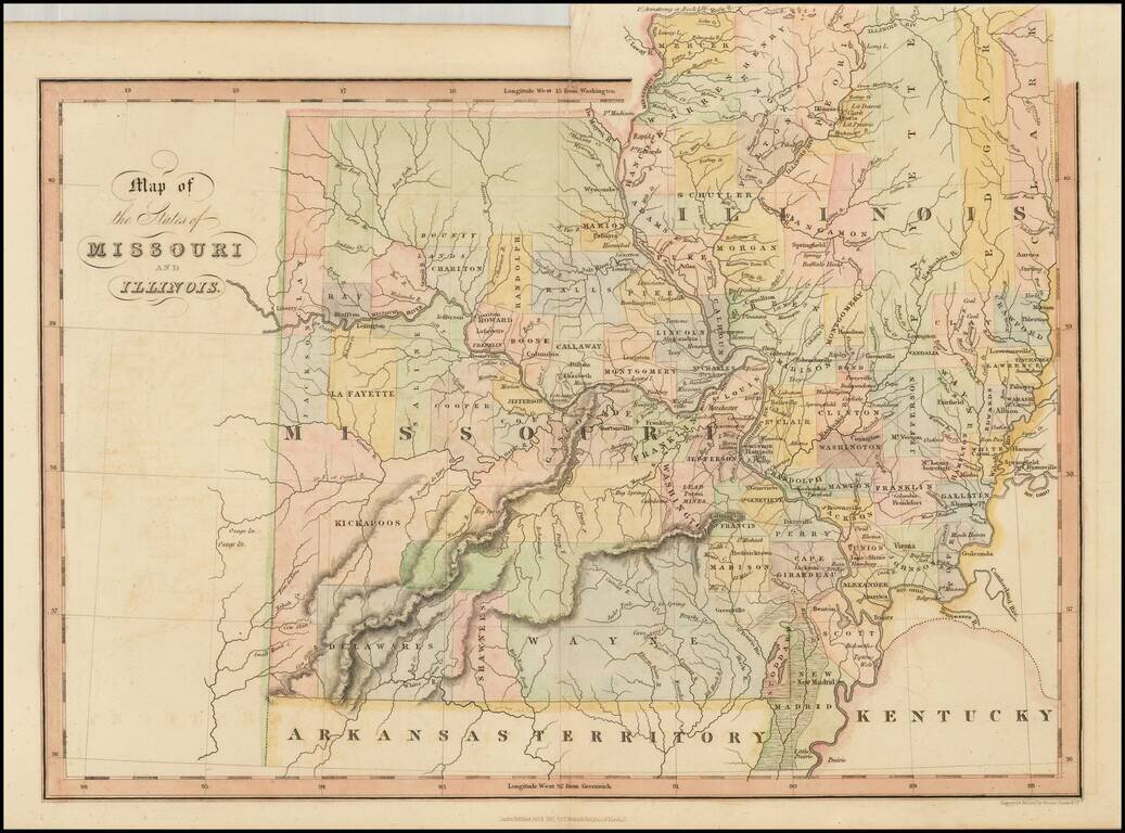
Scarce early map of Missouri and Illinois, hand colored by counties. Many of the western counties are Indian Lands, such as Kickapoo, Delawares, Shawnees, etc. The Boundy Lands are shown in the North. A massive Wayne County dominates the south. A...
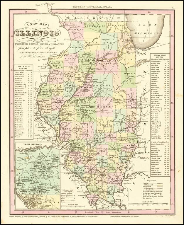
Marvelous example of Tanner's map of Illinois, hand colored by counties. Shows canals, railroads, towns, roads, distances, and tables with steam boat routes and distances. The county configuations are largely complete. Inset of the Lead Region of...
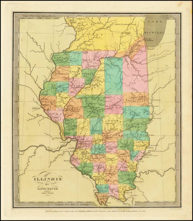
Striking full color example of the first edition of David Burr's map of Illinois, which appeared in his Universal Atlas, first issued in 1836. Includes fascinating primitive counties, including an odd Joe Davis County at the top and a number of...
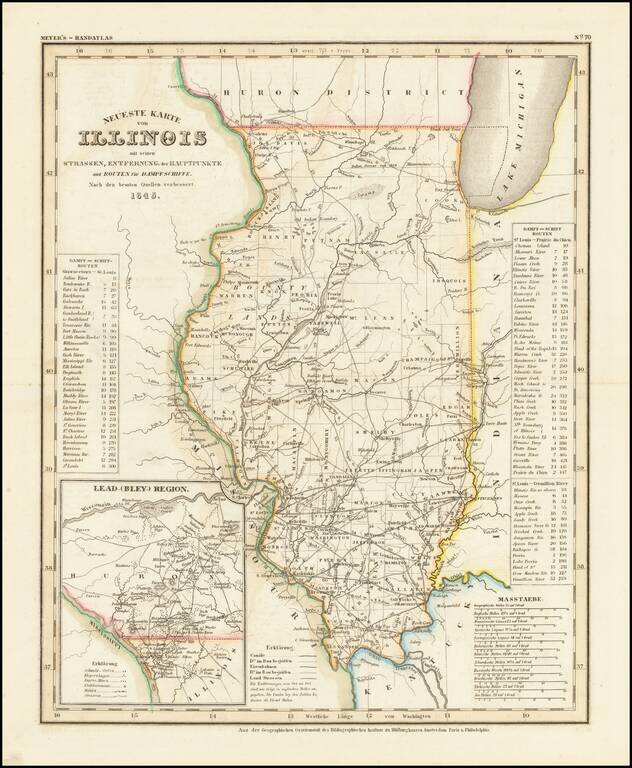
Fine example of this elegantly engraved & detailed map of Illinois, based upon Tanner's work in the early 1840s. Shows counties, towns, roads, rivers, lakes, etc. While often referred to as the German Mitchell, this characterization is unfair, as...
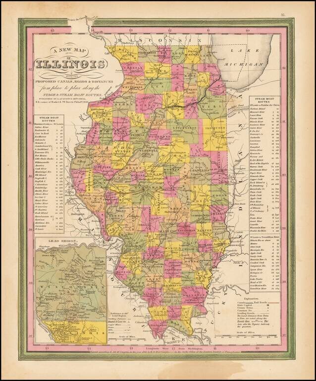
Interesting detailed map of Illinois with an inset of the Lead Region showing Northwestern Illinois and Southwestern Wisconsin. Shows canals, rivers, towns, roads etc. Counties are hand colored. Statistical tables show steam boat routes. Very good...
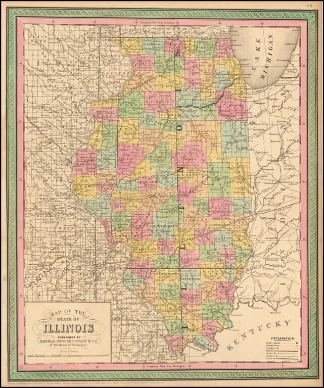
Detailed and interesting map, hand colored by county and showing towns, rivers, lakes, railroads, roads, distances, forts, etc. An exceptional example.
1852 edition of Peck & Messinger's map of Illinois, hand colored by County, published in 1852. Peck & Messenger's map of Illinois was one of the most enduring map legacies of the midwest, with issues dated as early as 1836 and still in...