Map size in jpg-format: 21.5113MiB
Click to open in high resolution (open in new tab).
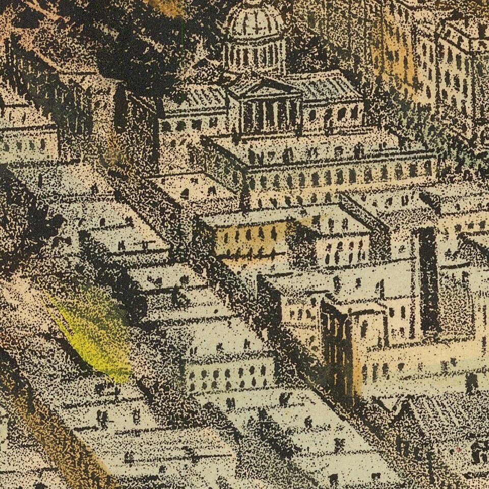
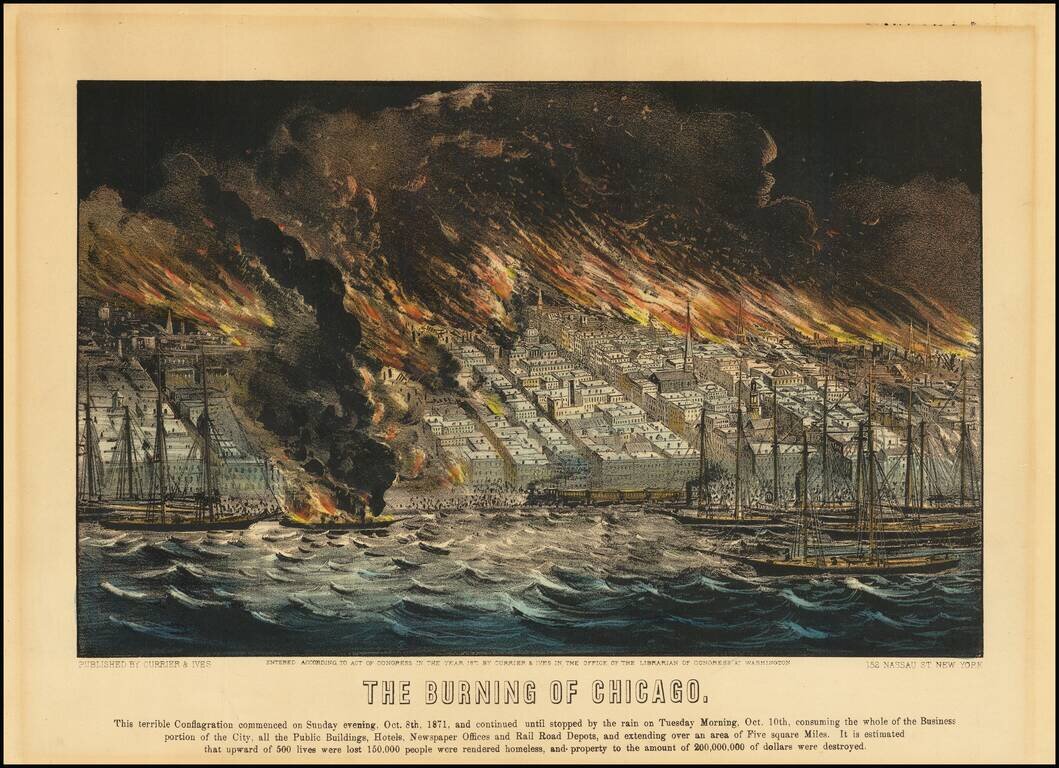
Hand-colored antique lithograph view of the burning of Chicago in 1871, issued by the famed lithography publishers Currier & Ives.
The text below the image reads: "This terrible conflagration commenced on Sunday evening, Oct. 8th, 1871, and continued until stopped by the rain on Tuesday Morning, Oct. 10th, consuming the whole of the Business : Portion of the City, all the Public Buildings, Hotels, Newspaper Offices and Rail Road Depots, and extending over an area of Five square Miles. It is estimated : that upward of 500 lives were lost 150,000 people were rendered homeless, and property to the amount of 200,000,000 of dollars were destroyed."
The Great Chicago Fire
The Great Chicago Fire was a conflagration that burned in the American city of Chicago on October 8–10, 1871. The fire killed approximately 300 people, destroyed roughly 3.3 square miles (9 km2) of the city, and left more than 100,000 residents homeless.
If you are a student, write to us in telegram: @antiquemaps and indicate what material you need and for what work you need a map in high detail. We are ready to provide material on special terms. For students only!