Map size in jpg-format: 4.89159MiB
Click to open in high resolution (open in new tab).
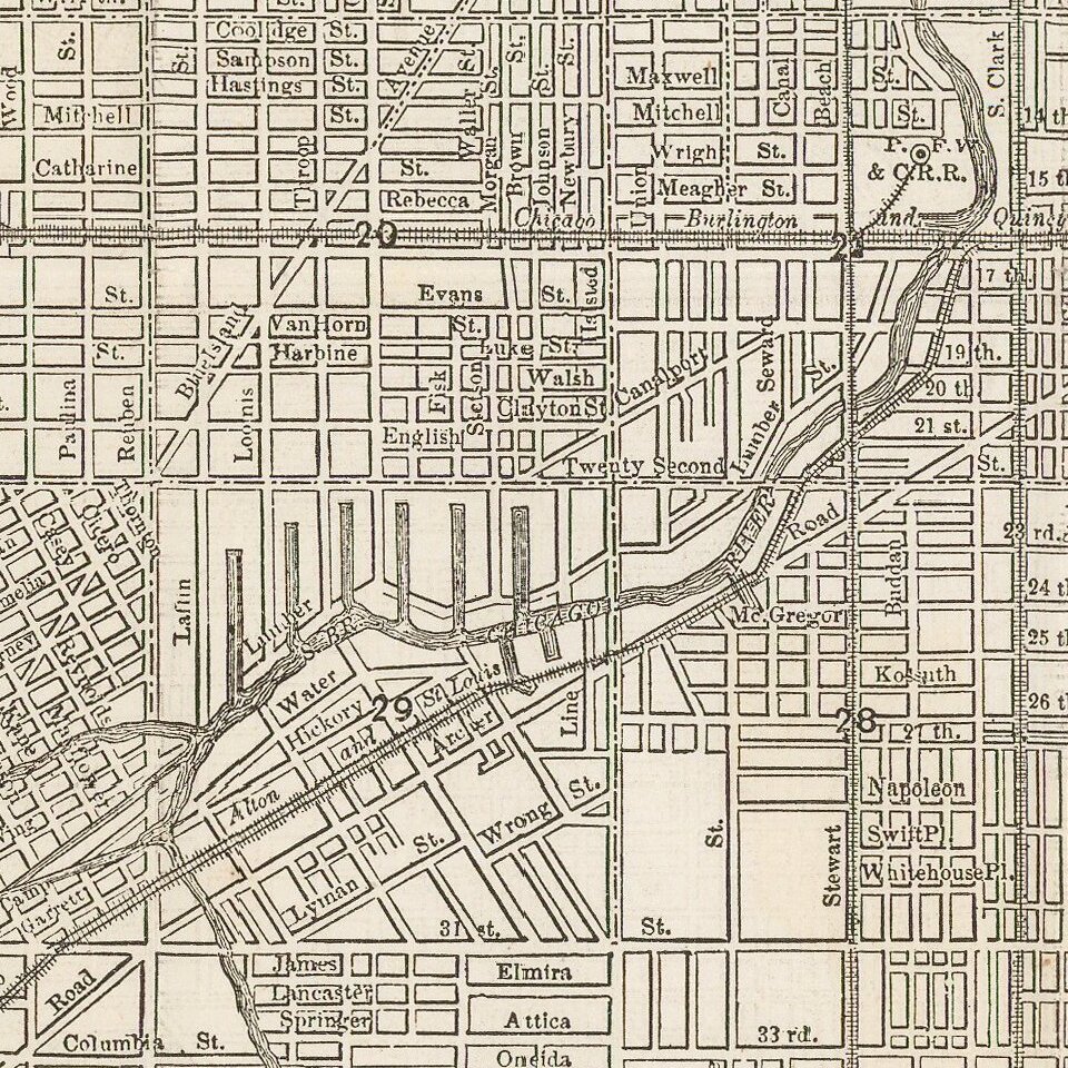
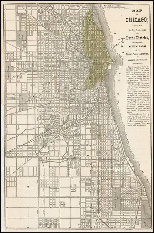
Early map of Chicago issued shortly after the 1871 Fire.
The darkened portion of the map shows the Burned District consisting of 2,124 acres and containing 17,450 buildings.
A scarce map -- this is the first example we have offered.
The Great Chicago Fire
The Great Chicago Fire was a conflagration that burned in the American city of Chicago on October 8–10, 1871. The fire killed approximately 300 people, destroyed roughly 3.3 square miles (9 km2) of the city, and left more than 100,000 residents homeless.
If you are a student, write to us in telegram: @antiquemaps and indicate what material you need and for what work you need a map in high detail. We are ready to provide material on special terms. For students only!
![[The First Maps in a la poupée Printed Color] Cartes en Couleur des Lieux Sujets aux tremblements de Terre Dans toutes les parties du Monde Selon le Sisteme de l’impulsion Solaire](/map/small/52293op.jpg)