
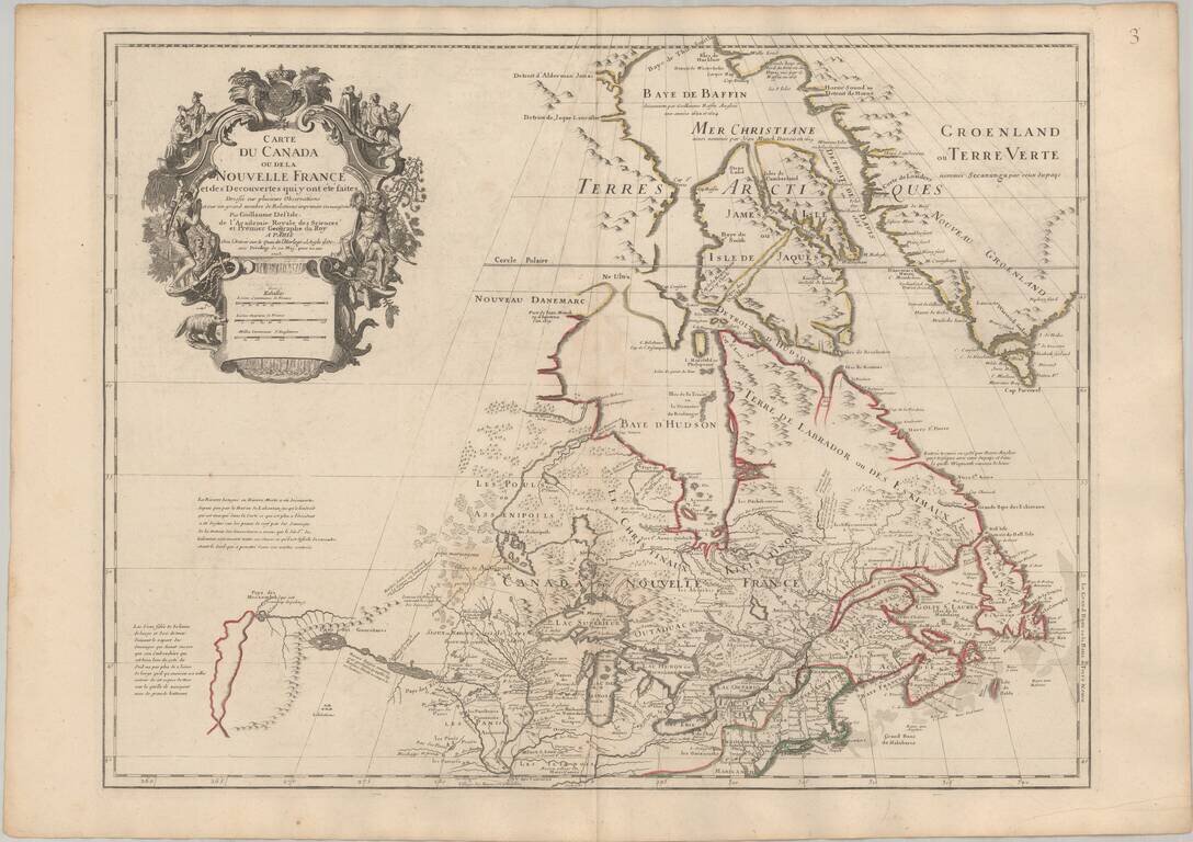
Seminal Early Map of Canada & The Great Lakes -- One of The First Maps To Reference The Rocky Mountains Nice example of Guillaume De L'Isle's map of Canada, the Great Lakes and Upper Midwest, one of the most important and influential maps of...
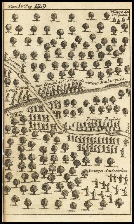
Striking Illustration of an Iroquis Battle Scene from the Work of Lahontan Interesting engraving depicting the forest near an Iroquois village, with several lines of soldiers facing off. Upon a hill, toward the top of the engraving, are Iriquois...
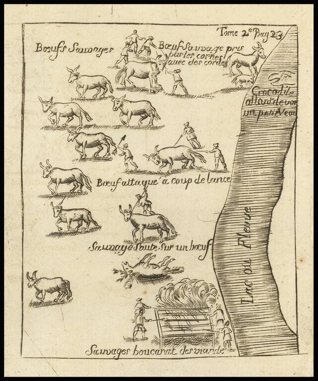
The Crocodile on Baron Lahanton's Longue River This small map was prepared to illustrate a section of Baron Lahontan's imaginary west to east Long River (Riviere Longue), rising in distant western mountains and emptying into the upper Mississippi....
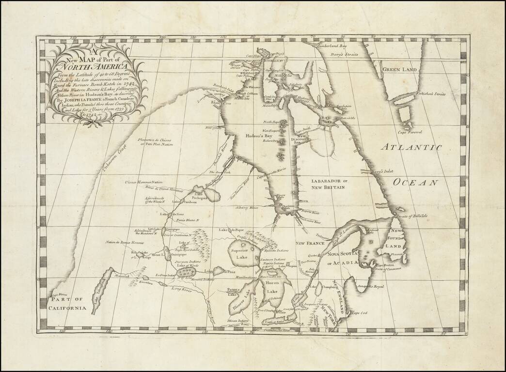
Important early map illustrating the controversy over the Northwest Passage. The map was part of the great Dobbs-Middleton debate concerning British exploration in search of a northwest passage. The present map extends from the Great Lakes, Upper...
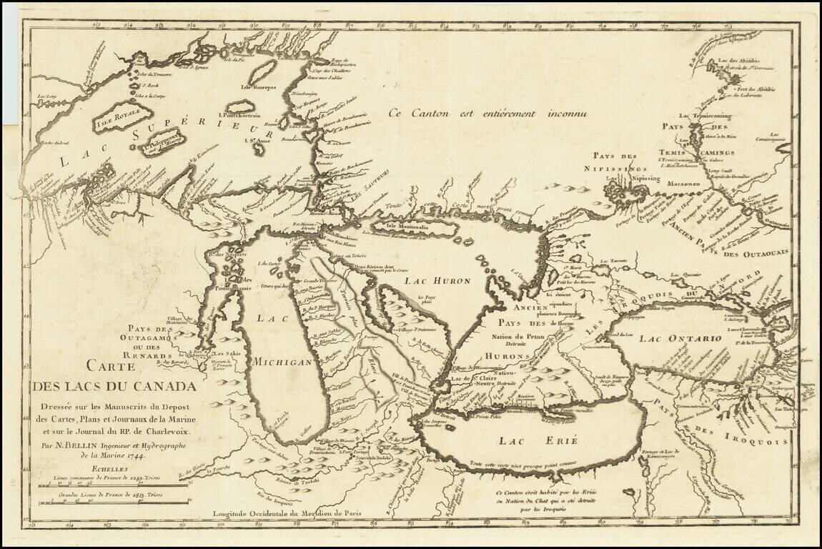
Fine example of Bellin's Landmark map of the Great Lakes region, published in 1744 Bellin's seminal early map of the Great Lakes represented a milestone in the progress of the mapping of the region. It is also one of the earliest appearances of...
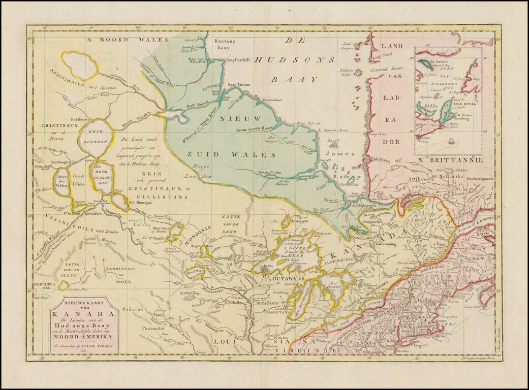
Interesting map of Canada and the Upper Midwest, centered on the Great Lakes and Hudson's Bay, published by Issak Tirion. The map shows the region shortly after the conclusion of the French and Indian War. Included are the Hudson Bay Company forts and...
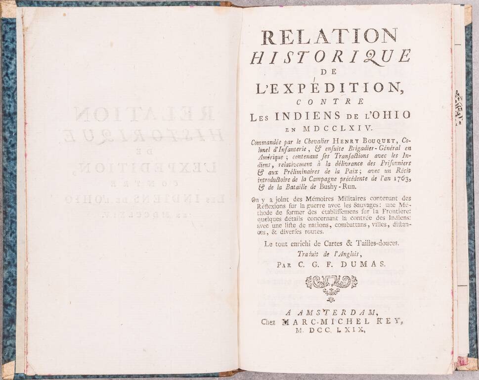
First Edition in French of Smith's An historical account of the expedition against the Ohio Indians, which was originally published in Philadelphia by William Bradford in 1765. The introduction described Bouquet's successful expedition of 1763, to...
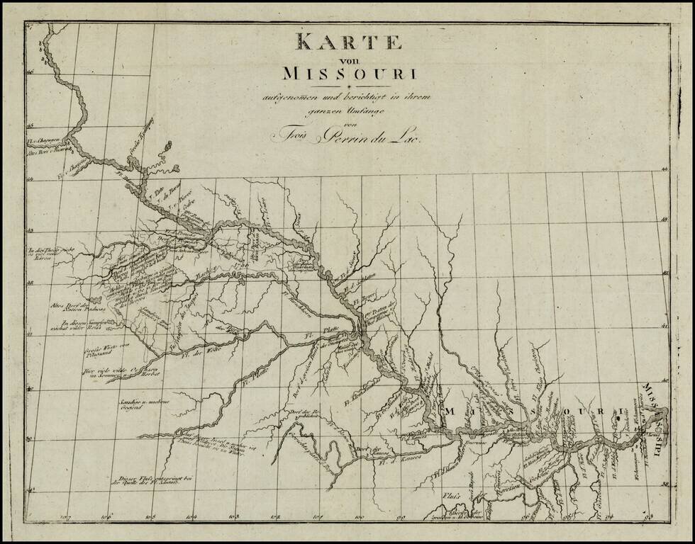
Fine example of the German edition of Perrin du Lac's seminal map of the course of the Missouri River. As noted by Wagner-Camp, Wagner states that the map . . "is the earliest published map of the trans-Missisisppi region which can be said to display...
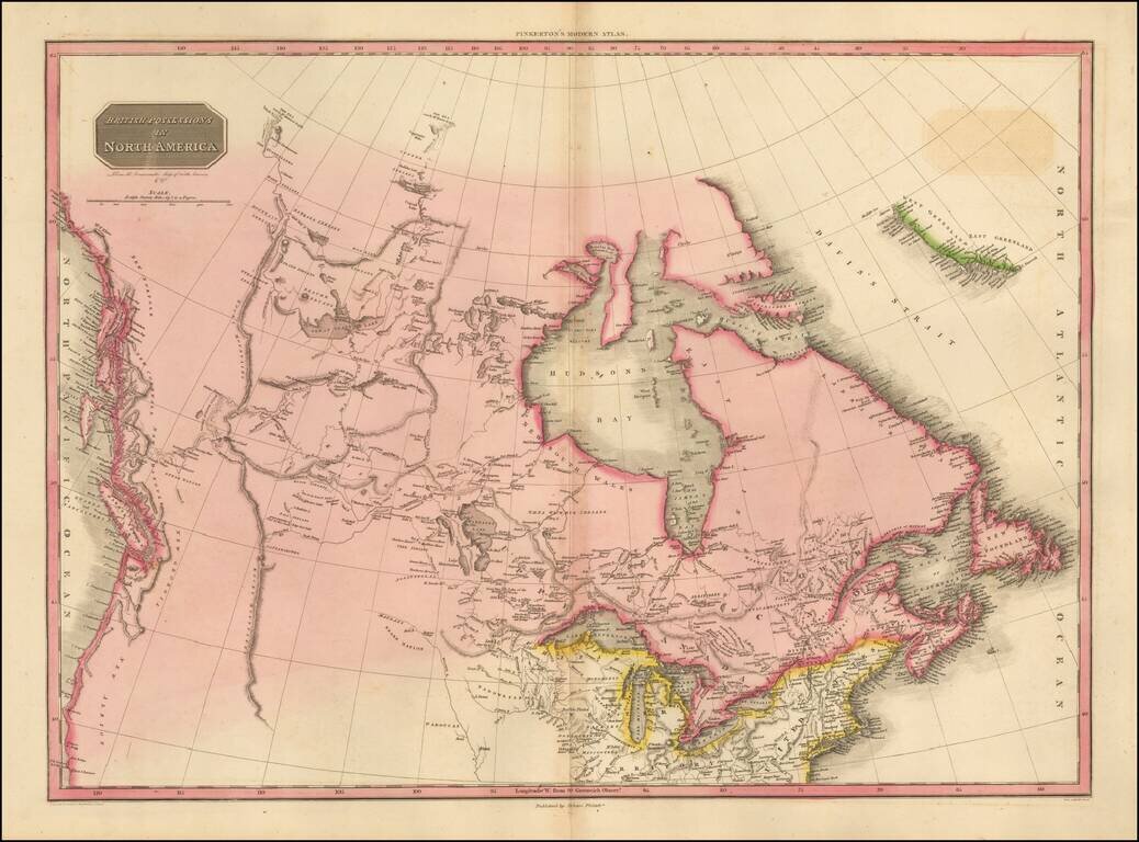
The Pacific Northwest Before Lewis & Clark Fascinating map of British America, Alaska and the Northwest part of America, immediately pre-dating the first incorporations of the details from the Lewis & Clark expeditions, published in 1814....
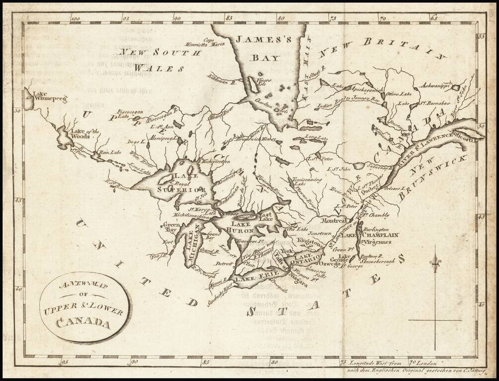
Interesting map of the Great Lakes and Canada, from a German edition of Isaac Weld's Travels Through the States of North America During the Years 1795-97, first published in London in 1798. The map extends from the St. Lawrence to Lake Winnipeg,...
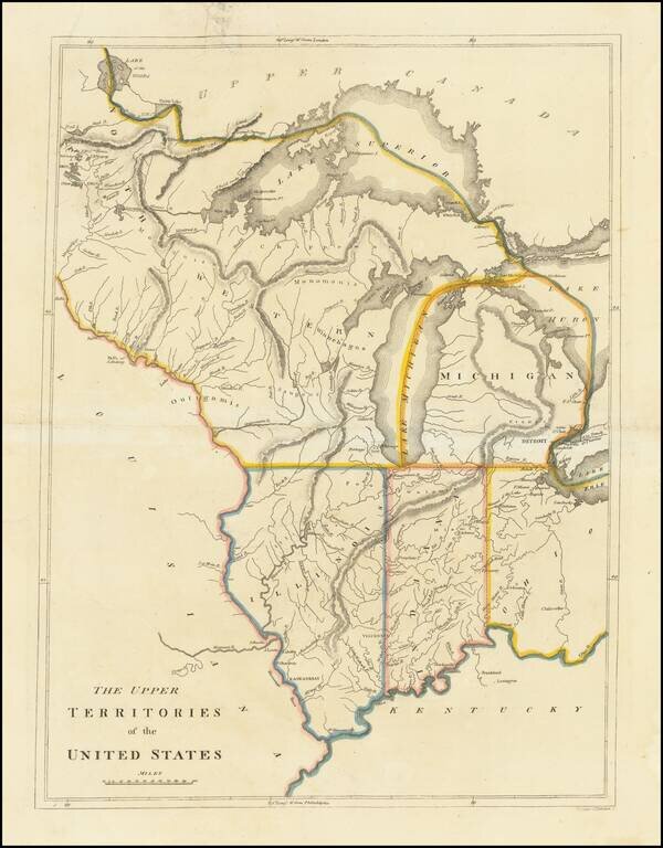
An Early American Map of the Old Northwest Nice example of the rare 1814 edition of Mathew Carey's map of the old Northwest. The map reflects a very early appearance of Michigan Territory (organized 1805), which had not yet appeared separately on any...
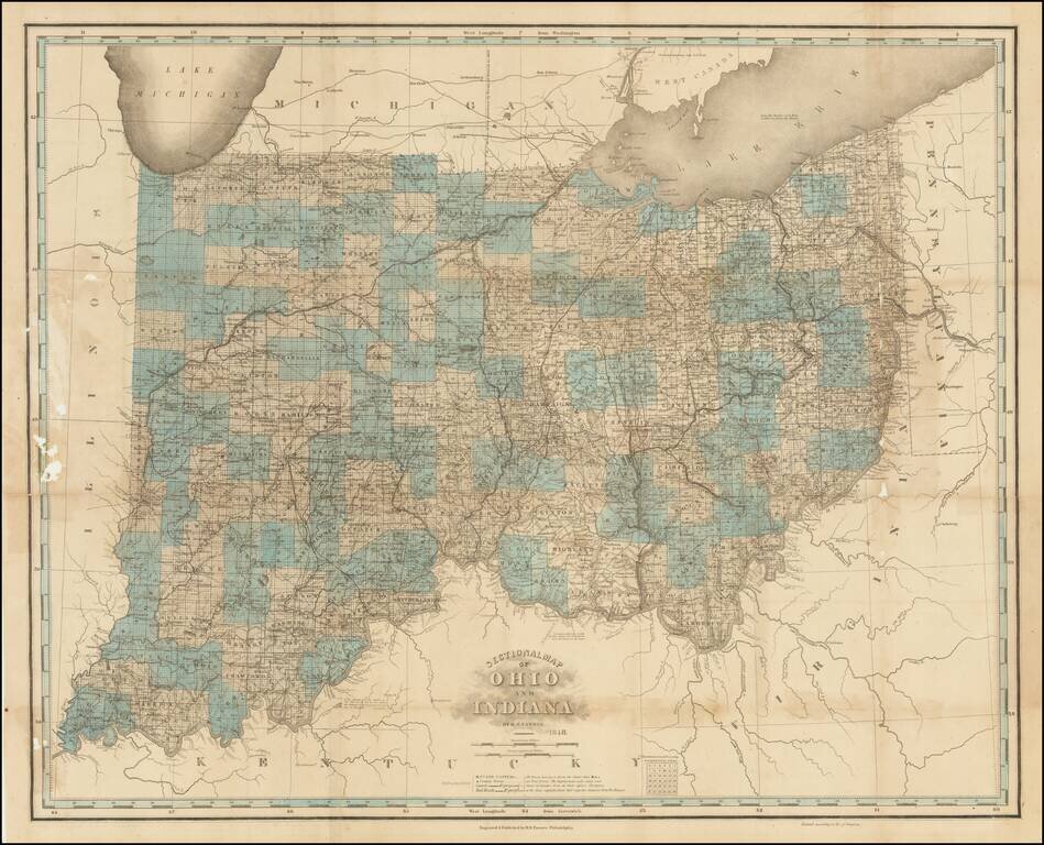
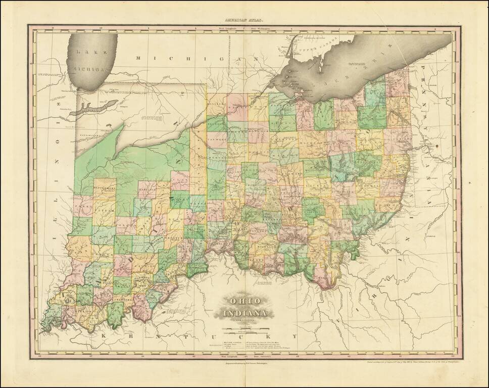
Unrecorded Final State. Extremely rare 10th state (and presumed final) state of one of the best 19th-century maps of Ohio and Indiana. The map was initially issued in 1819, though here that information has been obliterated from the imprint line in...
A nice example of this important early map of Indiana and Ohio, published by Henry Schenk Tanner. The present example is the 3rd state of the map, most notable for the addition of Randolph County and a massive Kankakee Pond, plus a new Indian Village...
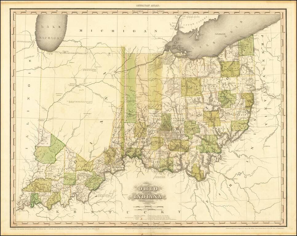
A nice example of this important early map of Indiana and Ohio, published by Henry Schenk Tanner. The present example is the 1st state of the map, most notable for the addition of Randolph County and a massive Kankakee Pond, plus a new Indian Village...
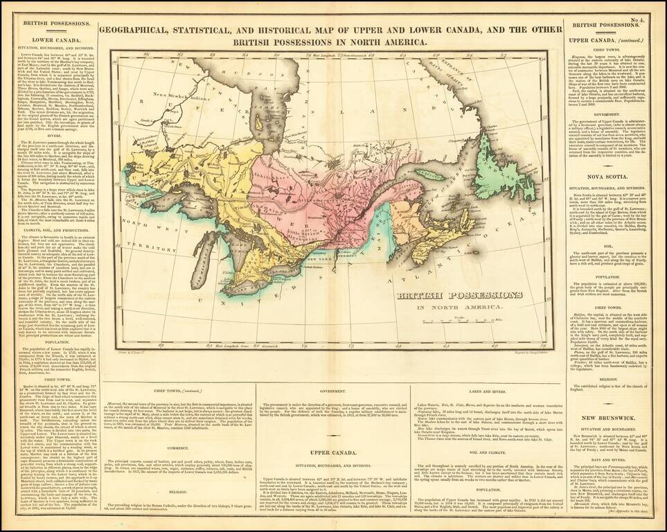
Nice example of Carey & Lea's map of Canada and the Great Lakes. The map covers Upper and Lower Canada and the Great Lakes, extending west to the Lake of the Woods and Red Land House and the Severn River, showing nice Indian details. The map is...
![Canada [with Great Lakes]](/map/small/53469.jpg)
Striking map of Canada, colored by territories. The map shows towns, rivers, lakes, mountains, etc. Fielding Lucas produced the best engraved an most attractive of all general atlases published in America (the 1823 Tanner and 1825 Finley being...