Map size in jpg-format: 19.8257MiB
Click to open in high resolution (open in new tab).
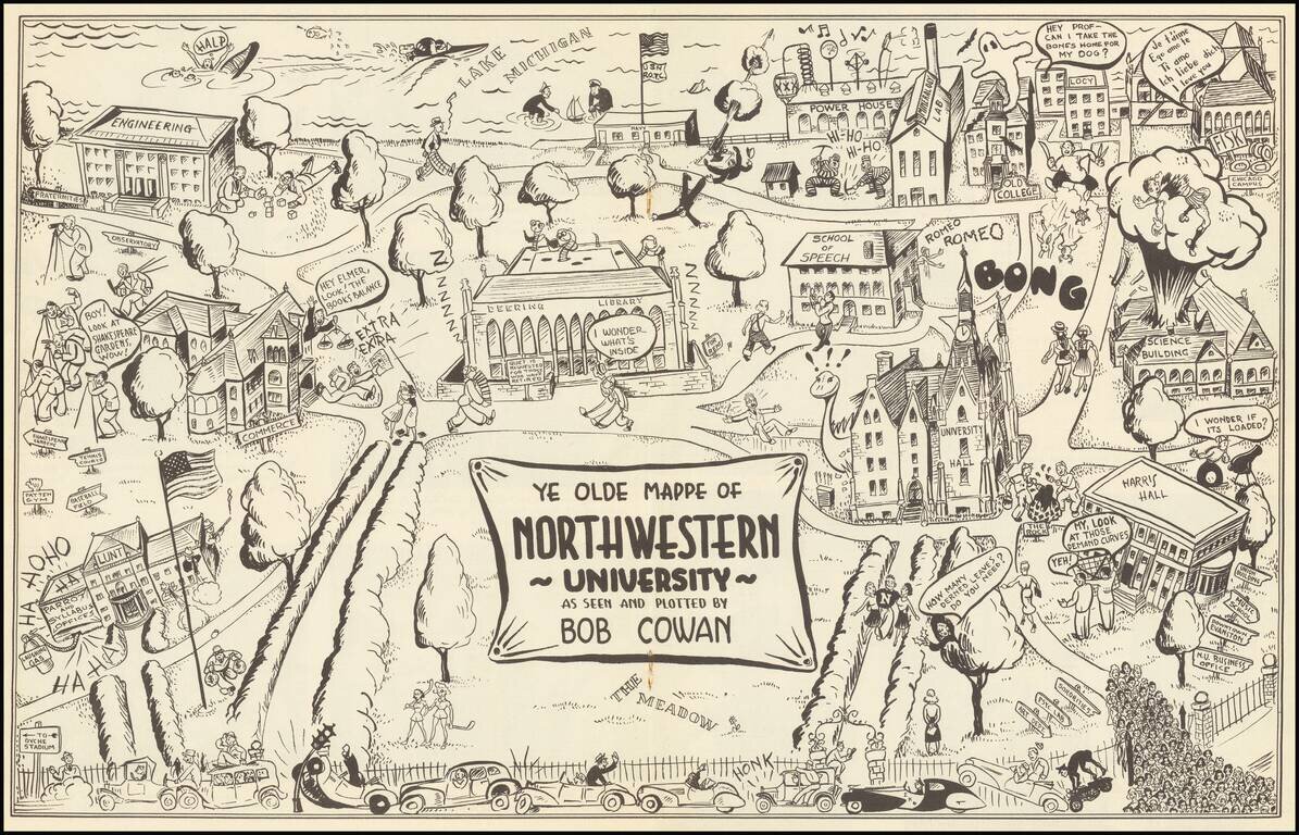
Rare Pictorial of Northwestern - Only Traced Example.
This is a vintage pictorial map of Northwestern, providing a humorous portrayal of the prestigious Evanston university. The campus is easily recognizable, portrayed from the west with Lake Michigan in the background.
Humorous representations of student life abound on the map. Students walking by the library question what's inside, while the science building is exploding. The ROTC students are launching a mortar at lake Michigan where sailors play with a toy sailboat. The humor takes on a slightly raunchier aspect in parts of the map.
Northwestern was charted in 1851, with money raised by the sale of a "perpetual scholarship" for $100 entitling the purchaser and their heirs to free tuition. The university rose to importance quickly before facing difficulties during the Great Depression. It was able to evade a takeover by the University of Chicago and was rescued by a $6 million dollar donation before being transformed by World War II. The first African Studies program in the United States would be founded in 1948.
Dating the map precisely is a challenge. The youngest building we located on the map is the Deering Library, dating to 1933. The map may record the second position of Patten Gymnasium, relocated in 1939, though this is unclear. The style of the map suggests that it was produced in the period between 1930 to 1940, especially as it is uncolored. The title appears to be a humorous reference to an earlier map, "Ye Newe-fangled Mappe of Northwestern," published in 1927 by Lilian McKinstry Fitch (Rumsey map number 13276).
We find no other examples in OCLC searches or elsewhere.
If you are a student, write to us in telegram: @antiquemaps and indicate what material you need and for what work you need a map in high detail. We are ready to provide material on special terms. For students only!
![[Signed Political Satire Artwork] Vietnam ... Vietnam ... Vietnam ...](/map/small/68726.jpg)

