Map size in jpg-format: 971889B
Click to open in high resolution (open in new tab).
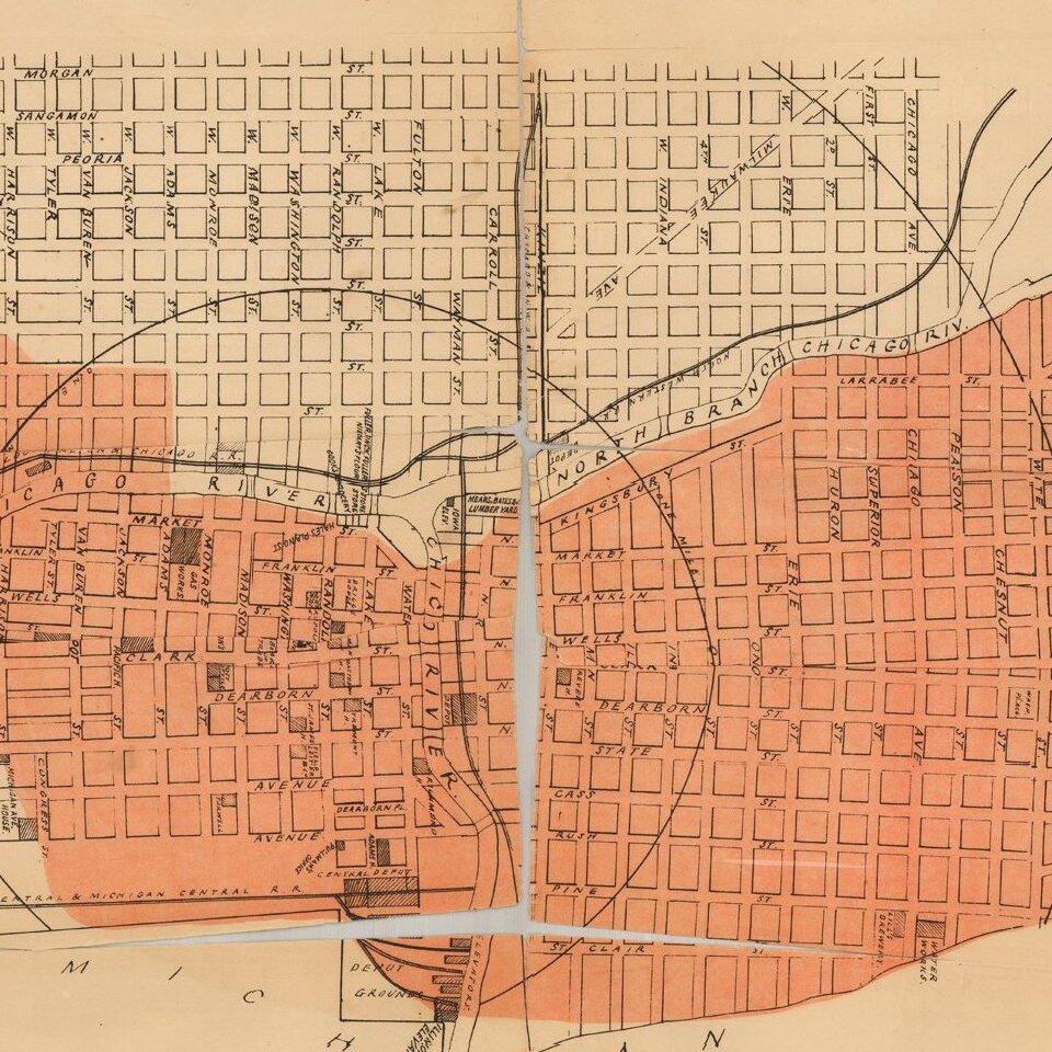
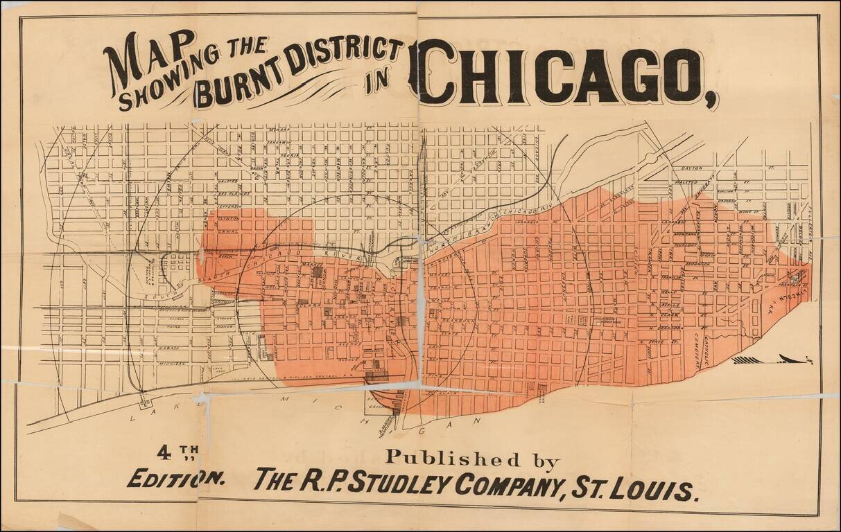
Rare map of Chicago, focusing on the parts of town which were affected by the Great Chicago Fire, October 10, 1871.
The map shows in fine detail (in red) the areas affected by the fire.
The map identifies streets, buildings, railroads, parks and public places.
The shading for the fire does not include the Malin Ogden Wooden House at Whitney and Dearborn. The Mahlon D. Ogden mansion, on the site that has been occupied since the early 1890s by the Newberry Library (the north side of Walton Street, between Dearborn and Clark), was saved from destruction by a combination of luck and the timely application of soaked carpets to the building's exterior in order to protect it from flying sparks and large pieces of flaming wood that whirled through the air and spread the fire.
Rarity
We locate no examples in recorded auctions or dealer catalogs. OCLC locates 3 copies, Library of Congress, University of Michigan and Wisconsin Historical Society.
The Great Chicago Fire
The Great Chicago Fire was a conflagration that burned in the American city of Chicago on October 8–10, 1871. The fire killed approximately 300 people, destroyed roughly 3.3 square miles (9 km2) of the city, and left more than 100,000 residents homeless.
If you are a student, write to us in telegram: @antiquemaps and indicate what material you need and for what work you need a map in high detail. We are ready to provide material on special terms. For students only!
![[The First Maps in a la poupée Printed Color] Cartes en Couleur des Lieux Sujets aux tremblements de Terre Dans toutes les parties du Monde Selon le Sisteme de l’impulsion Solaire](/map/small/52293op.jpg)