Map size in jpg-format: 188.38MiB
Click to open in high resolution (open in new tab).
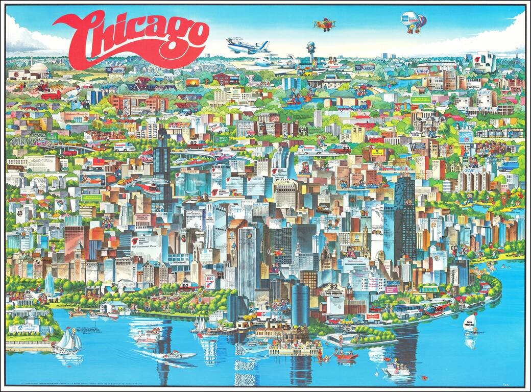
Richly embellished advertising oriented pictorial map / birdseye view of the Chicago area, published by Archar Inc. of Canada.
Packed with advertising for local businesses, the images shows buildings, tourism and other landmarks, recreational activities, radio station logos, and other local icons and color.
This is one a series of "City Character Prints" created in the late 1970s and 1980s by Archar.
If you are a student, write to us in telegram: @antiquemaps and indicate what material you need and for what work you need a map in high detail. We are ready to provide material on special terms. For students only!
![[Signed Political Satire Artwork] Vietnam ... Vietnam ... Vietnam ...](/map/small/68726.jpg)

