
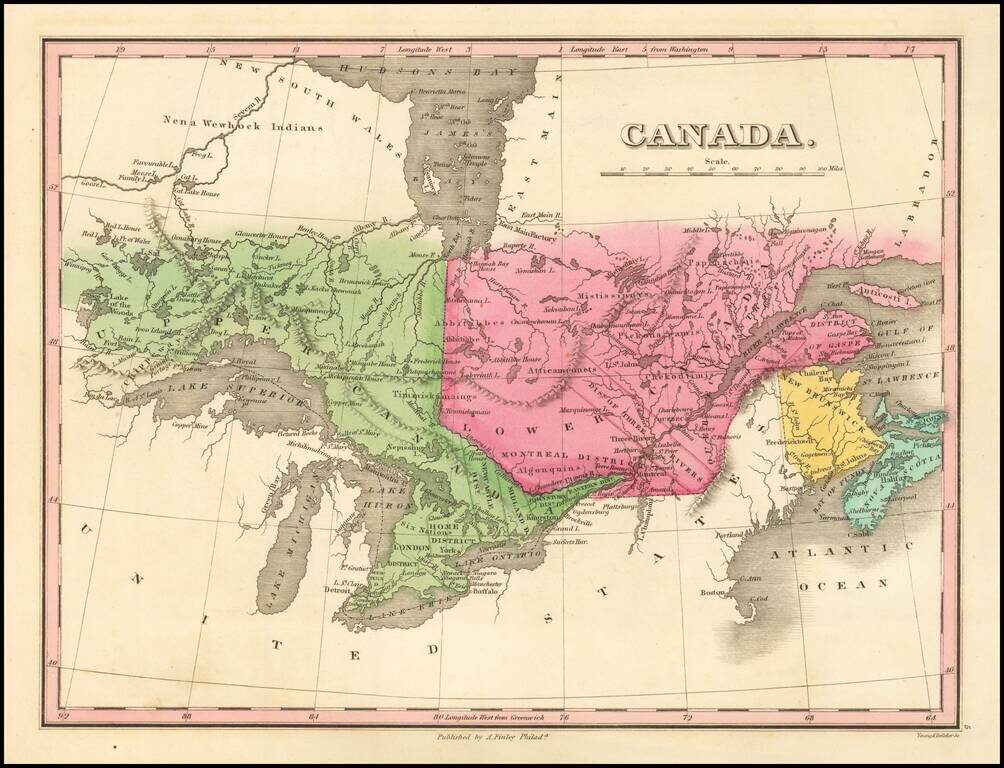
Detailed map of the Great Lakes and Eastern Canada, colored by regions and showing towns, rivers, lakes, islands, bays ,etc. Early roads are also shown.
![Amer. Sep. No. 49. Partie des États Unis [Missouri, Illinois, Indian Territory, Kansas, Nebraska, Iowa]](/map/small/22888.jpg)
Important Early Mapping of the Missouri River, Upper Mississippi and Indian Regions Remarkable map of the central part of the Mississippi Valley and Lower MIssouri River Valley, only a few years after Missouri gained its statehood. The detail along...
![Amer. Sep. No. 33. Partie De La Nouvelle Bretagne (Upper Missouri River, Lake Winnepeg, Lake of the Woods and Saskatehawan River]](/map/small/41687.jpg)
Large format map of the region, centered on Lake Winnepeg and showing Riviere Skatehawan ou Fleuve Bourbon in the Northwest, the Missouri River and Assinniboines in the Southwest, Nenawecouhen and Lake Pike in the Northeast and the Lake of the Woods...
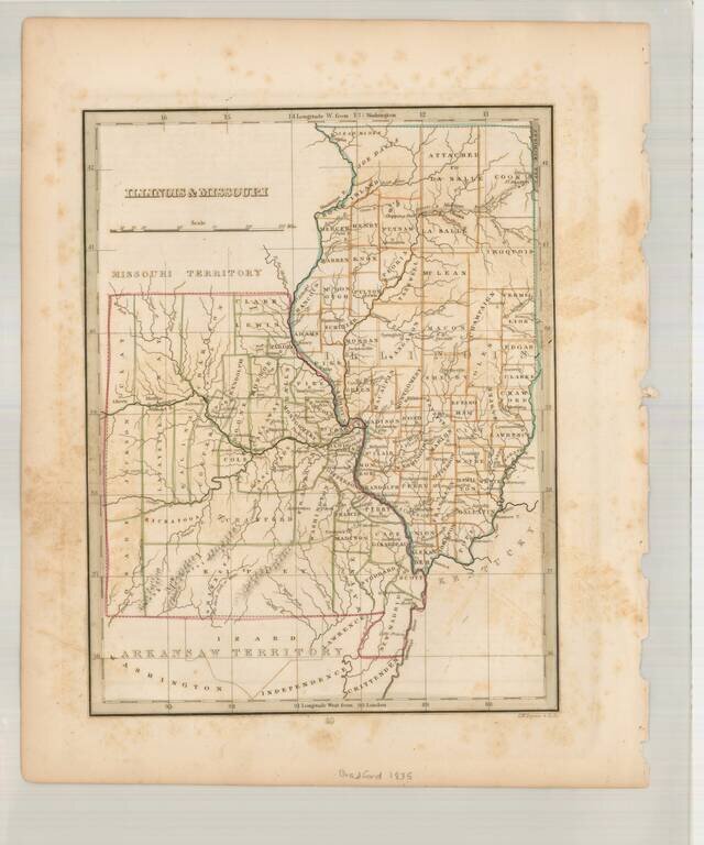
Scarce early map of Missouri & Illinois, also showing Arkansaw Territory to the South and Missouri Territory to the North. A number of early primitive counties still appear, especially in Missouri. Missouri has 38 counties, but lacks the Platte...
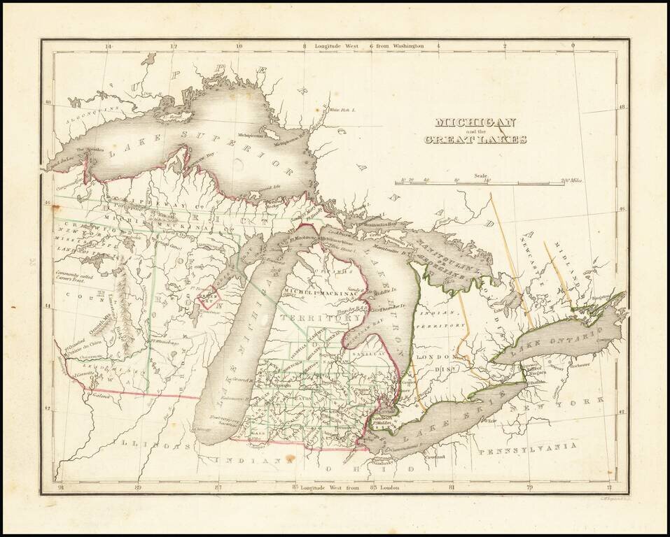
Nice example of this early map of Michigan Territory and adjoining regions (including what would become Wisconsin), published by S.A. Bradford. Michigan proper is shown with counties in the southern half, the north being Ottawa and Michilmackinac...
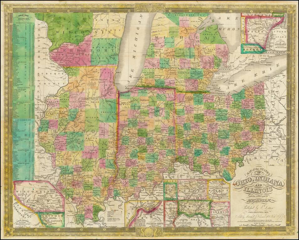
Excellent antique hand-colored engraved map of the eastern Midwest, covering Michigan, Ohio, Indiana, Illinois, and the southern half of Wisconsin. This is a rare later state of Finley's map of eastern Midwest, first issued in 1825, here in the 1835...
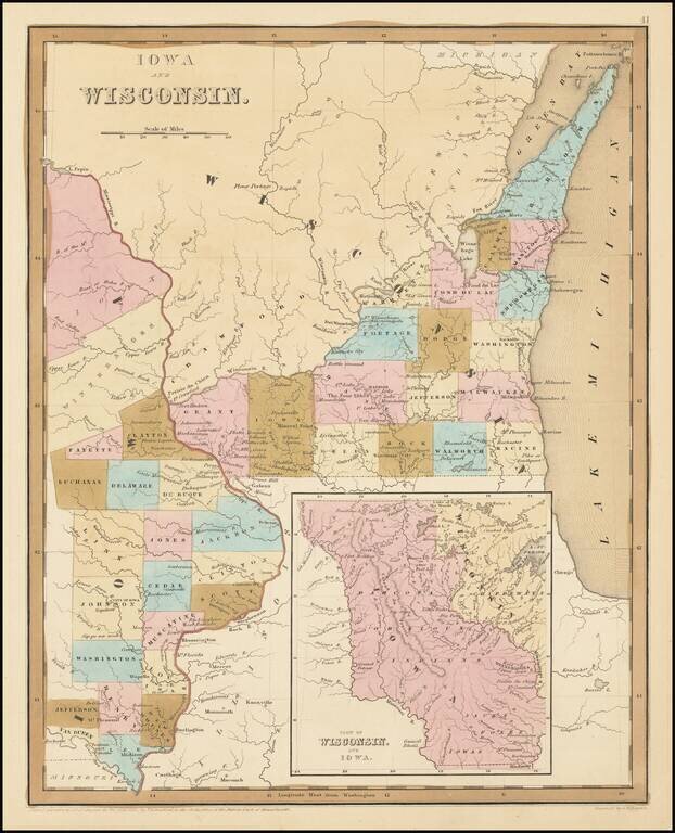
Early Antique Map of Iowa Territory and Wisconsin Territory Important early map of part of Iowa and Wisconsin, with large inset showing all of Iowa Territory and Wisconsin Territory extending to the Canadian Border. Iowa Territory was organized in...
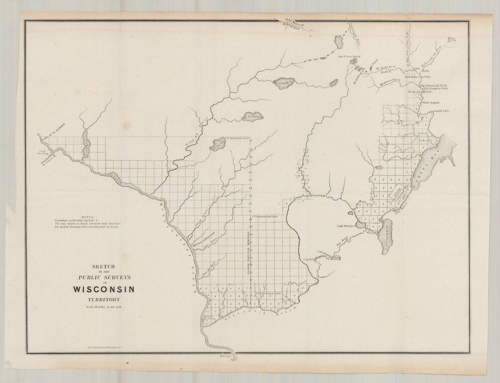
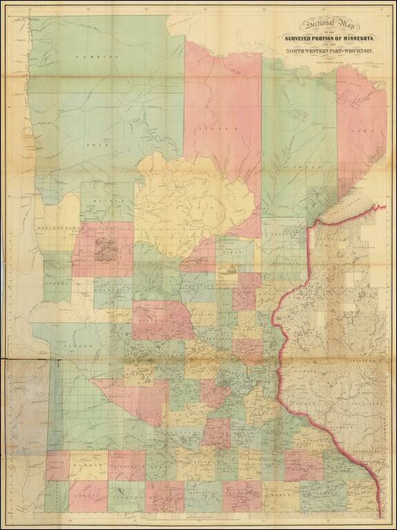
Fine example of one of the earliest obtainable maps focused on Wisconsin Territory. The map extends west to the Falls of St. Anthony and Fort Snelling, and north to the Headwaters of the Montreal Reiver, Ontonagon River and the area north of Green...
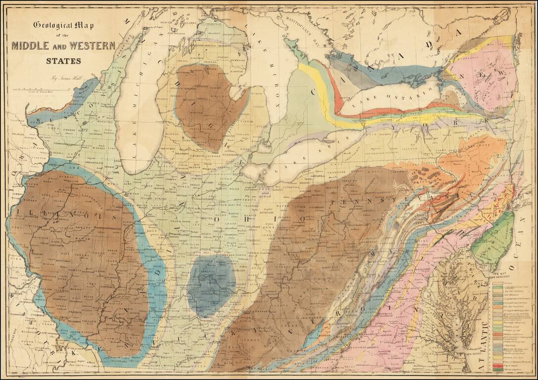
Finely executed geological lithograph map of the Midwest and contiguous regions, published by American geologist James Hall. The map is color coded by 23 geological formations for which there is a key in the lower right. Hall’s map is one of the...
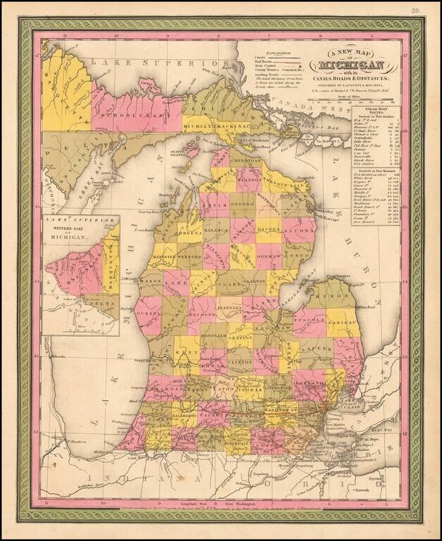
Detailed and interesting map of Michigan from Mitchell's New Universal Atlas. It is hand colored by counties and contains towns, rivers, canals, railroads, roads, etc. Inset shows the Western Part of Michigan. Statistical Table shows steam boat routes....
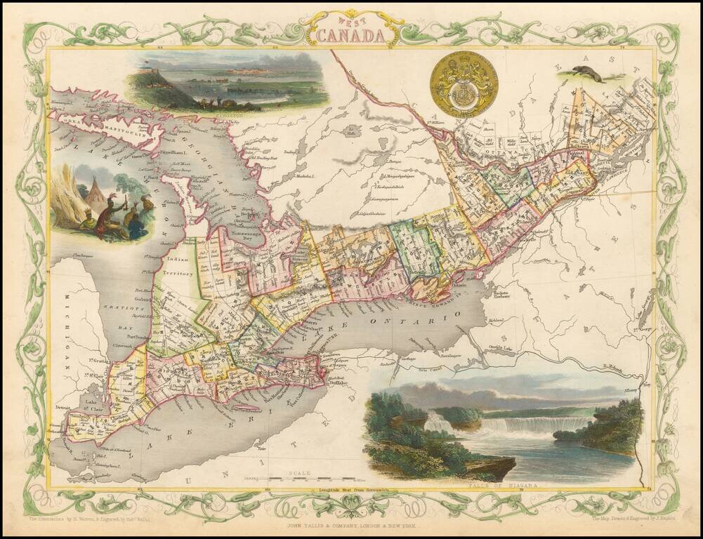
Interesting and highly detailed map of the Great Lakes region, showing counties and townships, Lake Huron, Lake Ontario and Lake Erie, as well as the Erie Canal and Mohawk River. Vignettes of Kingston, Niagara Falls and Indians in an encampment, along...
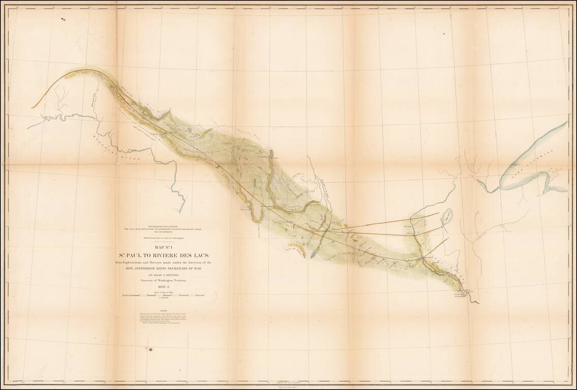
Detrailed map of the area from St. Paul and the Mississippi River to Fort Union and the confluence of the Yellowstone River and the Missouri River, published as part of the Pacific Railroad Surveys. The map shows one of the routes surveyed from St....
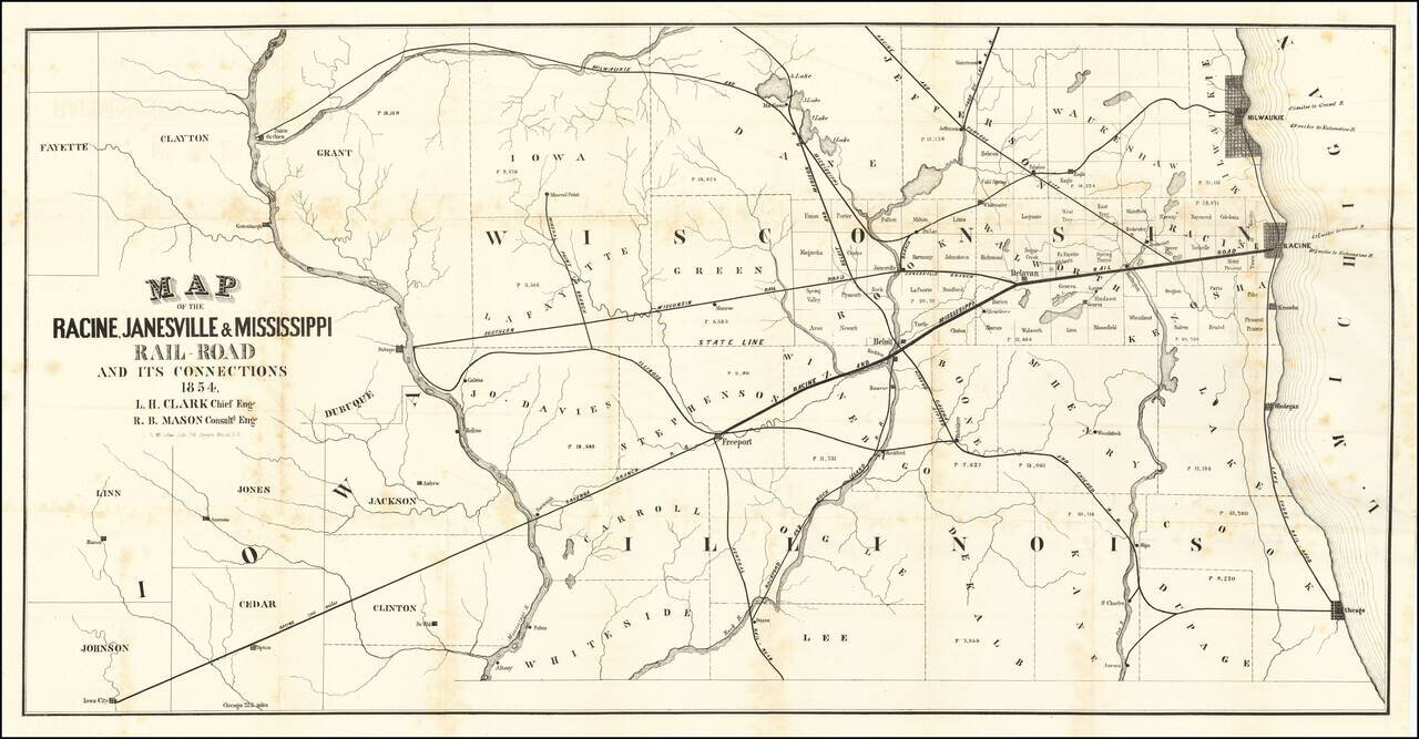
A Wisconsin Railroad That Never Was Rare map of the railroad lines of the Racine, Janesville & Mississippi Railroad, published in Racine with the first annual report of the Racine, Janesville & Mississippi Railroad. The map shows the area...
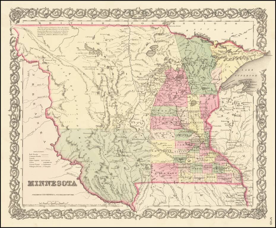
First Atlas State of Colton's Map of Minnesota Territory First atlas state of Colton's Map of Minnesota Territory, which extends to the Missouri River. Massive Pembina County and Yankton County dominate the western 2/3rds of the map. Only a hand...
Scarce St. Paul-published pocket map of Minnesota depicting the state from the Lake of the Wood to the Iowa border. The map extends eastward towards Wisconsin's Bayfield Peninsula. Sewall was publishing maps out of St. Paul at the time of statehood....
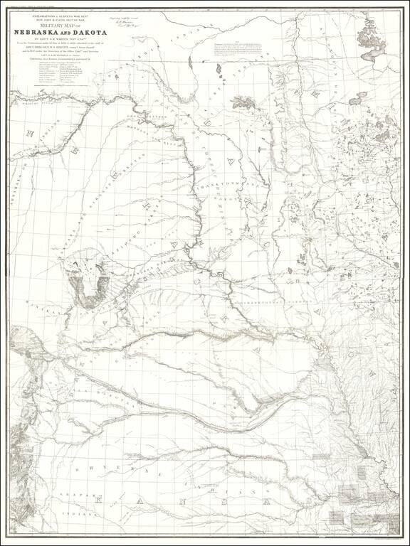
1875 Edition of Warren's Pivotal Map of the American Plains -- Early Reference To the Colorado / Kansas Gold Regions 1875 edition of Gouverneur Kemble Warren's large format map of Kansas, Nebraska, Dakota and part Colorado and Wyoming, based upon...