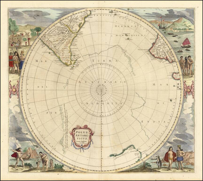
Third state of Hondius' decorative map of the South Polar region, with the name Joannes Janssonius appearing for the first time. The present state predates the first appearance of New Zealand and Van Dieman's Land. The map includes significant...
![[South Polar Regions]](/map/small/43970.jpg)
Decorative example of Jansson's map of the South Polar region, including the earliest appearance of New Zealand and Van Dieman's Land. The supposed coastline of the unknown southern continent continues to appear. Includes notes regarding the...
![[Untitled Map of South Pole]](/map/small/69130.jpg)
Old color example of this rare late edition of Hondius' decorative map of the South Polar region, including the earliest appearance of New Zealand and Van Dieman's Land on this map. The supposed coastline of the unknown southern continent continues to...

Scarce map of the South Polar regions, published in a late edition of the Jansson-Cloppenberg Atlas Minor. Includes an early depiction of Australia and New Zealand, with a note on islands seen by Magellan. Remnants of the mythical Terra Australis...
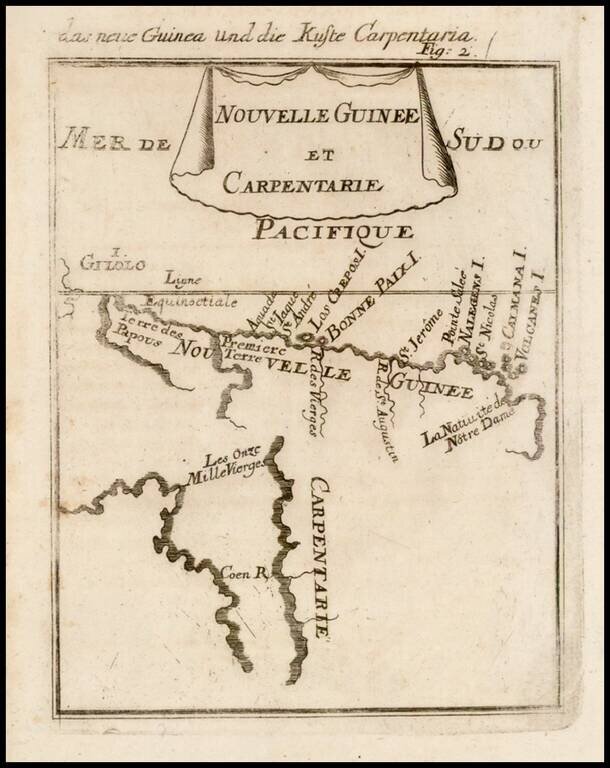
Beautifully engraved hand colored antique map of Cape York Peninsula, the Gulf of Carpenteria and New Guinea. The area is depicted before the Torres Strait was charted. The map was published as part of the 1686 German edition of Alain Manesson Mallet's...
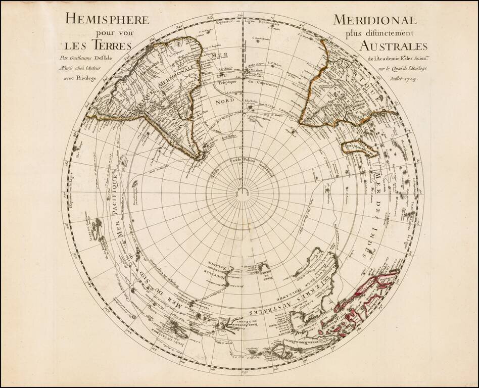
First edition of De L'Isle's important map of the Southern Hemisphere, first published in 1714. De L'Isle's map is an important early map of the South Polar regions, which would become the standard base map for French and Dutch map makers for much of...
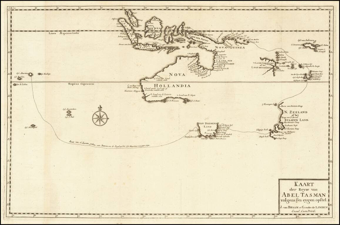
A Foundational Rarity for the Mapping of Australia and The Earliest Printed Map of Australia Based Upon Tasman's Discoveries Antique engraved map showing the track of Abel Tasman's First Voyage of 1642-43, when he sailed from Mauritius. Although the...
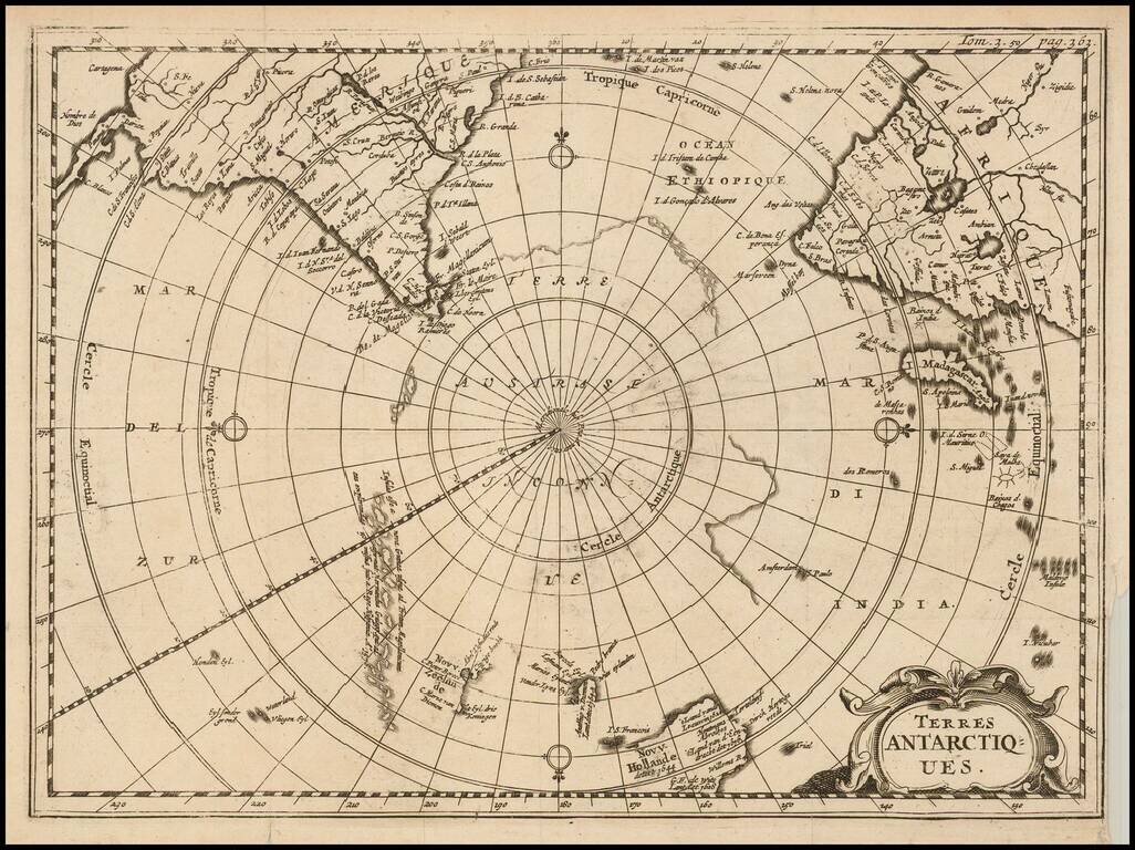
Rare map of the Southern Hemisphere, illustrating the known and imagined lands of the Antipodes. The map provides a fine accounting of the lands of the South Polar regions, some of which were fictional. The map includes outlines of Antarctic...
A Rare Ottens map of the Southern Hemisphere, with an additional text panels Southern Hemisphere This fascinating map captures the entire Southern Hemisphere from a polar projection. This rare variant example includes an additional text panel...

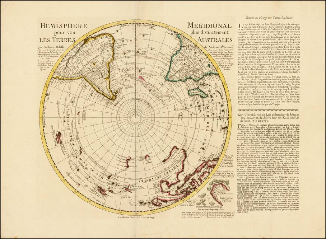
A Rare Pair of Ottens Maps of the Northern and Southern Hemisphere, made especially to commemorate Lozier Bouvet's 1738-9 voyage. Fine pair of maps of the northern and southern hemispheres, originally by Guillaume Delisle and here re-issued by...
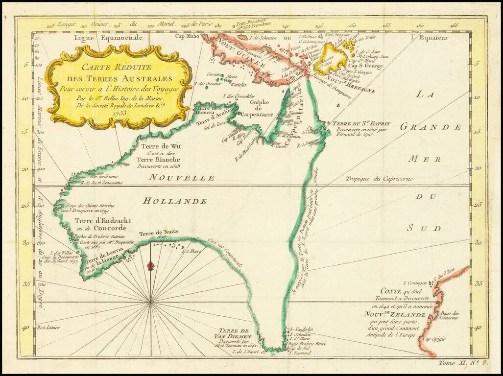
Fine Early Map of Australia with Dutch Discoveries and Innovative Geographic Theories Nice example of Bellin's map of Australia, which featured in the Abbe Prevost’s massive voyage collection, Histoire générale des voyages, published from 1746 to...

Cook’s Map of the Southern Hemisphere, Highlighting Historic Exploration toward Antarctica--French Edition French edition of Cook’s highly-detailed, large-format map of the Southern Hemisphere, showing the tracks of major voyages of exploration in...
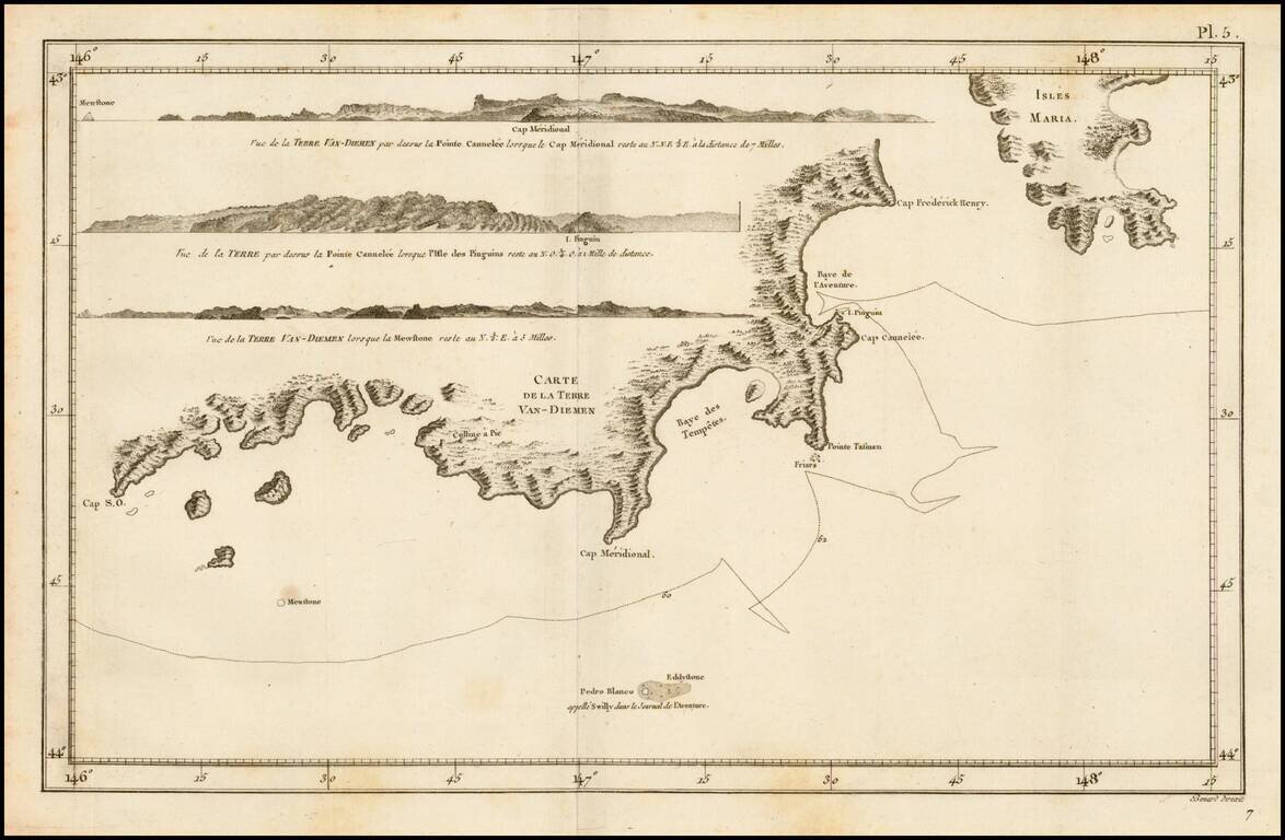
Detailed map of the Coast of Van-Diemen (Tasmania), from the French edition of the official account of Cook's voyage. Includes several profile views.
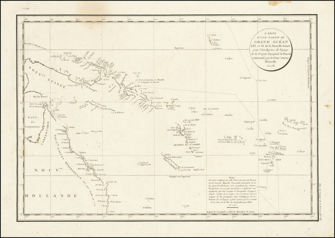
Interesting chart of Eastern Australia and part of the south-western Pacific, showing the routes taken by the Spanish explorer Don Francisco Antonio Maurelle in 1781 along the northern coast of New Guinea and across the Pacific to Fiji and Tonga,...
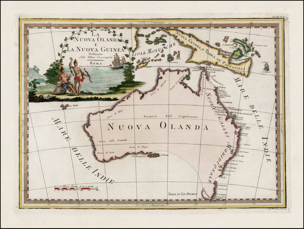
Striking early map of Australia, with large decorative title cartouche. Cassini's map of Australia is by far the most decorative map of Australia to appear in a commercially published atlas. Following Cook's landmark discovery of Australia's east...
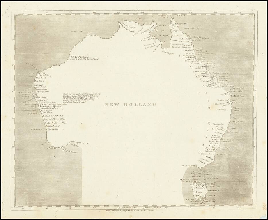
Engraved map of Australia featuring a curious interpretation of the southern coastline. This simple map shows Van Diemen's Land as an Island, reflecting the knowledge after Flinders, but is completely devoid of coastal features in the south and...