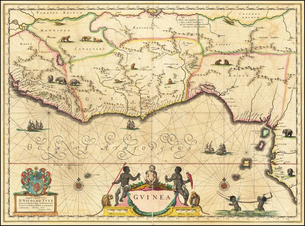
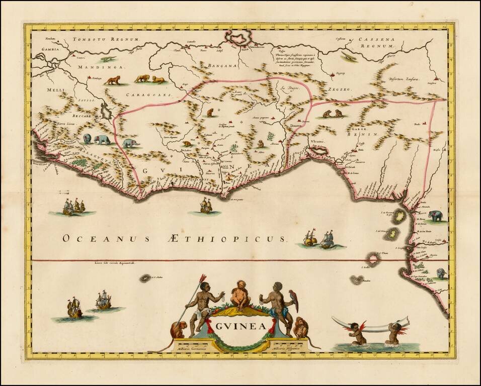
Fine Map of the Guinea Coast Included in Blaeu’s Famous Atlas and Including the Famous Apes of Dr. Tulp Detailed map of Guinea, showing the length of a coast important to African-European trade, including the slave trade. Originally drawn by Willem...
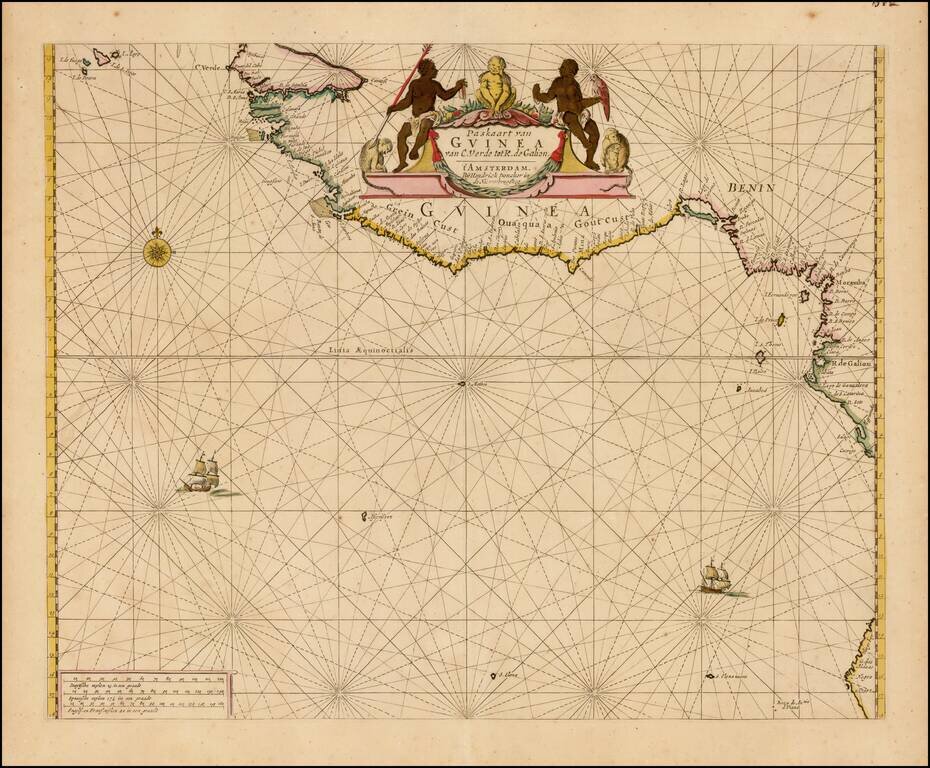
Finely colored example of Doncker's sea chart of West Africa, which appeared in his De Zee-Atlas of Water-Waerelt, published in Amsterdam, circa 1665. The map extends from the Cape Verde Islands, Dakar and the area just north of the Gambia River in...
Striking old color example of the first edition of De Wit's sea chart of West Africa, from his Orbis Maritimus ofte Zee Atlas. The map extends from Senegal in the north to Angola in the south, centered on the Bay of Guinea. There is a wealth of...
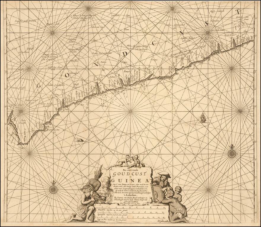
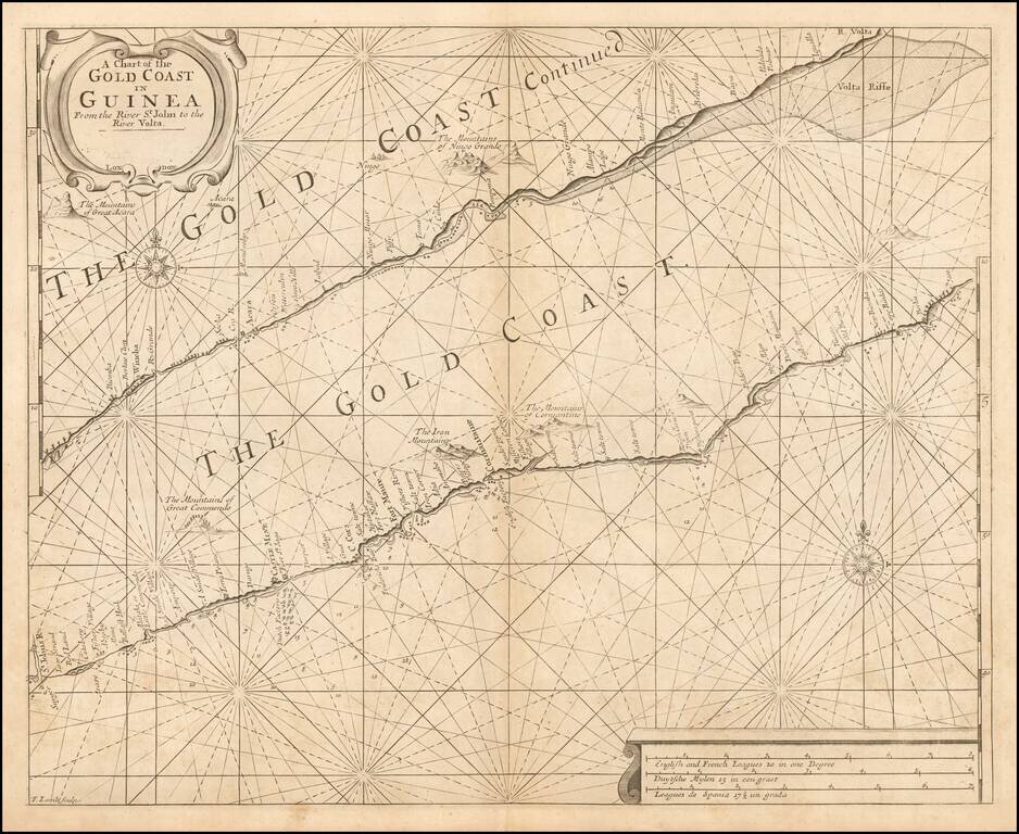
Detailed sea chart of a portion of the coast of west Africa, covering the Ghanaian Gold Coast, published by Johannes Van Keulen in Amsterdam. The detail in the interior is spotty at best. The allegorical cartouche is suggestive of the English trading...
![[Black Kingdom] Nigritarum Regnum](/map/small/56999.jpg)
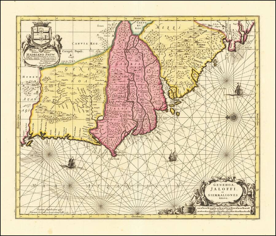
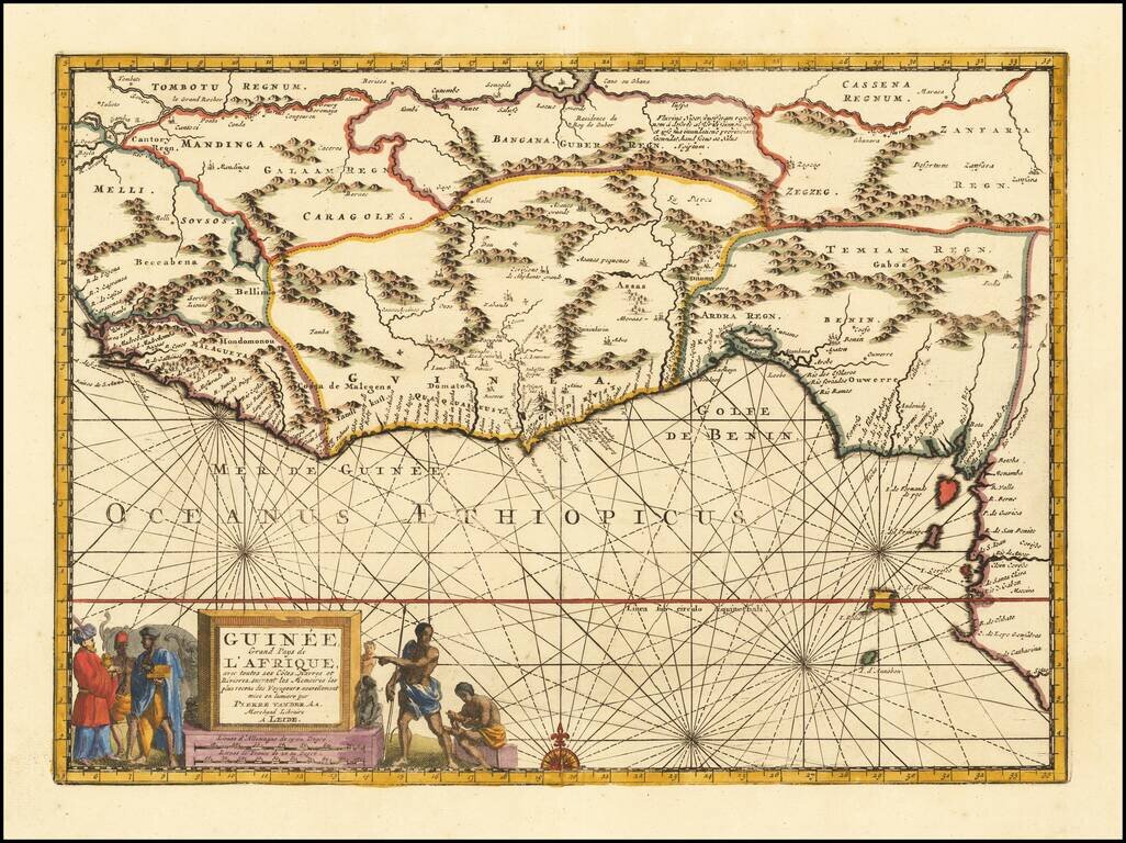
The Black Kingdom Nice example of this decorative late 17th Century map of a part of West Africa, from the region surrounding the Senegal River to Angola. Nigritarum is the feminine plural work in Latin for the word negritis, meaning black. Richly...
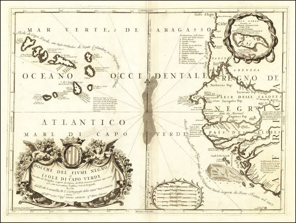
Detailed engraved antique map of the West African coast showing present-day Senegal, Gambia, and Cape Verde. An inset map shows Île de Gorée (here called "Isola Goree"), which is a large island in the harbor of Dakar, Senegal. The island played an...
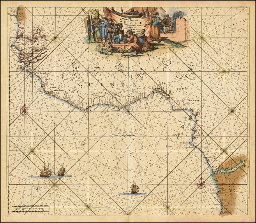
Nice old color example of this detailed sea chart of the West African Coast, from Senegal to Sierra Leone. Decorative cartouches, rhumblines, sailing ships and other decorative features embellish the map.
Decorative map of West Africa, published by Valk & Schenk in Amsterdam. The map includes numerous animals in the interior, sailing ships and several elegant cartouches. The sea is show with Rhumb lines. The first state of this fascinating map,...
Rare English sea chart of the Gold Coast, published by Samuel Thornton. The chart includes 2 sections of the West African Coastline, along the Cape Coast of Ghana. A number of Western settlements are noted, including: Dutch Factory at Fort St. Jago...
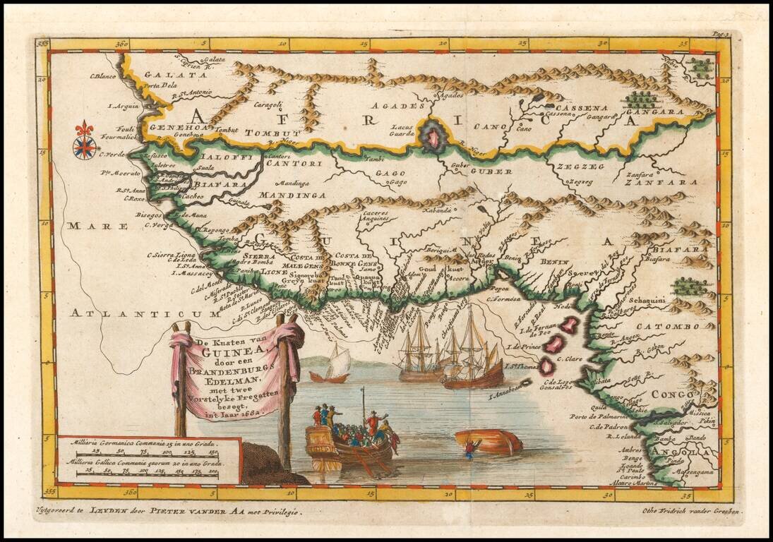
Sriking map of western Africa based upon the 1682 desciptions of Otho Frederic vander Greuben. Includes nice detail along the coast and in the interior, 4 ships (one capsized) and other decorative features.
Striking map of West Africa, including extensive notes in the interior and nice topographical details. Vander Aa's decorative maps were some of the best engraved and most interesting maps of the early 18th Century.
![[West Coast Africa: Sierra Leone, Liberia and Guinea]](/map/small/40123.jpg)
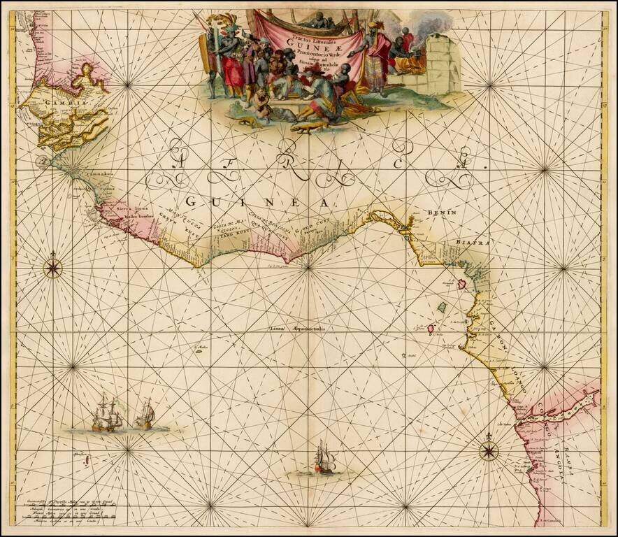
Fine Map of the West African Coastline From a Celebrated Voyage Collection Detailed, striking map of the coasts of Sierra Leone, Liberia, and Guinea, from the Churchills' famous voyage collection, published in London in 1732. It is based on the voyage...
![A Chart of the Gold Coast of Guinea from Rio da Costa to Rio da Volta [with a view of Cape Santa Appollonia]](/map/small/64635.jpg)
Detailed Map of the Gold Coast From a Celebrated Voyage Collection Finely-wrought map of the coast of Ghana, from the voyage account of Jean Barbot in the Churchill brothers’ renowned voyage collection, published in London in 1732. The maps of the...
Nice old color example of the Ottens sea chart of West Africa. The map extends from Senegal in the north to Angola in the south, centered on the Bay of Guinea. There is a wealth of navigational information including sandbanks and shoals. The chart is...
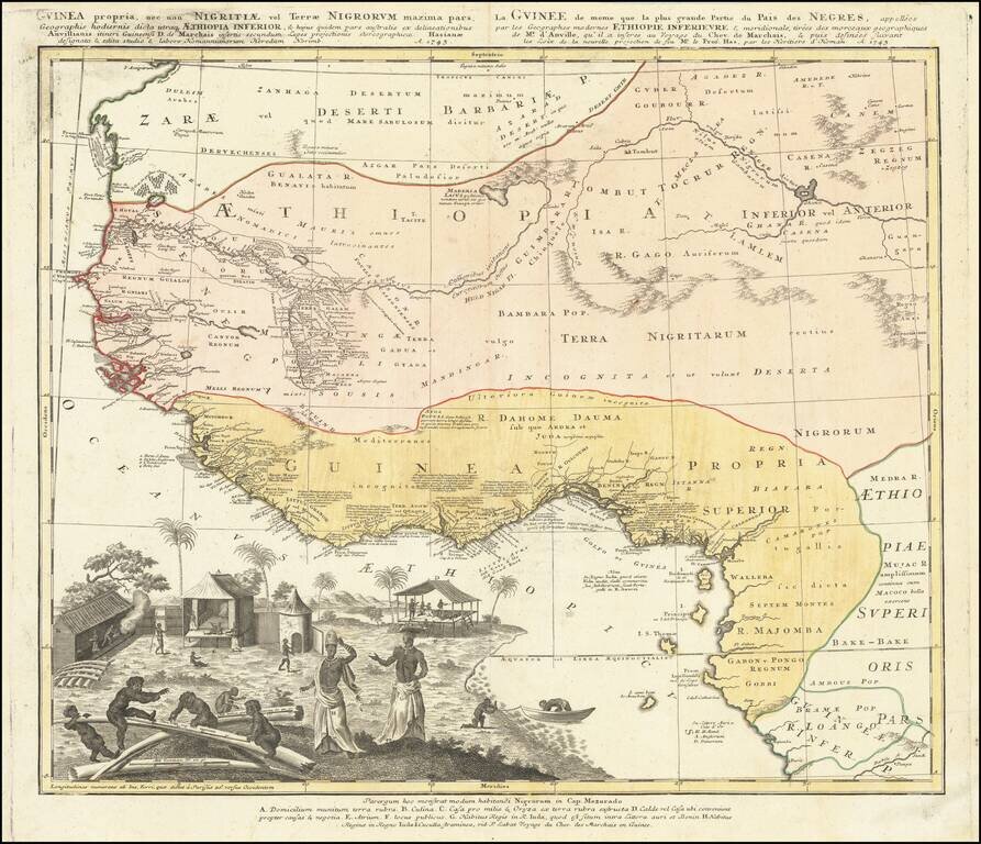
Strikingly-Illustrated Eighteenth-Century Atlas Map of West Africa Dynamic example of this highly decorative and detailed antique map of West Africa, published by the Homann Heirs in 1743. This is one of the best atlas maps of the region made during...
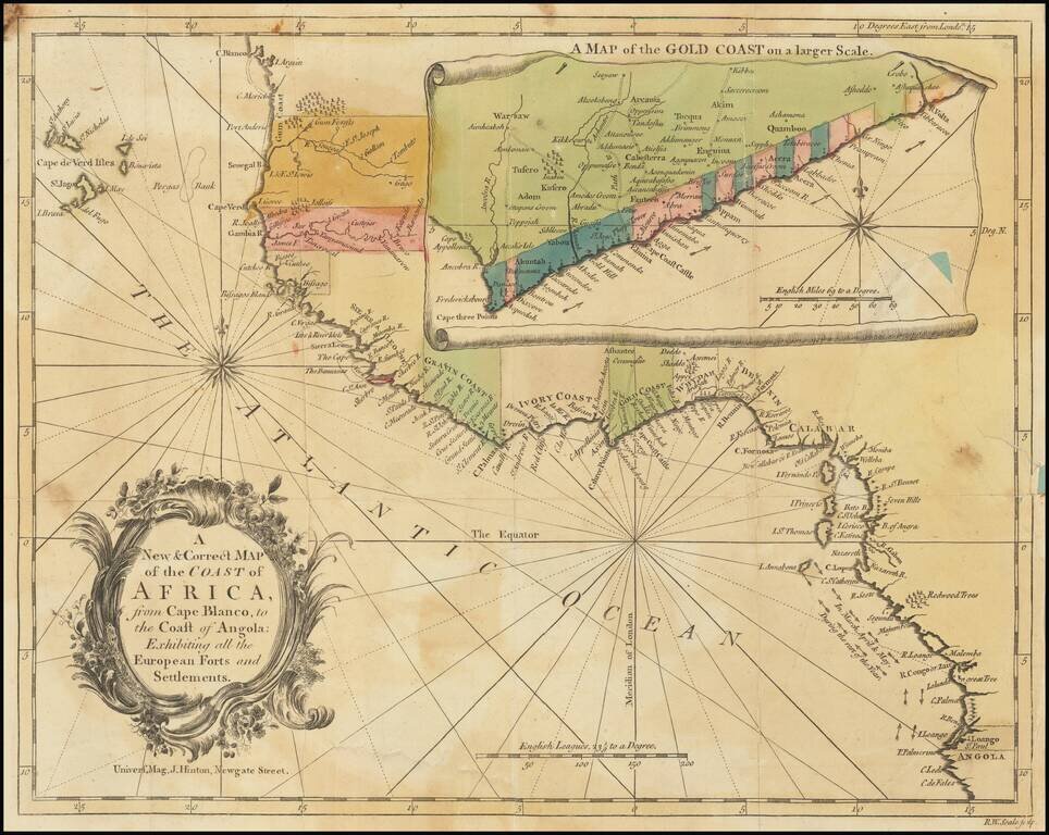
Detailed map of the of the West African Coastline, with a large inset of the Gold Coast, from an early edition of the Universal Magazine. These early Universal Magazine maps are quite rare on the market.