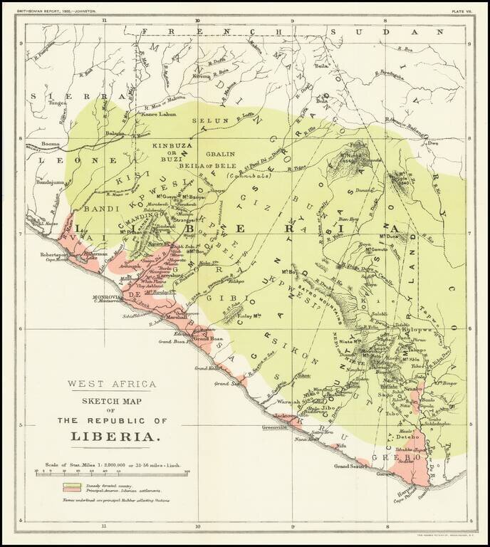
Mapping The Freed American Slave Efforts -- Republic of Liberia Scarce map of the Republic of Liberia, which illustrated an article by Sir Harry Johnston on Liberia, which was read at the Royal Geographical Society on March 27, 1905 and appeared in...
![[Cote d'Ivore] Dakar et le Cap Vert Vue cavaliere de la presqu'ilse caput pulcherrimum - dessinee et elumminee par Abou Siril](/map/small/58864.jpg)
A Whimsical View of Dakar Whimsical promotional / pictorial map of the area around Dakar in the Cote d'Ivore. Includes the note "Université de Dakar, Institut Français d'Afrique Noire" on verso. The map is signed by Theodore Monsou.
![[Madagascar] S. Lorenzo](/map/small/37926.jpg)
Marvelous example of Porcacchi's map of the Island of Madagascar. One of the earliest obtainable maps of the Island and one of the few published in the 16th Century. Excellent topographical detail, if a bit conjectural, and naming many locations....
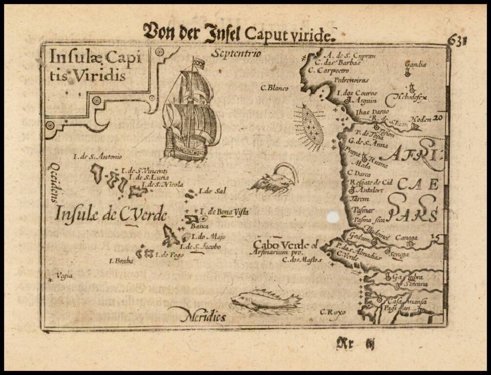
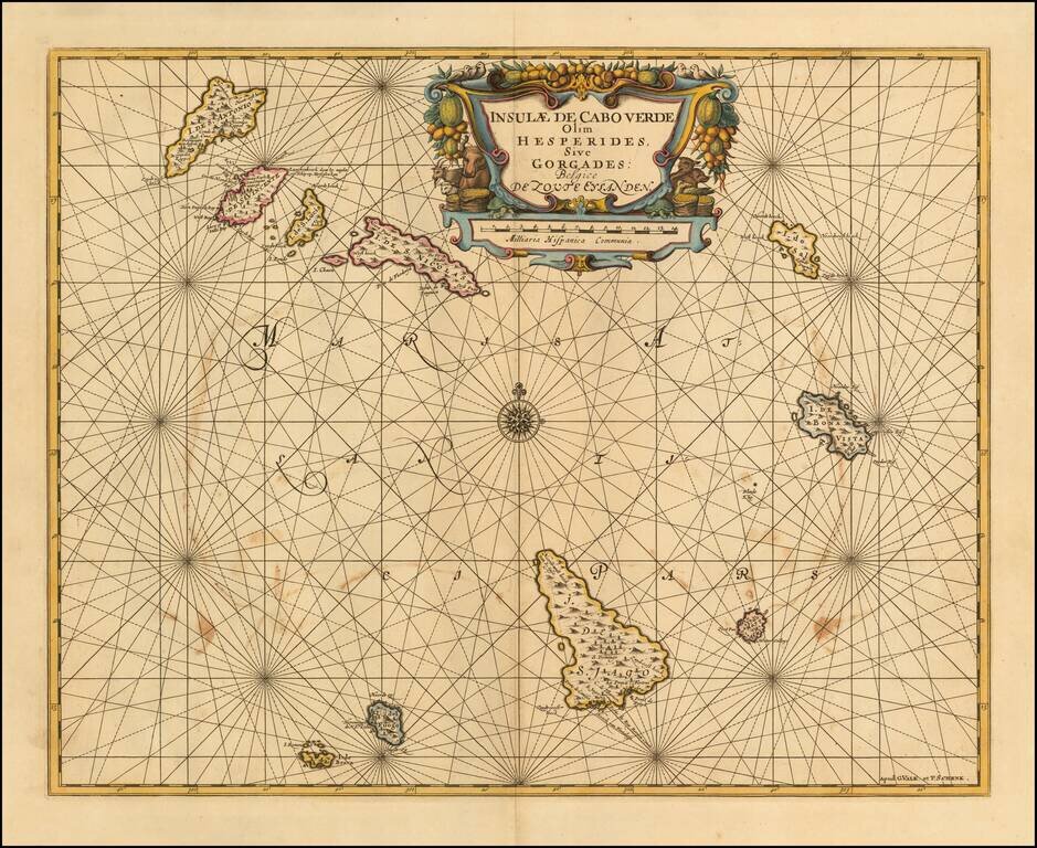
Nice example of this early state of Barent Langenes map of the Cape Verde Islands, which first appeared in the 1598 edition of Langenes Caert-Thresoor, published in Middelburg. Langenes's map was first issued in his Caert-Thresoor and later...
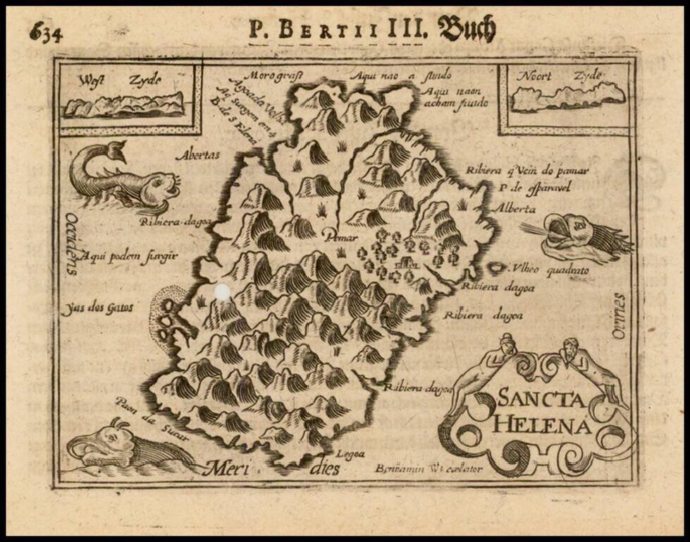
Nice example of this early state of Barent Langenes map of the island of St. Helana, which first appeared in the 1598 edition of Langenes Caert-Thresoor, published in Middelburg. Langenes's map was first issued in his Caert-Thresoor and later...
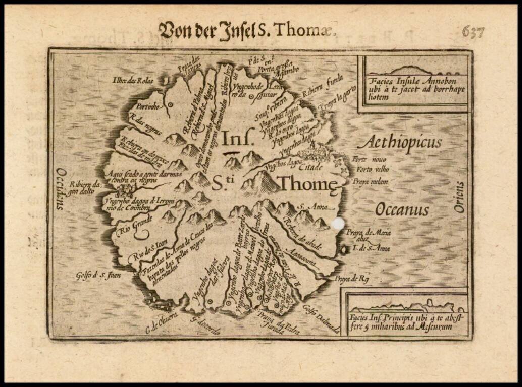
Nice example of this early state of Barent Langenes map of the island of St. Thomas, which first appeared in the 1598 edition of Langenes Caert-Thresoor, published in Middelburg. Langenes's map was first issued in his Caert-Thresoor and later...
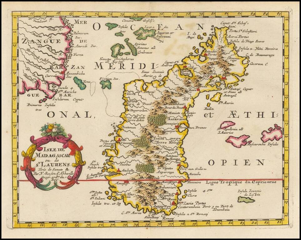
Exceptional old color example of this finely engraved map of Madagascar, first published by Sanson in 1657. Sanson notes the source of his map as Livio Sanuto and others. Livio Sanuto was a mid-16th Century Italian cosmographer and mathematician who...
![[Cape Verde] Pascaerte vande Soute Eylanden oftge Ilhas de Cabo Verde](/map/small/67911.jpg)
A Rare Early Sea Chart of Cape Verde Rare early sea chart of the the Cape Verde Islands by Johannes Van Loon. The islands shown with its towns and anchoring places. Island of Del Fuogo is shown with an erupting volcano. Very decorative map with a...
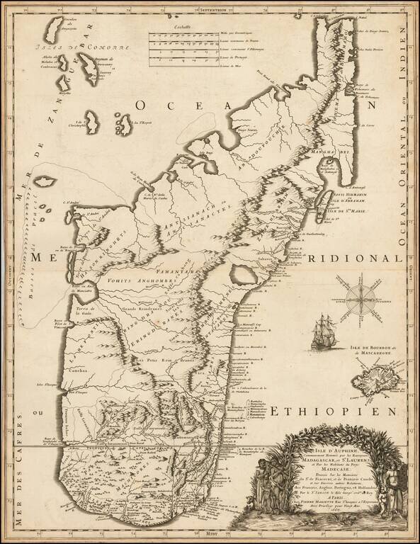
Finely engraved map of Madagascar, published by Pierre Mariette. The map was perhaps the finest and most up to date of its time, utilized by contemporary explorers. As noted in The Voyages Made by Sieur Du Bois To The Islands of Dauphine of Madagacar...
Detailed sea chart of the Cape Verde Islands, published in Amsterdam. Shows a volcano erupting on the Isla de Fuogo.
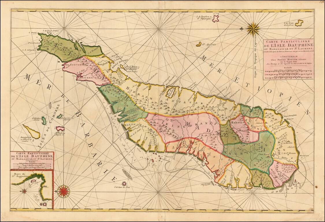
Madagascar -- Pirate Haven Fine old color example of Mortier's large sea of Madagascar, published in Amsterdam by Pierre Mortier. Fine large format chart of Madagascar, orientated with north to the left, appears in Pierre Mortier's sea-atlas, 'Le...
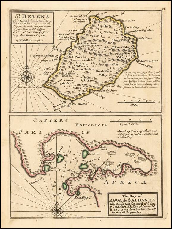
A nice example of Herman Moll's map of the island of St. Helena.
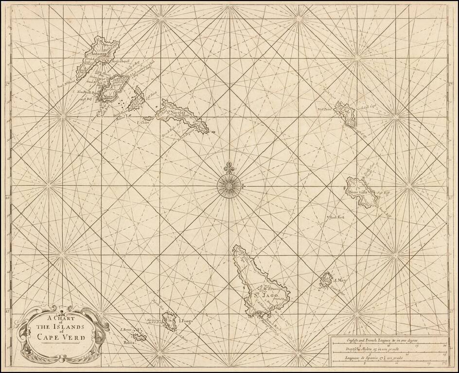
Nice example of Mount & Page's sea chart of the Cape Verde Islands, which appeared in the English Pilot, Book I. Located in the South Atlantic some 300 miles west of Africa, the Cape Verde archipelago was discovered by the Portuguese in 1460. The...
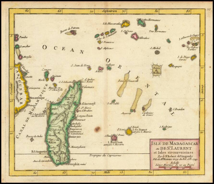
Detailed engraved map of Madagascar, the Mascarene Islands, and other nearby Indian Ocean African islands, published in De Vaugondy's first atlas. The map extends as far east as Chagos and as far west as Zanzibar.
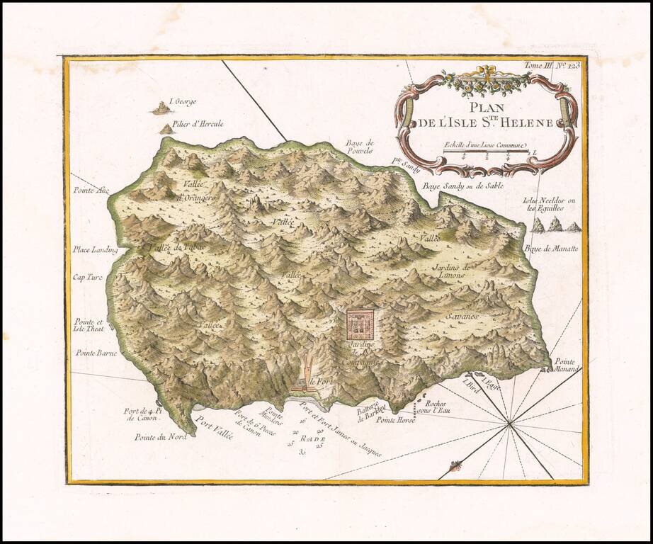
Fine early map of the St. Helene. Bellin's map Plan de l'Isle Ste Helene is largely is derived from the maps of Seller and Moll. The outline of the island essentially is that portrayed by Seller, with, for example, the very pronounced 'finger' of...
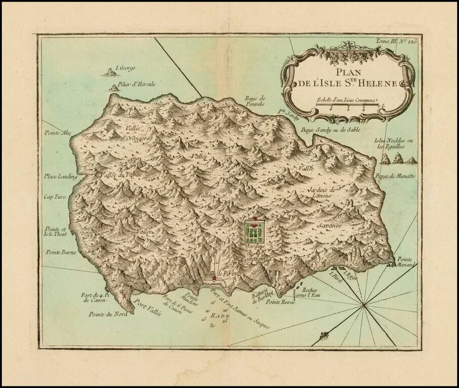
Fine early map of the St. Helene. Bellin's map Plan de l'Isle Ste Helene is largely is derived from the maps of Seller and Moll. The outline of the island essentially is that portrayed by Seller, with, for example, the very pronounced 'finger' of...