Map size in jpg-format: 45.466MiB
Click to open in high resolution (open in new tab).

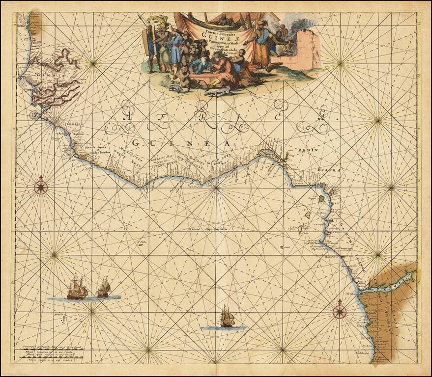
Nice old color example of the Ottens sea chart of West Africa.
The map extends from Senegal in the north to Angola in the south, centered on the Bay of Guinea.
There is a wealth of navigational information including sandbanks and shoals. The chart is a masterpiece of decorative engraving with illustrations of sailing vessels, compass roses and an elaborate allegorical title cartouche, showing Dutch and native traders, slavery images and local commerce.
If you are a student, write to us in telegram: @antiquemaps and indicate what material you need and for what work you need a map in high detail. We are ready to provide material on special terms. For students only!
![[Wall Map] West-Indische Paskaert waer in de graden der breedde over weder zyden vande middelyn wassende so vergrooten dat die geproportioneert syn tegen hunne nevenstaende graden de lengde.](/map/small/60169.jpg)
![[The First Maps in a la poupée Printed Color] Cartes en Couleur des Lieux Sujets aux tremblements de Terre Dans toutes les parties du Monde Selon le Sisteme de l’impulsion Solaire](/map/small/52293op.jpg)
