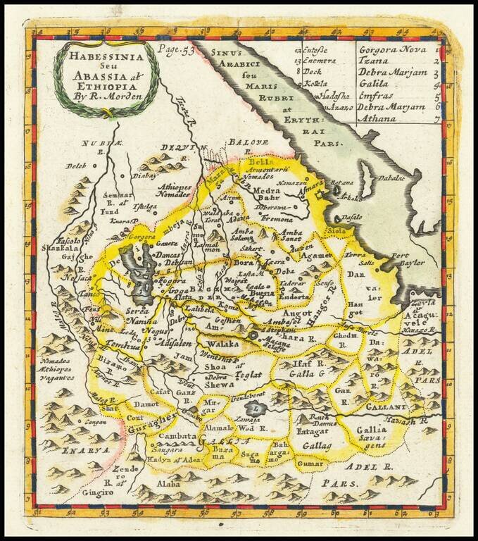
Scarce early English map of the region south of Egypt and the Red Sea. This first map appeared in Modern's rare Atlas Terestris, first published in 1687.
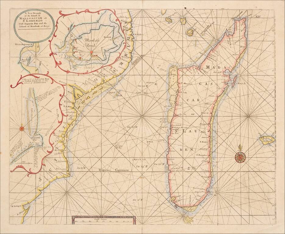
Scarce engraved sea chart of the coast of coast of Mozambique and the island of Madagascar with three insets of important ports north of Mozambique. This is an important map for Kenya as well, as it shows "Mombass Island", now Mombasa, with a...
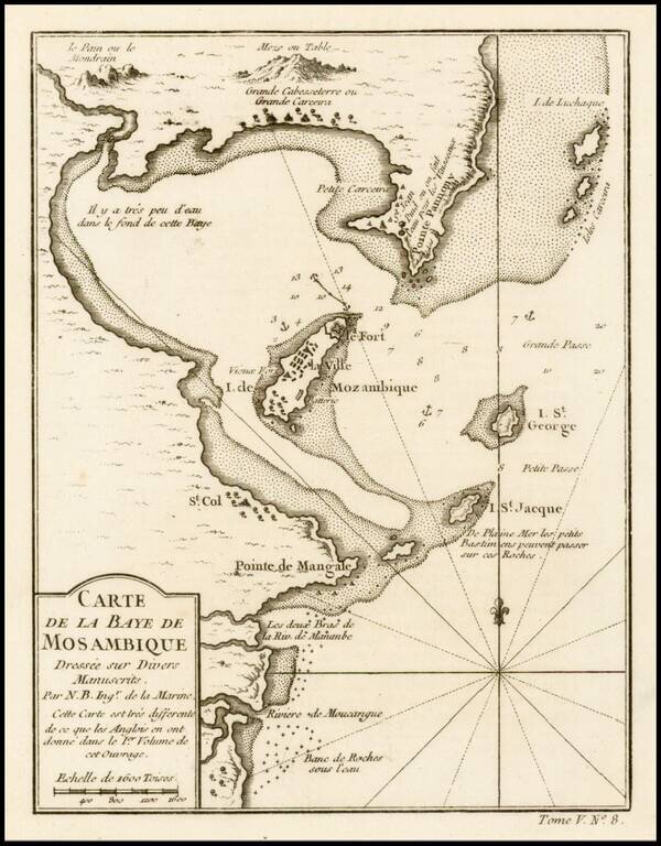
Fine example of this highly detailed map of the Bay of Mosambique, published by French Royal Geographer J.N. Bellin in Paris.
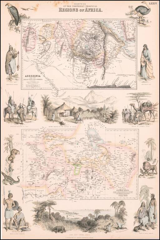
Decorative pair of maps of Abyssinia and Central Africa, published in Edinburgh. Includes large views of Mount Mamrat and Lake Tsad (Chad), with smaller vignettes of indigenous animals and peoples.
![[Lake Tanganyika, Lake Victoria and Northwest Tanzania]](/map/small/63611.jpg)
Fine early map of Northeast Tanzania, published as part of a Petermann & Hassenstein's map of Inner Africa. The map features a number of roads and the routes of 19th Century African explorers, including: Burton & Speke - 1857-58 Speke -...
![[Uganda - South Sudan ]](/map/small/63642.jpg)
Fine early map of Northern Uganda,Lake Albert and the southern part of South Sudan, published as part of a Petermann & Hassenstein's map of Inner Africa. The map features a number of roads and the routes of 19th Century African explorers,...
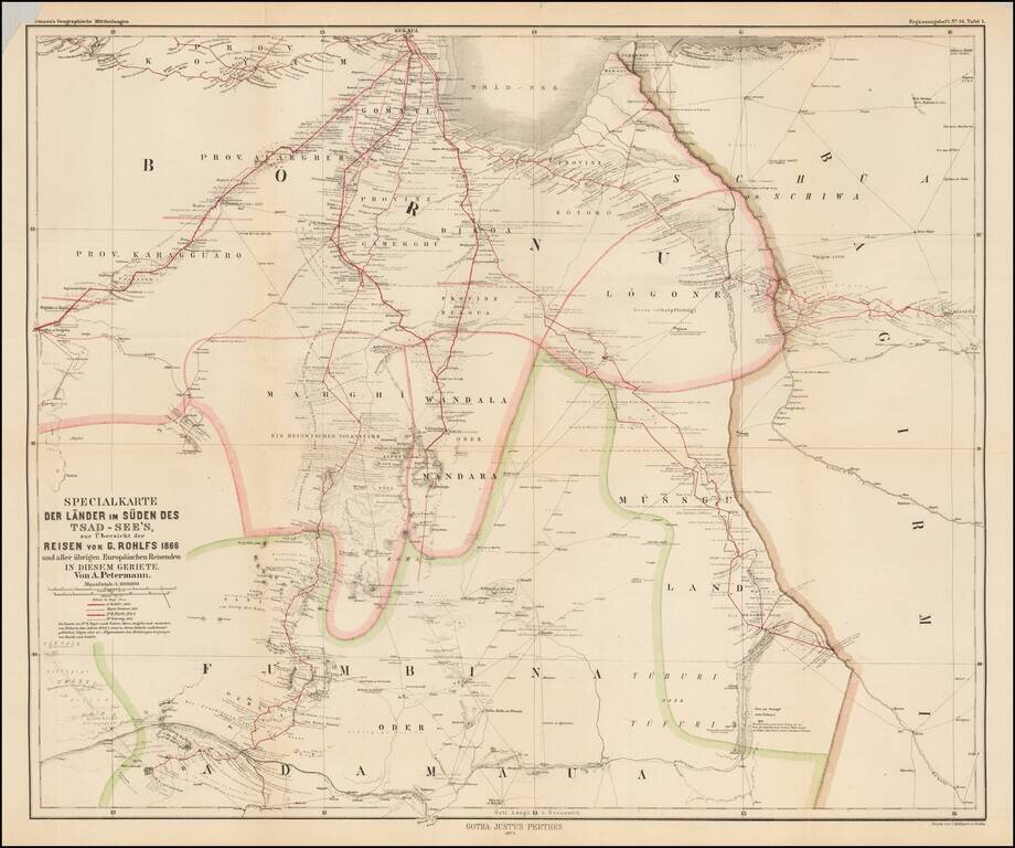
Scarce map of central Africa, illustrating the region to the south of Lake Chad, focusing on the explorations of Gerhard Rohlfs. The map identifies the routes of a number of explorers, including: Gerhard Rohlfs -- 1866 Major Denham -- 1824 Dr. M....
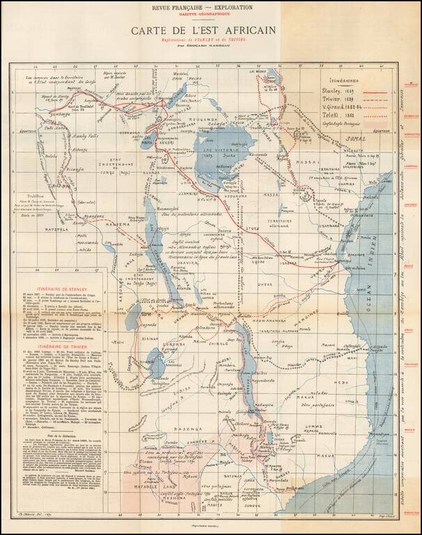
Rare map of East Africa, published by the Gazette Geographique in Paris. The map details the routes of 4 explorers in East Africa, along with the area in conflict between the English and the Portuguese. The explorer routes shown include: Henry...
![[Timbuktu and Environs] Carte de la region de Tombouctou au 1/500,000.e Dressee par Mr. le Lieutenant Vaisseau Hourst, Commandant la Flottile du Niger et Mr. le Lieutenant Bluzet de l'Infanterie de Marine d'apres la carte Caron et Lefort, les travaux d](/map/small/65023.jpg)
Rare map of the region around Timbuktu, published by the French Geographical Society in April, 1895. Finely detailed map of the lake region of Faguibine and Tele, near Timbuktu, formed by the branching off of the Niger River. This rich and...
![[Kenya, Southern Ethiopia & Somalia - Jubaland and Tanaland Provinces] Boran](/map/small/67233.jpg)
Jubaland and Tanaland Provicinces Finely detailed map of Kenya, along with western Somalia and southern Ethiopia. The map extends from Lake Rudolph (Lake Turkana) to Lake Baringo and Afmadow in Somalia. Details include: Railroads completed and in...
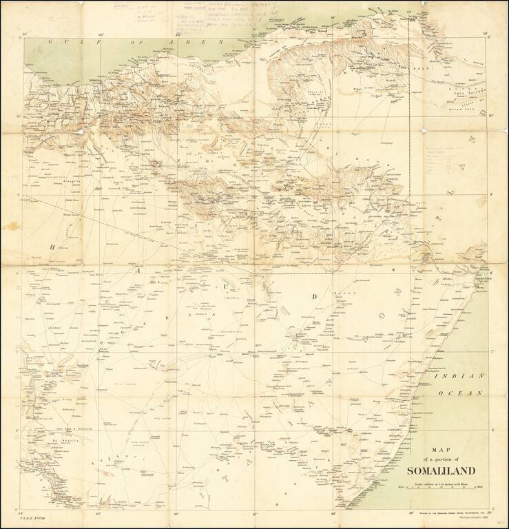
Rare Ordinance Survey Map of Northern Somalia and Eastern Ethiopia, published by the British Ordnance Survey in 1906. The map provides an overview of roads, topography and coastal details, along with the Anglo-Ethiopian Treaty boundary of July 28,...
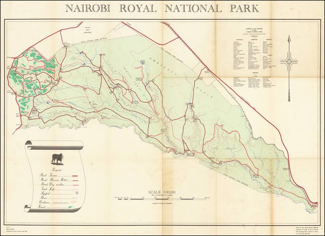
The Survey of Kenya's First Map of Nairobi Royal National Park The first map of Kenya’s first national park, Nairobi Royal National Park, documenting wildlife, topography, and roads. It was compiled and drawn in 1956, just ten years after the park...
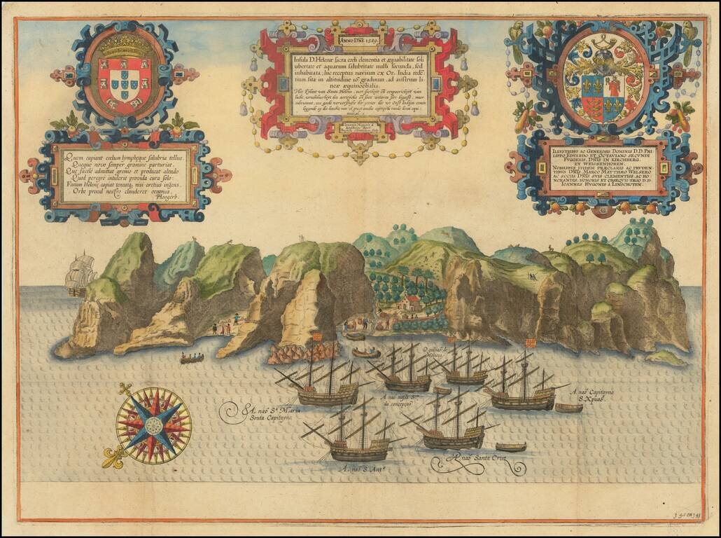
Spectacular birds-eye view of the island of Santa Helena, engraved by Baptista van Deutecum in Amsterdam, for Linschoten's Itinerario. Linschoten served 6 years as the bookkeeper for the Archbishop of Goa (1583-89). While in Goa, as a result of his...
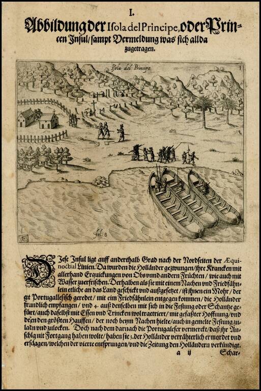
Early image of Sao Tome and Principe, off the coast of West Africa, from the De Bry edition of Olivier Van Noort's Description du Penible Voyage Faict entour de l'Univers ou Globe Terrestre, published by Cornelis Claes in 1602. Van Noort's map,...
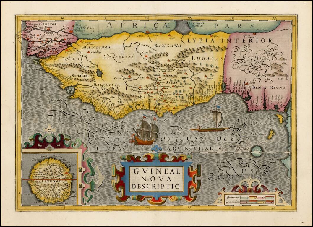
Gorgeous map of the West African Coast from Rio Senego (Senegal) to Cape Lopez, just below the equator, and includes Guinea with parts of Benin and Lybia. Detailed inset of St. Thomas. The map reflects the Portuguese exploration and mapping of the...
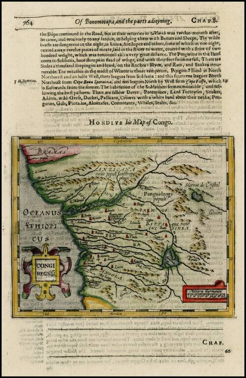
Detailed regional map, extending from Bramas to Angola and extending inland to Sierras de Cristobal and Salnitre. From the 1625-26 edition of Purchas His Pilgrims, one of the seminal early 17th Century English Language travel works. On a 13 x 9 inch...