Map size in jpg-format: 2.67189MiB
Click to open in high resolution (open in new tab).
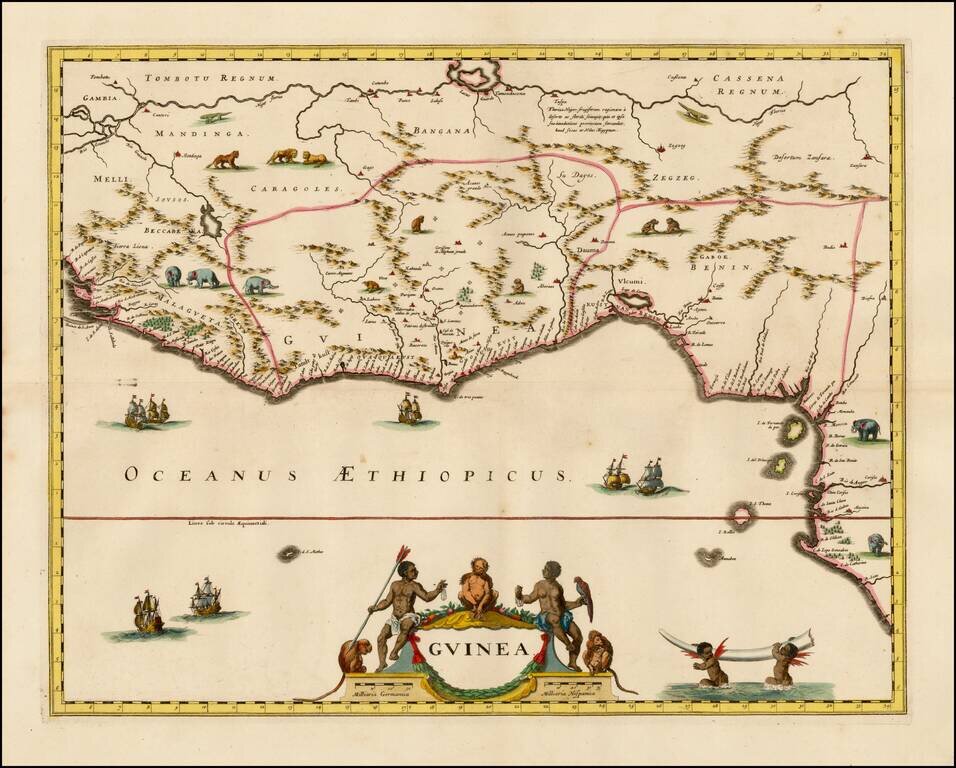
Decorative map of West Africa, published by Valk & Schenk in Amsterdam.
The map includes numerous animals in the interior, sailing ships and several elegant cartouches. The sea is show with Rhumb lines.
The first state of this fascinating map, which was copied by several later Dutch cartographers. The map is a variant of Blaeu's map, enlarged and re-engraved. The rhumb lines and dedication cartouche have been removed and the map modestly enlarged in the north and south.
Peter Schenk the Elder (1660-1711) moved to Amsterdam in 1675 and began to learn the art of mezzotint. In 1694 he bought some of the copperplate stock of the mapmaker Johannes Janssonius, which allowed him to specialize in the engraving and printing of maps and prints. He split his time between his Amsterdam shop and Leipzig and also sold a considerable volume of materials to London.
Peter Schenk the Elder had three sons. Peter the Younger carried on his father’s business in Leipzig while the other two, Leonard and Jan, worked in Amsterdam. Leonard engraved several maps and also carried on his father’s relationship with engraving plates for the Amsterdam edition of the Histoire de l'Académie Royale des Sciences.
If you are a student, write to us in telegram: @antiquemaps and indicate what material you need and for what work you need a map in high detail. We are ready to provide material on special terms. For students only!
![[Wall Map] West-Indische Paskaert waer in de graden der breedde over weder zyden vande middelyn wassende so vergrooten dat die geproportioneert syn tegen hunne nevenstaende graden de lengde.](/map/small/60169.jpg)
![[The First Maps in a la poupée Printed Color] Cartes en Couleur des Lieux Sujets aux tremblements de Terre Dans toutes les parties du Monde Selon le Sisteme de l’impulsion Solaire](/map/small/52293op.jpg)
