Map size in jpg-format: 3.03376MiB
Click to open in high resolution (open in new tab).
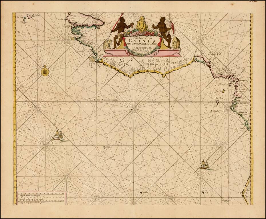
Finely colored example of Doncker's sea chart of West Africa, which appeared in his De Zee-Atlas of Water-Waerelt, published in Amsterdam, circa 1665.
The map extends from the Cape Verde Islands, Dakar and the area just north of the Gambia River in the north, to Mayumba and Gabon in the south, with a small section of Angola in the area of Cabo Negro in southern Angola being shown.
The map includes Rhumb Lines, 2 sailing ships and compass rose. The map also extends west to the islands of St. Helena and Ascencion.
The map covers Guinea, Guinea-Bissau, Sierra Leone, Liberia, Cote d'Ivoire, Ghana, Togo, Benin, Nigeria, Cameroon, Equitorial Guinea, Gabon and Congo, as well as a small section of Angola.
If you are a student, write to us in telegram: @antiquemaps and indicate what material you need and for what work you need a map in high detail. We are ready to provide material on special terms. For students only!
![[Wall Map] West-Indische Paskaert waer in de graden der breedde over weder zyden vande middelyn wassende so vergrooten dat die geproportioneert syn tegen hunne nevenstaende graden de lengde.](/map/small/60169.jpg)
![[The First Maps in a la poupée Printed Color] Cartes en Couleur des Lieux Sujets aux tremblements de Terre Dans toutes les parties du Monde Selon le Sisteme de l’impulsion Solaire](/map/small/52293op.jpg)
