Map size in jpg-format: 3.60326MiB
Click to open in high resolution (open in new tab).
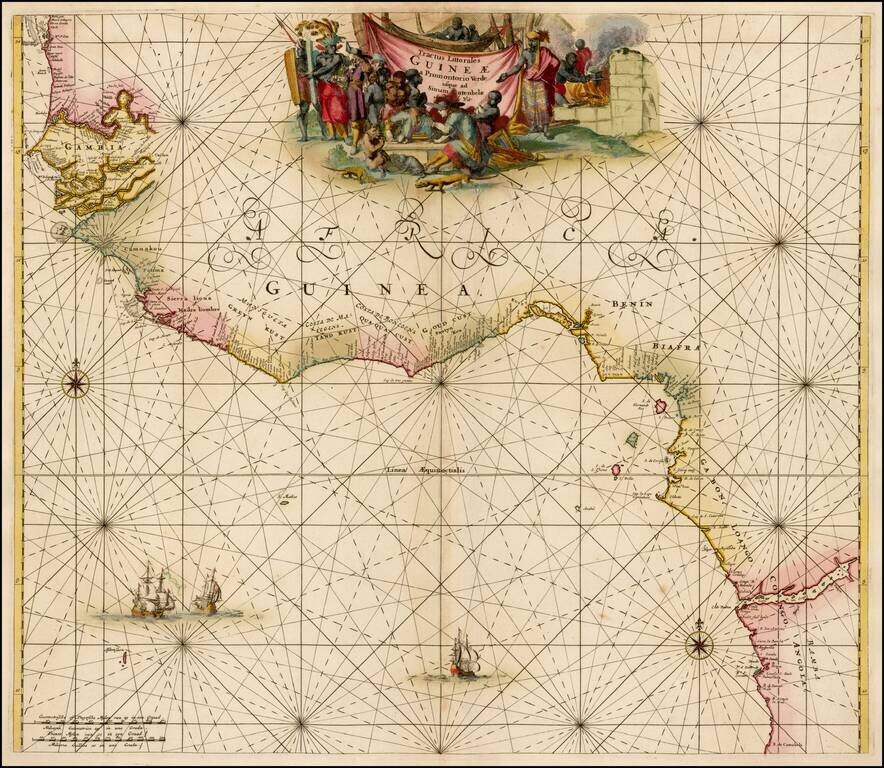
Striking old color example of the first edition of De Wit's sea chart of West Africa, from his Orbis Maritimus ofte Zee Atlas.
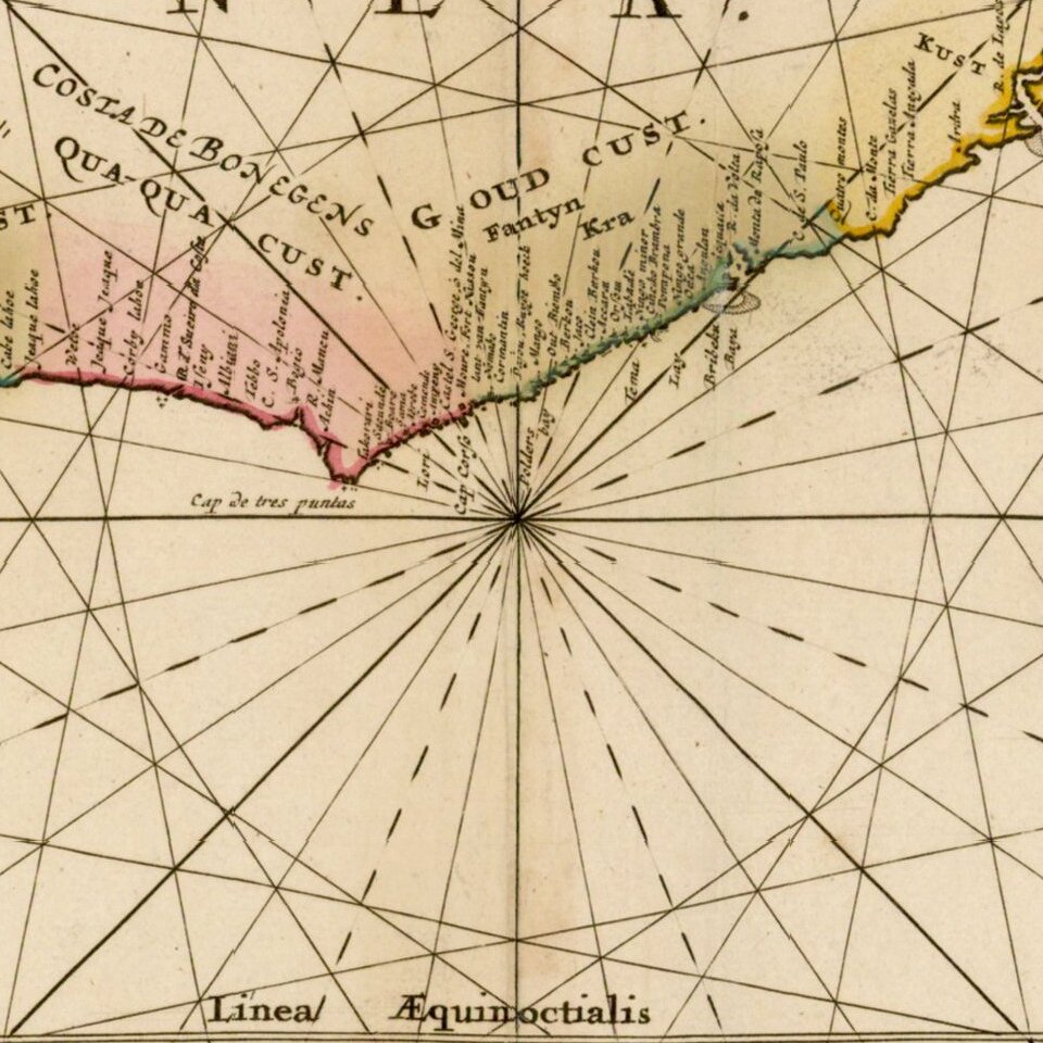
The map extends from Senegal in the north to Angola in the south, centered on the Bay of Guinea.
There is a wealth of navigational information including sandbanks and shoals. The chart is a masterpiece of decorative engraving with illustrations of sailing vessels, compass roses and an elaborate allegorical title cartouche, showing Dutch and native traders, slavery images and local commerce.
A gorgeous old color example.
De Wit (1629 ca.-1706) was a mapmaker and mapseller who was born in Gouda but who worked and died in Amsterdam. He moved to the city in 1648, where he opened a printing operation under the name of The Three Crabs; later, he changed the name of his shop to The White Chart. From the 1660s onward, he published atlases with a variety of maps; he is best known for these atlases and his Dutch town maps. After Frederik’s death in 1706, his wife Maria ran the shop for four years before selling it. Their son, Franciscus, was a stockfish merchant and had no interest in the map shop. At the auction to liquidate the de Wit stock, most of the plates went to Pieter Mortier, whose firm eventually became Covens & Mortier, one of the biggest cartography houses of the eighteenth century.
If you are a student, write to us in telegram: @antiquemaps and indicate what material you need and for what work you need a map in high detail. We are ready to provide material on special terms. For students only!
![[Wall Map] West-Indische Paskaert waer in de graden der breedde over weder zyden vande middelyn wassende so vergrooten dat die geproportioneert syn tegen hunne nevenstaende graden de lengde.](/map/small/60169.jpg)
![[The First Maps in a la poupée Printed Color] Cartes en Couleur des Lieux Sujets aux tremblements de Terre Dans toutes les parties du Monde Selon le Sisteme de l’impulsion Solaire](/map/small/52293op.jpg)
