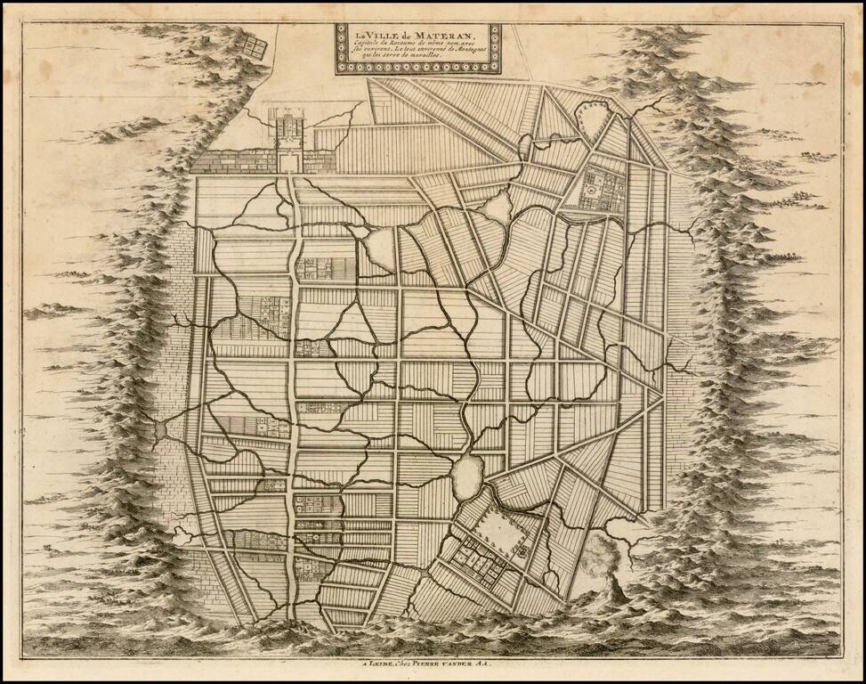
Rare plan of the city of Mataram on the Island of Lombok, immediately east of Bali in Indonesia. The Dutch had first visited Lombok in 1674 and the Dutch East India Company concluded its first treaty with the Sasak Princess of Lombok.
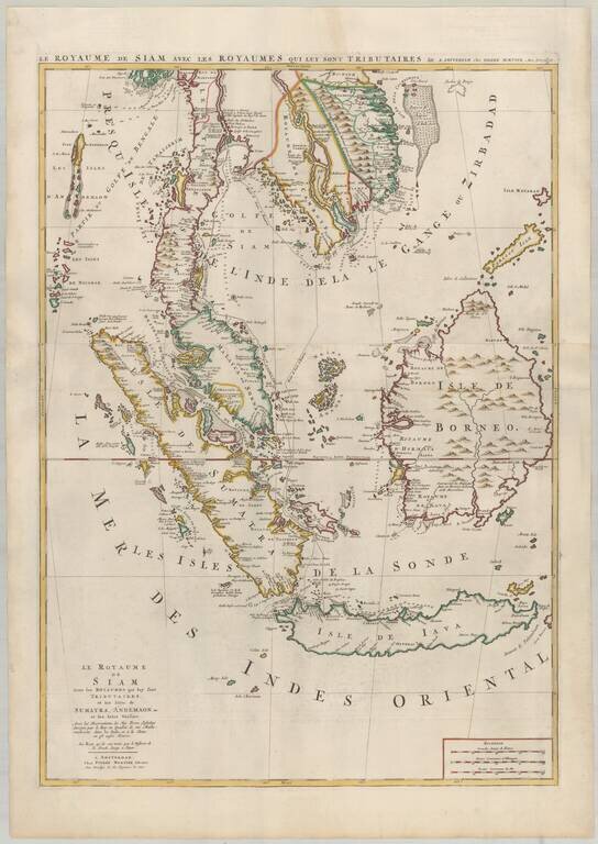
Mortier's Large Format Map of the Kingdome of Siam, Malaysian Peninsula, Singapore, Indonesia, etc. Finely colored example of Pierre Mortier's map of Southeast Asia, extending from Thailand, Cambodia, Viet Nam, and the Malay Peninsula and Gulf of...
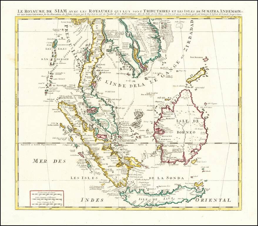
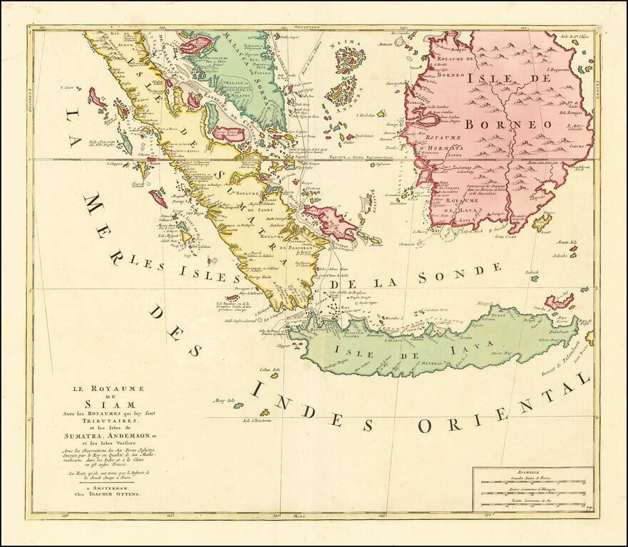
![[Singapore, Sumatra, Borneo and Java] Le Royaume de Siam Avec les Royaumes qui luy sont Tributaires et les Isles de Sumatra, Andemaon, etc. et les Isles Voisine Avec les Observations des Six Peres Jesuits Envojez par le Roy en Qualite de Ses Mathematici](/map/small/64646.jpg)
Singapore, Sumatra, Borneo and Java Nice example of the lower sheet of Pierre Mortier's 2-sheet map, extending from Sinagpore to Java and Sumatra in the South. One of the more fascinating notes shows a discovery attributed to "Pierre Bertollo" in...
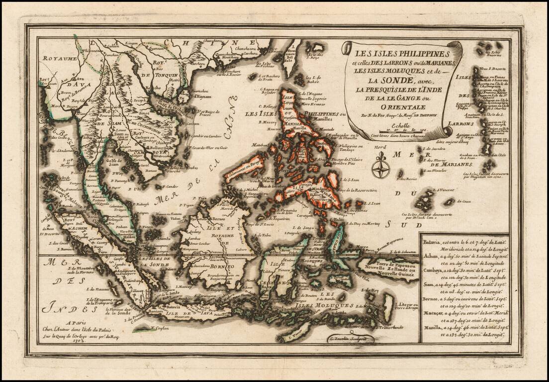
Striking map of the Philippines and Southeast Asia, showing excellent detail throughout. From De Fer's Atlas Curieux. Nice wide margins and decorative cartouche.
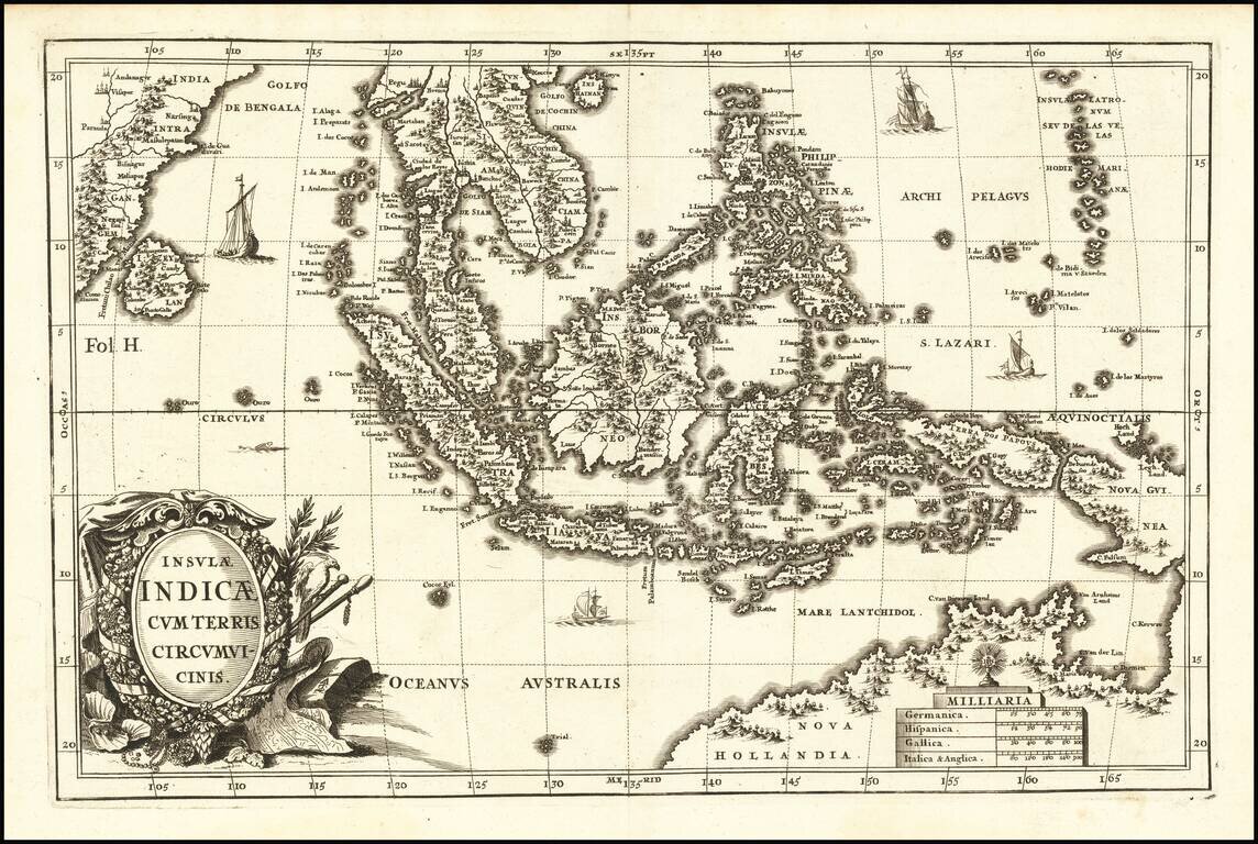
Striking example of Scherer's map of Southeast Asia and the Northern part of Australia. Nova Guinea is still tenatively attached to Nova Hollandia. The coastline shows Van Arnham's Land, Van Der Lin, C. Diemen and C. Van Diemen's Land. A narrow strait...
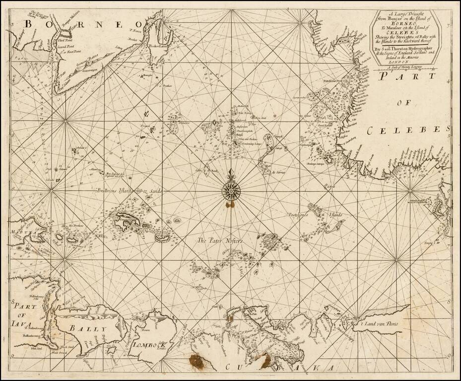
Rare early example of this working English sea chart of part of Indondesia, extending from the northwest corner of Borneo near Banjarmasin, to Java and Bali in the outhwest, "t Land van Floris" in the southeast, and Celebes in the northeast. The chart...
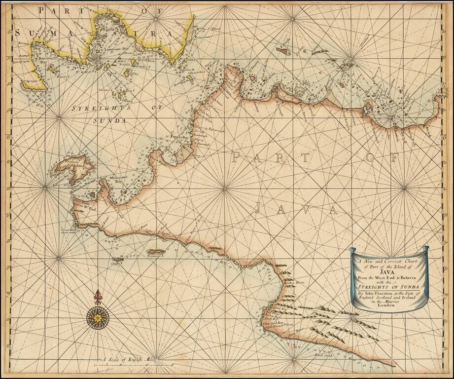
Scarce engraved sea chart of the coast of Western Java and the southern tip of Sumatra, published by John Thornton. The map includes details along the coast that suggest the firsthand surveying that went into its production. Soundings are given from...
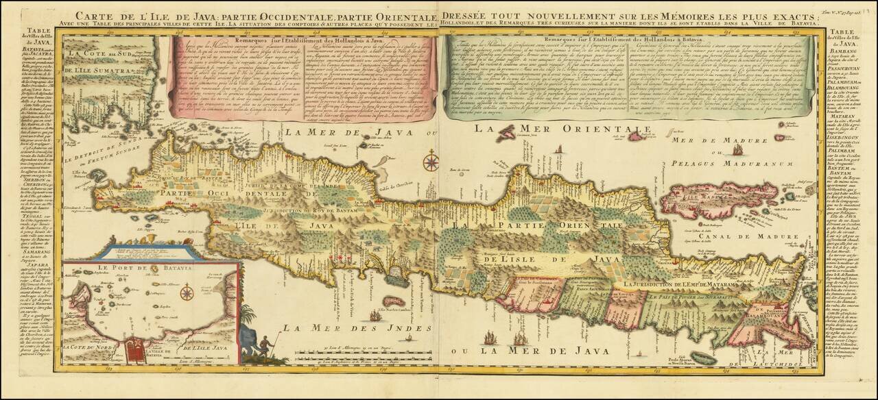
Decorative large format map of Java, with an inset of the bay of Batavia in the lower left corner. Two title banners include a short sketch of the history of the Dutch on the island, Remarques sur l'Etablissement des Hollandois à Java , written by...
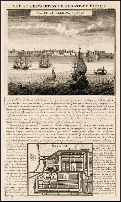
Attractive view of the town and harbor of Surate on the northwest coast of India, and a bird's-eye city plan of Batavia (Jakarta) present-day capital of Indonesia, from Chatelain's monumental 7 volume Atlas Historique, published in Amsterdam. Surate...
Finely colored example of Chatelain's map of Southeast Asia. The map extends from Thailand, Cambodia, Vietnam, the Malay Peninsula and Gulf of Bengal in the north to Java and Sumatra in the south, and is centered on Malacca and Borneo. Gorgeous wash...
In Fine Contemporary Dutch Color Fine old color example of Joshua Ottens map of Southeast Asia, extending from the Malay Peninsula in the north to Java and Sumatra in the south, with Malacca and Borneo. One of the more fascinating notes shows a...
![[Untitled Map of Southeast Asia & The Philippines]](/map/small/47007.jpg)
Extremely rare map of Southeast Asia and the Philippines, based upon the 1596 map of Southeast Asia by de Bry/Commelin/Lodewijckszn. Includes a large inset of Bottoni. Narrow upper left margin, as issued. The map is very rare.
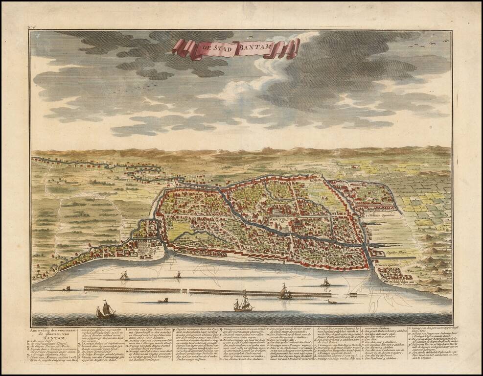
Fine early view of Bantam (Banten) which illustrated the work of Francois Valentijn. Includes a key locating about 30 points of interest. François Valentijn (1666-1727), a missionary, worked at Amboina from 1684 to 1694 and 1705 to 1713. He also...
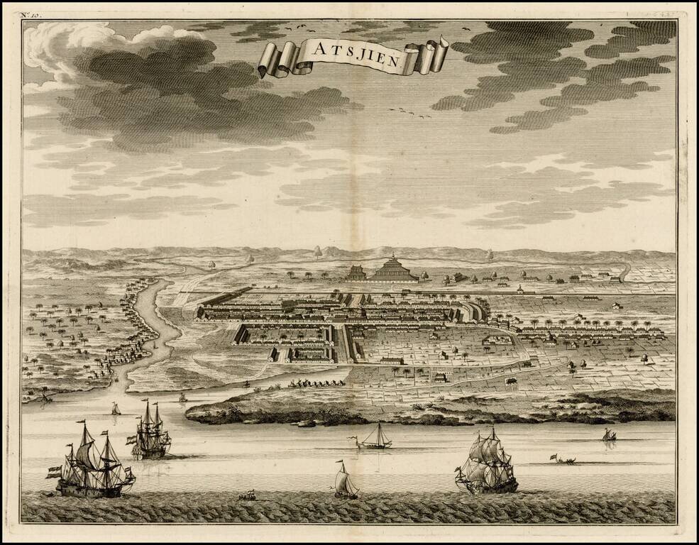
Nice bird's eye-view of the Town of Atjien on the northernmost point of Sumatra, from Francois Valentyn's Oud en Nieuw Oost Indien, part V : Beschryving van Coromandel, Pegu, Arrakan, Bengale, Mocha, Persien, Malakka, Sumatra, Ceylon. Francois...
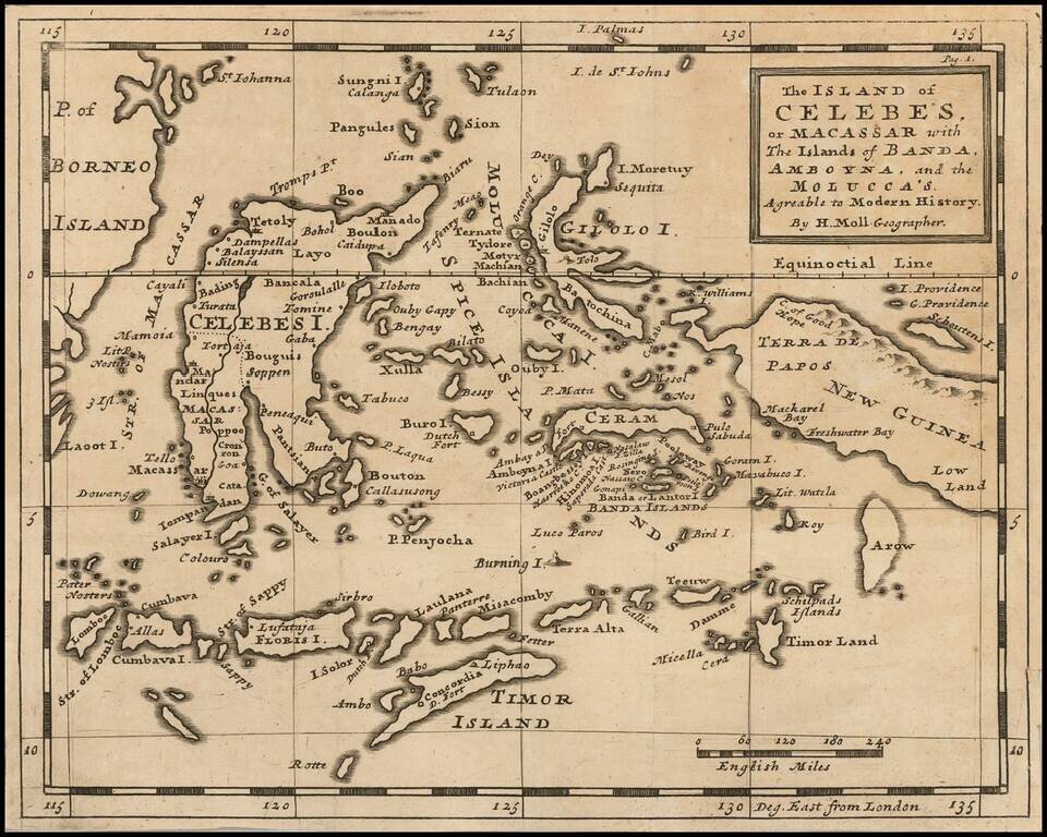
Detailed map of the islands from Eastern Brunei to Timor and part of New Guinea, centered on the Moluccas.
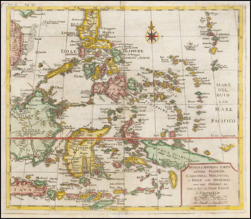
Scare map of Southeast Asia, from the Second Italian edition of Thomas Salmon's, Modern History: or, the present state of all Nations. . . entitled Lo Stato Presente... published in Venice from 1740-1762. The maps are attributed to Tirion in...