Map size in jpg-format: 11.7119MiB
Click to open in high resolution (open in new tab).

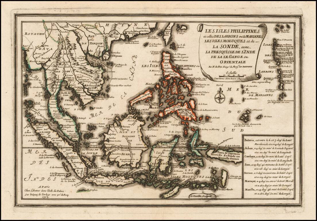
Striking map of the Philippines and Southeast Asia, showing excellent detail throughout. From De Fer's Atlas Curieux.
Nice wide margins and decorative cartouche.
Nicholas de Fer (1646-1720) was the son of a map seller, Antoine de Fer, and grew to be one of the most well-known mapmakers in France in the seventeenth century. He was apprenticed at twelve years old to Louis Spirinx, an engraver. When his father died in 1673, Nicholas helped his mother run the business until 1687, when he became the sole proprietor.
His earliest known work is a map of the Canal of Languedoc in 1669, while some of his earliest engravings are in the revised edition of Methode pour Apprendre Facilement la Geographie (1685). In 1697, he published his first world atlas. Perhaps his most famous map is his wall map of America, published in 1698, with its celebrated beaver scene (engraved by Hendrick van Loon, designed by Nicolas Guerard). After his death in 1720, the business passed to his sons-in-law, Guillaume Danet and Jacques-Francois Benard.
If you are a student, write to us in telegram: @antiquemaps and indicate what material you need and for what work you need a map in high detail. We are ready to provide material on special terms. For students only!
![[Signed Political Satire Artwork] Vietnam ... Vietnam ... Vietnam ...](/map/small/68726.jpg)
![[Martin Behaim Globe / Book] Pars Globi terrestris Ao. 1492 a Martino Behaim Equite Lusitano Norimbergae confecti Delineavit Christoph. Theoph de Murr 1778 (bound with:) Diplomatische Geschichte des Portugesischen berühmten Ritters Martin Behaims](/map/small/68828.jpg)
![Il Disegno Della Terza Parte Dell' Asia [Gastaldi's Wall Map of SE Asia with extra panels!]](/map/small/30554hbp.jpg)