![Asiatic Archipelago [Early Singapore Inset]](/map/small/64854.jpg)
Nice example of John Arrowsmith's map of the Asiatic Archipelago, including a large inset map of Singapore. Centered on the Philippines and Borneo, the map shows a number of different seasonal passages through the region to Hong Kong and Macao. The...
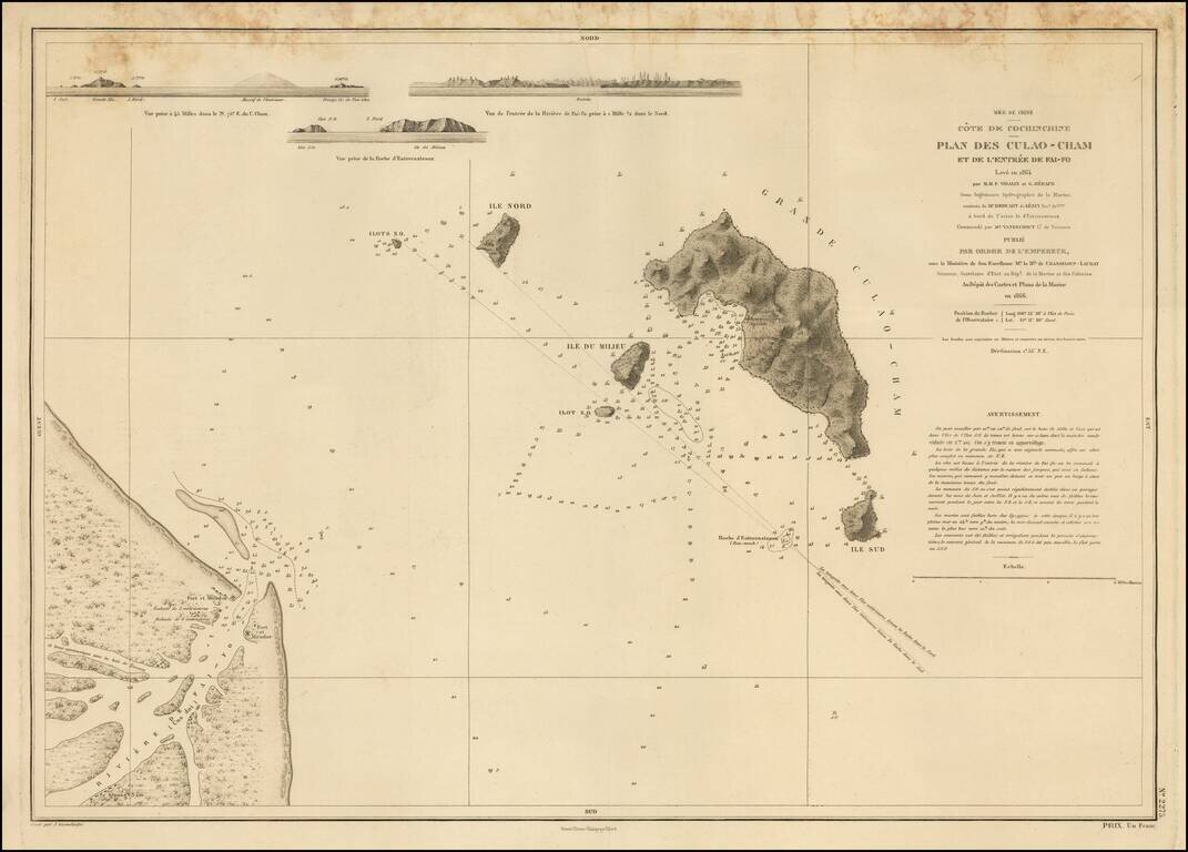
Detailed French chart of the entrance to Hội An, in Vietnam. Hội An has an interesting history related to foreign attempts to establish trade in Vietnam. In 1535, the Portuguese explorer and sea captain António de Faria attempted to establish a...
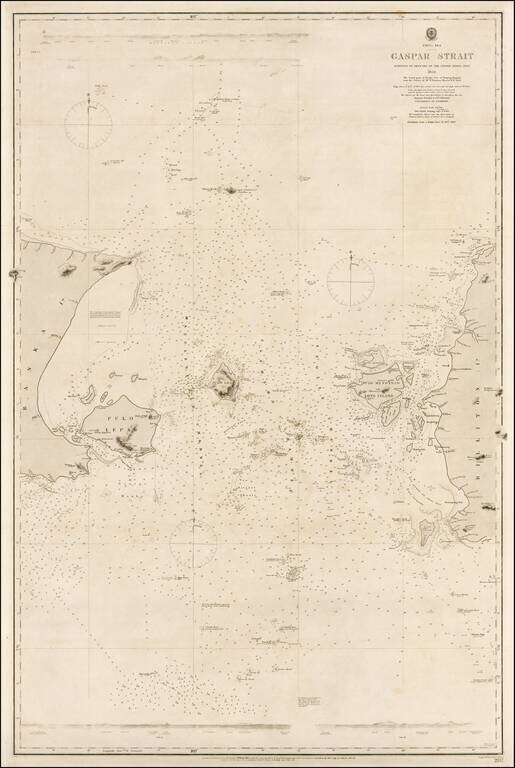
Rare example of this authoritative sea chart of the Gaspar Strait, Indonesia, a critical point of passage for navigation en route from Singapore to the Sunda Strait. This fine sea chart details the Gaspar Strait that runs between the islands of Bangka...
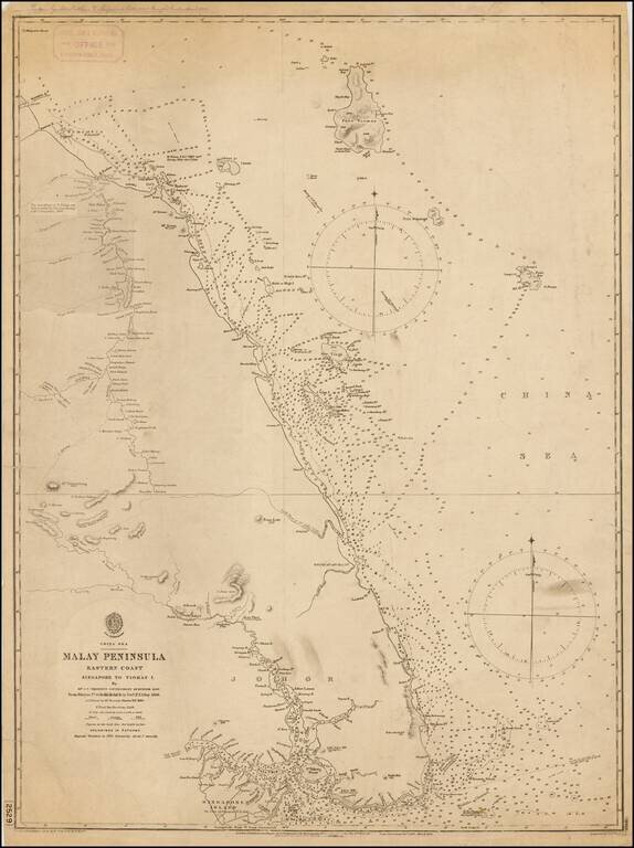
A rare British Admiralty sea, depicting southeastern Malaysia and the eastern part of the island of Singapore. This fine chart details the eastern parts of what is now the mainland Malayisian State of Johor, from the site of Jahor Bahru eastwards,...
![[Straits of Malacca, Sumatra, Java and Western Borneo]](/map/small/51765.jpg)
Detailed sea chart of the Straits of Malacca, Sumatra, Java and Western Borneo, Banca Island, Billiton Island, etc. The chart identifies lighthouses in Yellow, with extensive sailing information, soundings, etc. Includes a large inset map of the...
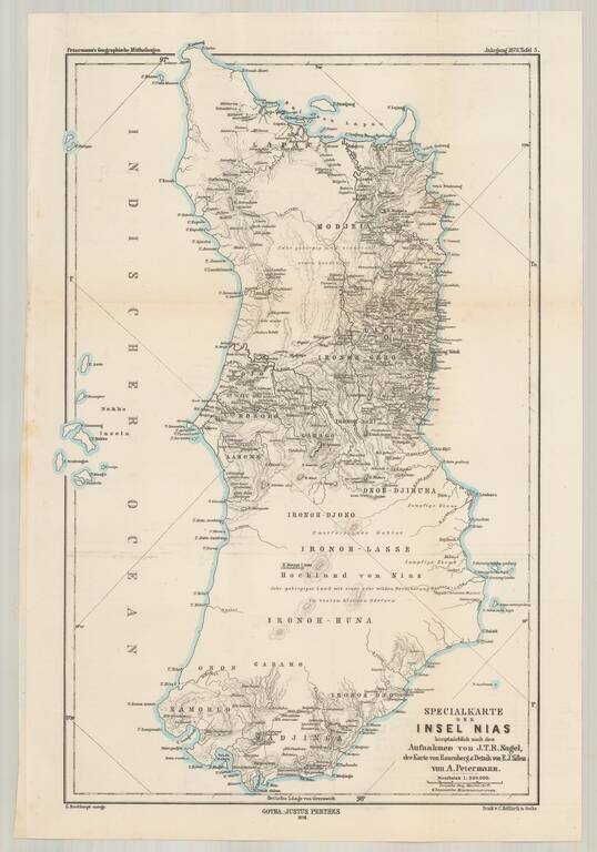
Highly detailed map of the Island of Nias (Pulau Nias) off the west coast of Sumatra , depicting the most recent explorations. This is one of the earliest printed maps to provide significant detail for this island and includes a fairly extensive...
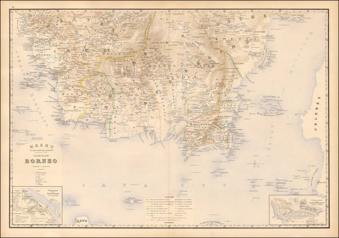
Fine map of southern Borneo, from Stemfoort's Atlas der Nederlandsche bezittingen in Oost-Indië naar de nieuwste bronnen samengesteld en aan de regering opgedragen. A fine highly detailed map, with topographical details, plance names and regional...
![[Sumatra] Kaart van Zuid Sumatra Residentien Benkoelen, Lampongsche Distrikten en Palembang.](/map/small/51736.jpg)
Attractively color-printed map of the southern tip of Sumatra, from Stemfoort's Atlas der Nederlandsche bezittingen in Oost-Indië naar de nieuwste bronnen samengesteld en aan de regering opgedragen. A fine, highly detailed map, with topographical...
![[Sulawesi] Kaart van Zuid West Celebes bevattende deGouvernemts. de Leenroerige en Een Gedeelte der Bondgenootschappelijke Landen behoorende tot het Gouvernements van Celebes en Onderh . . .](/map/small/51902.jpg)
Southwestern Sulawesi Attractively color-printed map of the southern tip of the southwestern part of Sulawesi, from Stemfoort's Atlas der Nederlandsche bezittingen in Oost-Indië naar de nieuwste bronnen samengesteld en aan de regering opgedragen....
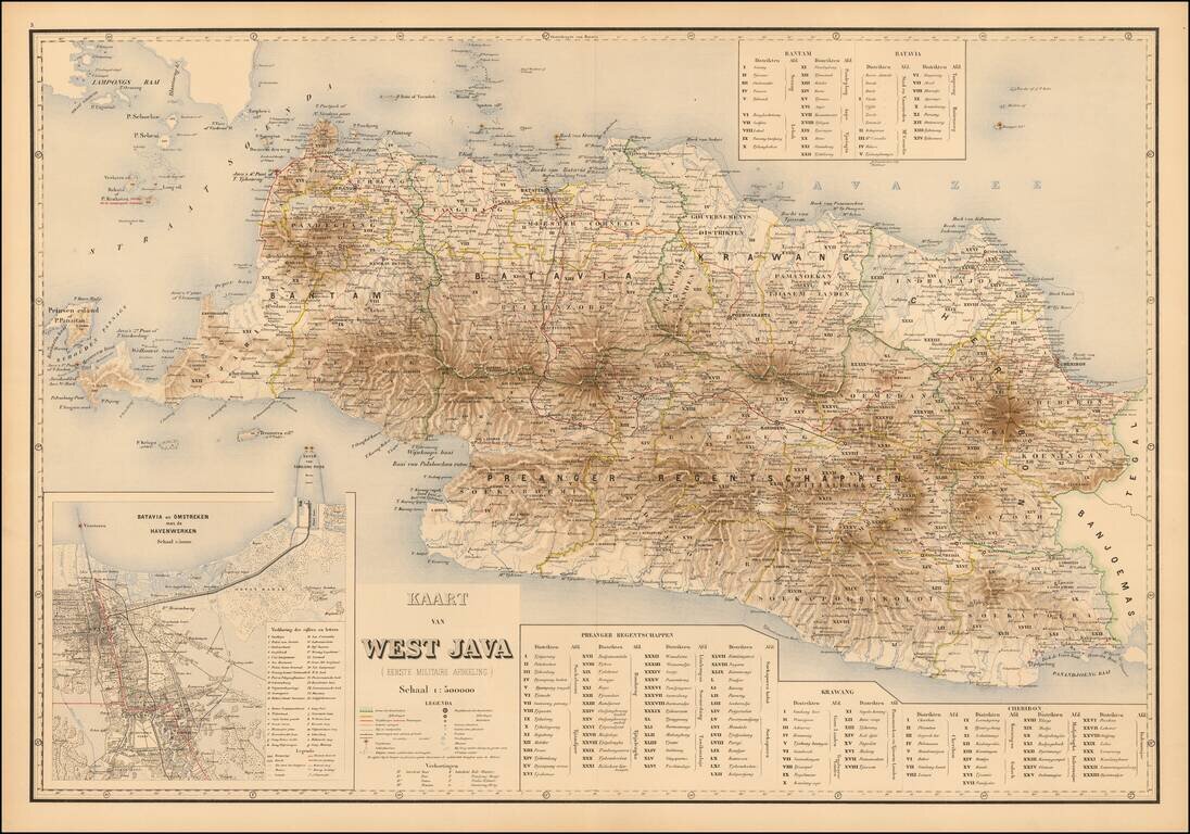
West Java Attractively color-printed map of Western Java, with a large inset of the Harbor of Batavia and environs, from Stemfoort's Atlas der Nederlandsche bezittingen in Oost-Indië naar de nieuwste bronnen samengesteld en aan de regering...
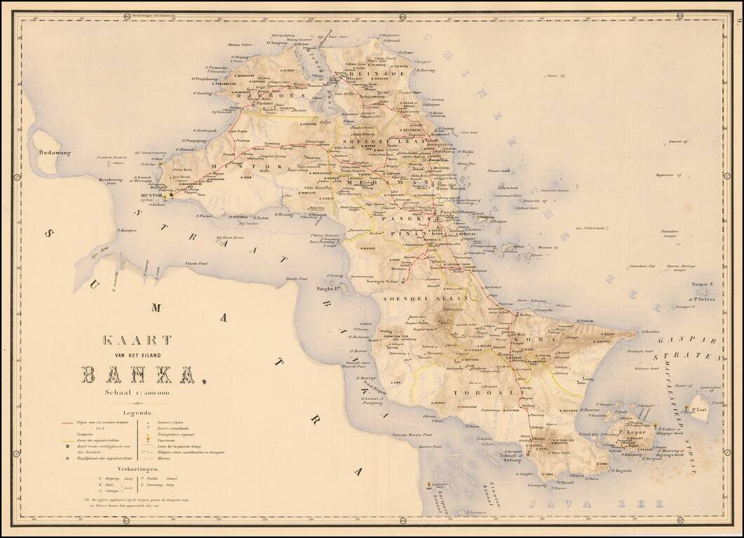
The Island of Banka Attractively color-printed map of Banka from Stemfoort's Atlas der Nederlandsche bezittingen in Oost-Indië naar de nieuwste bronnen samengesteld en aan de regering opgedragen. A fine, highly detailed map, with topographical...
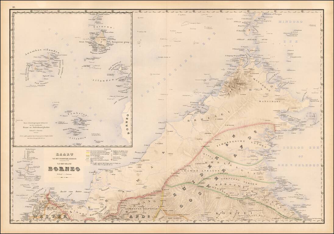
Fine map of northwestern Borneo, from Stemfoort's Atlas der Nederlandsche bezittingen in Oost-Indië naar de nieuwste bronnen samengesteld en aan de regering opgedragen. The map extends from the Api Passage and Sambas to Berouwsche Landen and north to...
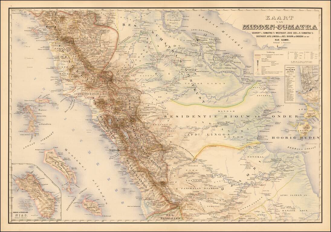
Detailed map of the central part of the Island of Sumatra, Stemfoort's Atlas der Nederlandsche bezittingen in Oost-Indië naar de nieuwste bronnen samengesteld en aan de regering opgedragen. The map extends from Sibolga on the west coast of Sumatra in...
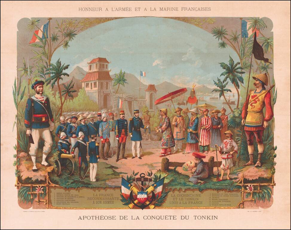
Fine chromolithograph celebrating the French conquest in Indochina. Includes a fine mix of French Military costumes and contemporary Vietnamese costumes.
![[South Vietnam & Cambodia] Carte de la Cochinchine . . . Dressee au Bureau Topographique Des Troupes De L'Indo-Chine Fevrier 1890](/map/small/62547.jpg)
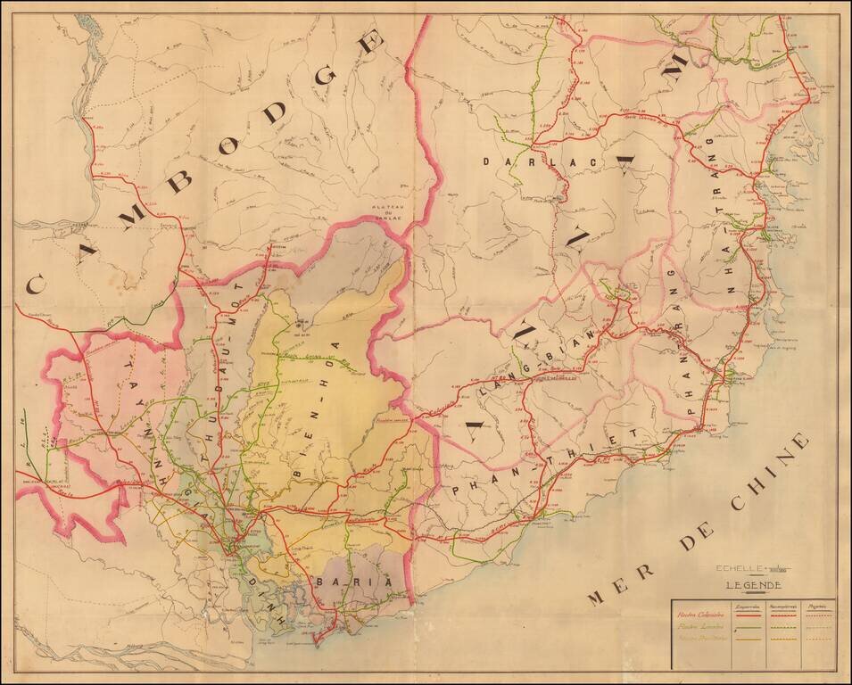
Rare Hanoi Imprint of French South Vietnam -- First Railroad Line In Vietnam Illustrated Finely executed map of South Vietnam and part of Cambodia, published in Hanoi for the French Colonial Government. The map provides a highly detailed accounting...
A Detailed French Study of the Roads in Southern Vietnam Finely mauscript map of part of Southern Vietnam, drawn by an unknown French source. The map focuses on the various roads throughout the region, all of which include distances in Kilometers at...