Map size in jpg-format: 13.2708MiB
Click to open in high resolution (open in new tab).
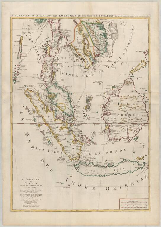
Mortier's Large Format Map of the Kingdome of Siam, Malaysian Peninsula, Singapore, Indonesia, etc.
Finely colored example of Pierre Mortier's map of Southeast Asia, extending from Thailand, Cambodia, Viet Nam, and the Malay Peninsula and Gulf of Bengal in the North, to Java and Sumatra in the South, centered on Malacca and Borneo.
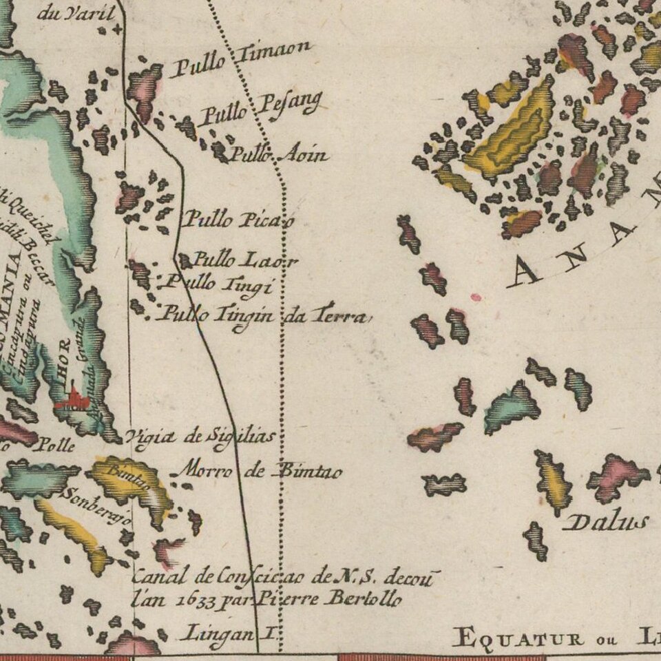
One of the more fascinating notes shows a discovery attributed to "Pierre Bertollo" in 1633 near Singapore, referred to as the "Canal de Consicao de N(uestra) S(enhora)." This note references the Portuguese captain Pedro Bertollo's "discovery" of a new passage from south of Bintan and Galang and west of the Karimun Islands, which extended through the heart of the Riau Archipelago in 1633, corresponding with the first year that the Straits of Singapore and Malacca were blockaded by the Dutch East India Company.
Striking dark impression on two sheets.
Pierre, or Pieter, Mortier (1661-1711) was a Dutch engraver, son of a French refugee. He was born in Leiden. In 1690 he was granted a privilege to publish French maps in Dutch lands. In 1693 he released the first and accompanying volume of the Neptune Francois. The third followed in 1700. His son, Cornelis (1699-1783), would partner with Johannes Covens I, creating one of the most important map publishing companies of the eighteenth century.
If you are a student, write to us in telegram: @antiquemaps and indicate what material you need and for what work you need a map in high detail. We are ready to provide material on special terms. For students only!
![[Signed Political Satire Artwork] Vietnam ... Vietnam ... Vietnam ...](/map/small/68726.jpg)
![[Martin Behaim Globe / Book] Pars Globi terrestris Ao. 1492 a Martino Behaim Equite Lusitano Norimbergae confecti Delineavit Christoph. Theoph de Murr 1778 (bound with:) Diplomatische Geschichte des Portugesischen berühmten Ritters Martin Behaims](/map/small/68828.jpg)
![Il Disegno Della Terza Parte Dell' Asia [Gastaldi's Wall Map of SE Asia with extra panels!]](/map/small/30554hbp.jpg)