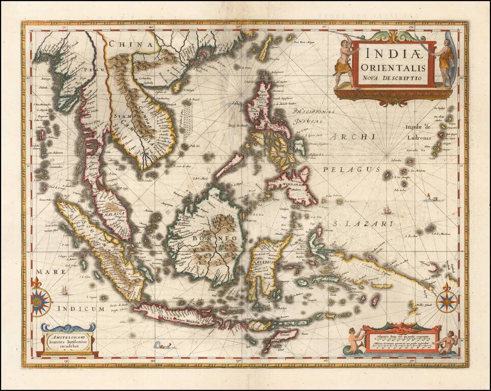
Important early map of Southeast Asia and the Philippines as well as a landmark map in the mapping of Australia, first published by Jan Jansson in 1630. The detail in the Philippines and Southeast Asia is excellent for the period. The map is perhaps...
Fine example of Jansson's new map of Southeast Asia and the Philippines, which appeared in his Atlas Minor, first issued in 1628. Jansson has revised and significantly improved this regional map, which had been previously issued by Hondius in 1607,...
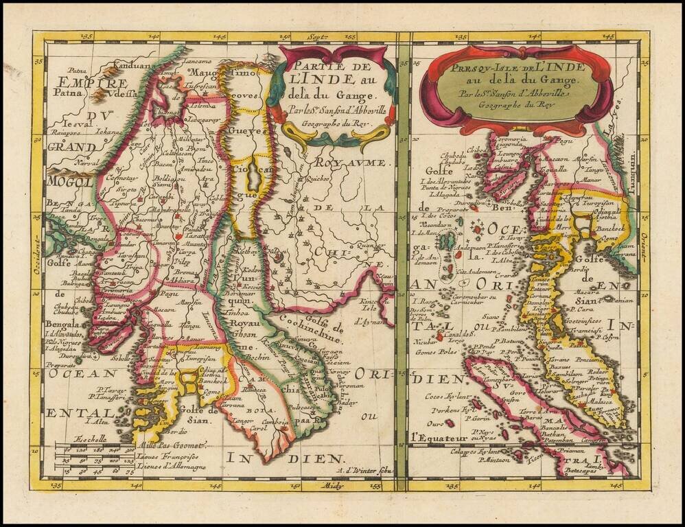
Detailed pair of maps, first published by Nicolas Sanson, circa 1657, in Paris. The map at the left shows the region bounded by the Gulf of Bengal in the West, to Southern China and the Gulf of Siam. The map at the right extends from Pegu (Bago,...
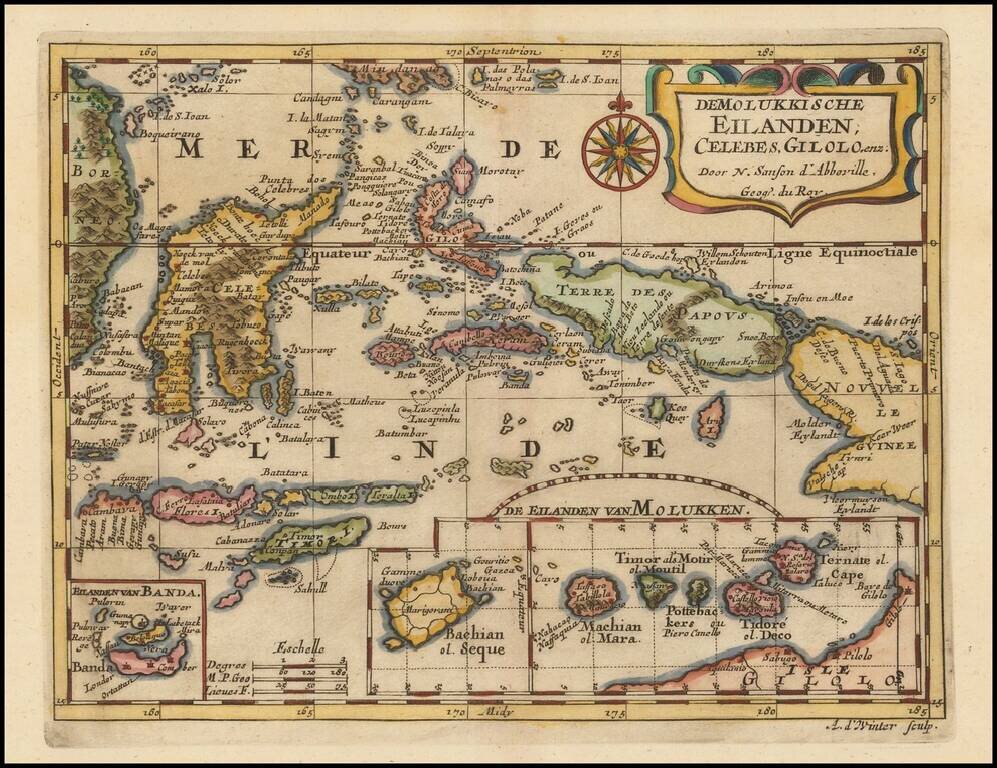
Fine example of the Spice Islandsa and Vicinity, first published by Nicholas Sanson in 1657. Sanson was the Royal Geographer to the King of France and perhaps the most important commercial mapmaker of his generation.
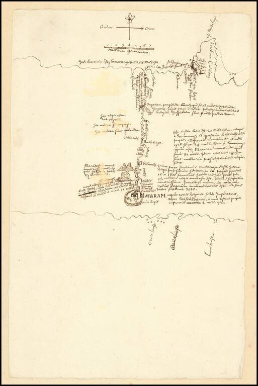
VOC Manuscript Map Record of an Inland Expedition to the Kingdom of Mataram Important early VOC manuscript map of Central Java, focusing on the Kingdom of Mataram at the time of the Dutch embassy led by Captain Tack to Surakarta in 1685. The map...
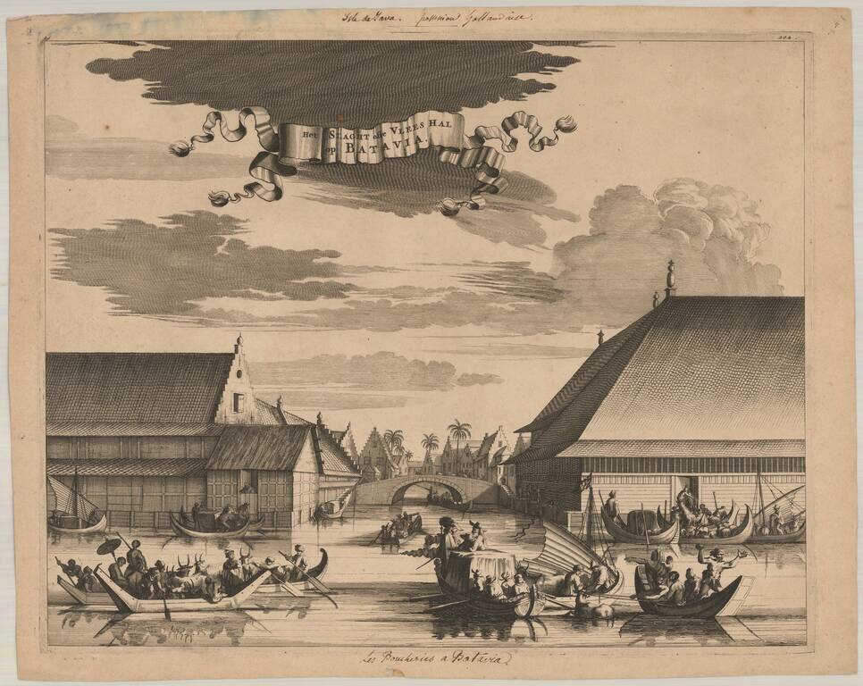
This interesting engraving shows the slaughterhouse at Batavia. The canal is filled with small boats filled with a variety of animals being brought to the large building. There is a commotion at right where a cow has fallen overboard.
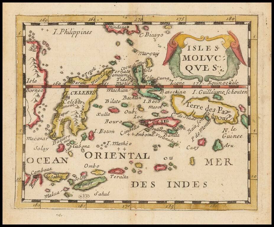
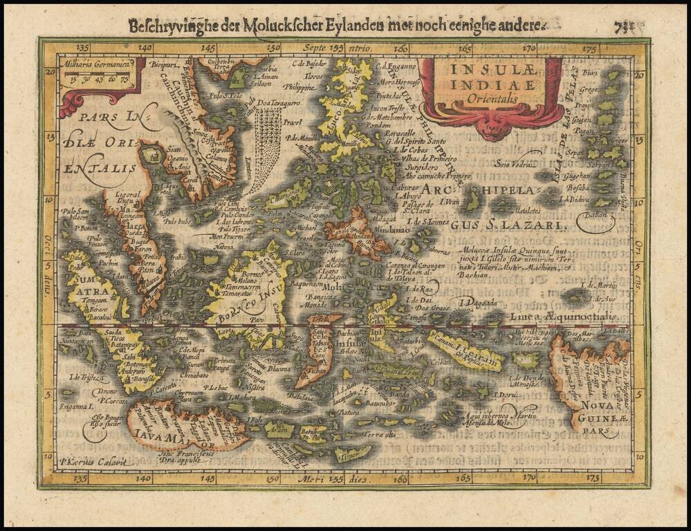
Scarce small format map of the Spice Islands, published by Pierre Du Val in Paris. One of the earliest obtainable maps to focus so closely on this region.
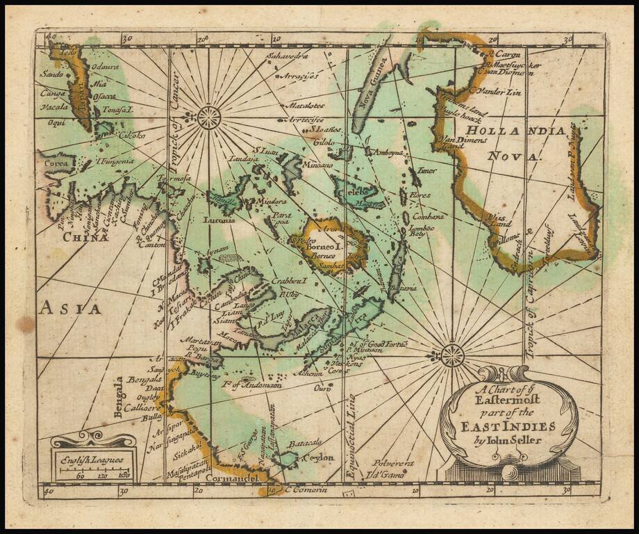
Extremely rare English map of the East Indies and Australia, oriented with the East at top of the map. The map covers the East Indies from India to Japan in the north and New Guinea and Australia in the south. Australia is named Hollandia Nova and...
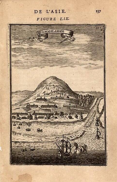
Fascinating birdseye view. From Mallet's monumental Description de l' Univers, first published in Paris in 1683, perhaps the greatest work of its kind in the 17th Century. Complete sets of this work are now fetching in excess of $15,000.00.
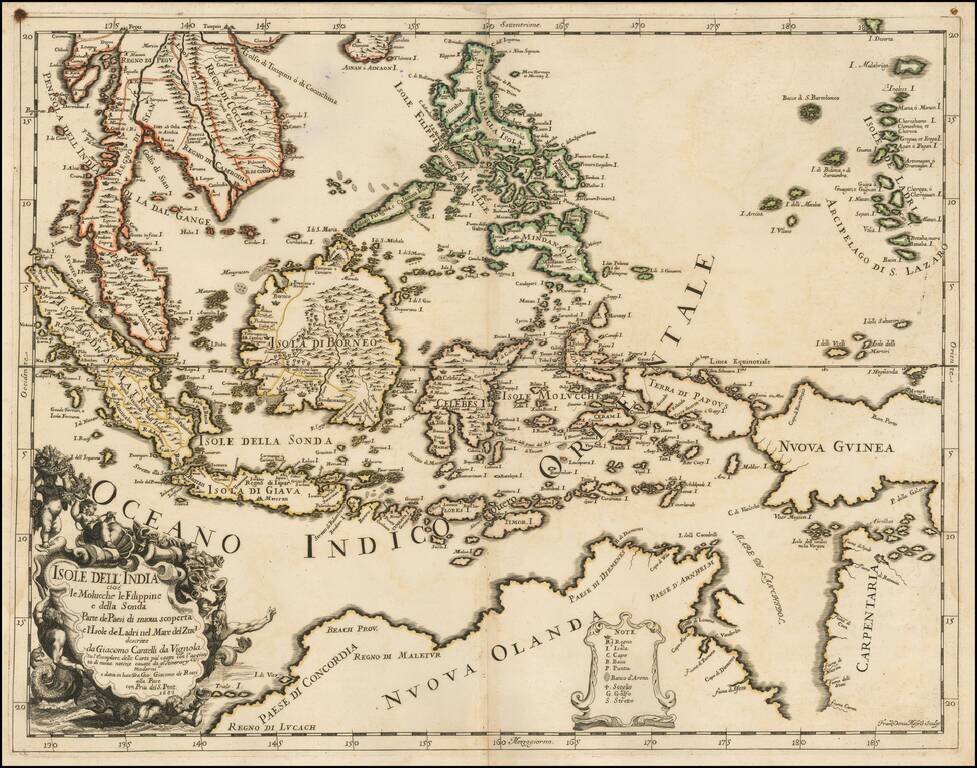
Scarce first state of this decorative map of Southeast Asia and the North Coast of Australia by Cantelli da Vignola and published in Rome by Rossi. Detailed and highly decorative 17th-century Italian map of northern Australia and the islands of...
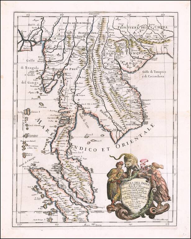
Decorative example of the Cantelli-Rossi map of part of Southeast Asia, extending from Singapore and the Straits of Malacca in the south, to the mouth of the Ganges and southeastern China in the north, produced by Cantelli da Vignola and published in...
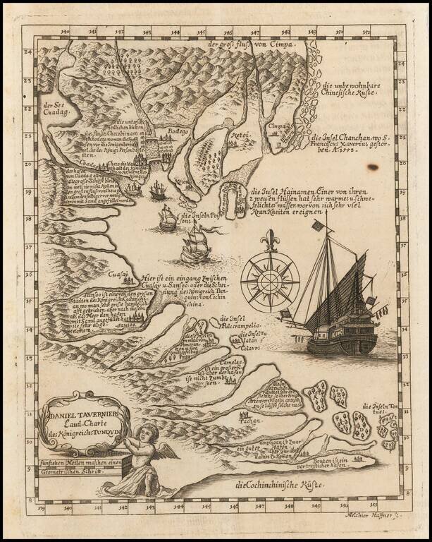
Rare German edition of Daniel Tavernier's map of Indo-China, engraved by Melchior Haffner. The map covers the Gulf of Tonkin from Canton to Vietnam. The interior of the lands and islands are covered in sloping hills and orderly woods. Port cities mark...
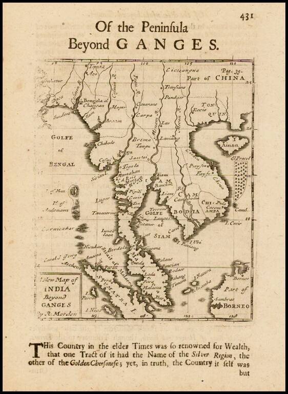
Rare English map of the Malay Peninsula, Cambodia, Vietnam, Thailand, part of China, Borneo, Sumatra and the Gulf of Bengal. One of the earliest obtainable English maps of the region.
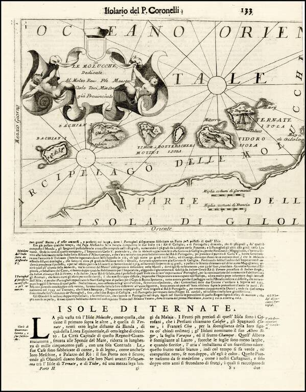
Striking map of the Spice Islands, published in Venice. The map provides detailed topographical image of the Spice Islands, including topography, towns, and fortifications, along with an elaborate cartouche and text below the image.
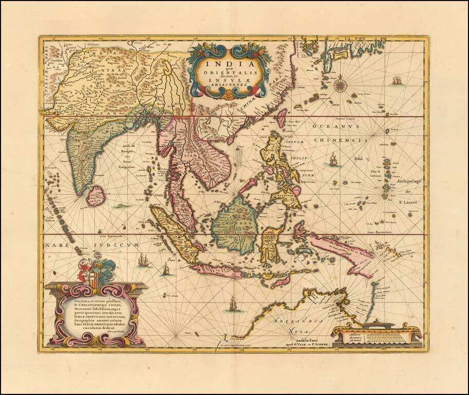
Gorgeous example Valk & Schenk's edition of Hondius' map of Southeast Asia, based upon Blaeu's map of 1635. An important Dutch map of South East Asia, noteworthy for being the second map to include the discoveries made in New Guinea and northern...
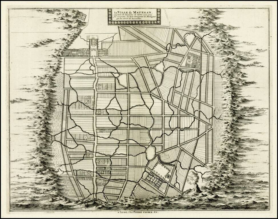
Rare plan of the city of Mataram on the Island of Lombok, immediately east of Bali in Indonesia. The Dutch had first visited Lombok in 1674 and the Dutch East India Company concluded its first treaty with the Sasak Princess of Lombok.