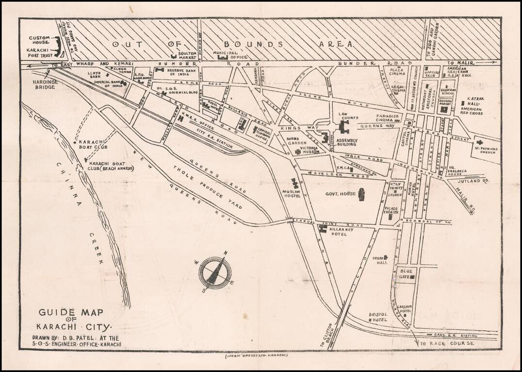
Rare Karachi Imprint Early guide map of Karachi, drawn by D.B. Patel. Points of interest shown on the map include: Customs House Karachi Port Trust Imperial Bank of India Boulton Market Reserve Bank of India Hq. S.O.S. Oriental Building...
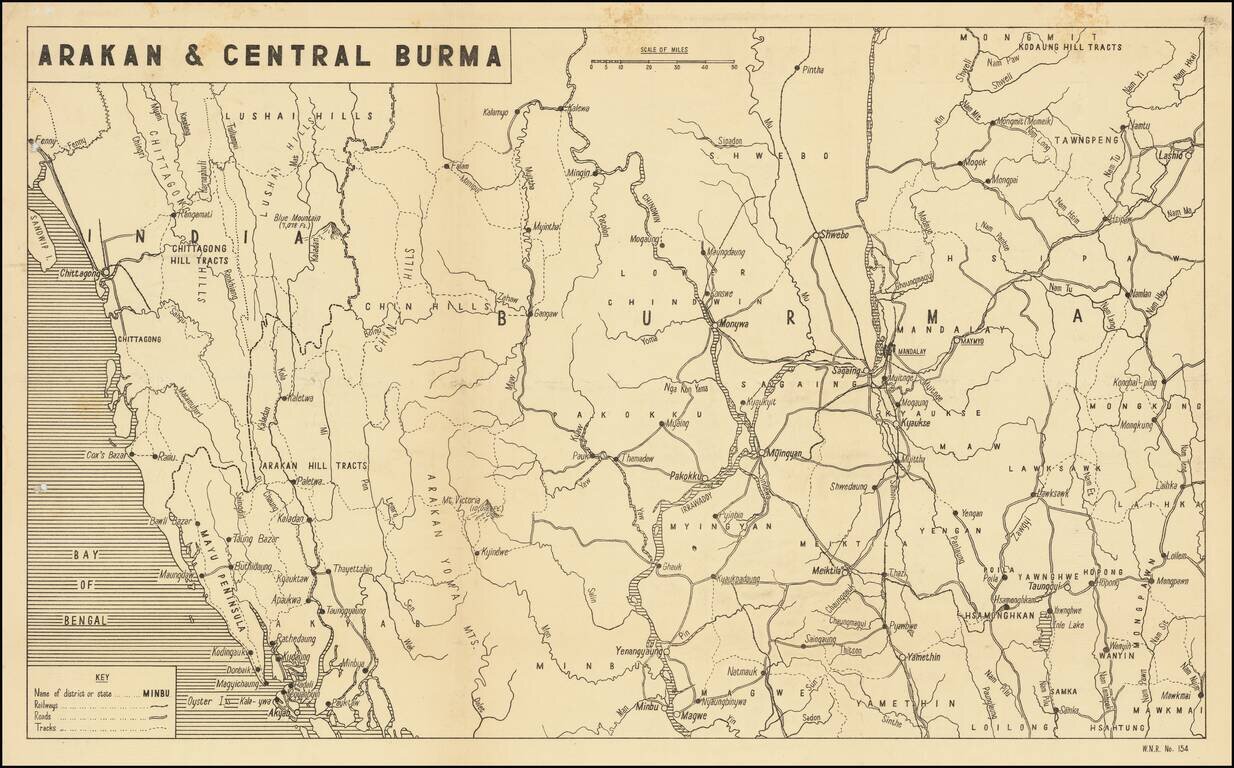
Scarce Map of the War in Burmah / Myanmar Detailed map of Burmah and India, published in India for audiences within the British Empire, providing news of the war around the world. The present map illustrates the theater of War in Birmah, centered...
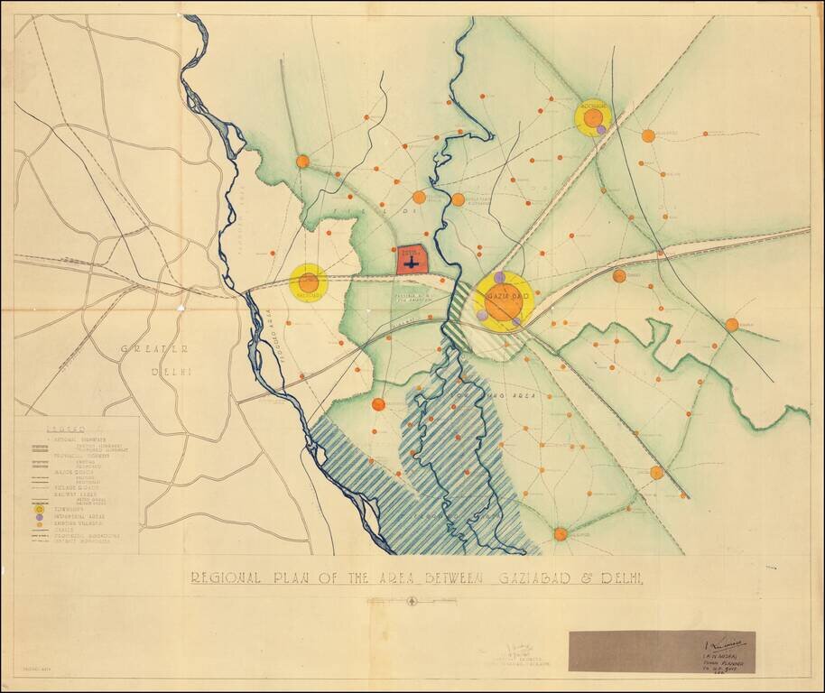
Modernizing Utter Pradesh Following Indian Independence By Renowned Urban Planner Robert Dudley Trudgett Interesting master planning document and map, prepared by the Town & Village Planning Office in Lucknow by renown American architect and urban...
![[District Bholawade]](/map/small/66013.jpg)
Fine large map of Bholawade District and environs, in the region of Maharashtra, in Western India.
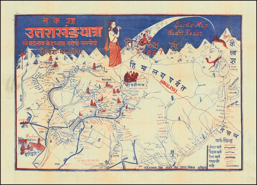
Pictorial Pilgrimage Guide Map for Uttarakhand, India Showing Important Holy Sites for Multiple Religions This interesting pictorial guide map shows pilgrimage routes for all the temples on the Chota Char Dam pilgrimage circuit, Badrinath, Kedarnath,...

Large Tourist Map Poster of Assam, India. Nice map of Assam, published in Shillong, India in the middle of the 20th century, aimed at the budding tourist industry in that tea-producing region. The key enumerates the following: Rail Road; Rail Road...
![[Trekking in the Himalayas]](/map/small/43997.jpg)
Trekking in the Annapurna Conservation Zone Detailed trekking map of the Himalayas, centered on the Gandaki Zone and the town of Pokhara, published in Kathmandu for Amtrek Nepal, "Your Reliable Partner in Himalayas." Includes inset maps showing:...
![[Early Trekking Map] Latest Map of Kathmandu to Tibet](/map/small/51007.jpg)
Large format Trekking map of the Tibetan Mountains, published in Kathmandu. Includes a larger inset of Lhasa City and a second inset map of Tibet.
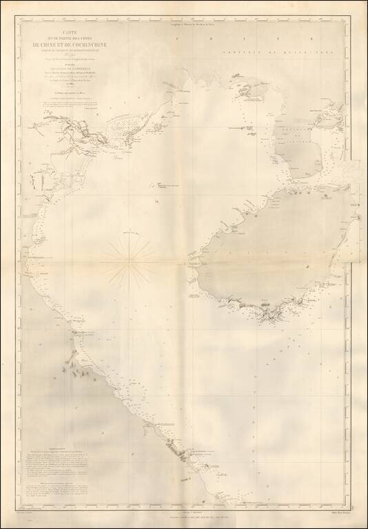
Detailed coastal chart of the Southern Coastline of China and the Coast of Vietnam, south to the Da Nang area, published in Paris by the French Depot de la Marine. The chart was apparently used in the 1870s, shortly after French obtained Territorial...
![[Southeast Asia] Tabu. Mo. In. Orig. (First Modern Map of Southeast Asia -- Old Color)](/map/small/41330.jpg)
Old color gold heightened (on verso) example of the rare 1522 edition of the first printed map to focus on the Southeast Asian islands and indeed, the only map to focus on this area in the first half of the 16th Century. Fries map was a significant...
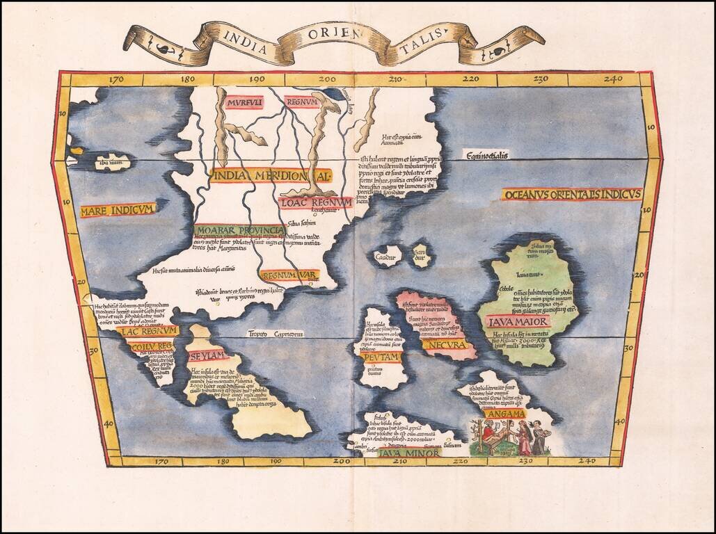
Early Antique Map of Southeast Asia Finely colored example of the first printed map to focus on Southeast Asia and the only map to focus on this area in the first half of the 16th century. Fries' map was a significant milestone in the Mapping of...
![[The Spice Map] Insulae Moluccae celeberrimae sunt ob Maximam aromatum copiam quam totu terrarum orbem mittunt harum praecipue sunt Ternate, Tidoris, Motir Machion et Bachion, his quidam adiungunt Gilolum, Celebiam, Borneonem, Amboinum et Bandam, Ex Insu](/map/small/70838.jpg)
The Spice Map—Rare, Striking Map of Southeast Asia Rare English edition of Petrus Plancius's "Spice Map," first published in 1594, covering the Philippines and Maritime Southeast Asia, including the famed Spice Islands. Plancius based his map on...
Theodore De Bry's Edition of The Most Important Map of the Straits of Malacca and Vicinity published in the 16th Century Fine example of Willem Lodewijcksz's suppressed map of the region centered on the Straits of Malacca, from Part II of Theodor De...
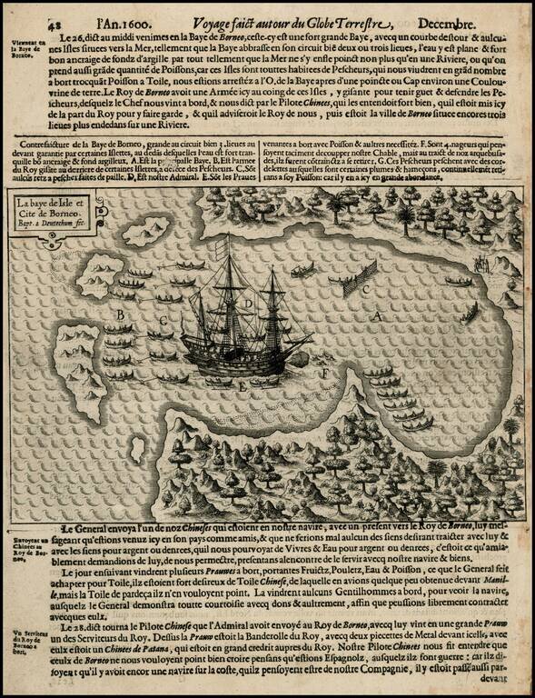
Rare early map of Borneo and neighboring islands, from Olivier Van Noort's Description du Penible Voyage Faict entour de l'Univers ou Globe Terrestre, published by Cornelis Claes in 1602, the first printed account of Van Noort's voyage, which would...
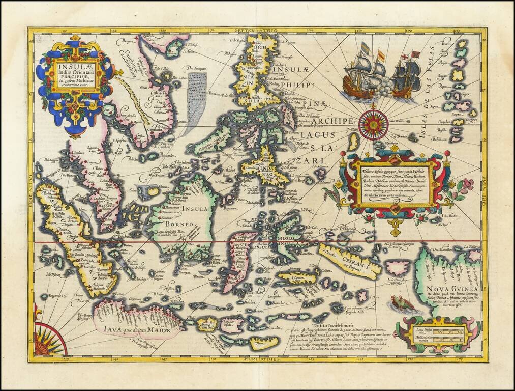
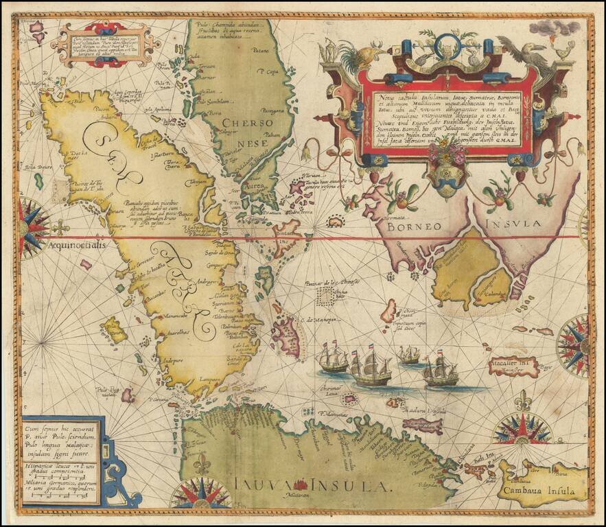
Fine Example of Decorative Map of the East Indies from the Mercator-Hondius Atlas This map showcases European knowledge of the East Indies, an area of increasing importance to Europe from the early-sixteenth century onwards. The focus is on the...
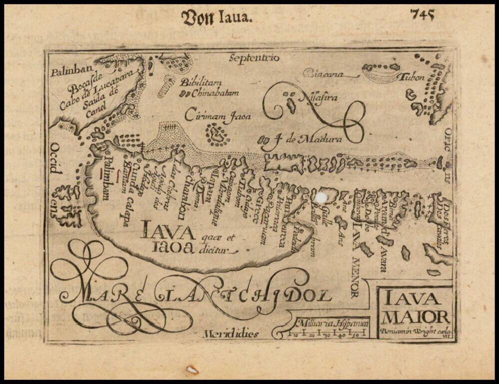
Nice example of this early state of Barent Langenes, map of Java and neighboring Islands, which first appeared in the 1598 edition of Langenes Caert-Thresoor, published in Middelburg. The present map is one of the earliest obtainable maps of Java,...