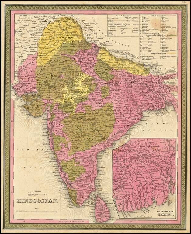
Detailed map of India and Ceylon, extending to the Himalayas. Shows towns, islands, rivers, mountains, gulfs, bays, etc. Large inset of the Delta of the Ganges. Tables show British, French, Portuguese and Danish Possessions and Independent States....
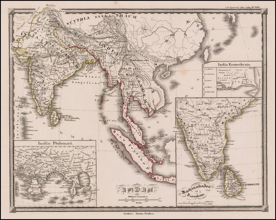
Interesting map of India and Southeast Asia, with large insets of the regions in Ancient times. From Spruner's Historisch-Geographischer Atlas Antiquus.
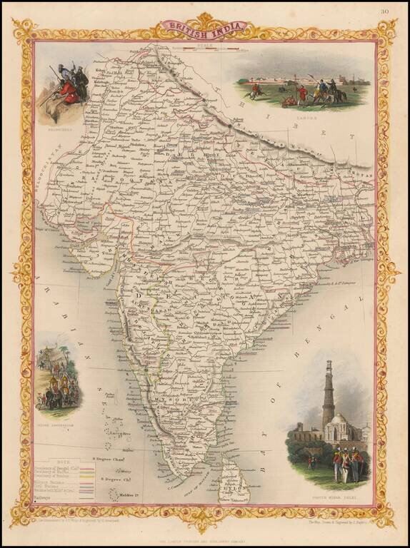
Gorgeous full color example of this decorative map of India. Vignettes show Lahore, Cootub Minar in Dehli, an Indian Procession and Beloochees, all in striking color. From R. Montgomery Martin's Illustrated Atlas, one of the last great decorative...
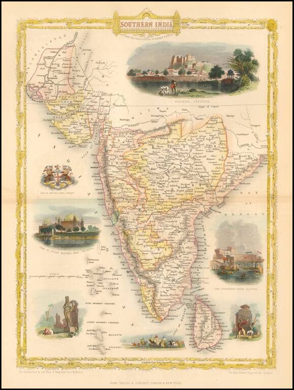
Striking full color example of this decorative map of India, including decorative vignettes. The map extends to the Indus and the Bay of Bengal. Decorative vignettes of the Government House in Calcutta, Tomb of Sultan Mahomed Shah, Bejapoor, Seal of...
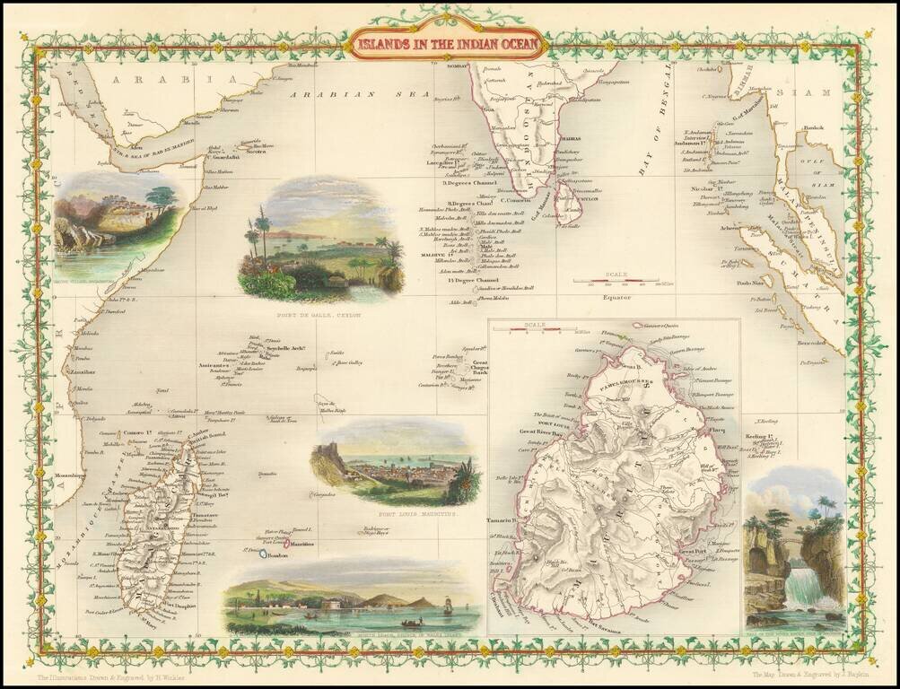
Striking full color example of this marvelous map of the Indian Ocean, including Madagascar, Ceylon and a large inset of Mauritius. Showing vignettes of Point De Gall, Ceylon, Port Louis Mauritius with Inset of Island of Mauritius. Engraved for R....
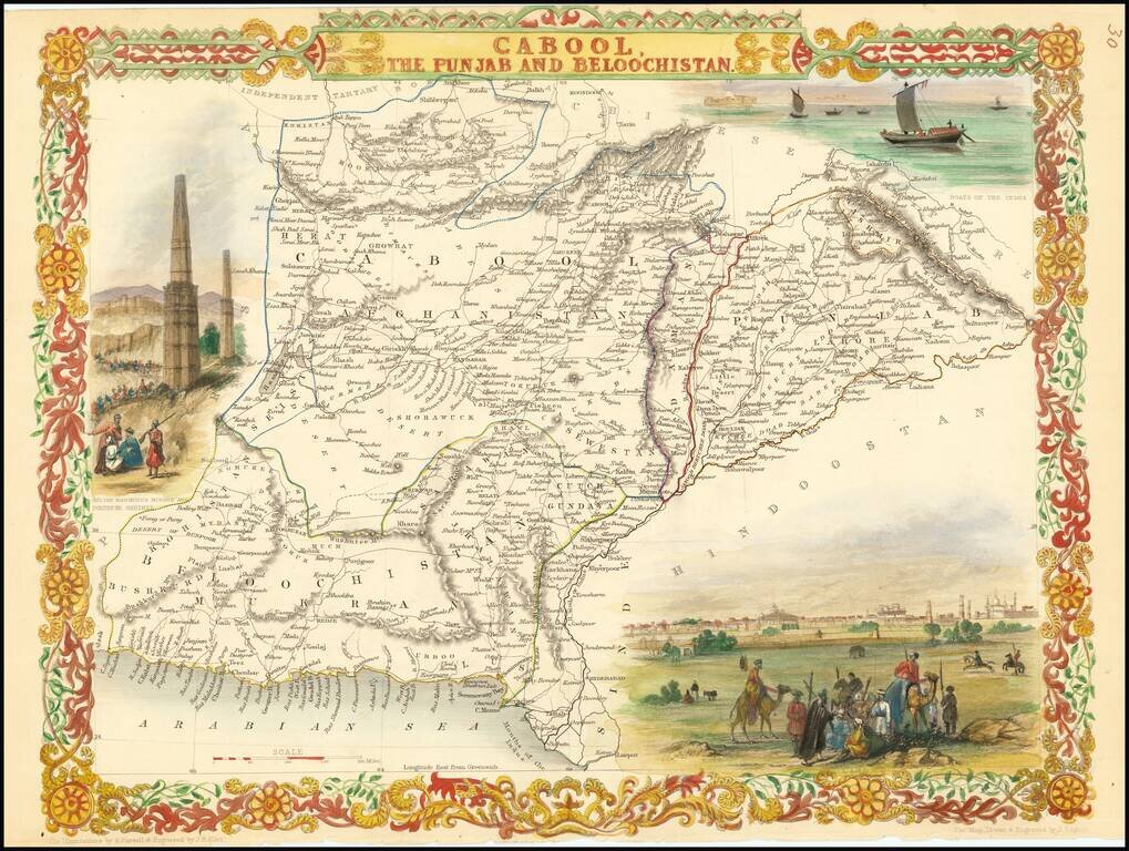
Nice example of this decorative regional map, covering Afghanistan and part of Pakistan. Decorative Vignettes of Boats on the Indus, Lahore and Sulton Mahmoud's Minars and Fortress, Ghuznee. Engraved for R. Montgomery Martin's Illustrated Atlas....
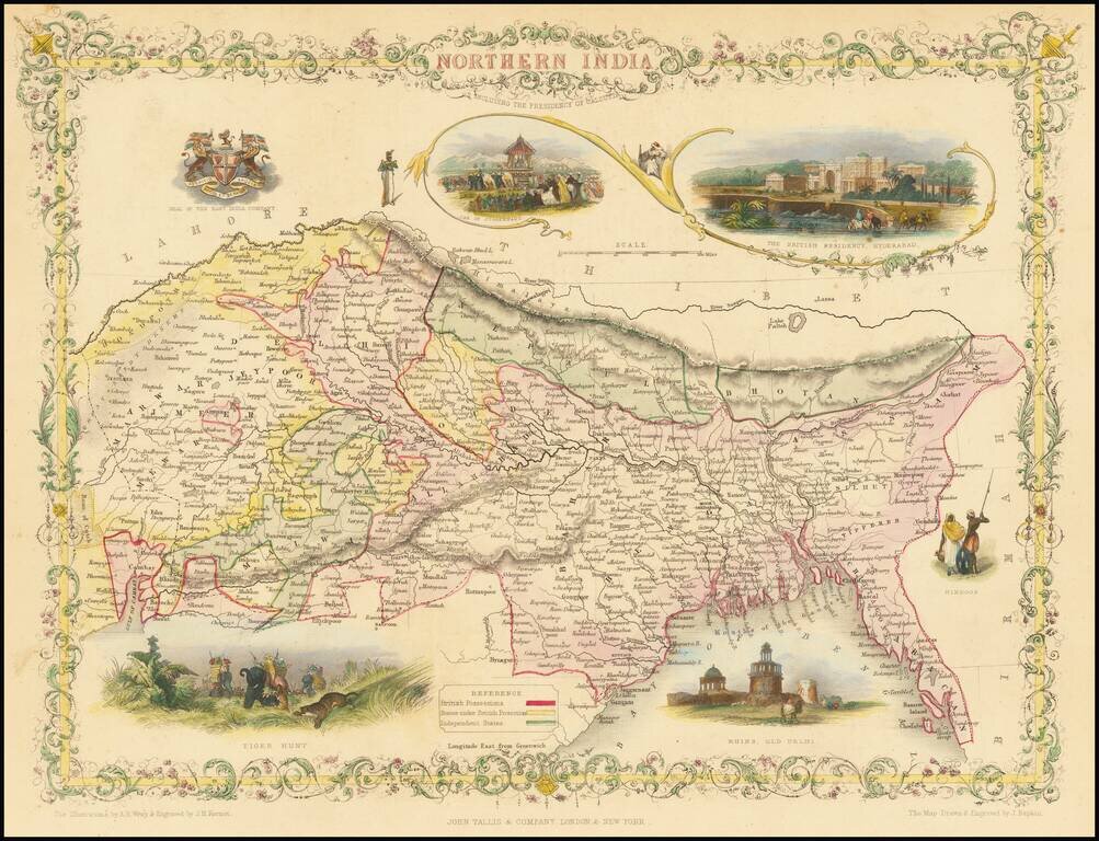
A striking full-color example of this marvelous map of the northern part of India. The area shown encompasses present-day northeastern India, Bangladesh, Bhutan, and Nepal. The map includes vignettes of life during the Company Raj as well as other...
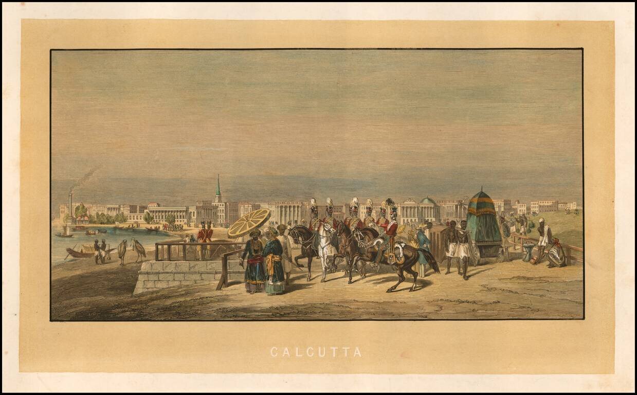
Fine early view of Calcutta, with various soldiers and costumed figures in the foreground and the city on the banks of the Hoogley River beyond. The printing of the image is rather intriguing, as it would appear that the yellow background and...
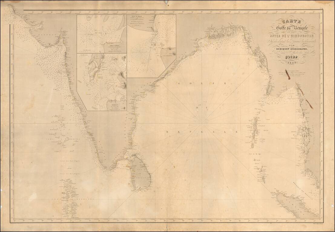
Scarce French sea chart of India and the west coast of Malaysia, etc., published in Paris by Robiquet. Includes large inset maps of: Bombay Amerst Akiab (Sittwe, Myanmar) Includes pencil annotations showing a voyage of the coast of Coromandel...
![[Puducherry-- Hand Drawn Map] Plan de la Ville de Pondichery. Legende des Rues de la ville blanche et de la ville noire de Pondichery avec les numeros d'ordre correspondant a ceux du plan que Mr. le Gouvernor a approuve le Mai 1856](/map/small/58607.jpg)
"Black Town" and "White Town": Geographical Segregation in French-Colonial India Fine hand-drawn plan of Puducherry, "Corresponding to the Plan approved by the Governor May 13, 1856." The map is meticulously drawn, illustrating the streets, canals,...
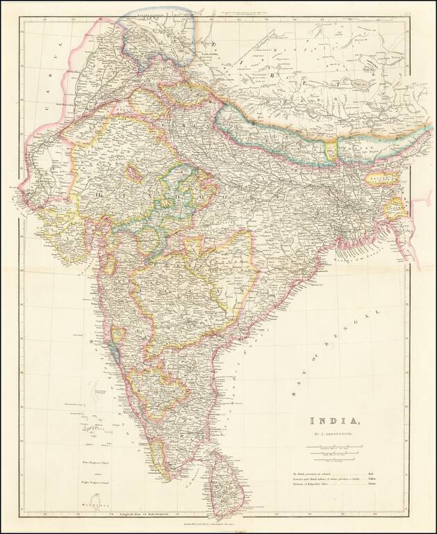
Striking example of Arrowsmith's map of India. The map appeared in Arrowsmith's London Atlas, one of the most popular English atlases of the mid-19th Century.
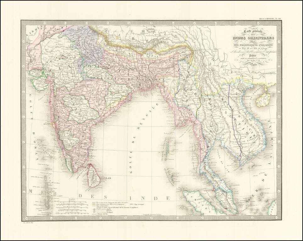
Detailed regional map of India and Southeast Asia, extending from the Gulf of Kambaye to the Gulf of Tonquin and from Sumatra and Ceylon to Tibet and the Himalayas. Shows towns mountains, rivers, lakes, islands, bays, etc. An excellent mid 19th...
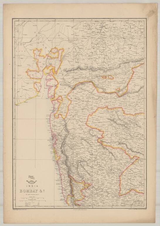
Highly detailed map of Bombay, from the Weekly Dispatch Atlas. 'The Weekly Dispatch' newspaper between the years 1856 and 1862, included in each edition, a map of a part of the world. During this period a total of 118 maps were issued. The maps bear...
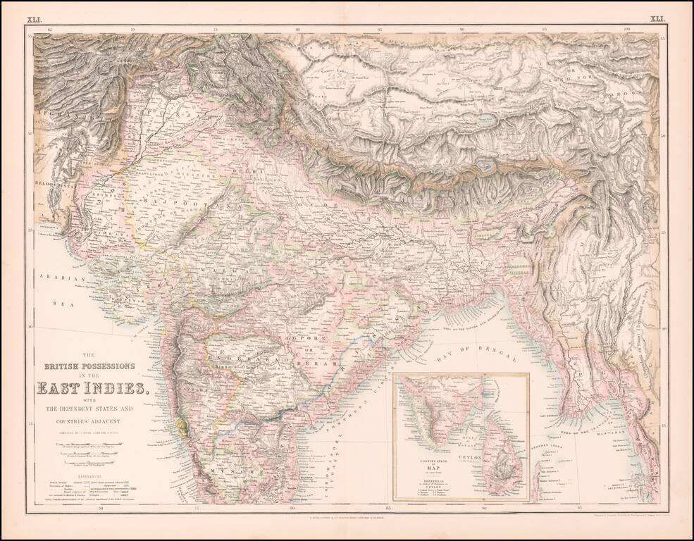
Highly detailed map of India, Pakistan, Afganistan, Tibet and the Himalayas, extending east to Siam. Inset of the southern tip of India and Ceylon.
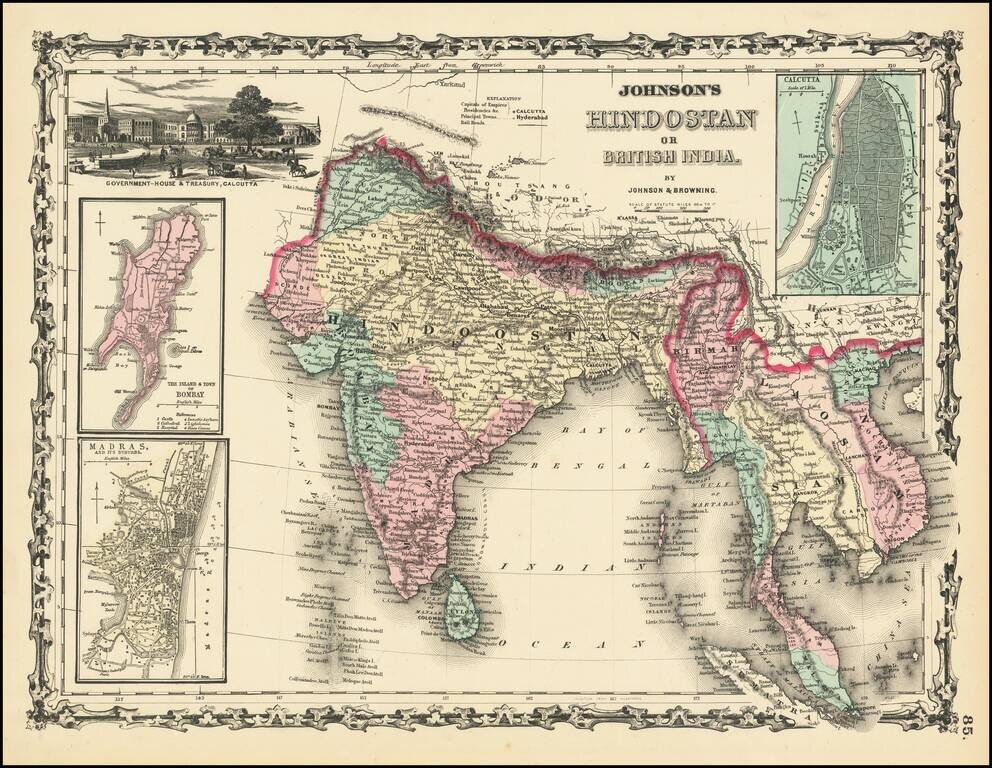
Scarce first edition of Johnson & Browning's map of India, Ceylon, Birmah, Laos, Vietnam, Cambodia, Thailand and part of Malaysia and Sumatra. Insets of Bombay, Madras and Calcutta. Vignette of Government House and Treasury in Calcutta. Colored by...
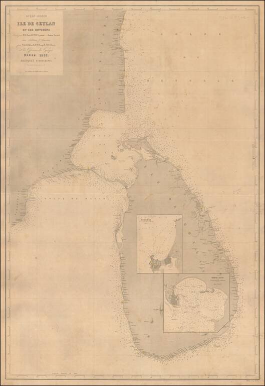
A Rare Large Chart of Sri Lanka Scarce large format sea chart of Sri Lanka and the adjacent coast of India with inset maps of the harbors at Colombo and Galle. Detail is confined to the coastlines, and includes soundings, navigational hazards and...