Map size in jpg-format: 14.9467MiB
Click to open in high resolution (open in new tab).
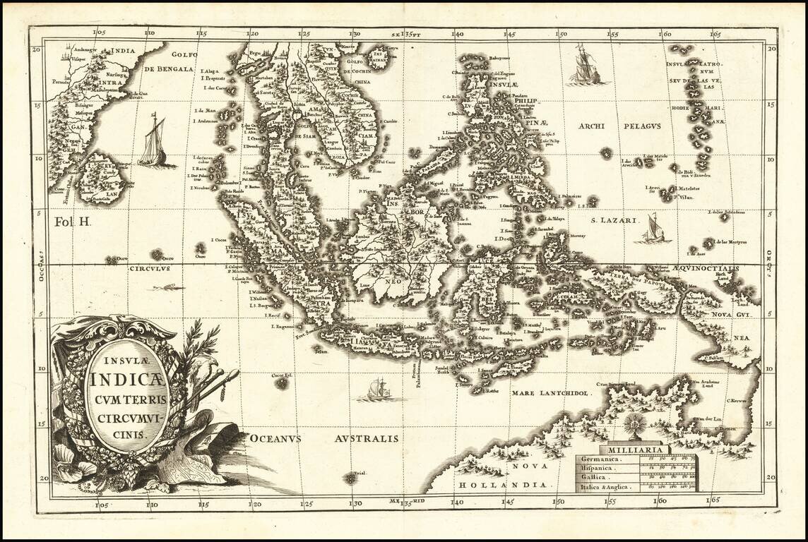
Striking example of Scherer's map of Southeast Asia and the Northern part of Australia.
Nova Guinea is still tenatively attached to Nova Hollandia. The coastline shows Van Arnham's Land, Van Der Lin, C. Diemen and C. Van Diemen's Land. A narrow strait between Nova Guinea and Papua New Guinea is in evidence. Detailed and elaborate treatment of the Philippines. Extends west to Ceylon and the Gulf of Bengal.
If you are a student, write to us in telegram: @antiquemaps and indicate what material you need and for what work you need a map in high detail. We are ready to provide material on special terms. For students only!
![[Signed Political Satire Artwork] Vietnam ... Vietnam ... Vietnam ...](/map/small/68726.jpg)
![[Martin Behaim Globe / Book] Pars Globi terrestris Ao. 1492 a Martino Behaim Equite Lusitano Norimbergae confecti Delineavit Christoph. Theoph de Murr 1778 (bound with:) Diplomatische Geschichte des Portugesischen berühmten Ritters Martin Behaims](/map/small/68828.jpg)
![Il Disegno Della Terza Parte Dell' Asia [Gastaldi's Wall Map of SE Asia with extra panels!]](/map/small/30554hbp.jpg)