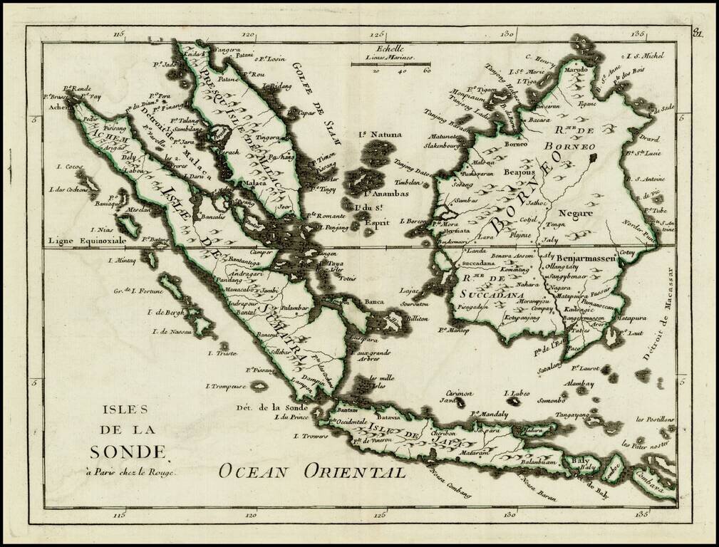
Interesting map of Singapore, the Molucques, Java and Borneo, from Le Rouge's Nouvel Atlas Portatif.
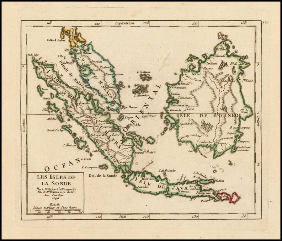
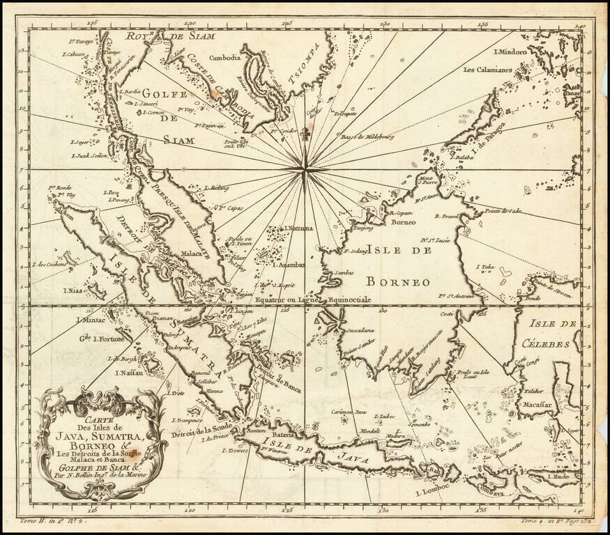
Attractive map of the Straits of Singapore, Sumatra, Java, Malaca, Borneo and neighboring islands, showing towns, harbours, bays, and other details. The map appeared in De Vaugondy's Atlas Portatif.
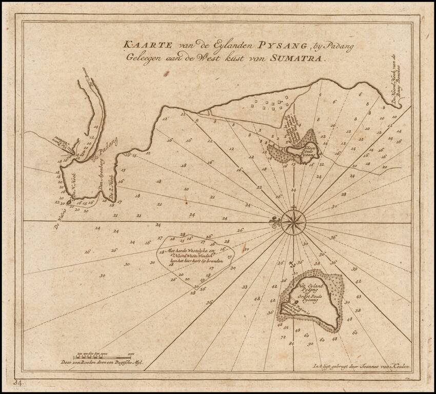
Finely detailed sea chart of Padang and vicinity on the west coast of Sumatra, from Van Keulen's "secret atlas." The chart shows the coast of Padang, and the neighboring islands, including Pulau Pisang. The map notes numerous depth soundings, reefs...
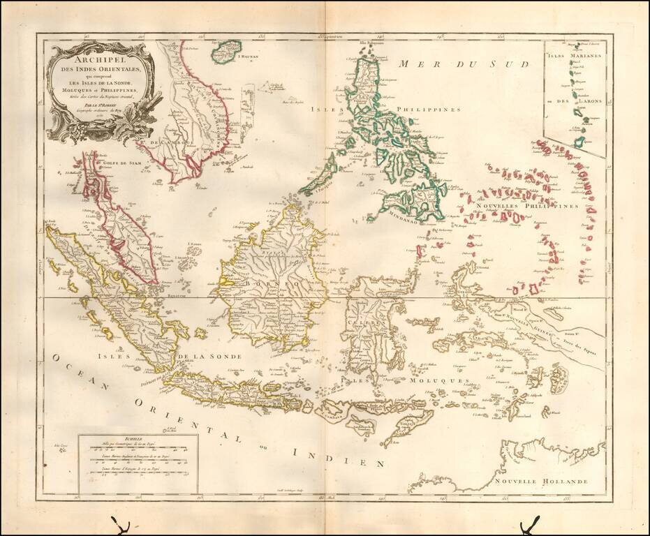
Striking and highly detailed map of the region from Sumatra and Malacca and Southern China to the Philippines, New Guinea and Northern Australia, centered on Borneo. Includes a large inset of the Marianas. Wonderful early detail, derived from the...
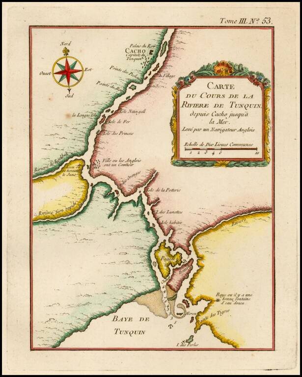
Detailed map of the Tunquin River and Bay, extending north to Cacho, the capital city. One of the maps produced by Nichlas Bellin for Prevost d'Exiles influential travel book, L'Histoire Generale des Voyages.
![[Southwest Coast fo Myanmar - Myeik and Andaman Sea] Coast of Tenasserim](/map/small/64783.jpg)
Extremely rare English sea chart, covering some of the far southern portions of Burma, present-day Myanmar, along its Andaman Sea coastline. The map focuses on the large archipelago that sits off of Mergui, present-day Myeik, near the border with...
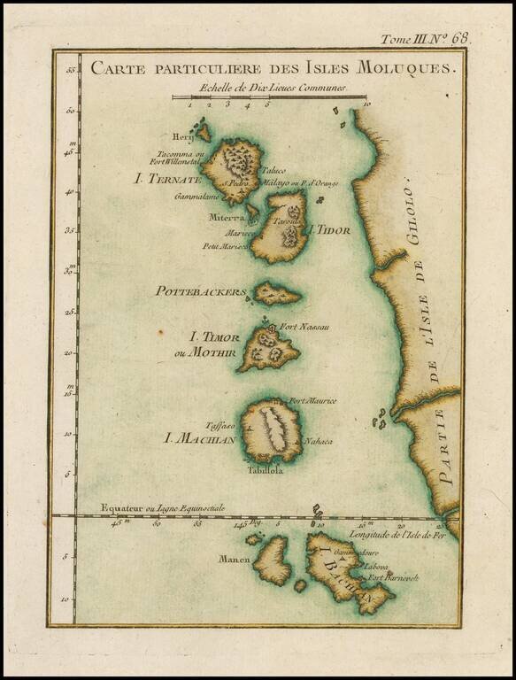
Finely engraved map of Moluccas, from Jacques Nicolas Bellin's Le Petit Atlas Maritime Recueti de Cartes et Plans des Quatre Parlies du Monde en Cinq Volumes, first published in Paris in 1764. Jacques Nicolas Bellin Jacques Nicolas Bellin (1703-1772)...
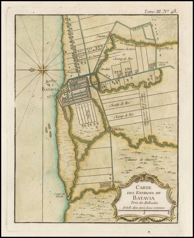
Finely engraved map of Batavia (Jakarata) and environs, from Jacques Nicolas Bellin's Le Petit Atlas Maritime Recueti de Cartes et Plans des Quatre Parlies du Monde en Cinq Volumes, first published in Paris in 1764.
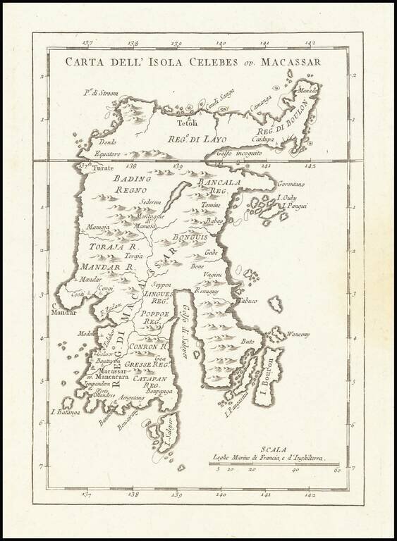
Finely engraved map of the Malay Peninsula, Sumatra, Borneo, Java, the Celebes, etc., from Jacques Nicolas Bellin's, Le Petit Atlas Maritime Recueti de Cartes et Plans des Quatre Parlies du Monde en Cinq Volumes, first published in Paris in 1764.
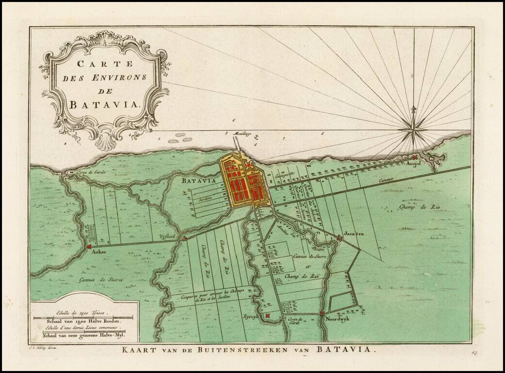
Detailed plan of the area around Batavia, including a small area southeast of the town plan which is named Jacarta. Includes notes on the Gardens, roads, rivers and other features around what is now Jakarta.
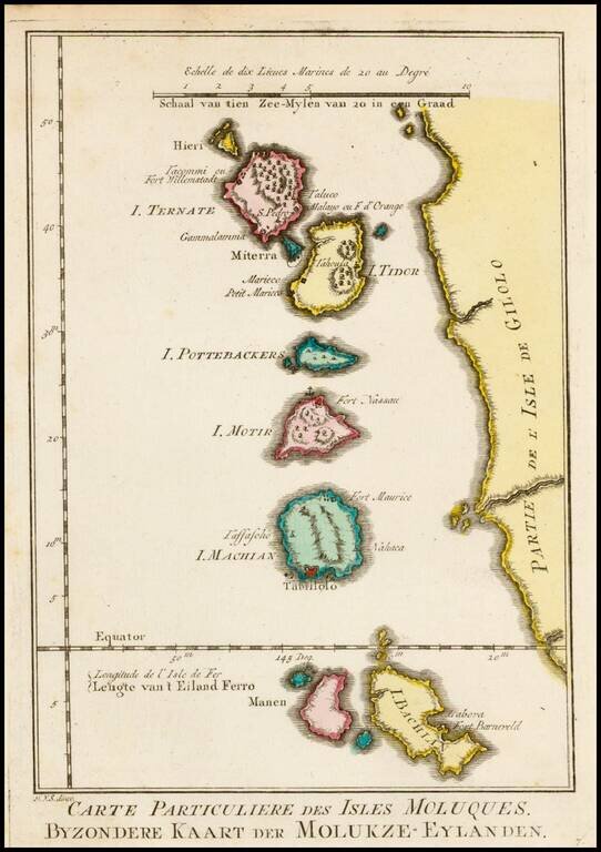
Detailed map of the Molucas. One of the maps produced for the Dutch edition of Bellin's work.
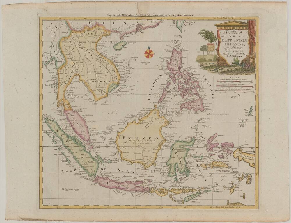
Scarce map of the Philippines and Southeast Asia, published for Millar's New Complete & Universal System of Geography. The map is centered on the Philippines and Brunei, and includes a decorative cartouche.
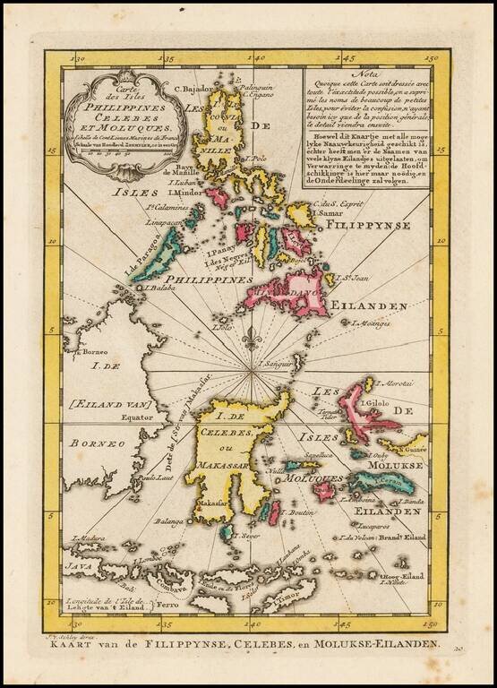
Detailed map of the Philippines and islands to the south, including the Moluques, part of the New Guinea, Gilolo, Timor and parts of Borneo and Java. From a Dutch edition of Bellin's Atlas.
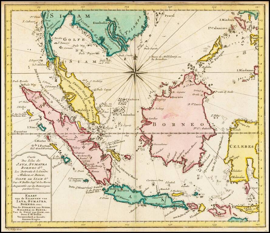
Detailed map of the Region from Siam and Mindoro to Sumatra, Java and the Straits of Maskasar, centered on Borneo. Decorative compass rose. Nice full wash color.
![[Jakarta] Prospect von der Bastion Perl langst der Courtine des Castells Batavia gezeichnet / Vue de la Bastion Perl desine pres de Courtine du Chateau de Batavie](/map/small/68834.jpg)