Map size in jpg-format: 1.06933MiB
Click to open in high resolution (open in new tab).
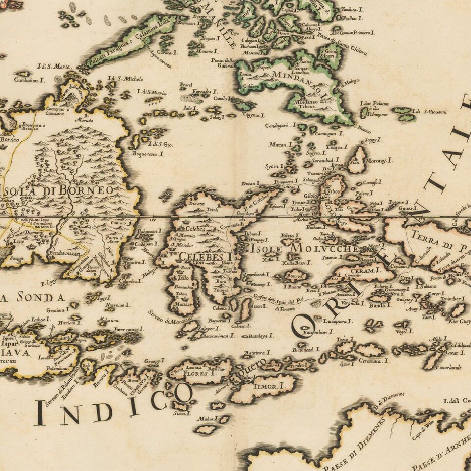
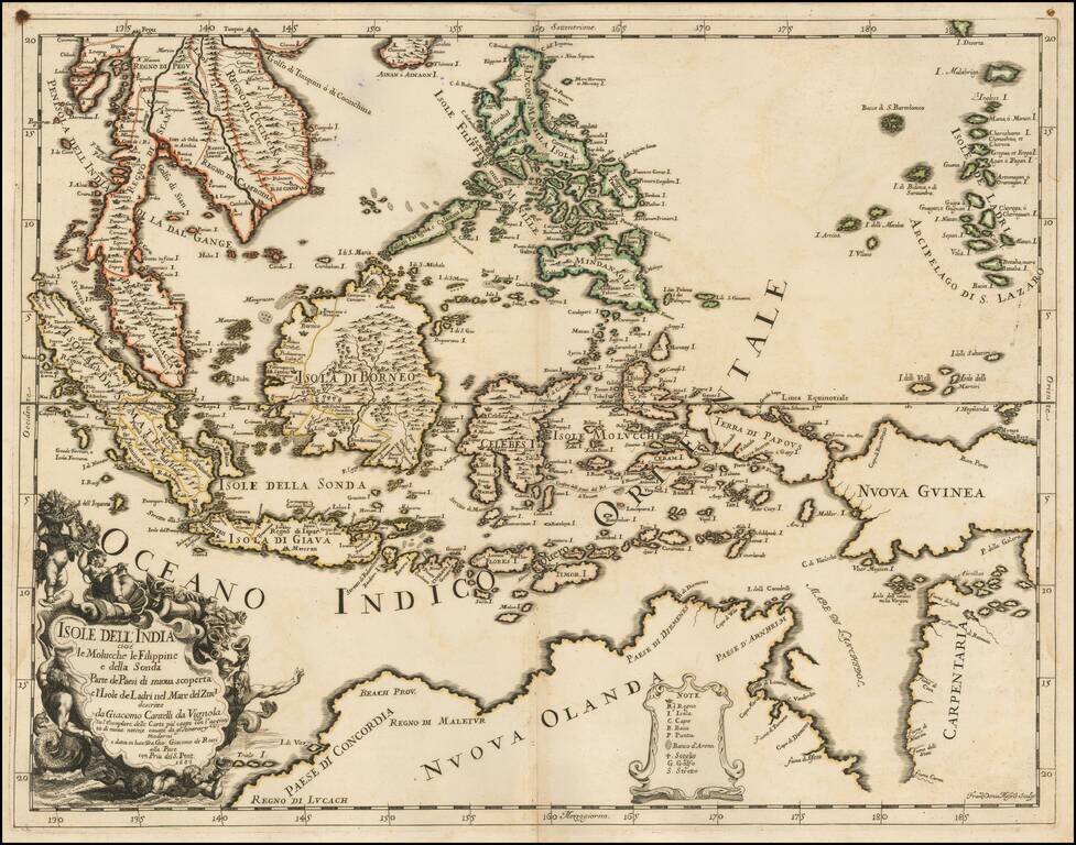
Scarce first state of this decorative map of Southeast Asia and the North Coast of Australia by Cantelli da Vignola and published in Rome by Rossi.
Detailed and highly decorative 17th-century Italian map of northern Australia and the islands of Melanesia and South East Asia, depicting Malaya (Penisola di Malacca), Sumatra, Java, Celebes, Nova Guinea, and Nuova Olanda (Australia). Includes all of Tasman's discoveries in north Australia, but still retains some of the earlier hypothetical provinces associated with the north-west coast (from Marco Polo), Maletur, etc. A clear passage between Cape York and New Guinea with a noted Abrolhos.
Dimensional, decorative cartouche with mermen and cherubs around the title.
If you are a student, write to us in telegram: @antiquemaps and indicate what material you need and for what work you need a map in high detail. We are ready to provide material on special terms. For students only!
![[Signed Political Satire Artwork] Vietnam ... Vietnam ... Vietnam ...](/map/small/68726.jpg)
![[Martin Behaim Globe / Book] Pars Globi terrestris Ao. 1492 a Martino Behaim Equite Lusitano Norimbergae confecti Delineavit Christoph. Theoph de Murr 1778 (bound with:) Diplomatische Geschichte des Portugesischen berühmten Ritters Martin Behaims](/map/small/68828.jpg)
![Il Disegno Della Terza Parte Dell' Asia [Gastaldi's Wall Map of SE Asia with extra panels!]](/map/small/30554hbp.jpg)